
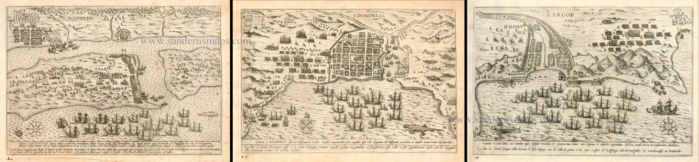
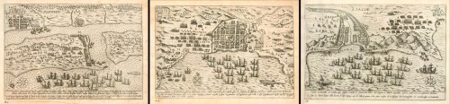
Antique maps by Boazio Baptista: Florida, San Augustine; Santo Domingo; and the Cape Verde Islands (Santiago). 1589
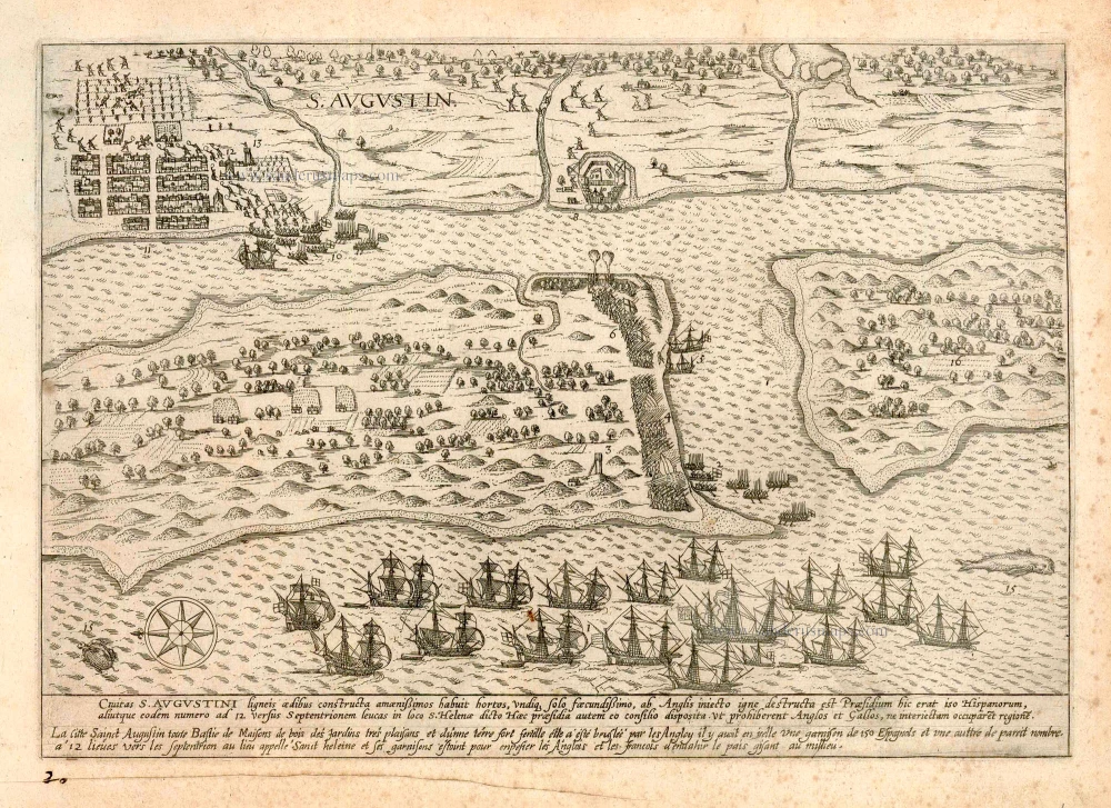
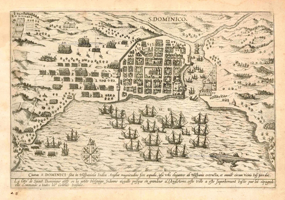
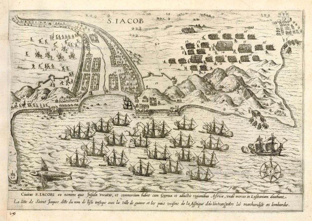
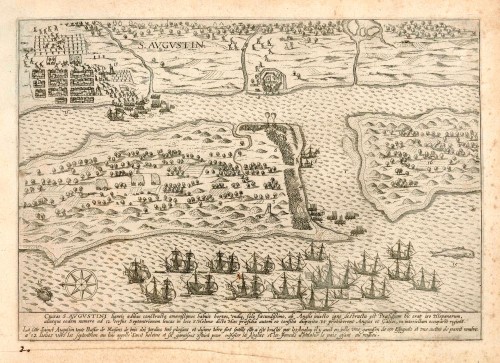

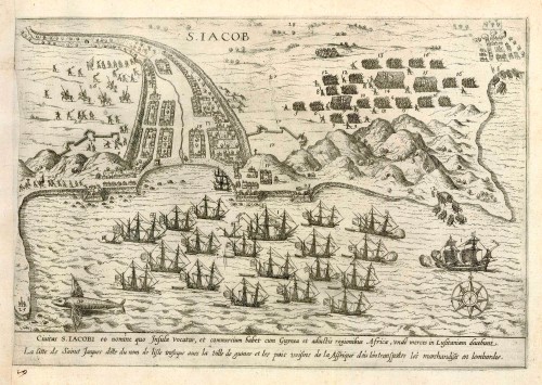
Civitas S. Augustini ... [in set with:] Civitas S. Dominici sita in Hispaniola Indica Angliae ... [and] Civitas S. Iacobi eo nomine quo insula vocatur ...
Item Number: 24610 Authenticity Guarantee
Category: Antique maps > Africa
Three antique maps by Boazio Baptista (of a set of four): Florida, San Augustine; Santo Domingo; and the Cape Verde Islands (Santiago).
The maps were made, probably by Fr. Hogenberg, to illustrate an account of Drake's expedition of 1585-86. They are included in some copies of Walter Bigges' A summarie and true discourse of Sir Frances Drakes West Indian Voyage. London, R. Field, 1589. Church says that the maps are much more rare than the book and that they also appeared in the Latin edition printed at Leyden in 1588.
The Library of Congress has 3 of the 4 maps by B. Boazio; they are missing the map of San Augustine.
San Augustine: The map depicts Drake's capture of the town in 1586, after which the town was destroyed. This is a reduced version of the Baptista Boazio plan of Saint Augustine first published a year earlier, "The first printed plan of a United States city", and is equally as scarce. The main visible differences are the removal of the two cartouches with Latin text. ... Two distinct states exist:
State 1 With four lines of text below, two Latin and two French (as this copy)
State 2 Just two lines of Latin text.
State one has not been identified with any particular publication. Burden attributes these maps to Frans Hogenberg.
Santo Domingo: Bird's eye view of Santo Domingo and environs in present Dominican Republic (founded by Bartolomew in 1496), the oldest continuously inhabited European settlement in the Americas and first seat of Spanish rule in the New World. Depicted is a well laid-out city showing various architecture; the harbour is filled with ships and a giant alligator is at lower right. Sir Francis Drake captured the supposedly impregnable city of Santo Domingo in 1585, sacked it (even the church bells), collected a ransom of 25,000 ducats, and before sailing away, burned the town.
Santiago, Cape Verde Islands: This is a depiction of Drake's 1585 capture of Santiago. Scene of naval warfare with a squadron of ships blockading the harbour, troops on foot and horseback, boats, a town, dwellings, fortifications, and giant flying fish at lower left.
The fourth map is a bird’s-eye view of the city and port of Cartagena in present-day Colombia. (Here not present).
Copper engravings
Size each: 200 x 28.5cm (78 x 11.1 inches)
Verso: Blank
Condition: Excellent.
Condition Rating: A
References: Burden, 71, State 1; Church, 136
From: Separate publication, 1589.