
Cape Verde Islands and Atlantic coast of West Africa, by Coronelli V.M. 1691
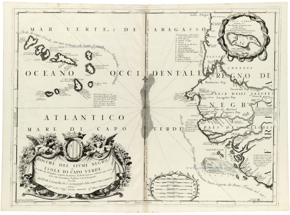
The map extends from the Bay of Arguin and the coast of present-day Mauritania southwards across Senegal to the mouth of the Gambia River. To the west, the Cape Verde archipelago occupies a prominent position in the Atlantic Ocean, its islands individually named and accompanied by numerous geographical and historical annotations.
The African coastline is depicted in considerable detail, with numerous rivers, estuaries, coastal settlements and indigenous territories identified. Named regions include the kingdoms of the Jalofes (Wolof), along with other territories and peoples inhabiting the Senegalese and Gambian coastal regions. Particularly noteworthy is the representation of the Senegal River, here associated with the historical designation Fiume Negro. The river system and its various mouths are shown in considerable detail, reflecting the region's importance to European navigators and merchants in the seventeenth century.
The map includes extensive annotations concerning the early exploration of the Cape Verde Islands and the West African coast. Several islands include alternative names and references to Dutch voyages, illustrating the mix of Portuguese and Dutch geographical information available to Coronelli. The Cape Verde Islands are represented in a distinctive arrangement, with the individual islands carefully delineated and identified. The archipelago had been an important Atlantic navigational centre since the fifteenth century, serving as a stopping point for ships travelling between Europe, Africa and the Americas.
Numerous rhumb lines cross the surrounding Atlantic Ocean, radiating from a central point and recalling the traditions of maritime chartmaking. A large graduated geographical framework and an elaborate scale of distances complete the composition.
In the upper right corner, an ornamental cartouche encloses a detailed inset map of the island of Gorée, situated off the coast of present-day Dakar.
During the seventeenth century, the coast of Senegal and the Cape Verde Islands occupied an increasingly important position in European maritime trade and Atlantic navigation. Portuguese navigators had explored the region during the fifteenth century, establishing settlements and trading connections along the coast and throughout the Cape Verde archipelago. During the following centuries, Dutch, French and English merchants became increasingly active in the region. The island of Gorée became an important fortified trading station and was contested by several European maritime powers. Its strategic location near the Cape Verde peninsula made it particularly valuable for controlling commercial activity along the Senegalese coast.
The region was also deeply involved in the Atlantic slave trade, an essential historical context for understanding the European commercial interest in these coastal settlements.
Coronelli's map reflects the growing accumulation of geographical knowledge derived from maritime exploration, commercial activity and the reports of European travellers.
Vincenzo Coronelli (1650-1718)
Vincenzo Coronelli was born in Venice on 16 August 1650 and primarily brought up in Ravenna. He returned to Venice in 1665 and joined the convent of the Minor Conventuals. Five years later, he was sent to Rome to study, and by 1673, he was already a doctor of theology.
Having achieved fame by constructing two globes for the Duke of Parma, he was invited to Paris for three years in 1681 and made two enormous examples for Louis XIV. On his return to Venice, he assiduously collected cartographic material and founded the Academy of the Argonauts. In 1685, he was appointed Cosmographer to the Republic of Venice and authorised to publish a large atlas. He became a geography lecturer at the University of Venice and brought out an Atlante Veneto the following year.
In 1696, he visited Germany, Holland and southern England. During intervals in compiling his vast encyclopaedia, he continued with cartographic projects up to 1709. He died in his native Venice on 9 December 1718.
Coronelli became famous for his globes. In addition, he was a renowned encyclopaedist, mapmaker and geographer. Most of his maps and other material are gathered in his Atlante Veneto (13 vols, 1690-1705). The first volume, subtitled Descrizione generale istorica geografica, was his masterpiece, planned as an extension of Blaeu’s atlas.
Other volumes of the atlas which contain maps are Isolario, two parts (1696-8), with detailed maps and plans, mostly of islands; Corso geografico, two parts based on the edition 1694-7; Libro de’ globi (1697); and Lo Specchio del Mare, a reprint of Levanto's Lo Specchio del Mare Mediterraneo of 1664.
The other vital aspects of his mapping are those arising from the Venetian conquest and his travels. His most extensive military compilation was the Teatro della Guerra, in more than 30 volumes.
Bocche del Fiume Negro et Isole di Capo Verde
Item Number: 33380 Authenticity Guarantee
Category: Antique maps > Africa
Cape Verde Islands, by Coronelli V.M.
Title: Bocche del Fiume Negro et Isole di Capo Verde
dal P.M. Coronelli M.C. Cosmografo della Seren.ma Rep. di Venetia ...
Date of the first edition: 1691.
Date of this map: 1691.
Copper engraving, printed on paper.
Image size: 450 x 610mm (17¾ x 24 inches).
Sheet size: 475 x 655mm (18¾ x 25¾ inches).
Verso: Blank.
Condition: Excellent.
Condition Rating: A+.
From: Atlante Veneto, nel quale si contiene la descrittione... degl' Imperii, Regni, Provincie, e Stati dell' Universo. Venice: Girolamo Albrizzi, 1691. Shirley (Brit.Lib.), T.CORO-7a
The map extends from the Bay of Arguin and the coast of present-day Mauritania southwards across Senegal to the mouth of the Gambia River. To the west, the Cape Verde archipelago occupies a prominent position in the Atlantic Ocean, its islands individually named and accompanied by numerous geographical and historical annotations.
The African coastline is depicted in considerable detail, with numerous rivers, estuaries, coastal settlements and indigenous territories identified. Named regions include the kingdoms of the Jalofes (Wolof), along with other territories and peoples inhabiting the Senegalese and Gambian coastal regions. Particularly noteworthy is the representation of the Senegal River, here associated with the historical designation Fiume Negro. The river system and its various mouths are shown in considerable detail, reflecting the region's importance to European navigators and merchants in the seventeenth century.
The map includes extensive annotations concerning the early exploration of the Cape Verde Islands and the West African coast. Several islands include alternative names and references to Dutch voyages, illustrating the mix of Portuguese and Dutch geographical information available to Coronelli. The Cape Verde Islands are represented in a distinctive arrangement, with the individual islands carefully delineated and identified. The archipelago had been an important Atlantic navigational centre since the fifteenth century, serving as a stopping point for ships travelling between Europe, Africa and the Americas.
Numerous rhumb lines cross the surrounding Atlantic Ocean, radiating from a central point and recalling the traditions of maritime chartmaking. A large graduated geographical framework and an elaborate scale of distances complete the composition.
In the upper right corner, an ornamental cartouche encloses a detailed inset map of the island of Gorée, situated off the coast of present-day Dakar.
During the seventeenth century, the coast of Senegal and the Cape Verde Islands occupied an increasingly important position in European maritime trade and Atlantic navigation. Portuguese navigators had explored the region during the fifteenth century, establishing settlements and trading connections along the coast and throughout the Cape Verde archipelago. During the following centuries, Dutch, French and English merchants became increasingly active in the region. The island of Gorée became an important fortified trading station and was contested by several European maritime powers. Its strategic location near the Cape Verde peninsula made it particularly valuable for controlling commercial activity along the Senegalese coast.
The region was also deeply involved in the Atlantic slave trade, an essential historical context for understanding the European commercial interest in these coastal settlements.
Coronelli's map reflects the growing accumulation of geographical knowledge derived from maritime exploration, commercial activity and the reports of European travellers.
Vincenzo Coronelli (1650-1718)
Vincenzo Coronelli was born in Venice on 16 August 1650 and primarily brought up in Ravenna. He returned to Venice in 1665 and joined the convent of the Minor Conventuals. Five years later, he was sent to Rome to study, and by 1673, he was already a doctor of theology.
Having achieved fame by constructing two globes for the Duke of Parma, he was invited to Paris for three years in 1681 and made two enormous examples for Louis XIV. On his return to Venice, he assiduously collected cartographic material and founded the Academy of the Argonauts. In 1685, he was appointed Cosmographer to the Republic of Venice and authorised to publish a large atlas. He became a geography lecturer at the University of Venice and brought out an Atlante Veneto the following year.
In 1696, he visited Germany, Holland and southern England. During intervals in compiling his vast encyclopaedia, he continued with cartographic projects up to 1709. He died in his native Venice on 9 December 1718.
Coronelli became famous for his globes. In addition, he was a renowned encyclopaedist, mapmaker and geographer. Most of his maps and other material are gathered in his Atlante Veneto (13 vols, 1690-1705). The first volume, subtitled Descrizione generale istorica geografica, was his masterpiece, planned as an extension of Blaeu’s atlas.
Other volumes of the atlas which contain maps are Isolario, two parts (1696-8), with detailed maps and plans, mostly of islands; Corso geografico, two parts based on the edition 1694-7; Libro de’ globi (1697); and Lo Specchio del Mare, a reprint of Levanto's Lo Specchio del Mare Mediterraneo of 1664.
The other vital aspects of his mapping are those arising from the Venetian conquest and his travels. His most extensive military compilation was the Teatro della Guerra, in more than 30 volumes.
Related items
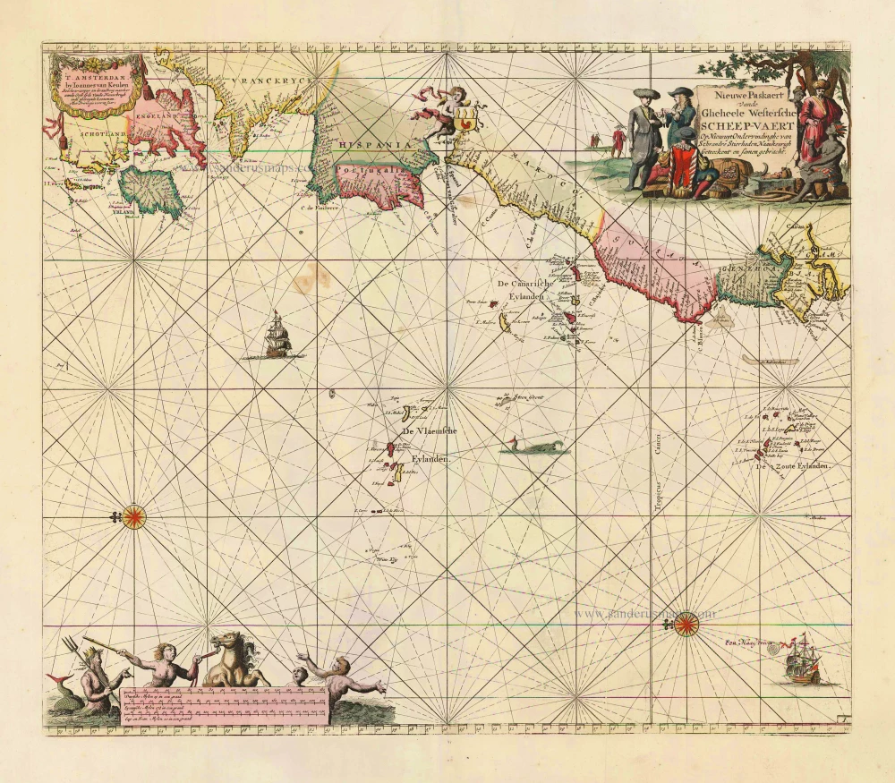
Nieuwe Paskaert vande Gheheele Westersche Scheep-Vaert, op Nieus uyt Ondervindinghe van Schrandre Stierlieden Naaukeurigh Geteeckent en Samen Gebracht. 1697-1709
The Atlantic Ocean, by J. Van Keulen.
[Item number: 11218]
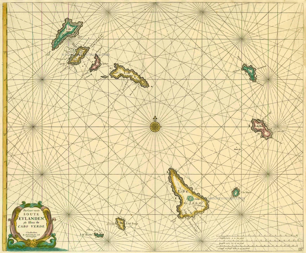
Pas-Caart vande Soute Eylanden ofte Ilhas de Cabo Verde 1686
Cape Verde Islands, by Doncker H.
[Item number: 13643]

Isles du Cap Verd Hispanis Islas de Cabo Verde Belgis de Soute Eylanden. 1721-41
Cape Verde Islands, by Covens & Mortier.
[Item number: 23621]
Heightened in gold!
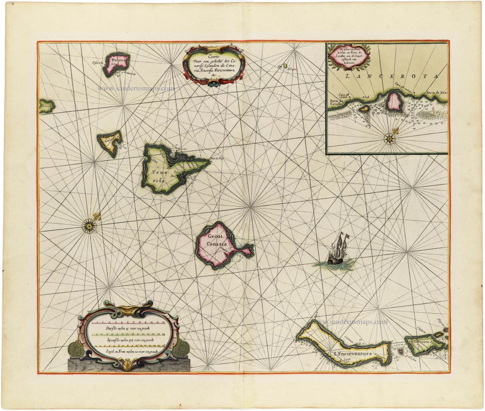
Caarte voor en Gedeelte der Canarise Eylanden als Canaria, Tenerifa, Forteventura, etc. 1666
The Canary Islands, by Pieter Goos.
[Item number: 25612]

Les Iles du Cap Verd, nommées par quelques Auteurs Iles de Sel. 1713
Cape Verde Islands, by Pieter van der Aa.
[Item number: 26164]
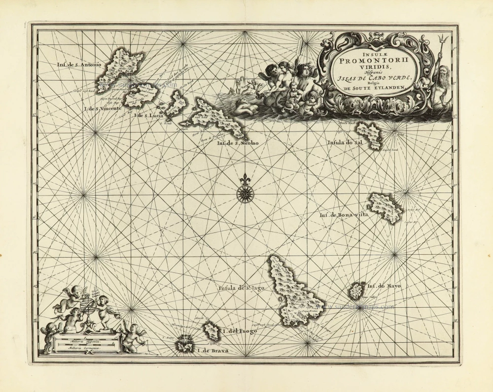
Insulae Promotorii viridis Hispanis - Illas de Cabo Verde, Belgis De Soute Eylanden. 1668
Cape Verde Islands by Dapper O.
[Item number: 30938]

Luxury colouring with gold
De Cust van Barbaria, Gualata, Arguyn, en Genheo, van Capo S. Vicente tot Capo Verde 1666
North-West African Coast by Pieter Goos.
[Item number: 33067]