
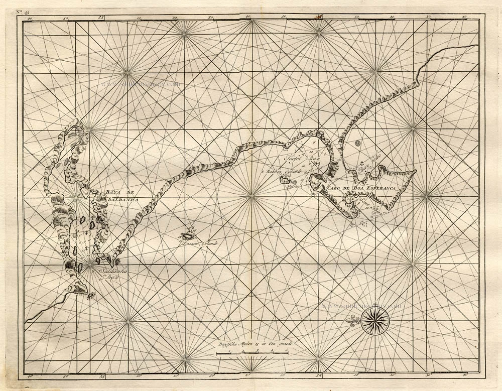
Old antique map of Cape of Good Hope, by Pieter van der Aa. 1713

Le Cap de Bonne Esperance.
Item Number: 26161 Authenticity Guarantee
Category: Antique maps > Africa
Old, antique map of the Cape of Good Hope, by P. Van der Aa.
Date of the first edition: 1713
Date of this map: 1713
Copper engraving, printed on paper.
Size (not including margins): 28.5 x 34.5cm (11.1 x 13.5 inches)
Verso: Blank
Condition: Original body colour, trimmed to neatline and mounted on heavy paper at an early time.
Condition Rating: A
References: Van der Krogt A, 62:01; Koeman, Aa7 (169); Not in Norwich O.I.
From: Nouvel Atlas, très exact et fort commode pour toutes sortes de personnes, Contenant Les Principales cartes géographiques. Leiden, P. Van der Aa, n.d. (1713) (Koeman, Aa7).
Van der Aa maps are rarely found in original colouring.
Related items
No title 1724-26
The South African Coast, by François Valentyn (Valentijn).
[Item number: 17825]

Aethiopia Inferior vel Exterior Monomotapa. 1638
Southern Africa, by M. Merian.
[Item number: 25907]
Aethiopia Inferior, vel Exterior. 1641
Johannes Janssonius, Southern Africa.
[Item number: 26450]