
Dr David Livingstone
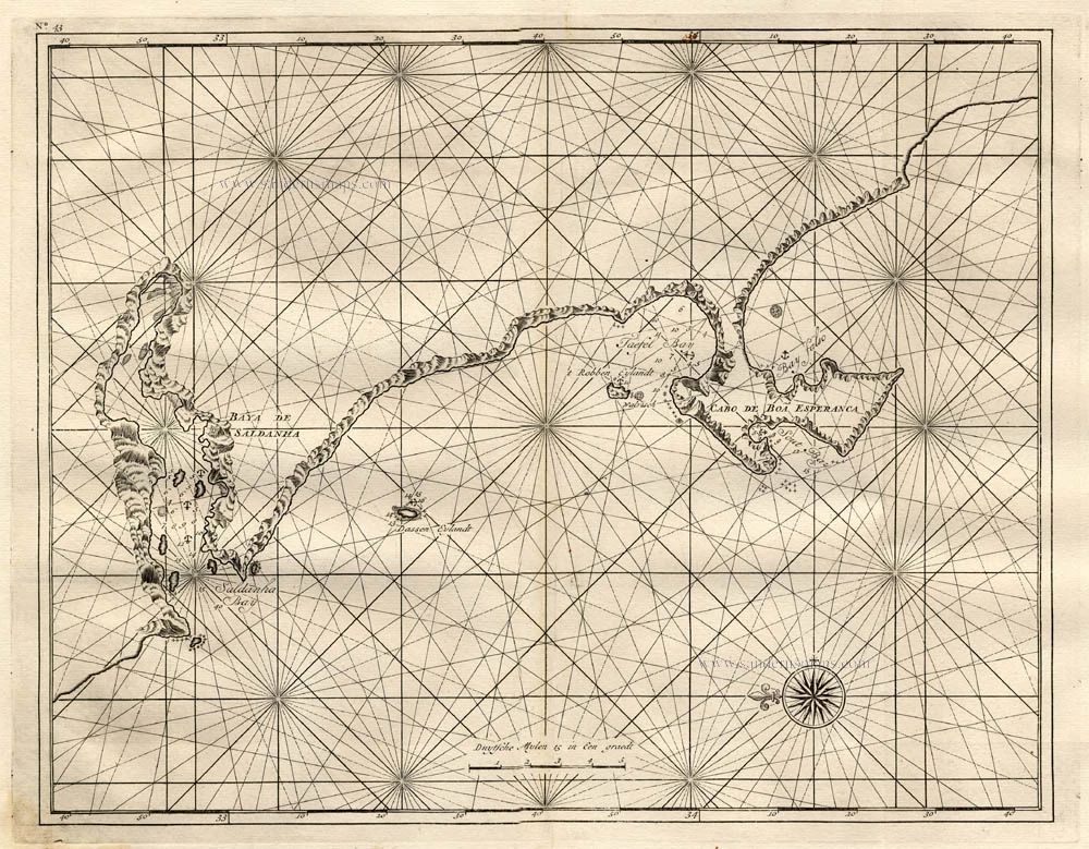
South Eastern Africa by Dr D. Livingstone.

Dr David Livingstone (1813-1873)
Scottish explorer, doctor of medicine and missionary in Africa. First European to cross the African continent, charting unknown territory. He also discovered Lake Nyasa, Victoria Falls, and the Shirwa Highlands. Contributed to various maps for the Royal Geographical Society.
Map of the River Shire, The Lakes Nyassa, & Shirwa, The Lower Courses of the Rivers Zambesi & Rovuma.
Item Number: 29939 Authenticity Guarantee
Category: Antique maps > Africa
Old map of South Eastern Africa by Dr D. Livingstone.
Title: Map of the River Shire, The Lakes Nyassa, & Shirwa, The Lower Courses of the Rivers Zambesi & Rovuma.
Based on the Astronomical Observations & Sketches of Dr Livingstone.
Constructed by John Arrowsmith. 1865.
London, John Murray - John Arrowsmith.
Date: 1866.
Date on map: 1865.
Image size: 375 x 585mm (14.76 x 23.03 inches).
Sheet size: 400 x 600mm (15.75 x 23.62 inches).
Verso: Blank.
Condition: Folds as issued, some wear at the fold intersections.
Condition Rating: B.
Dr David Livingstone (1813-1873)
Scottish explorer, doctor of medicine and missionary in Africa. First European to cross the African continent, charting unknown territory. He also discovered Lake Nyasa, Victoria Falls, and the Shirwa Highlands. Contributed to various maps for the Royal Geographical Society.
Related items

Africa Ex magna orbis terre 1633
Africa, by G. Mercator.
[Item number: 1452]

Africae Antiquae, et quarundam Europae, Asiaeque Adiacentium Regionum, 1684
Africa, by Janssonius à Waesberghe.
[Item number: 10916]
No title 1724-26
The South African Coast, by François Valentyn (Valentijn).
[Item number: 17825]

Aethiopia Inferior, vel Exterior. 1641
Johannes Janssonius, Southern Africa.
[Item number: 26450]

Scarce
Africae Tabula Nova. 1575
Africa, by François de Belleforest.
[Item number: 27380]