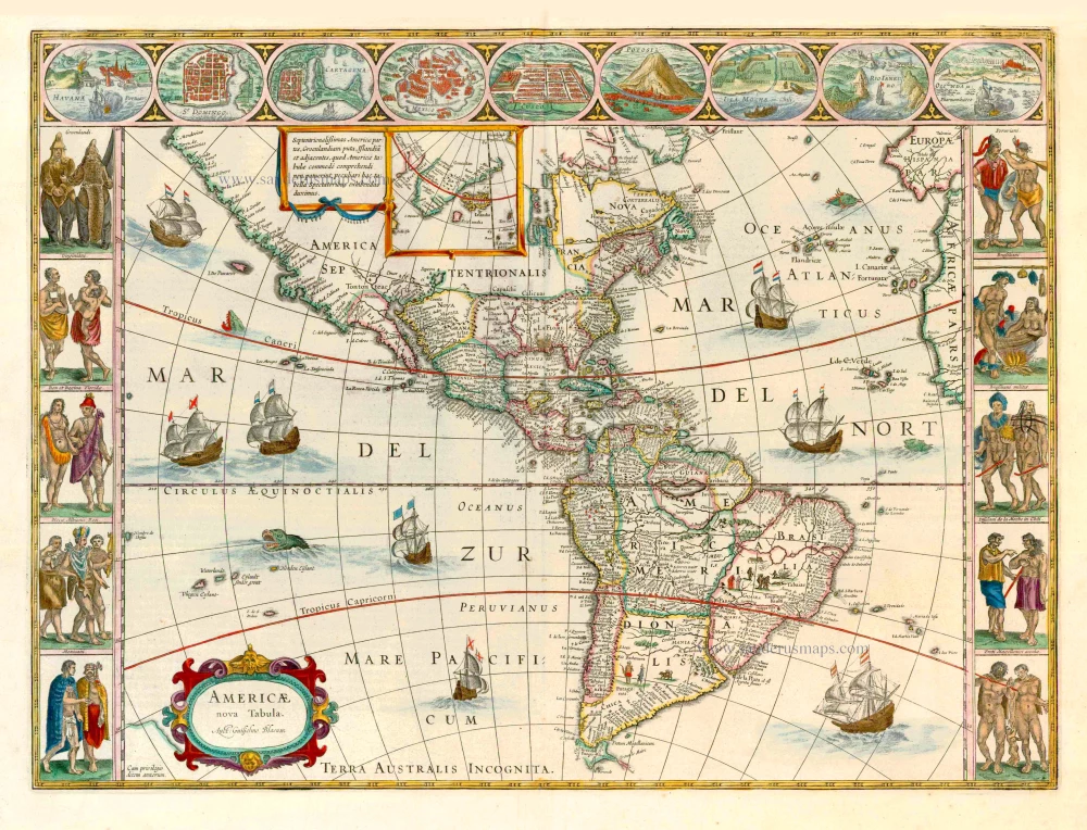
AMERICA by de Wit F. c. 1680
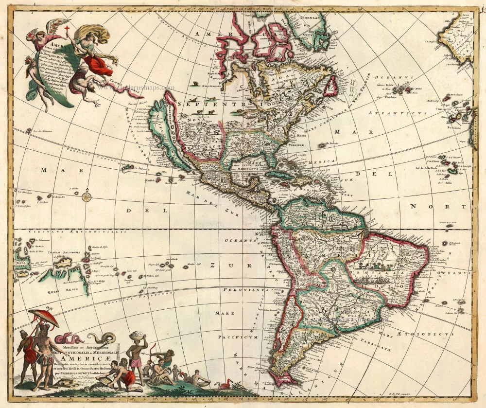
This map is cartographically drawn directly from De Wit's own wall map version published in 1672. The most notable improvement is the depiction of the five Great Lakes, this for the first time on a Dutch map. There is also an altered west coast depiction of the Hudson Bay region. Both features appear to have been taken from Guillaume Sanson's AMERIQUE SEPTENTRIONALE, published in 1669. The two decorative cartouches are extracted from Nicolaas Jansz. Visscher's map of the same first published c.1658. The title cartouche is reversed and in the process New Zealand is removed from the map. The dedication which appeared in the other is replaced by a description of the discovery of the Americas. (Burden)
Burden identified nine states of the map, the privilege being added in this seventh state to an altered title, the same time as de Wit changed the spelling of his name on the map to de Witt.
Frederick de Wit (1630-1706)
The engraver and map-seller, Frederick de Wit, was born in Gouda (Netherlands) in 1630 as a son of Hendrick Fredericksz de Wit. Through his marriage with Maria van der Waag of Amsterdam in 1661, he obtained citizenship of the city where he had been working since 1648 and where he became one of the most famous engravers of maps of the second half of the 17th century. Although De Wit was a Catholic, which meant that he was not favoured at the time by the city council, he was awarded the honour of being listed as one of the "excellent citizens" on the roll of the city council in the years 1694-1704. However, his name was not written in the Guild of St. Luke book before 1664. At that time, he lived on the Kalverstraat "in de Witte Pascaert", where he stayed until his death in 1706. His earliest dates on maps engraved are 1659 (Regni Daniae) and 1660 (World map).
Frederick de Wit published several world atlases, a sea atlas, and an atlas of the Netherlands.
The dating of the maps is difficult. However, as a privilege was granted in 1689, the annotation 'cum privilegio' marks an edition after 1688.
Around 1700, Frederick de Wit entered the market with a town atlas. He produced two volumes with a total of 260 plans and views. Most were printed from plates used for Janssonius and Blaeu town atlases.
After he died in 1706, his widow continued the shop until 1709. The plates and stock of De Wit's atlas were sold to Covens & Mortier in 1710, who sold the atlas for an extended period.
Novissima et Accuratissima Septentrionalis ac Meridionalis Americae Descriptio ...
Item Number: 24437 Authenticity Guarantee
Category: Antique maps > America > The Americas
Antique map of America by F. De Wit, with insular California.
Revised edition of the 1670 Visscher map.
Copper engraving
Size: 49 x 58cm (19.1 x 22.6 inches)
Verso: Blank
Condition: Original coloured, excellent.
Condition Rating: A
References: Burden, 465/7; Tooley (America) p.120, #33; Portinaro - Knirsch XCIV; McLaughlin, 49 State 3.
From: Composite Atlas by F. De Wit, c. 1680.
This map is cartographically drawn directly from De Wit's own wall map version published in 1672. The most notable improvement is the depiction of the five Great Lakes, this for the first time on a Dutch map. There is also an altered west coast depiction of the Hudson Bay region. Both features appear to have been taken from Guillaume Sanson's AMERIQUE SEPTENTRIONALE, published in 1669. The two decorative cartouches are extracted from Nicolaas Jansz. Visscher's map of the same first published c.1658. The title cartouche is reversed and in the process New Zealand is removed from the map. The dedication which appeared in the other is replaced by a description of the discovery of the Americas. (Burden)
Burden identified nine states of the map, the privilege being added in this seventh state to an altered title, the same time as de Wit changed the spelling of his name on the map to de Witt.
Frederick de Wit (1630-1706)
The engraver and map-seller, Frederick de Wit, was born in Gouda (Netherlands) in 1630 as a son of Hendrick Fredericksz de Wit. Through his marriage with Maria van der Waag of Amsterdam in 1661, he obtained citizenship of the city where he had been working since 1648 and where he became one of the most famous engravers of maps of the second half of the 17th century. Although De Wit was a Catholic, which meant that he was not favoured at the time by the city council, he was awarded the honour of being listed as one of the "excellent citizens" on the roll of the city council in the years 1694-1704. However, his name was not written in the Guild of St. Luke book before 1664. At that time, he lived on the Kalverstraat "in de Witte Pascaert", where he stayed until his death in 1706. His earliest dates on maps engraved are 1659 (Regni Daniae) and 1660 (World map).
Frederick de Wit published several world atlases, a sea atlas, and an atlas of the Netherlands.
The dating of the maps is difficult. However, as a privilege was granted in 1689, the annotation 'cum privilegio' marks an edition after 1688.
Around 1700, Frederick de Wit entered the market with a town atlas. He produced two volumes with a total of 260 plans and views. Most were printed from plates used for Janssonius and Blaeu town atlases.
After he died in 1706, his widow continued the shop until 1709. The plates and stock of De Wit's atlas were sold to Covens & Mortier in 1710, who sold the atlas for an extended period.