
Antique map of the Western Hemisphere by A. de Herrera y Tordesillas - L. Hulsius 1623
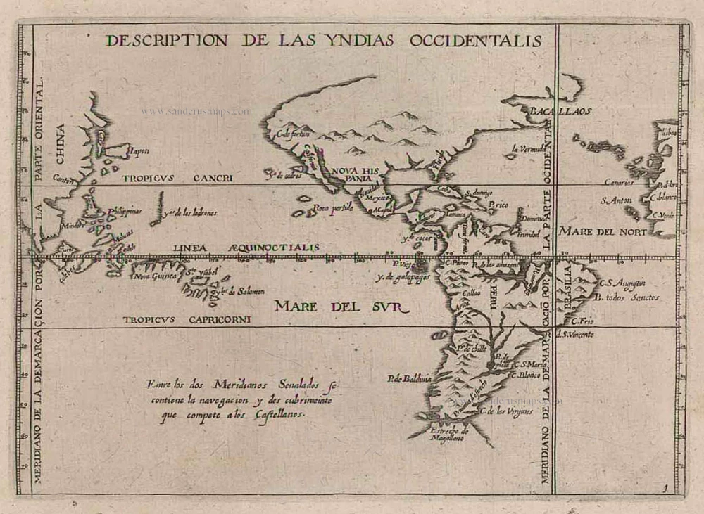
Description de las Yndias Occidentalis
Item Number: 24665 Authenticity Guarantee
Category: Antique maps > America > The Americas
Antique map of the Western Hemisphere by A. de Herrera y Tordesillas - L. Hulsius
This very rare map is a reduced version of Herrera's Americas map of 1601. It depicts the Papal line of demarcation dividing the world between Spanish and Portuguese spheres of influence. Being Spanish in origin this map naturally favours that country, placing the Philippines and Moluccas some 40° too far east. The cartography is based on the manuscript charts of Juan López de Velasco, c. 1575-80.
Date of the first edition: 1601
Date of this map: 1623
Copper engraving
Size: 13 x 18.5cm (5.1 x 7.2 inches)
Verso: Blank
Condition: Excellent.
Condition Rating: A
References: Burden, 204, 4th state; Church, 310.
From: L. Hulsius. Achtzehender Theil der Newen Welt. Frankfurt am Main, 1623.