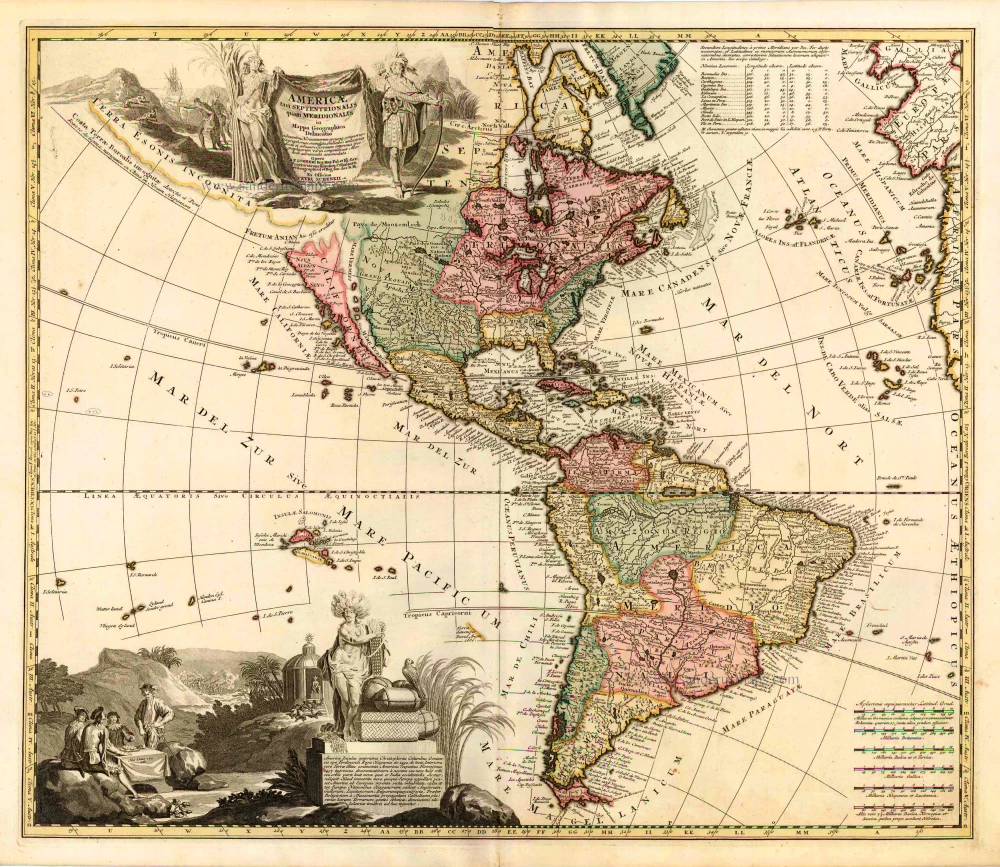
Old, antique map of America by Carolus Allard c. 1700
The Allard Family
The founder of this family of map-makers, publishers and print-sellers was Huych (Hugo) Allard (1625-1691). He worked in Amsterdam in 1684 and is supposed to have begun his business as early as 1645. He died in 1691, leaving his shop to his son, Carel Allard (1648-c. 1706). Carel brought out many maps and some atlases. His atlases are mainly composed of maps from the stock of other publishers like Janssonius and De Wit. However, some maps were his original creations. The States of Holland granted him a privilege for these maps in 1683.
One of the sons of Carel, Abraham Allard (1676-c.1730), joined his father in the map trade and was accepted as a member of the ‘Constvercoopers gilde’ (Art dealer’s Guild) in 1708.
The original geographical maps by Allard, designed and cut between 1680 and 1700, are very decorative, well-composed and up-to-date.
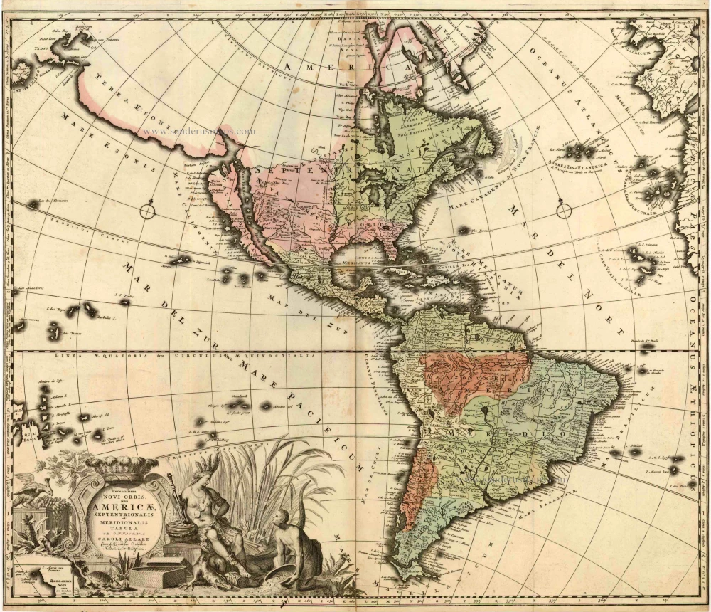
Recentissima Novi Orbis sive Americae Septentrionalis et Meridionalis Tabula.
Item Number: 5115 Authenticity Guarantee
Category: Antique maps > America > The Americas
Old, antique map of America by Carolus Allard
Date of the first edition: c. 1696
Date of this map: c. 1700
Copper engraving
Size: 50 x 59cm (19.4 x 23 inches)
Verso: Blank
Condition: Original old coloured, side margins trimmed to neatline.
Condition Rating: A
References: Burden, 724 State 3.
From: Carolus Allard. Atlas Minor, c.1700.
The map of America by Allard is derived from that of Frederick de Wit, c.1675. Here he draws on the fifth state with the added place name in the Great Lakes. The Dutch are still depicted laying claim to the New Netherlands. The main area of deviation is in the decorative cartouches, which are entirely different. That which was to the upper left on the de Wit is not replaced, allowing a greater display if the perceived cartography in the northern Pacific Ocean. The main title cartouche is altered to that of the figure of America sitting in the foreground of a field of sugar cane. An area in the immediate corner is left ingeniously unfinished to allow the insertion in the correct place of ZEELANDIA NOVA. The map includes five Great Lakes; de Wit being the first Dutch cartographer to do so. The two western lakes of Michigan and Superior are, however, left open to the west.
There are four states of the map. For the second state Allard enclosed within a ruled border the portion of the map within the title cartouche depicting New Zealand and added longitude markings and more nomenclature. He also completely re-engraved the cartography of QUIR REGIO and the islands nearby. The main area of alteration, however, is in the region of the Great Lakes and the Mississippi valley. The former are entirely re-engraved as are the nearby waterways off the St Lawrence River including Lake Champlain, which is moved south-west. Lake Superior is now enclosed to the west as is Lac des Puans, which is renamed Lac Illinois, placing the previous toponym correctly in Green Bay. To the west, an entirely new and more recent depiction of the Mississippi valley is inserted. This is derived directly from that of Louis Hennepin entitled CARTE d'un tres grand PAYS published in 1697. This includes the curious features of a R. Massourite draining a lake in the west into the Mississippi River, the same one which previously fed the R. del Norte into the Gulf of California. Similarly, from a point just south of Santa Fe the Rio Grande splits flowing both south-west as before and now southeast into the Gulf of Mexico. (Burden)
The Allard Family
The founder of this family of map-makers, publishers and print-sellers was Huych (Hugo) Allard (1625-1691). He worked in Amsterdam in 1684 and is supposed to have begun his business as early as 1645. He died in 1691, leaving his shop to his son, Carel Allard (1648-c. 1706). Carel brought out many maps and some atlases. His atlases are mainly composed of maps from the stock of other publishers like Janssonius and De Wit. However, some maps were his original creations. The States of Holland granted him a privilege for these maps in 1683.
One of the sons of Carel, Abraham Allard (1676-c.1730), joined his father in the map trade and was accepted as a member of the ‘Constvercoopers gilde’ (Art dealer’s Guild) in 1708.
The original geographical maps by Allard, designed and cut between 1680 and 1700, are very decorative, well-composed and up-to-date.

