
AMERICA by Danckerts J. c. 1680.
The item displayed on this page has been sold. However, we have a similar map in stock:
America by Justus Danckerts - California as an island 1696
Recentissima Novi Orbis Sive Americae...
[Item number: 32460]

Justus Danckerts (1635-1701) here replaces his earlier map of the American continent first issued c.1680.
Like the earlier map by Danckerts, this utilises the title cartouche of the Nicolaas Jansz Visscher, c.1658. This feature and the map's cartography are derived entirely from that by Frederick de Wit, c.1675. Here he draws on the fifth state with the added place name in the Great Lakes. The only significant difference is that Danckerts, this time removes the decorative cartouche top left. This enables him to include more of the Dutch explored lands of Terra Esonis, Yedso and Iaponiae. Like the De Wit, the rare first state does not bear nomenclature in Terra Esonis. This Danckerts soon changed in this second state. The map includes five Great Lakes, de Wit being the first Dutch cartographer to do so. However, the two western lakes of Michigan and Superior are left open to the west. The Dutch are still depicted laying claim to New Netherlands. (Burden)
The Danckerts Family.
The Danckerts family of Amsterdam was one of the best-known print and map sellers in 17th century Amsterdam. Their business activity covered a vast period, from ca. 1633. From 1669 until 1701, father Justus and his sons had their shop in the ‘Calverstraet in de Danckbaerheyt’.
Cornelis Danckerts (1561-1631) was a printseller born in Amsterdam and active in Antwerp.
Cornelis Danckerts, the elder (1603-1656) was an engraver and publisher in Amsterdam and Nieuwendijk. Son of Cornelis (above), whom he succeeded in 1631.
The house of Danckerts gained its greatest fame from Justus Danckerts (1635-1701 - son of Cornelis the elder) and his two sons, Theodorus and Cornelis. Dancker Danckerts (1634-1666), the elder brother of Justus, was known for his etchings of paintings, maps, and publications.
The grandfather, father, and sons were highly skilled and excellent artistic drafters and engravers. They are famous for the edition of their Atlas, which appeared from ca. 1686, and for several monumental and beautiful wall maps and views. However, compared with that published by the Blaeu's or Janssonius's, their cartographic work has attracted little attention and has never received proper recognition.
On 14 August 1684, Justus and his sons obtained the privilege from the States of Holland for their publications. In 1713, twelve years after Justus Danckerts, the heirs decided to sell part of the stock of maps and atlases and many copperplates. In 1727, after the death of the last surviving brother Theodorus, a final sale took place.
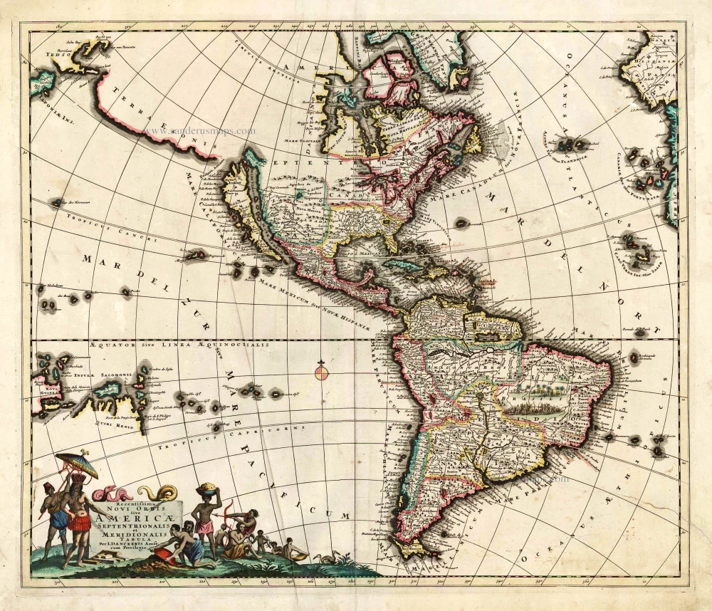
Recentissima Novi Orbis Sive Americae Septentrionalis et Meridionalis Tabula.
Item Number: 26527 Authenticity Guarantee
Category: Antique maps > America > The Americas
Old, antique map of America, by J. Danckerts.
Date of the first edition: c. 1696
Date of this map: c. 1696.
Copper engraving, printed on paper.
Size (not including margins): 50 x 58cm (19.5 x 22.6 inches)
Verso: Blank
Condition: Original coloured, a few light creases.
Condition Rating: A
References: Burden, 725 State 2.
From: Atlas. Amsterdam, J. Danckerts, c. 1696.
Justus Danckerts (1635-1701) here replaces his earlier map of the American continent first issued c.1680.
Like the earlier map by Danckerts, this utilises the title cartouche of the Nicolaas Jansz Visscher, c.1658. This feature and the map's cartography are derived entirely from that by Frederick de Wit, c.1675. Here he draws on the fifth state with the added place name in the Great Lakes. The only significant difference is that Danckerts, this time removes the decorative cartouche top left. This enables him to include more of the Dutch explored lands of Terra Esonis, Yedso and Iaponiae. Like the De Wit, the rare first state does not bear nomenclature in Terra Esonis. This Danckerts soon changed in this second state. The map includes five Great Lakes, de Wit being the first Dutch cartographer to do so. However, the two western lakes of Michigan and Superior are left open to the west. The Dutch are still depicted laying claim to New Netherlands. (Burden)
The Danckerts Family.
The Danckerts family of Amsterdam was one of the best-known print and map sellers in 17th century Amsterdam. Their business activity covered a vast period, from ca. 1633. From 1669 until 1701, father Justus and his sons had their shop in the ‘Calverstraet in de Danckbaerheyt’.
Cornelis Danckerts (1561-1631) was a printseller born in Amsterdam and active in Antwerp.
Cornelis Danckerts, the elder (1603-1656) was an engraver and publisher in Amsterdam and Nieuwendijk. Son of Cornelis (above), whom he succeeded in 1631.
The house of Danckerts gained its greatest fame from Justus Danckerts (1635-1701 - son of Cornelis the elder) and his two sons, Theodorus and Cornelis. Dancker Danckerts (1634-1666), the elder brother of Justus, was known for his etchings of paintings, maps, and publications.
The grandfather, father, and sons were highly skilled and excellent artistic drafters and engravers. They are famous for the edition of their Atlas, which appeared from ca. 1686, and for several monumental and beautiful wall maps and views. However, compared with that published by the Blaeu's or Janssonius's, their cartographic work has attracted little attention and has never received proper recognition.
On 14 August 1684, Justus and his sons obtained the privilege from the States of Holland for their publications. In 1713, twelve years after Justus Danckerts, the heirs decided to sell part of the stock of maps and atlases and many copperplates. In 1727, after the death of the last surviving brother Theodorus, a final sale took place.
Related items
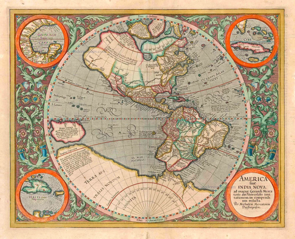
America sive India Nova ad magnae Gerardi Mercatoris avi Universalis imitationem in compendium redacta. 1623
America, by Gerard Mercator
[Item number: 131]
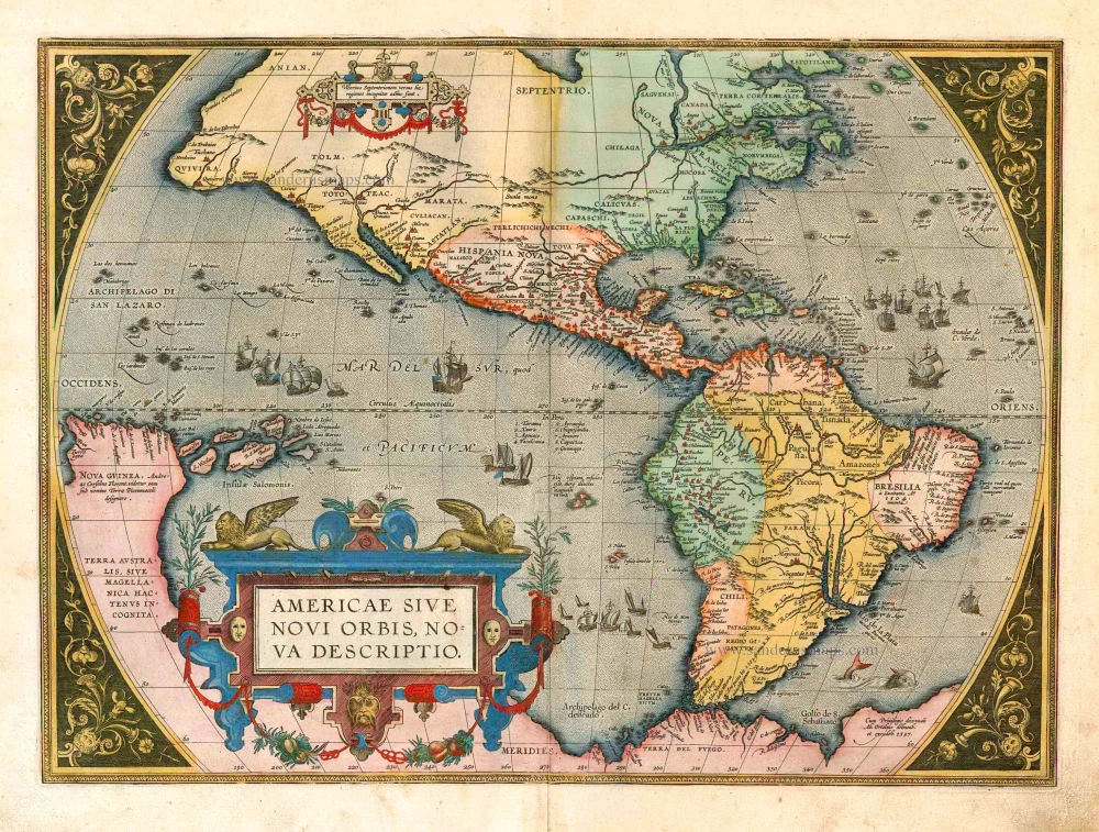
Americae Sive Novi Orbis, Nova Descriptio. 1598
America, by Abraham Ortelius.
[Item number: 25618]

California as an island
Nouveau Continent ou Amerique. 1685
The Western Hemisphere, by Alain Manesson-Mallet.
[Item number: 26644]
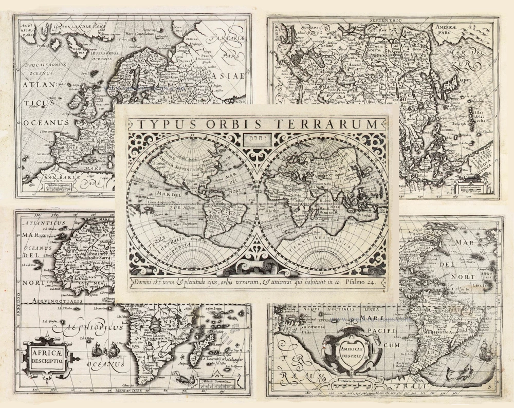
Typus Orbis Terrarum, [in set with:] Europa, [and] Asia, [and] Americae Descrip., [and] Africae Descriptio. 1607
World + Continents, by Jodocus Hondius.
[Item number: 27088]