
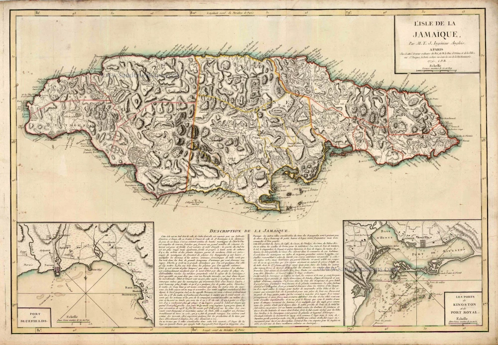
Old antique map of Jamaica by J. Lattré. 1779
Jean Lattré (???? - 1782)
'Graveur Ordinaire du Roi' (engraver to the King). A Paris-based engraver, bookseller, and map publisher. He worked with his father, Jean I, and specialised in town plans. Engraved maps for Robert de Vaugondy and for Rigobert Bonne. In 1771 he published Atlas moderne ou collection de cartes sur toutes les parties du Globe terrestre par plusieurs Auteurs.
L'Isle de la Jamaïque.
Item Number: 9391 Authenticity Guarantee
Category: Antique maps > America > West Indies
Old, antique map of Jamaica by J. Lattré.
With 2 insets: "Port de Bluefields" and "Les ports de Kingston et de Port Royal".
Cartographer: Thomas Jefferys
Copper engraving
Size: 49 x 71.5cm (19.1 x 27.9 inches)
Verso: Blank
Condition: Contemporary old coloured in outline, excellent.
Condition Rating: A
Jean Lattré (???? - 1782)
'Graveur Ordinaire du Roi' (engraver to the King). A Paris-based engraver, bookseller, and map publisher. He worked with his father, Jean I, and specialised in town plans. Engraved maps for Robert de Vaugondy and for Rigobert Bonne. In 1771 he published Atlas moderne ou collection de cartes sur toutes les parties du Globe terrestre par plusieurs Auteurs.
Related items
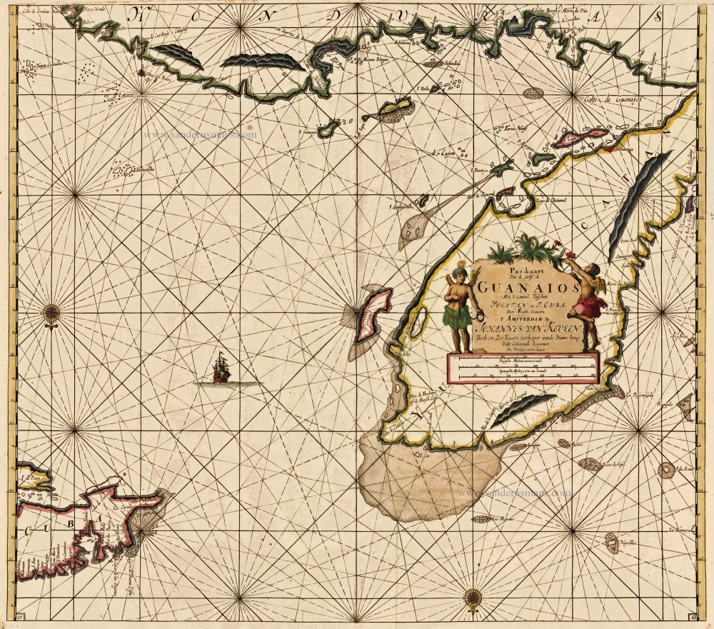
Pas-Kaart van de Golff de Guanaios. Met 't Canaal tusschen Yucatan en I. Cuba ... 1697-1709
The Caribbean Sea, by Johannes Van Keulen.
[Item number: 13037]
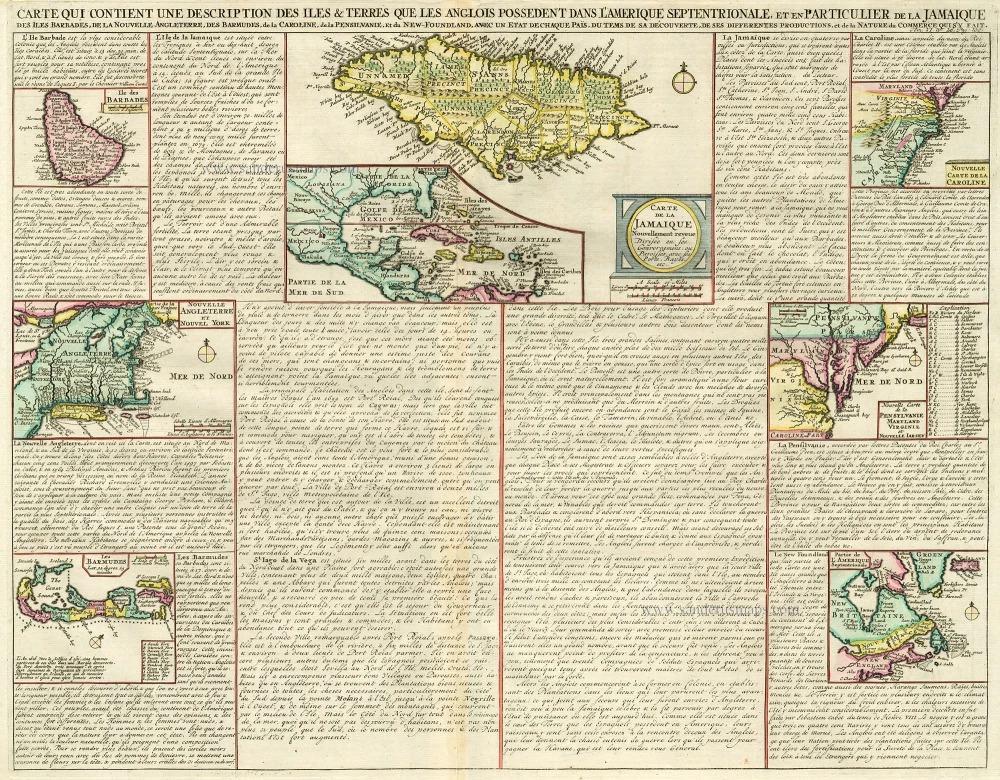
Carte qui Contient une Description des Iles & Terres que les Anglois Possèdent dans l'Amerique Septentrionale, et en Particulier de la Jamaique, .. 1713-1719
West Indies, Bermuda, New England, Virginia by Châtelain.
[Item number: 16834]
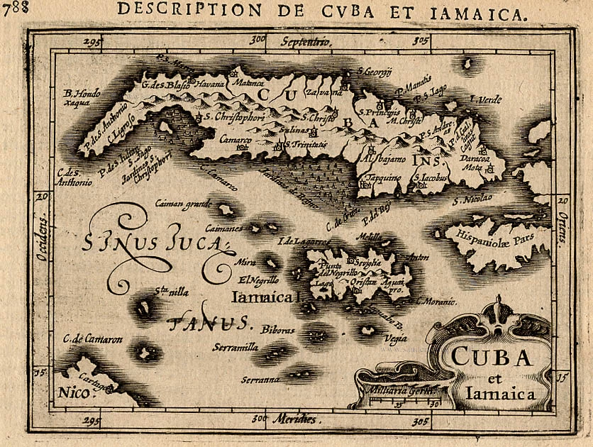
Cuba et Iamaica. 1618
Cuba and Jamaica,by Bertius P.
[Item number: 18315]