
Sea chart of the Gulf of Mexico, Yucatan Channel, by J. Van Keulen. 1680-1694

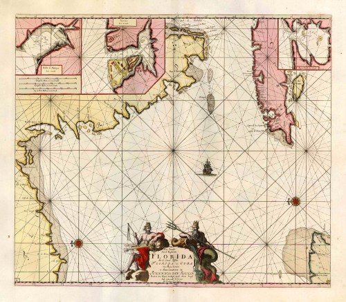

This map covers the mainland coastline from Biscayne Bay to what is believed to be the area of Apalachicola. The main feature of this map is its originality of form. It is the first sea chart of the eastern portion of the Gulf of Mexico detailing the west coast of Florida. The geography is primarily derived from the exceedingly rare Hessel Gerritsz chart of c.1631. The only region of variance is the coastline of Cuba. The entire area had not developed cartographically in a while, and all the toponyms are old Spanish ones. The three insets all relate to Cuban harbours. (Burden)
The House of Van Keulen
For more than two centuries, the chart makers firm of Van Keulen was established in the house with the name of “De Gekroonde Lootsman” (The Crowned Pilot). In 1678, the founder of the firm, Johannes I Van Keulen (1634-1689), registered with the Amsterdam booksellers’ guild. He had enlisted the aid of the well-known Mathematical Practitioner Claas Janz Vooght in the preparation of his nautical publications. In 1680 he published the first edition of the Zee-Atlas with 40 charts, all issued for the first time. In the short period of four years, they produced the five volumes of the Nieuwe Groote Ligtende Zee-Fakkel (1681-85). His acquisition of the stock of the bookseller Hendrik Doncker was an essential factor in the development of the firm.
In 1678 a son, Gerard Van Keulen (1678-1726), was born out of Johannes’s first marriage. This son was endowed with talent. He was a skilful engraver and proficient in mathematics and navigational science. Gerard was responsible for establishing the scientific basis of the firm of Van Keulen. In 1714 he was appointed to the office of hydrographer to the Dutch East India Company. The Van Keulens remained chart makers to the East India Company until the Company’s liquidation.
With the introductions to the Zee-Fakkel and Zee-Atlas, Gerard van Keulen gave a new impetus to the firm. Unfortunately, he did not live long, dying when he was 49. The business was carried on by his widow Ludwina Konst. Shortly before Gerard’s death, his son Johannes II had entered the bookseller’s guild, and in 1726 he assumed the management of the firm, though his mother retained her financial interests in the business.
Johannes II Van Keulen (1704-1755) is known in particular for his publication in 1753 of a sixth volume of the Zee-Fakkel, the volume containing the charts of the route to the East Indies.
Johannes II had two sons; they joined the firm as partners in 1757. A considerable number of books appeared in the period 1778-1801. New issues of the Zee-Fakkel again saw the light. The firm flourished under different names until 1885.
Pas Kaart van de Boght van Florida met de Canaal tusschen Florida en Cuba ...
Item Number: 16285 Authenticity Guarantee
Category: Antique maps > America > West Indies
Old, antique sea chart of the Gulf of Mexico, Yucatan Channel, by J. Van Keulen.
Oriented to the east.With insets of Matanzas Bay, Havana Harbor, and Hondo Bay.
Title: Pas Kaart van de Boght van Florida met de Canaal tusschen Florida en Cuba ...
Oriented to the east.
Cartographer: C.J. Vooght.
Date of the first edition: 1684.
Date of this map: 1680-1694.
Copper engraving, printed on paper.
Size (not including margins): 510 x 590mm (20.08 x 23.23 inches).
Verso: Blank.
Condition: Original coloured, on heavy paper with wide margins, excellent.
Condition Rating: A+.
From: De Groote Nieuwe Vermeerderde Zee-Atlas ofte Water-Werelt. ... Amsterdam, J. Van Keulen, 1680-1694. (Koeman, Keu2-23).
This map covers the mainland coastline from Biscayne Bay to what is believed to be the area of Apalachicola. The main feature of this map is its originality of form. It is the first sea chart of the eastern portion of the Gulf of Mexico detailing the west coast of Florida. The geography is primarily derived from the exceedingly rare Hessel Gerritsz chart of c.1631. The only region of variance is the coastline of Cuba. The entire area had not developed cartographically in a while, and all the toponyms are old Spanish ones. The three insets all relate to Cuban harbours. (Burden)
The House of Van Keulen
For more than two centuries, the chart makers firm of Van Keulen was established in the house with the name of “De Gekroonde Lootsman” (The Crowned Pilot). In 1678, the founder of the firm, Johannes I Van Keulen (1634-1689), registered with the Amsterdam booksellers’ guild. He had enlisted the aid of the well-known Mathematical Practitioner Claas Janz Vooght in the preparation of his nautical publications. In 1680 he published the first edition of the Zee-Atlas with 40 charts, all issued for the first time. In the short period of four years, they produced the five volumes of the Nieuwe Groote Ligtende Zee-Fakkel (1681-85). His acquisition of the stock of the bookseller Hendrik Doncker was an essential factor in the development of the firm.
In 1678 a son, Gerard Van Keulen (1678-1726), was born out of Johannes’s first marriage. This son was endowed with talent. He was a skilful engraver and proficient in mathematics and navigational science. Gerard was responsible for establishing the scientific basis of the firm of Van Keulen. In 1714 he was appointed to the office of hydrographer to the Dutch East India Company. The Van Keulens remained chart makers to the East India Company until the Company’s liquidation.
With the introductions to the Zee-Fakkel and Zee-Atlas, Gerard van Keulen gave a new impetus to the firm. Unfortunately, he did not live long, dying when he was 49. The business was carried on by his widow Ludwina Konst. Shortly before Gerard’s death, his son Johannes II had entered the bookseller’s guild, and in 1726 he assumed the management of the firm, though his mother retained her financial interests in the business.
Johannes II Van Keulen (1704-1755) is known in particular for his publication in 1753 of a sixth volume of the Zee-Fakkel, the volume containing the charts of the route to the East Indies.
Johannes II had two sons; they joined the firm as partners in 1757. A considerable number of books appeared in the period 1778-1801. New issues of the Zee-Fakkel again saw the light. The firm flourished under different names until 1885.
Related items
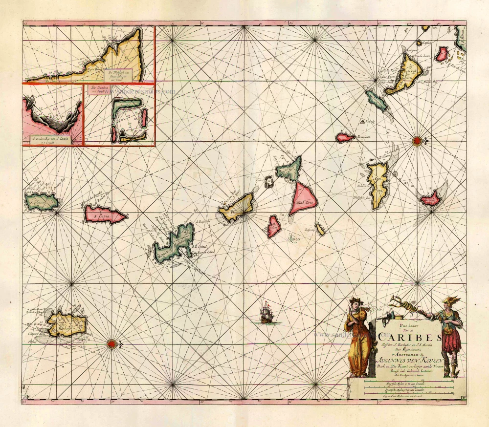
Pas Kaart van de Caribes tusschen I. Barbados en I.S. Martin. 1684
The Lesser Antilles, by J. Van Keulen.
[Item number: 2377]
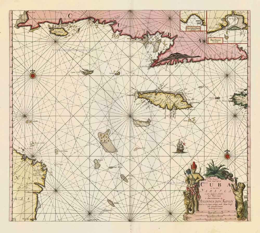
Pas Kaart vande Zuyd Kust van Cuba en van Geheel Yamaica en and're Bygeleegen Plaatsen ... 1697-1709
Cuba - Jamaica by Johannes van Keulen
[Item number: 11219]
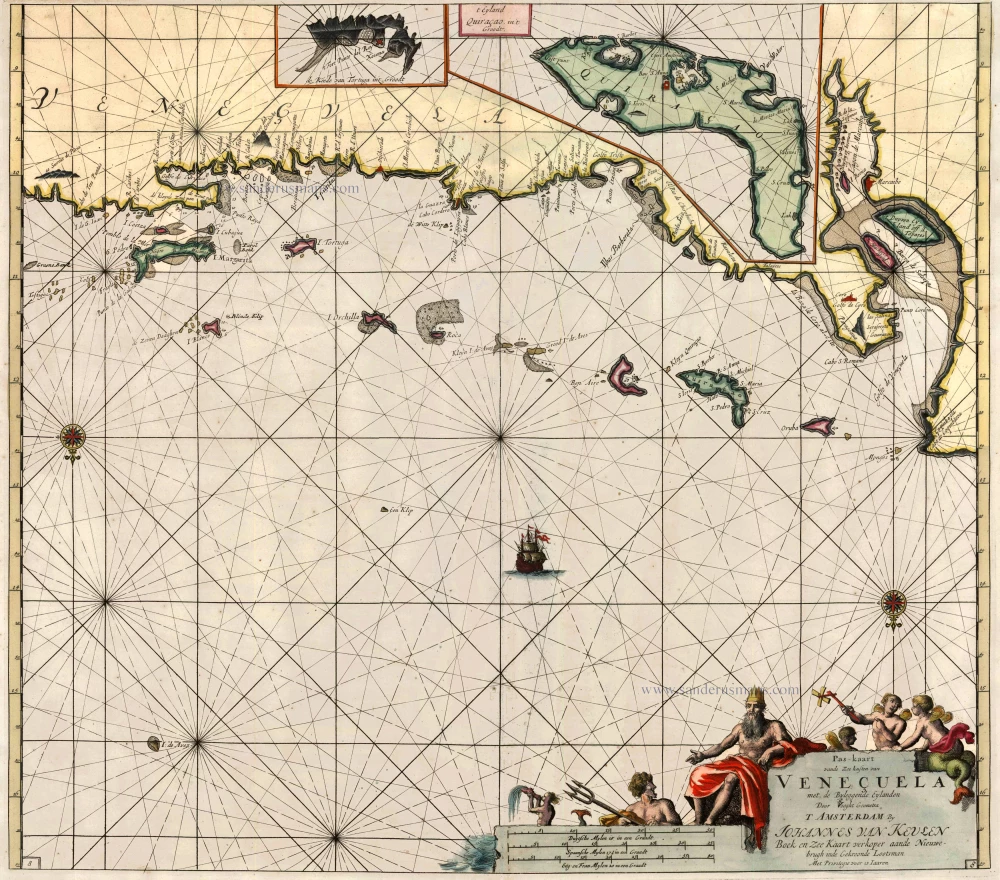
Pas-Kaart vande Zee-Kusten van Veneçuela met de Byleggende Eylanden 1697-1709
Sea chart of Venezuela, by J. Van Keulen.
[Item number: 13681]
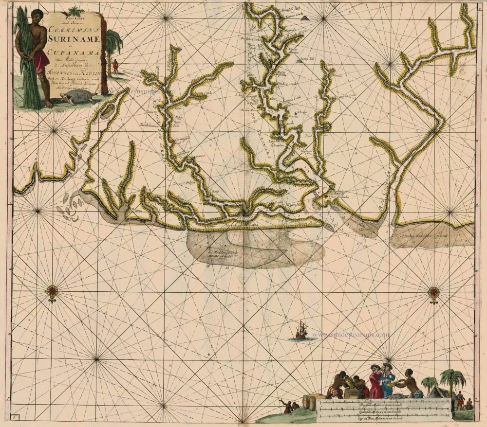
Pas-Kaart vande Rivieren Commewini Suriname en Cupanama. 1697-1709
Suriname by J. Van Keulen.
[Item number: 13692]
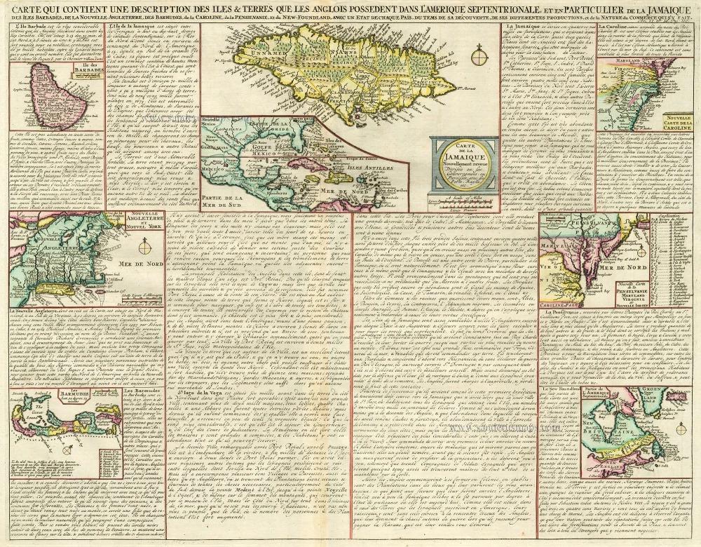
Carte qui Contient une Description des Iles & Terres que les Anglois Possèdent dans l'Amerique Septentrionale, et en Particulier de la Jamaique, .. 1713-1719
West Indies, Bermuda, New England, Virginia by Châtelain.
[Item number: 16834]
Hispaniae Novae sivae Magnae, recens et vera descriptio. 1612
New Spain (Mexico) by Abraham Ortelius.
[Item number: 23112]

Heightened in gold
Pascaert vande Caribes Eylanden. 1667
Sea chart of the Lesser Antilles, by Pieter Goos.
[Item number: 25708]
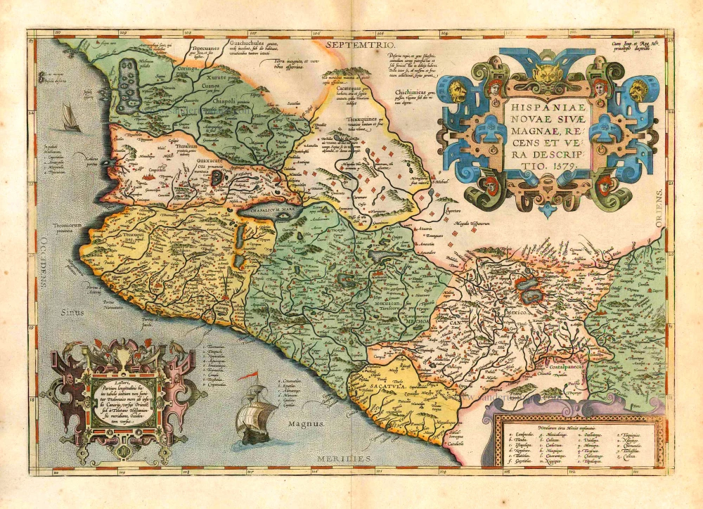
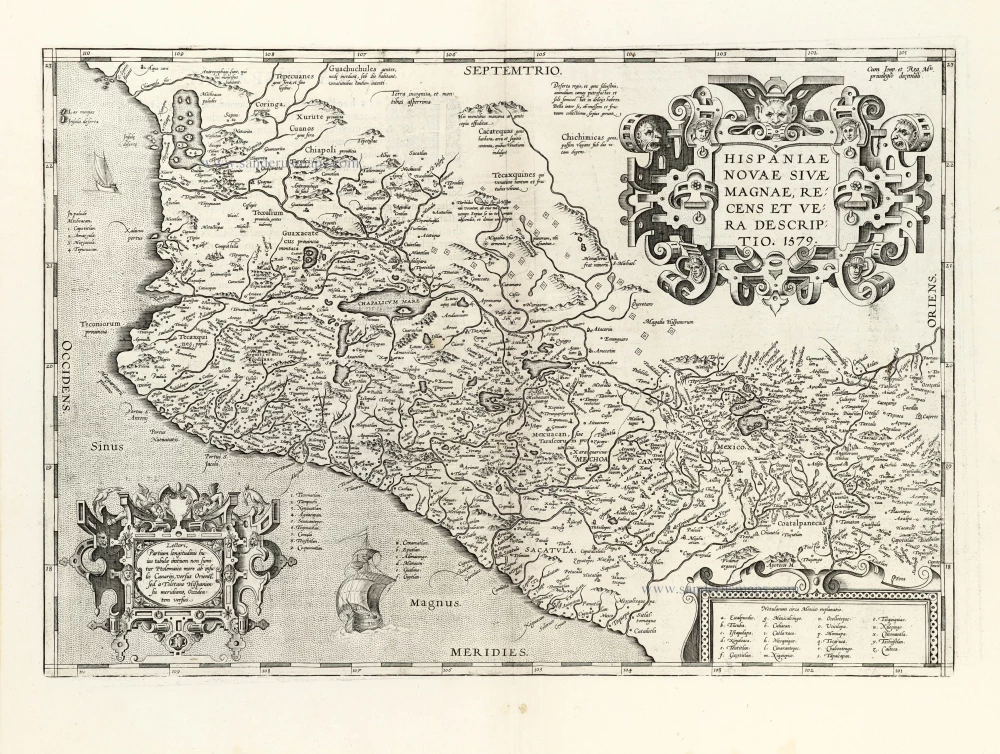
Hispaniae Novae sivae Magnae, recens et vera descriptio. 1579. 1595
New Spain (Mexico) by Abraham Ortelius.
[Item number: 26297]
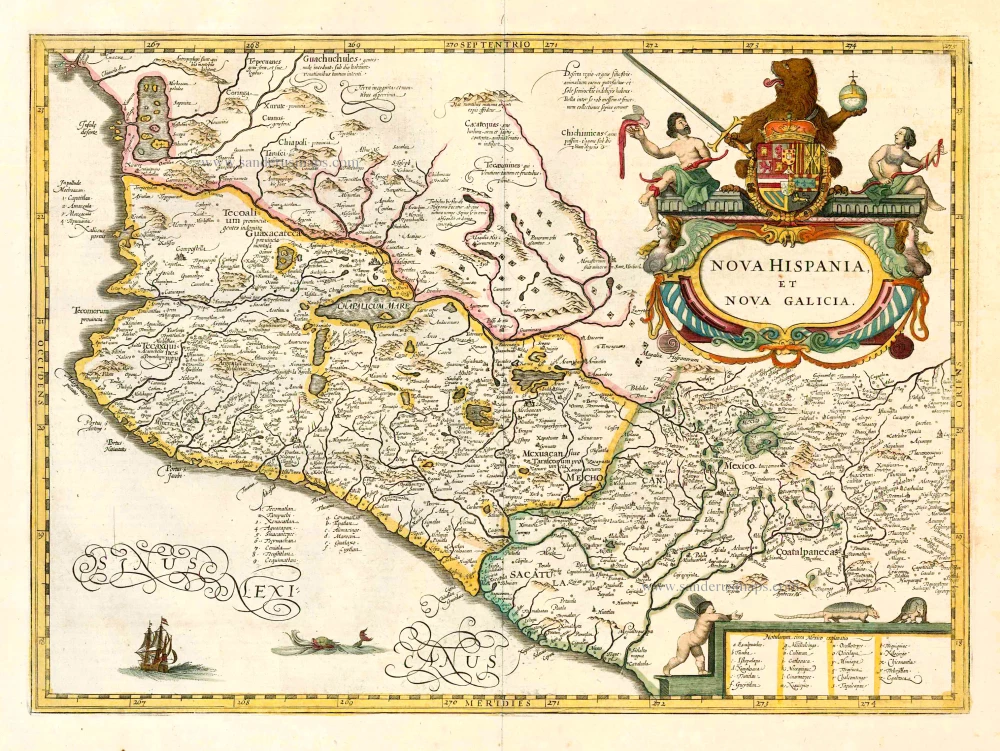
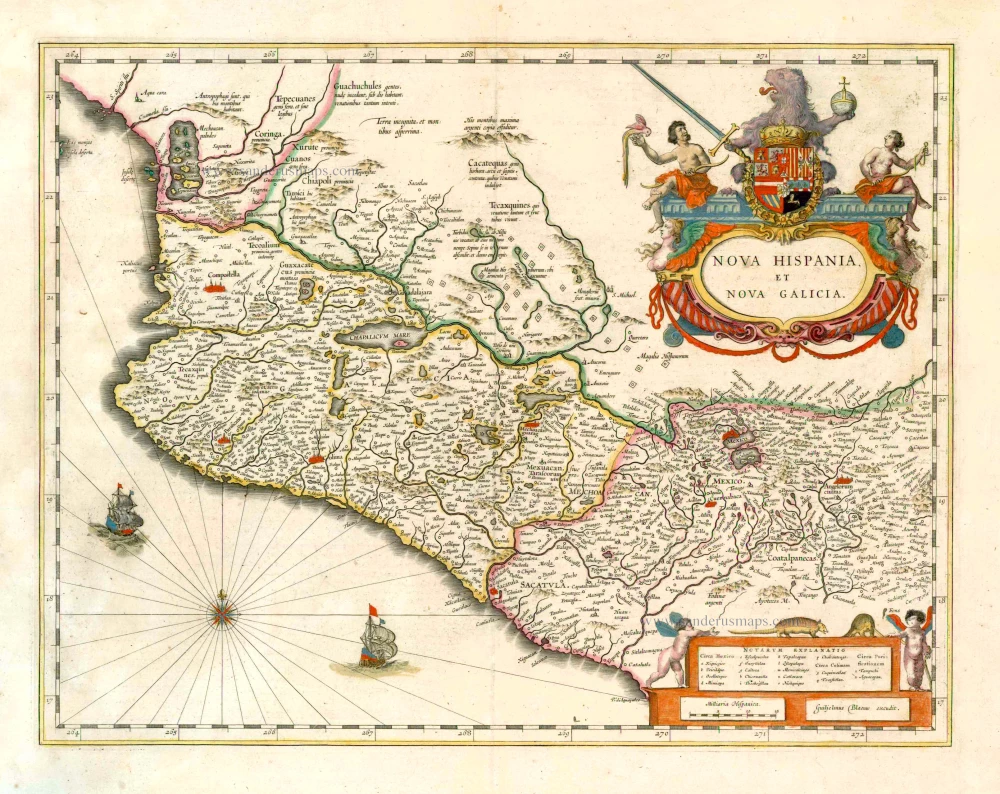
Nova Hispania et Nova Galicia. 1641
New Spain (Mexico), by Johannes Janssonius.
[Item number: 26463]
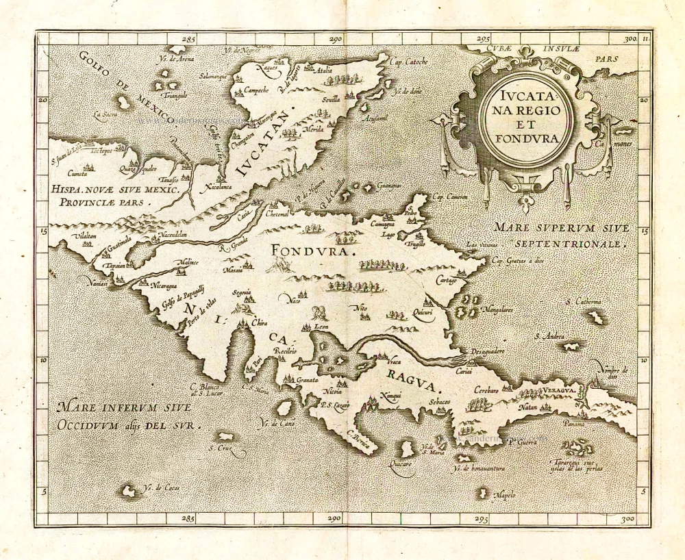
Iucatana Regio et Fondura. 1607
Yucatan, by Cornelis van Wytfliet.
[Item number: 26495]
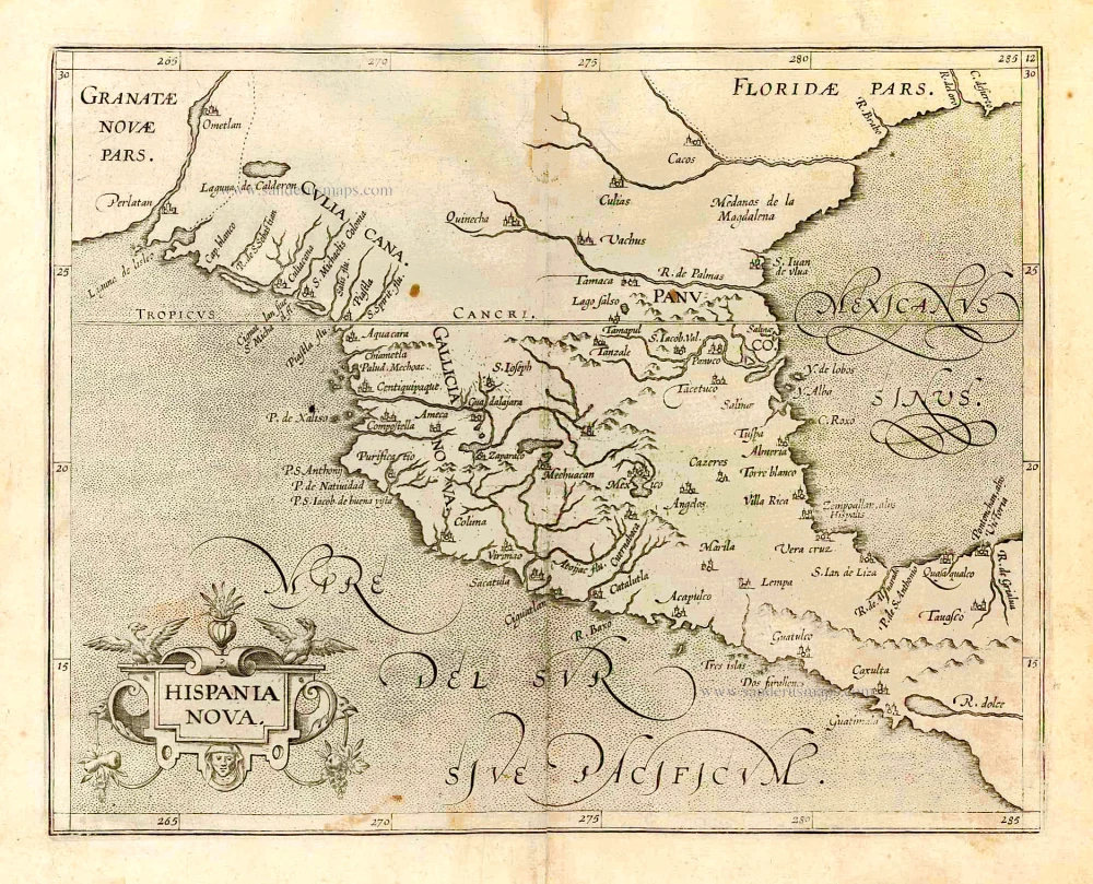
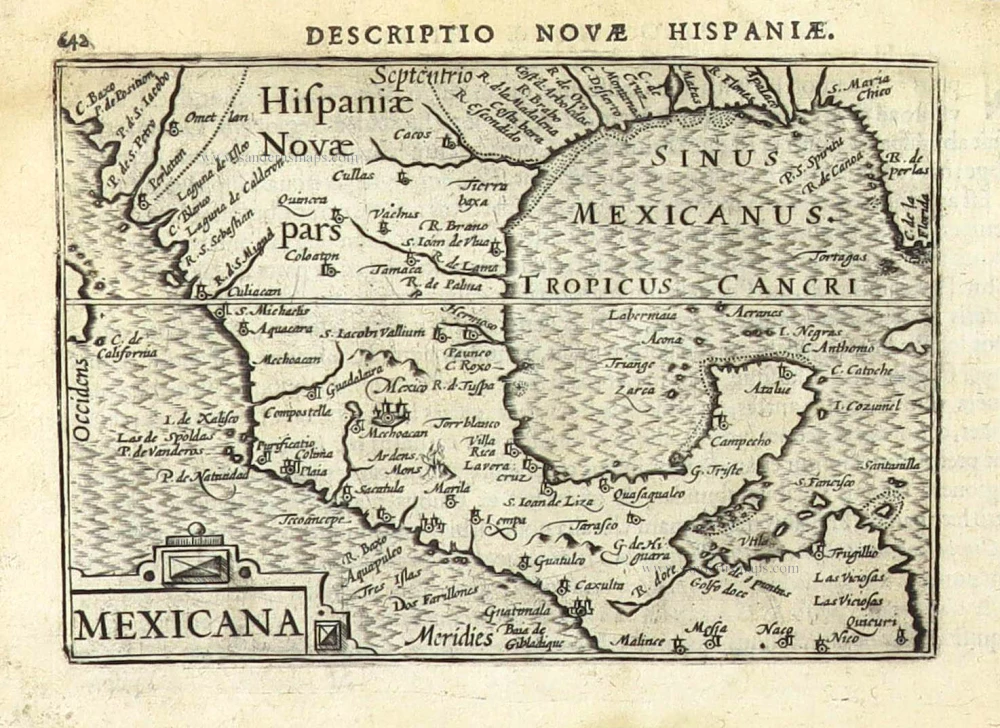
Hispania Nova. 1607
Mexico, by C. van Wytfliet.
[Item number: 26501]
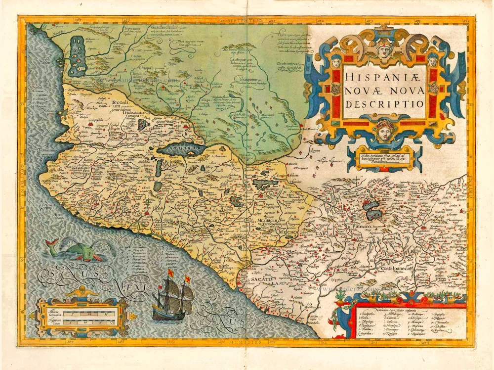
Nova Hispania et Nova Galicia. 1643-50
New Spain (West Mexico), by Willem & Joan Blaeu.
[Item number: 26738]

Haven van Aquapulco in 't Coninkryk van Nova Spagnien in de Zuyd Zee. 1724-26
Acapulco, by François Valentyn (Valentijn).
[Item number: 26873]
Hispaniae Novae Nova Descriptio. 1623
New Spain (Mexico) by Jodocus Hondius.
[Item number: 27817]
Mexico sive N. Hispania. 1661
Mexico, by Pierre Duval.
[Item number: 27839]
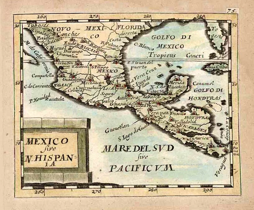
Mexicana. 1602
Mexico, Texas & Florida by Bertius Petrus
[Item number: 29492]
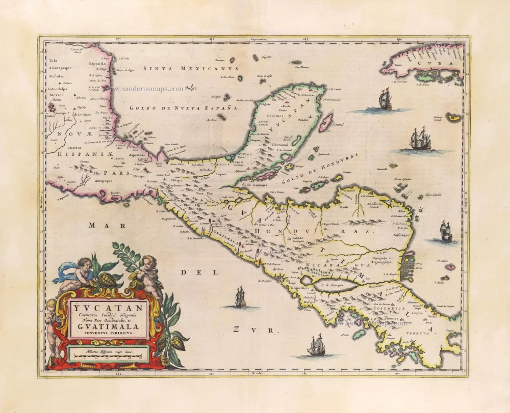
Yucatan Conventus Iuridici Hispaniae Novae Pars Occidentalis, et Guatimala Conventus Iuridicus. 1663
Yucatan by Joan Blaeu.
[Item number: 29706]
Very rare.
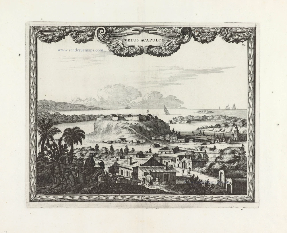
Portus Acapulco. 1685/90
View of Acapulco (Mexico) by Carel Allard.
[Item number: 30548]