
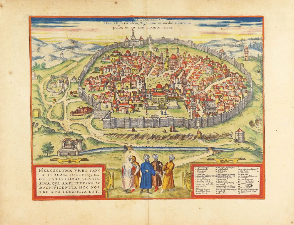
Jerusalem by Georg Braun and Frans Hogenberg. 1617
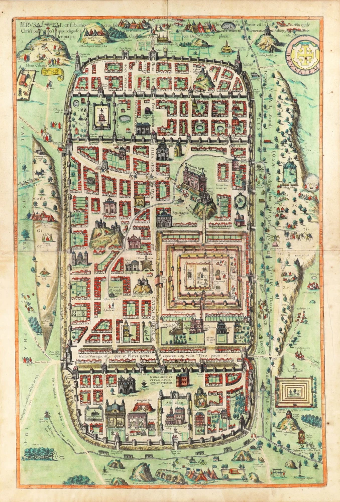
TRANSLATION OF CAPTION: Jerusalem and its suburbs as it flourished in the time of Christ, with the places where Christ suffered. Preserved with reverence by the Christians, they are still venerated today. Described by Christian Adrichom of Delft.
Braun G. & Hogenberg F. and the Civitates Orbis Terrarum.
The Civitates Orbis Terrarum, also known as the 'Braun & Hogenberg', is a six-volume town atlas and the most excellent book of town views and plans ever published: 363 engravings, sometimes beautifully coloured. It was one of the best-selling works in the last quarter of the 16th century. Georg Braun, a skilled writer, wrote the text accompanying the plans and views on the verso. Many plates were engraved after the original drawings of a professional artist, Joris Hoefnagel (1542-1600). The first volume was published in Latin in 1572 and the sixth in 1617. Frans Hogenberg, a talented engraver, created the tables for volumes I through IV, and Simon van den Neuwel made those for volumes V and VI. Other contributors were cartographers Daniel Freese and Heinrich Rantzau, who provided valuable geographical information. Works by Jacob van Deventer, Sebastian Münster, and Johannes Stumpf were also used as references. Translations appeared in German and French, making the atlas accessible to a wider audience.
Since its original publication of volume 1 in 1572, the Civitates Orbis Terrarum has left an indelible mark on the history of cartography. The first volume was followed by seven more editions in 1575, 1577, 1582, 1588, 1593, 1599, and 1612. Vol.2, initially released in 1575, saw subsequent editions in 1597 and 1612. The subsequent volumes, each a treasure trove of historical insights, graced the world in 1581, 1588, 1593, 1599, and 1606. The German translation of the first volume, a testament to its widespread appeal, debuted in 1574, followed by the French edition in 1575.
Several printers were involved: Theodor Graminaeus, Heinrich von Aich, Gottfried von Kempen, Johannis Sinniger, Bertram Buchholtz, and Peter von Brachel, all of whom worked in Cologne.
Georg Braun (1541-1622)
Georg Braun, the author of the text accompanying the plans and views in the Civitates Orbis Terrarum, was born in Cologne in 1541. After his studies in Cologne, he entered the Jesuit Order as a novice, indicating his commitment to learning and intellectual pursuits. In 1561, he obtained his bachelor's degree; in 1562, he received his Magister Artium, further demonstrating his academic achievements. Although he left the Jesuit Order, he continued his studies in theology, gaining a licentiate in theology. His theological background likely influenced the content and tone of the text in the Civitates Orbis Terrarum, adding a unique perspective to the work.
Frans Hogenberg (1535-1590)
Frans Hogenberg was a Flemish and German painter, engraver, and mapmaker. He was born in Mechelen as the son of Nicolaas Hogenberg.
By the end of the 1560s, Frans Hogenberg was employed upon Abraham Ortelius's Theatrum Orbis Terrarum, published in 1570; he is named an engraver of numerous maps. In 1568, he was banned from Antwerp by the Duke of Alva and travelled to London, where he stayed a few years before emigrating to Cologne. He immediately embarked on his two most important works, the Civitates, published in 1572 and the Geschichtsblätter, which appeared in several series from 1569 until about 1587.
Thanks to large-scale projects like the Geschichtsblätter and the Civitates, Hogenberg's social circumstances improved with each passing year. He died as a wealthy man in Cologne in 1590.
Ierusalem, et Suburbia eius, sicut Tempore Christi Floruit, cum Locis in quibus Christ Pass. est quae religiose à Christianis observata etiam num Veneratio ni habent descripta per Christianum Adrichom Delphum Delphum.
Item Number: 29850 Authenticity Guarantee
Category: Antique maps > Asia > Holy Land
Old, antique bird’s-eye view plan of Jerusalem by Georg Braun and Frans Hogenberg.
Title: Ierusalem, et Suburbia eius, sicut Tempore Christi Floruit, cum Locis in quibus Christ Pass. est quae religiose à Christianis observata etiam num Veneratio ni habent descripta per Christianum Adrichom Delphum Delphum.
Cartographer: Christiaan van Adrichom.
Date of the first edition: 1588.
Date of this map: 1617.
Copper engraving, printed from two plates on two sheets of paper, joined.
Image size: 730 x 490mm (28.74 x 19.29 inches).
Sheet size: 780 x 530mm (30.71 x 20.87 inches).
Verso: Latin text.
Condition: Original coloured, excellent.
Condition Rating: A+.
From: Liber Quartus Urbium Praecipuarum Totius Mundi. Cologne, Petrus von Brachel, 1617. (Van der Krogt 4, 41:1.4(1617))
TRANSLATION OF CAPTION: Jerusalem and its suburbs as it flourished in the time of Christ, with the places where Christ suffered. Preserved with reverence by the Christians, they are still venerated today. Described by Christian Adrichom of Delft.
Braun G. & Hogenberg F. and the Civitates Orbis Terrarum.
The Civitates Orbis Terrarum, also known as the 'Braun & Hogenberg', is a six-volume town atlas and the most excellent book of town views and plans ever published: 363 engravings, sometimes beautifully coloured. It was one of the best-selling works in the last quarter of the 16th century. Georg Braun, a skilled writer, wrote the text accompanying the plans and views on the verso. Many plates were engraved after the original drawings of a professional artist, Joris Hoefnagel (1542-1600). The first volume was published in Latin in 1572 and the sixth in 1617. Frans Hogenberg, a talented engraver, created the tables for volumes I through IV, and Simon van den Neuwel made those for volumes V and VI. Other contributors were cartographers Daniel Freese and Heinrich Rantzau, who provided valuable geographical information. Works by Jacob van Deventer, Sebastian Münster, and Johannes Stumpf were also used as references. Translations appeared in German and French, making the atlas accessible to a wider audience.
Since its original publication of volume 1 in 1572, the Civitates Orbis Terrarum has left an indelible mark on the history of cartography. The first volume was followed by seven more editions in 1575, 1577, 1582, 1588, 1593, 1599, and 1612. Vol.2, initially released in 1575, saw subsequent editions in 1597 and 1612. The subsequent volumes, each a treasure trove of historical insights, graced the world in 1581, 1588, 1593, 1599, and 1606. The German translation of the first volume, a testament to its widespread appeal, debuted in 1574, followed by the French edition in 1575.
Several printers were involved: Theodor Graminaeus, Heinrich von Aich, Gottfried von Kempen, Johannis Sinniger, Bertram Buchholtz, and Peter von Brachel, all of whom worked in Cologne.
Georg Braun (1541-1622)
Georg Braun, the author of the text accompanying the plans and views in the Civitates Orbis Terrarum, was born in Cologne in 1541. After his studies in Cologne, he entered the Jesuit Order as a novice, indicating his commitment to learning and intellectual pursuits. In 1561, he obtained his bachelor's degree; in 1562, he received his Magister Artium, further demonstrating his academic achievements. Although he left the Jesuit Order, he continued his studies in theology, gaining a licentiate in theology. His theological background likely influenced the content and tone of the text in the Civitates Orbis Terrarum, adding a unique perspective to the work.
Frans Hogenberg (1535-1590)
Frans Hogenberg was a Flemish and German painter, engraver, and mapmaker. He was born in Mechelen as the son of Nicolaas Hogenberg.
By the end of the 1560s, Frans Hogenberg was employed upon Abraham Ortelius's Theatrum Orbis Terrarum, published in 1570; he is named an engraver of numerous maps. In 1568, he was banned from Antwerp by the Duke of Alva and travelled to London, where he stayed a few years before emigrating to Cologne. He immediately embarked on his two most important works, the Civitates, published in 1572 and the Geschichtsblätter, which appeared in several series from 1569 until about 1587.
Thanks to large-scale projects like the Geschichtsblätter and the Civitates, Hogenberg's social circumstances improved with each passing year. He died as a wealthy man in Cologne in 1590.
Related items
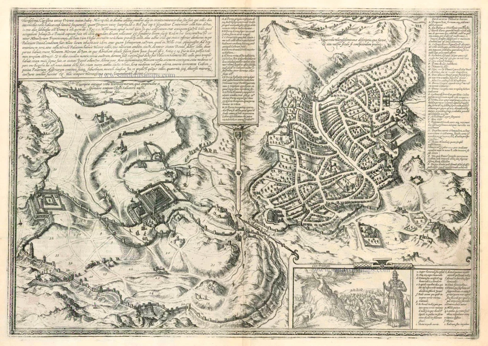
Hierosolyma, Clarissima Totius Orientis Civitas Iudaee Metropolis ... 1599
Jerusalem, by Georg Braun and Frans Hogenberg.
[Item number: 23948]
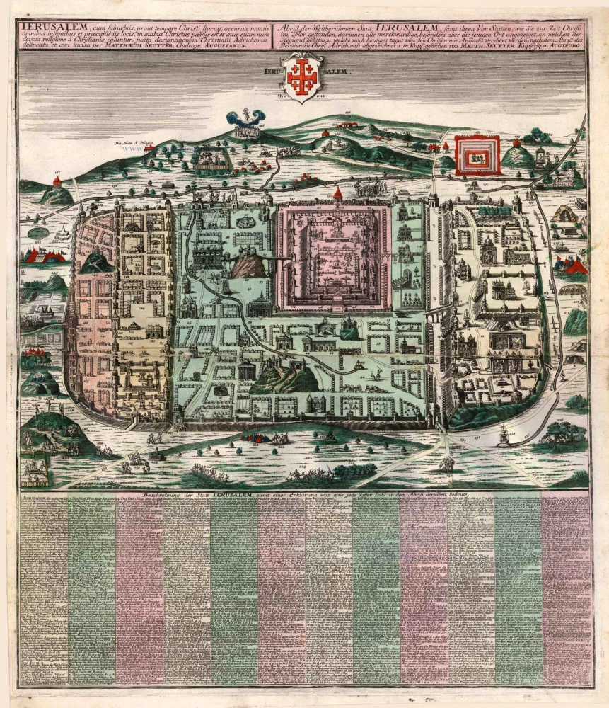
Ierusalem, cum Suburbiis, Prout Tempore Christi Floruit ... 1740
Jerusalem, by M. Seutter.
[Item number: 25345]
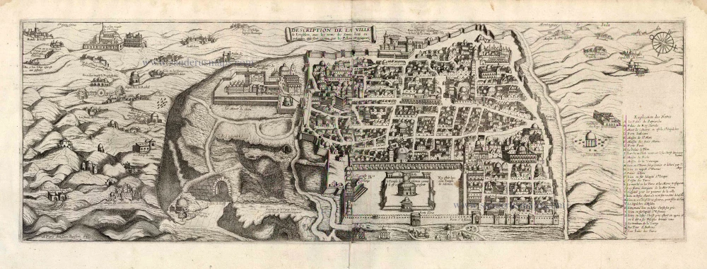
Description de la Ville de Jerusalem avec les Noms des Saints Lieux ou Antiquitez qui sont Visitez par les Pellerins et Voiageurs. 1648
Jerusalem by J. Boisseau.
[Item number: 25598]

La saincte cité de Ierusalem iadiz metropolitaine du royaume des Iuifz, & maintenant colonie du Turc. 1552
Jerusalem, by Sebastian Munster.
[Item number: 27359]
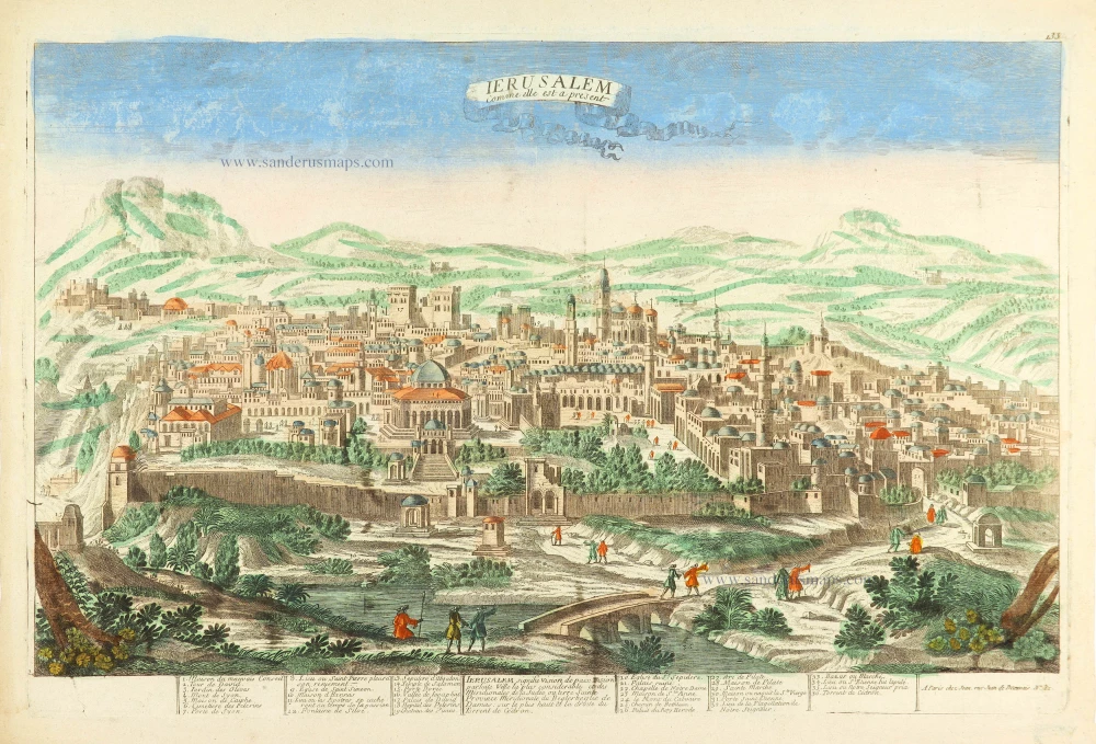
Ierusalem comme elle est a present. c. 1780
Jerusalem by Pierre Aveline.
[Item number: 28752]
Hierosolyma Urbs Sancta, Iudeae, Totiusque Orientis Longe Clarissima ... 1623
Jerusalem, by Georg Braun & Frans Hogenberg
[Item number: 29229]
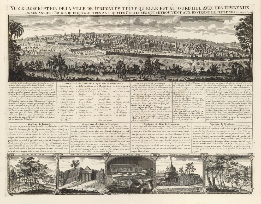
Vue & Description de la ville de Jerusalem telle qu'elle est aujourd'hui avec les tombeaux de ses anciens rois, & quelques autres antiquités curieuses qui se trouvent aux environs de cette ville. 1719
Jerusalem, by Z. Châtelain
[Item number: 29374]
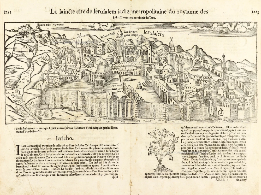
La saincte cité de Ierusalem iadiz metropolitaine du royaume des Iuifz, & maintenant colonie du Turc. 1568
Jerusalem, by Sebastian Munster.
[Item number: 30601]