
Antique map of India by Blaeu J. 1650
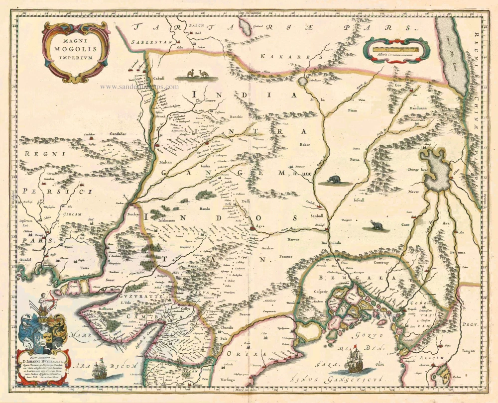
Magni Mogolis Imperium
Item Number: 6679 Authenticity Guarantee
Category: Antique maps > Asia > India - Ceylon
Antique map of India by Blaeu J., oriented to the North
The empire of the Great Mogol, founded at the beginning of the sixteenth century, extended from present-day Afghanistan to Dacca in Bangladesh. The English and Dutch trading companies in particular were enormously interested in this empire. The information on the map comes from that of William Baffin from 1618, who got his information from the reports of Sir Thomas Roe, embassador of King James I of England to the Great Mogul Jahangir in 1615.
Date of the first edition: 1640
Date of this map: 1650
Copper engraving
Size: 41.5 x 52cm (16.2 x 20.3 inches)
Verso text: Latin
Condition: Old coloured, excellent.
Condition Rating: A
References: Van der Krogt 2, 8330:2.
From: Theatrum Orbis Terrarum sive Atlas Novus. Pars Secunda. J. Blaeu, 1650. (Van der Krogt 2, 2:202)