
Alexander's Expeditions by Abraham Ortelius. 1595
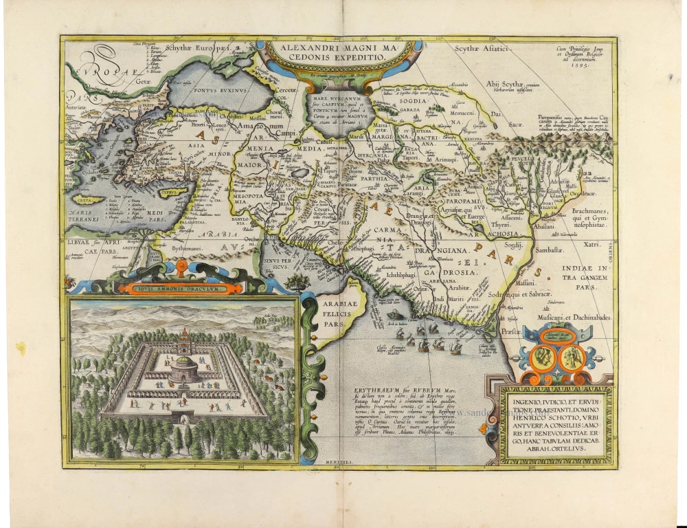
A magnificent and highly decorative historical map illustrating the military campaigns and conquests of Alexander the Great (356–323 BC), engraved by Abraham Ortelius, the celebrated Flemish cartographer and creator of the first modern atlas, the Theatrum Orbis Terrarum.
First published in 1595, this remarkable map traces the geographical extent of Alexander's expeditions, from Macedonia and Greece through Asia Minor, Egypt, Persia and Central Asia to the Indus Valley and northwestern India. It represents one of Ortelius's most ambitious attempts to reconstruct the geography of the ancient world using classical historical and geographical sources.
The map covers an immense geographical area, extending from the Mediterranean and the Balkans in the west to India in the east, and from the Black Sea and the Caspian region in the north to Arabia and the Indian Ocean in the south. Ancient geographical names are meticulously engraved, reflecting Ortelius's extensive knowledge of classical literature and his scholarly approach to historical cartography.
Particularly interesting is the representation of the Caspian Sea, shown in an elongated east–west configuration that reflects ancient geographical conceptions rather than contemporary cartographic knowledge. The map also depicts the rivers, mountain ranges, cities and regions associated with Alexander's campaigns, including Mesopotamia, Babylonia, Persia, Bactria and the Indus Valley.
The upper centre contains an elaborate ornamental title cartouche inscribed Alexandri Magni Macedonis Expeditio, while the upper right corner bears the date 1595 and the imperial and Netherlandish privilege.
One of the most striking features is the large inset illustration in the lower left corner, entitled Iovis Ammonis Oraculum. This finely engraved bird's-eye view represents the celebrated Oracle of Jupiter Ammon at the oasis of Siwa in the Libyan Desert. According to ancient historians, Alexander visited the sanctuary in 331 BC, where he was acknowledged as the son of Zeus-Ammon, an event of considerable significance in the development of his divine kingship. Ortelius depicts the sanctuary as a monumental walled complex, surrounded by trees and desert mountains, with a central circular temple and numerous small human figures.
The lower right corner contains an elaborate dedication cartouche addressed to Henricus Schotius (Hendrik Schot), a prominent Antwerp figure, and signed by Abraham Ortelius. Above it are two small circular medallions with classical imagery, further emphasising the map's historical character.
The Indian Ocean is decorated with a fleet of sailing ships, while the surrounding seas contain geographical annotations derived from ancient authorities. The finely engraved mountains, rivers and settlements, together with the attractive hand-colouring and richly ornamented cartouches, make this one of the most visually appealing historical maps in Ortelius's work.
The map was published in the Parergon, Ortelius's celebrated collection of historical maps, which accompanied later editions of the Theatrum Orbis Terrarum. Unlike the geographical maps of the main atlas, the Parergon reconstructed the ancient world through a critical study of classical authors, historical accounts, and geographical traditions. It is widely regarded as one of the earliest systematic atlases of historical geography.
The present example comes from the 1624 Latin edition of the Theatri Orbis Terrarum Parergon, published in Antwerp by Balthasar Moretus, several decades after Ortelius's death.
An outstanding example of Renaissance historical cartography, combining classical scholarship, geographical reconstruction and the decorative refinement characteristic of Ortelius's finest work.
Abraham Ortelius (1527-1598)
The maker of the 'first atlas', the Theatrum Orbis Terrarum (1570), was born on 4 April 1527 into an old Antwerp family. He learned Latin and studied Greek and mathematics.
Abraham and his sisters, Anne and Elizabeth, took up map colouring. Ortelius was admitted to the Guild of St. Luke as an "illuminator of maps." In addition to colouring maps, Ortelius was a dealer in antiques, coins, maps, and books, and the book and map trade gradually became his primary occupation.
Business went well because his means allowed him to amass an extensive collection of medals, coins, and antiques, as well as a library of many volumes. In addition, he travelled extensively, visited Italy and France, made contacts with scholars and editors everywhere, and maintained extensive correspondence with them.
In 1564, he published his first map, a large and ambitious world wall map. The inspiration for this map may well have been Gastaldi's large world map. In 1565, he published a map of Egypt and a map of the Holy Land; a large map of Asia followed.
In 1568, the production of individual maps for his atlas Theatrum Orbis Terrarum was already in full swing. He completed the atlas in 1569, and in May 1570, it was available for sale. It was one of the most expensive books ever published.
This first edition contained seventy maps on fifty-three sheets. Franciscus Hogenberg engraved the maps.
Later editions included Additamenta (additions), resulting in Ortelius' historical atlas, the Parergon, which is mainly bound together with the atlas. The Parergon can be considered a truly original work by Ortelius, who drew the maps based on his research.
The importance of the Theatrum Orbis Terrarum for geographical knowledge in the last quarter of the sixteenth century is difficult to overemphasise. Nothing was like it until Mercator's atlas appeared twenty-five years later. Demand for the Theatrum was remarkable. Some 24 editions appeared during Ortelius's lifetime, and another 10 after he died in 1598. Editions were published in Dutch, German, French, Spanish, English, and Italian. The number of map sheets grew from 53 in 1570 to 167 in the last edition in 1612.
In 1577, engraver Philip Galle and poet-translator Pieter Heyns published the first pocket-sized edition of the Theatrum, the Epitome. The work was trendy. Over thirty editions of this Epitome were published in different languages.
Ortelius is also remembered for an early idea resembling continental drift: he suggested that the Americas, Europe, and Africa may once have been joined together before separating over time. His work helped shape the development of modern geography and mapmaking.
Alexandri Magni Macedonis Expeditio.
Item Number: 33396 new Authenticity Guarantee
Category: Antique maps > Asia > Middle East
Alexander's Expeditions by Abraham Ortelius.
With an inset showing the oracle of Jupiter Ammon.
Title: Alexandri Magni Macedonis Expeditio.
Ex conatib. geographicis Ab. Ortelij.
Cum Privilegio Imp. et Ordinum Belgicor. ad decennium. 1595.
Cartographer: Abraham Ortelius.
Date of the first edition: 1595.
Date of this map: 1595.
Date on map: 1595.
Copper engraving, printed on paper.
Image size: 360 x 460mm (14¼ x 18 inches).
Sheet size: 440 x 570mm (17¼ x 22½ inches).
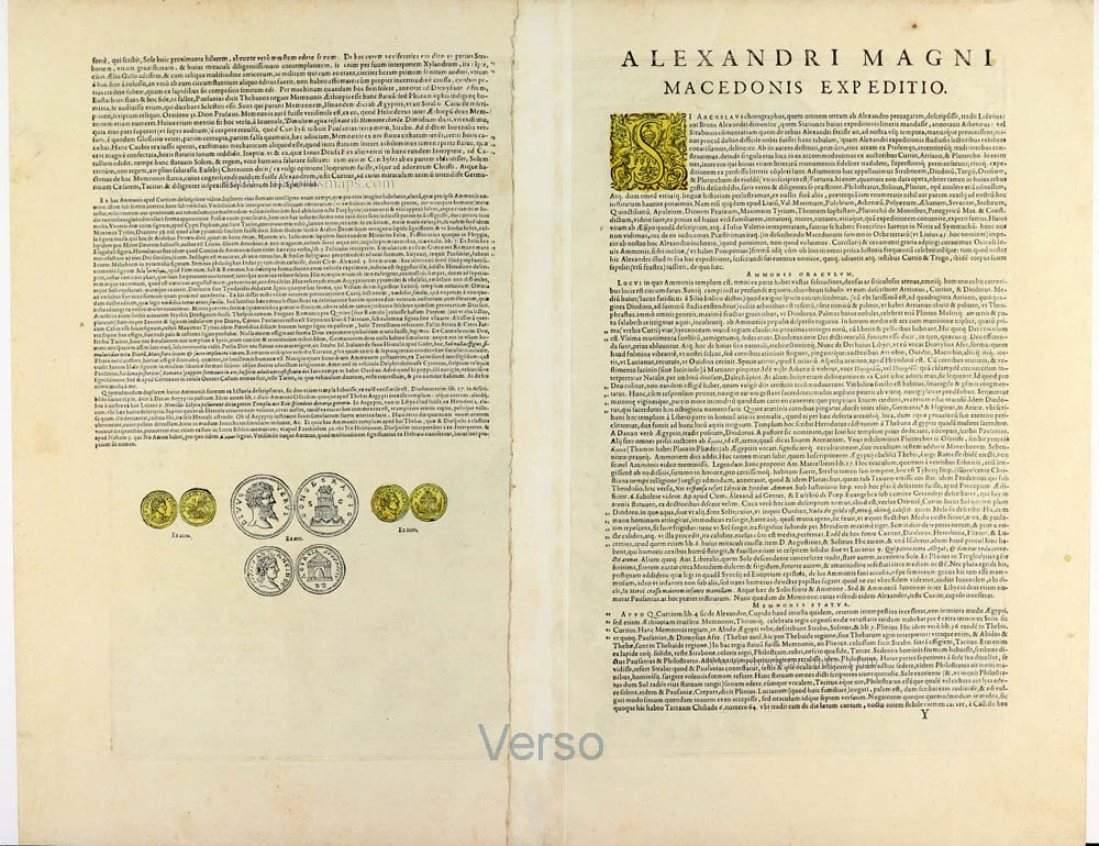
Verso: Latin text.
Condition: Original coloured, lower and upper centrefold reinforced.
Condition Rating: A.
From: Theatrum Orbis Terrarum. Antwerp, Plantin Press, 1595. (Van der Krogt 3, 31:051)
A magnificent and highly decorative historical map illustrating the military campaigns and conquests of Alexander the Great (356–323 BC), engraved by Abraham Ortelius, the celebrated Flemish cartographer and creator of the first modern atlas, the Theatrum Orbis Terrarum.
First published in 1595, this remarkable map traces the geographical extent of Alexander's expeditions, from Macedonia and Greece through Asia Minor, Egypt, Persia and Central Asia to the Indus Valley and northwestern India. It represents one of Ortelius's most ambitious attempts to reconstruct the geography of the ancient world using classical historical and geographical sources.
The map covers an immense geographical area, extending from the Mediterranean and the Balkans in the west to India in the east, and from the Black Sea and the Caspian region in the north to Arabia and the Indian Ocean in the south. Ancient geographical names are meticulously engraved, reflecting Ortelius's extensive knowledge of classical literature and his scholarly approach to historical cartography.
Particularly interesting is the representation of the Caspian Sea, shown in an elongated east–west configuration that reflects ancient geographical conceptions rather than contemporary cartographic knowledge. The map also depicts the rivers, mountain ranges, cities and regions associated with Alexander's campaigns, including Mesopotamia, Babylonia, Persia, Bactria and the Indus Valley.
The upper centre contains an elaborate ornamental title cartouche inscribed Alexandri Magni Macedonis Expeditio, while the upper right corner bears the date 1595 and the imperial and Netherlandish privilege.
One of the most striking features is the large inset illustration in the lower left corner, entitled Iovis Ammonis Oraculum. This finely engraved bird's-eye view represents the celebrated Oracle of Jupiter Ammon at the oasis of Siwa in the Libyan Desert. According to ancient historians, Alexander visited the sanctuary in 331 BC, where he was acknowledged as the son of Zeus-Ammon, an event of considerable significance in the development of his divine kingship. Ortelius depicts the sanctuary as a monumental walled complex, surrounded by trees and desert mountains, with a central circular temple and numerous small human figures.
The lower right corner contains an elaborate dedication cartouche addressed to Henricus Schotius (Hendrik Schot), a prominent Antwerp figure, and signed by Abraham Ortelius. Above it are two small circular medallions with classical imagery, further emphasising the map's historical character.
The Indian Ocean is decorated with a fleet of sailing ships, while the surrounding seas contain geographical annotations derived from ancient authorities. The finely engraved mountains, rivers and settlements, together with the attractive hand-colouring and richly ornamented cartouches, make this one of the most visually appealing historical maps in Ortelius's work.
The map was published in the Parergon, Ortelius's celebrated collection of historical maps, which accompanied later editions of the Theatrum Orbis Terrarum. Unlike the geographical maps of the main atlas, the Parergon reconstructed the ancient world through a critical study of classical authors, historical accounts, and geographical traditions. It is widely regarded as one of the earliest systematic atlases of historical geography.
The present example comes from the 1624 Latin edition of the Theatri Orbis Terrarum Parergon, published in Antwerp by Balthasar Moretus, several decades after Ortelius's death.
An outstanding example of Renaissance historical cartography, combining classical scholarship, geographical reconstruction and the decorative refinement characteristic of Ortelius's finest work.
Abraham Ortelius (1527-1598)
The maker of the 'first atlas', the Theatrum Orbis Terrarum (1570), was born on 4 April 1527 into an old Antwerp family. He learned Latin and studied Greek and mathematics.
Abraham and his sisters, Anne and Elizabeth, took up map colouring. Ortelius was admitted to the Guild of St. Luke as an "illuminator of maps." In addition to colouring maps, Ortelius was a dealer in antiques, coins, maps, and books, and the book and map trade gradually became his primary occupation.
Business went well because his means allowed him to amass an extensive collection of medals, coins, and antiques, as well as a library of many volumes. In addition, he travelled extensively, visited Italy and France, made contacts with scholars and editors everywhere, and maintained extensive correspondence with them.
In 1564, he published his first map, a large and ambitious world wall map. The inspiration for this map may well have been Gastaldi's large world map. In 1565, he published a map of Egypt and a map of the Holy Land; a large map of Asia followed.
In 1568, the production of individual maps for his atlas Theatrum Orbis Terrarum was already in full swing. He completed the atlas in 1569, and in May 1570, it was available for sale. It was one of the most expensive books ever published.
This first edition contained seventy maps on fifty-three sheets. Franciscus Hogenberg engraved the maps.
Later editions included Additamenta (additions), resulting in Ortelius' historical atlas, the Parergon, which is mainly bound together with the atlas. The Parergon can be considered a truly original work by Ortelius, who drew the maps based on his research.
The importance of the Theatrum Orbis Terrarum for geographical knowledge in the last quarter of the sixteenth century is difficult to overemphasise. Nothing was like it until Mercator's atlas appeared twenty-five years later. Demand for the Theatrum was remarkable. Some 24 editions appeared during Ortelius's lifetime, and another 10 after he died in 1598. Editions were published in Dutch, German, French, Spanish, English, and Italian. The number of map sheets grew from 53 in 1570 to 167 in the last edition in 1612.
In 1577, engraver Philip Galle and poet-translator Pieter Heyns published the first pocket-sized edition of the Theatrum, the Epitome. The work was trendy. Over thirty editions of this Epitome were published in different languages.
Ortelius is also remembered for an early idea resembling continental drift: he suggested that the Americas, Europe, and Africa may once have been joined together before separating over time. His work helped shape the development of modern geography and mapmaking.
Related items
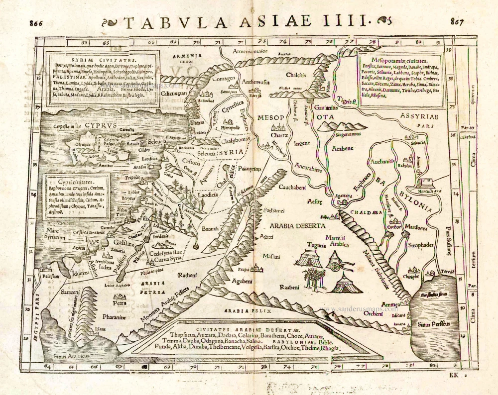
Tabula Asiae IIII. 1571
Middle East - Cyprus - Holy Land by Strabo - Sebastian Münster
[Item number: 25653]

Tabula .IIII. Asiae. 1525
Middle East, by Lorenz Fries.
[Item number: 27995]

Parergon map
Thraciae Veteris Typus. 1595
Thrace by Abraham Ortelius.
[Item number: 30637]

Parergon map
Itala nam tellus Graecia Maior. 1595
Ancient Southern Italy by Ortelius A.
[Item number: 30656]