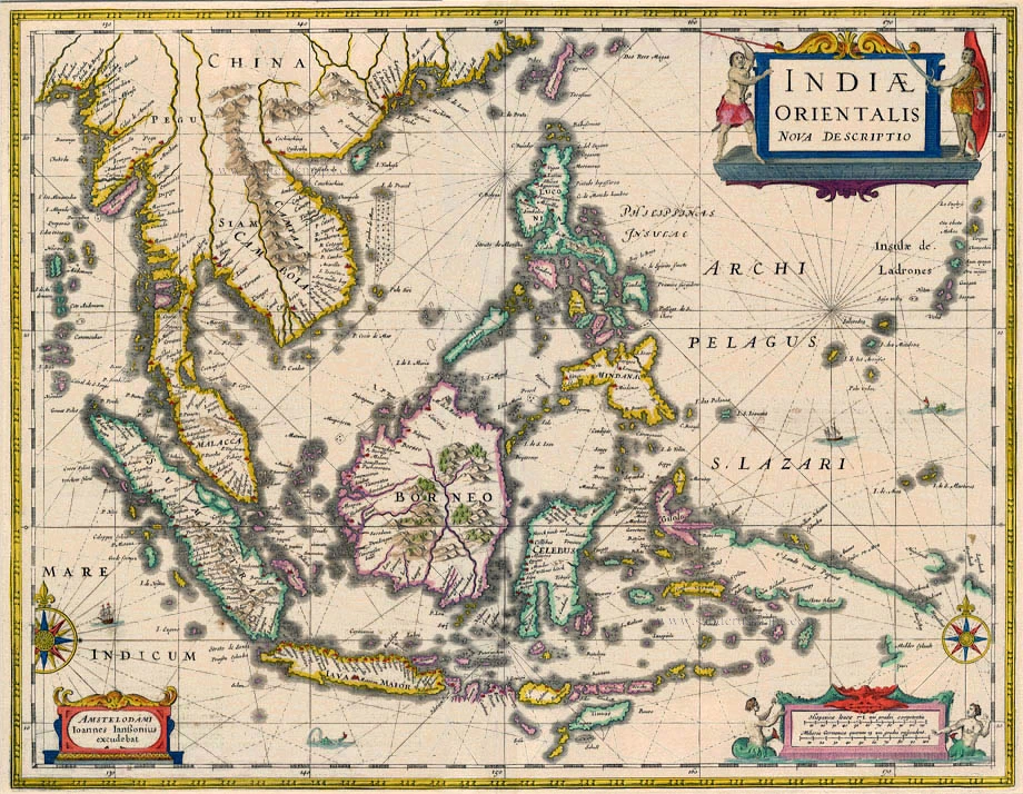
Antique map of Southeast Asia by Janssonius 1645-58
Indiae Orientalis Nova Descriptio
Item Number: 5255 Authenticity Guarantee
Category: Antique maps > Asia > Southeast Asia
Antique map of Southeast Asia by J. Janssonius.
Date of the first edition: 1630
Date of this map: 1645-58
Copper engraving
Size: 39 x 50.5cm (15.2 x 19.6 inches)
Verso text: Dutch
Condition: Old coloured, paper age-toned, shine-through of verso text.
Condition Rating: B+
References: Van der Krogt 1, 8500:1B.1; Parry, Plate 4.18.
From: Nieuwen Atlas, ofte Werelt-Beschrijvinge, vertonende de voornaemste Rijcken ende Landen, des Gheheelen Aerdt-Bodems. Amsterdam, J. Janssonius, 1645-47. (Van der Krogt 1, 433)
"The Hondius-Jansson publication included a completele new map of Southeast Asia and the East Indian archipelago by Jan Jansson entitled 'India Orientalis Nova Descriptio'. The map was the most accurate, as well as one of the most elegant, seventeenth-century maps of the East Indian Islands, and included one of the first inferences to the discoveries made on the northwestern coast of Australia in 1606 by William Jansz in the ship Duyfken. On the south coast of New Guinea the name 'Dufkens Eylant' appears, thereby immortalizing the name of the ship by which Australia had been discovered in 1606; however, the map only reaches ten degrees south latitude and does not show any part of the Australian mainland. The False Cape (Valschen Caep) and the Torres Strait or embayment, if they were mapped at all, would be hidden behind the decorative scale bar. Schilder believes that Jansson's map was of the greatest importance until the copy of the original 'Duyfken' map and the 1622 manuscript map of the Pacific by Hessel Gerritz, Blaeu's predecessor in the post of Official Hydrographer to the VOC, were found. William Blaeu must have been privy to these discoveries from his official position in the Dutch East India Company, but he did not publish his classic regional map, 'India Quae Orientalis Dicitur et Insulae Adiacentes' showing part of the Australian mainland, until 1635." (Parry, p.105)

