
Old, antique map of Southern Asia by Martin Waldseemüller 1513
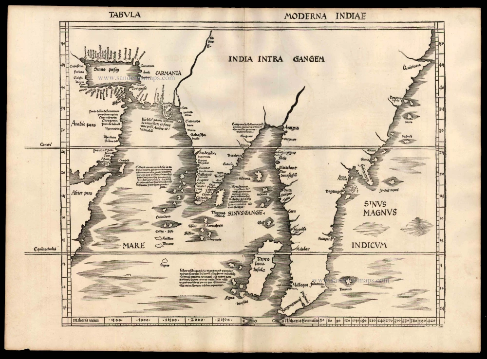
Tabula Moderna Indiae
Item Number: 4176 Authenticity Guarantee
Category: Antique maps > Asia > Southeast Asia
Old, antique map of Southern Asia by Martin Waldseemüller
Date of the first edition: 1513
Date of this map: 1513
Woodcut
Size, not including title and marginalia: 40.5 x 51cm (15.8 x 19.9 inches)
Verso: Blank
Condition: Excellent.
Condition Rating: A+
References: Karrow, 80/47.
From: Claudii Ptolemei viri Alexandrini Mathematice discipline Philosophi dictissimi Geographiae opus novissima . . . Strassburg, J. Schott, 1513.
The Strassbourg Ptolemy is the most important edition of the Geographia. Preparatory work was begun in about 1505 by Martin Waldseemüller, scholar-geographer of the small town of St. Dié in Lorraine, together with his associate Mathias Ringmann. Waldseemüller is believed to have incised many of the maps himself; all are firm distinctive woodcuts. By 1507 much progress had been made but the project was delayed and was not completed until 1513 under the editorship of Jacob Eszler and Georg Ubelin. The printer was Johann Schott, and the work, the first modern atlas, bears a dedication to the Emperor Maximilian.