
Turkey & Cyprus by Pierre Moullart-Sanson. 1700-1710

VERY RARE
SANSON FAMILY
Nicolas Sanson (1600-1667) - Guillaume Sanson (1633-1703) - Pierre Moullart-Sanson (? -1730)
Originally from Abbeville, Nicolas I Sanson showed a keen interest in historical geography. He was still very young; he published a map of ancient Gaul and two treatises, Britannia and Portus Itius on Abbeville and Boulogne's origins. His meeting with Melchior Tavernier was decisive: it prompted him to give up his duties as a military engineer in Picardy and devote himself to engraved cartography.
At the same time, Sanson had drawn up the outline of modern France. He got the help of Tavernier, who encouraged him to compete with the Dutch map publishers. Tavernier contacted other French cartographers whose works he published.
From 1643, N. Sanson obtained a privilege to publish a work personally, the Princes souverains de l'Italie. Then, in 1644 and 1645, he had his famous geographical tables printed, which significantly contributed to his fame. He also published a series of atlases in quarto of the four continents.
In 1648, N. Sanson associated himself with Mariette to publish atlases. From then on, specific maps bore his name and others Mariette's. N. Sanson and Mariette worked together for more than 20 years. After the death of N. Sanson, Mariette acquired the entire fund. Since Mariette only wanted to publish complete atlases, individual maps were no longer sold, and some army generals complained to the king.
The disagreement between the Sanson family and Pierre II Mariette culminated in 1671 when Guillaume Sanson took the case to court. There was no longer any question of collaboration: Guillaume Sanson started working for another publisher, Alexis-Hubert Jaillot.
The Sanson family faced financial difficulties, and in 1692, their cousin, Pierre Moullart-Sanson, bought the entire geographic fund from his uncles and aunt. Pierre Moullart-Sanson was the son of Françoise Sanson (third child of Nicolas) and Pierre Moullart. He restarted the publishing of Sanson's world atlas, and in 1704 he acquired a privilege for publishing all the works of Nicolas and Guillaume Sanson, which continued to be published until 1730.
Asia Minor In Epitomen contracta, Magnas Regiones seu Provincias Representans In Quibus Populi, Primariae Urbes Locaque Praecipua Notantur.
Item Number: 28532 Authenticity Guarantee
Category: Antique maps > Asia > Turkey - Cyprus
Scarce antique map of Turkey - Cyprus, by Pierre Moullart-Sanson.
Title: Asia Minor In Epitomen contracta, Magnas Regiones seu Provincias Representans In Quibus Populi, Primariae Urbes Locaque Praecipua Notantur.
Conatibus Geographicis Petri Moullart-Sanson Christianissimi Galliarum Regis Geographi
Lutetiae Parisiorum in Claustro Sancti Nicolai de Lupara 1708.
Joan Bapt. Dela Haye Sculps.
Engraver: Jean-Baptiste Delahaye.
Date on map: 1708.
Copper engraving, printed on paper.
Map size: 400 x 530mm (15.75 x 20.87 inches).
Sheet size: 450 x 605mm (17.72 x 23.82 inches).
Verso: Blank.
Condition: Original coloured in outline, backed with paper, excellent.
Condition Rating: A.
From: Composite Sanson Atlas. Paris, c. 1710.
VERY RARE
SANSON FAMILY
Nicolas Sanson (1600-1667) - Guillaume Sanson (1633-1703) - Pierre Moullart-Sanson (? -1730)
Originally from Abbeville, Nicolas I Sanson showed a keen interest in historical geography. He was still very young; he published a map of ancient Gaul and two treatises, Britannia and Portus Itius on Abbeville and Boulogne's origins. His meeting with Melchior Tavernier was decisive: it prompted him to give up his duties as a military engineer in Picardy and devote himself to engraved cartography.
At the same time, Sanson had drawn up the outline of modern France. He got the help of Tavernier, who encouraged him to compete with the Dutch map publishers. Tavernier contacted other French cartographers whose works he published.
From 1643, N. Sanson obtained a privilege to publish a work personally, the Princes souverains de l'Italie. Then, in 1644 and 1645, he had his famous geographical tables printed, which significantly contributed to his fame. He also published a series of atlases in quarto of the four continents.
In 1648, N. Sanson associated himself with Mariette to publish atlases. From then on, specific maps bore his name and others Mariette's. N. Sanson and Mariette worked together for more than 20 years. After the death of N. Sanson, Mariette acquired the entire fund. Since Mariette only wanted to publish complete atlases, individual maps were no longer sold, and some army generals complained to the king.
The disagreement between the Sanson family and Pierre II Mariette culminated in 1671 when Guillaume Sanson took the case to court. There was no longer any question of collaboration: Guillaume Sanson started working for another publisher, Alexis-Hubert Jaillot.
The Sanson family faced financial difficulties, and in 1692, their cousin, Pierre Moullart-Sanson, bought the entire geographic fund from his uncles and aunt. Pierre Moullart-Sanson was the son of Françoise Sanson (third child of Nicolas) and Pierre Moullart. He restarted the publishing of Sanson's world atlas, and in 1704 he acquired a privilege for publishing all the works of Nicolas and Guillaume Sanson, which continued to be published until 1730.
Related items

Natoliae quae olim Asia Minor [on sheet with] Argypti Recentioe Descriptio [and] Carthaginis Celeberrimi Sinus Typus 1612
Turkey - Egypt - Cartago by Ortelius A.
[Item number: 22800]

Natoliae quae olim Asia Minor [on sheet with] Argypti Recentioe Descriptio [and] Carthaginis Celeberrimi Sinus Typus 1598
Turkey - Egypt - Cartago, by A. Ortelius.
[Item number: 22865]

Tabula Nova Geographica Natoliae et Asiae Minoris. c. 1740
Turkey - Cyprus by N. Visscher II - P. Schenk.
[Item number: 25841]

Turquie en Europe. 1713
Greece, by P. Van der Aa.
[Item number: 26076]
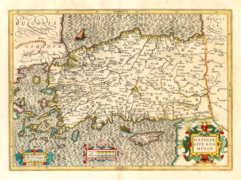
Natoliae sive Asia Minor. 1641
Turkey & Cyprus, by Jodocus Hondius.
[Item number: 26435]
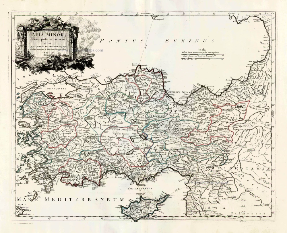
Asia Minor in suas partes seu provincias divisa. 1776-79
Turkey and Cyprus, by Paolo Santini.
[Item number: 27014]

Natolia quae olim Asia Minor. 1640
Turkey and Cyprus, by Willem Blaeu.
[Item number: 27148]
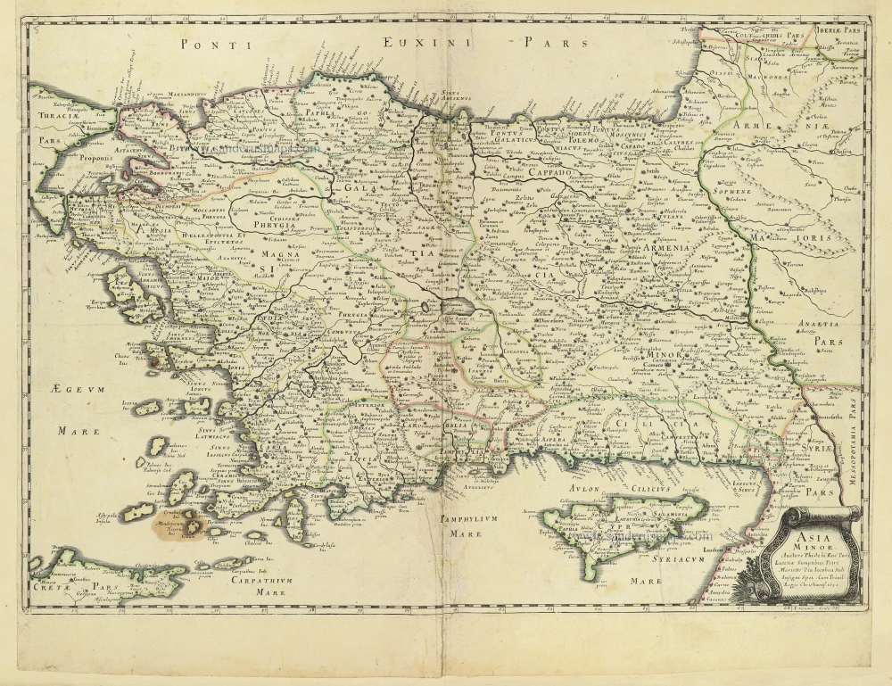
Asia Minor. 1665
Turkey - Cyprus by Philippe de la Rue.
[Item number: 28470]
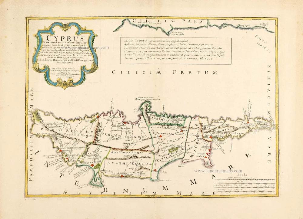
Rare!
Cyprus Praestantia nulli cedens Insulae. 1718
Cyprus by Pierre Moullart-Sanson.
[Item number: 28632]

Acamantis Insula hoggidi Cipro, 1696
Cyprus by Vincenzo Coronelli.
[Item number: 28655]
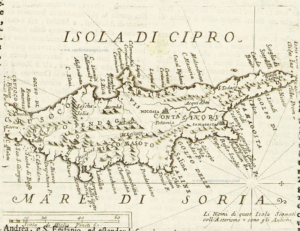
Isola di Cipro. 1696
Cyprus by Vincenzo Coronelli.
[Item number: 28667]

Cipro. - [Above map :] Descrittione dell'Isola di Cipro. 1590
Cyprus by Thomasso Porcacchi.
[Item number: 29827]

Pamphilia et Pisidia. 1670
Pamphylia & Pisidia (Anatolia - Turkey) by Pierre Mariette.
[Item number: 30022]

Lycaonia In Minores Regiones seu Tractus distincta; Et in ea Romana Itineraria, ex Tabula Peutingeriana et ex Antonino descripta. 1676
Lycaonia (Central Turkey) by Guillaume Sanson.
[Item number: 30023]

*** Scarce first edition ***
Ponti Pars, Ad Halym, Iridem Thermodontemq[ue]; Fluvios Sita; quam Heroicis Temporibus Amazones Romanorum Aetate Mithridatis Regnum Nobilitarunt: quae tandem Provincia Romanorum facta Pontus Galaticus mox Hellenopontus dicta et in Minores Regiones distincta; et in ea Romana Itineraria ex Tabula Peutingeriana, et ex Antonino descripta. 1676
Ancient Northern Turkey by Guillaume Sanson.
[Item number: 30024]

*** Rare first edition ***
Tabula Itineris Decies Mille Graecorum sub Cyro contra fratrem suum Artaxerxem Regem Persarum. 1653
Asia Minor through to Armenia and Babylon by Pierre Duval.
[Item number: 30038]

Anaplus Bosphori Thracii. 1665
Bosporus by Guillaume Sanson.
[Item number: 30040]

Natolia quae olim Asia Minor. ca. 1658-1663
Turkey by Nicolas Sanson, published by Pierre Mariette.
[Item number: 30046]

Cypri Insulae Nova Descript. 1573 1575
Cyprus by Abraham Ortelius.
[Item number: 30103]

Fanar nel' Arcipelago. c. 1690
Fanar (Istanbul - Turkey) by J. Peeters.
[Item number: 31381]
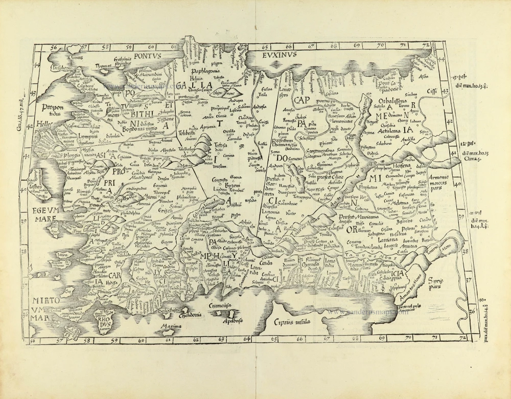
[Title on verso:] Tabula .I. Asiae. 1525
Ptolemaic map of Turkey, by Lorenz Fries.
[Item number: 32179]

Tabula nova Asiae minoris. 1525
Turkey, by Lorenz Fries.
[Item number: 32689]

Cyprus Insula. 1640
Cyprus, by W. & J. Blaeu.
[Item number: 32828]

Natoliae sive Asia Minor. c. 1630-1650
Turkey & Cyprus, by Jodocus Hondius.
[Item number: 33148]
new