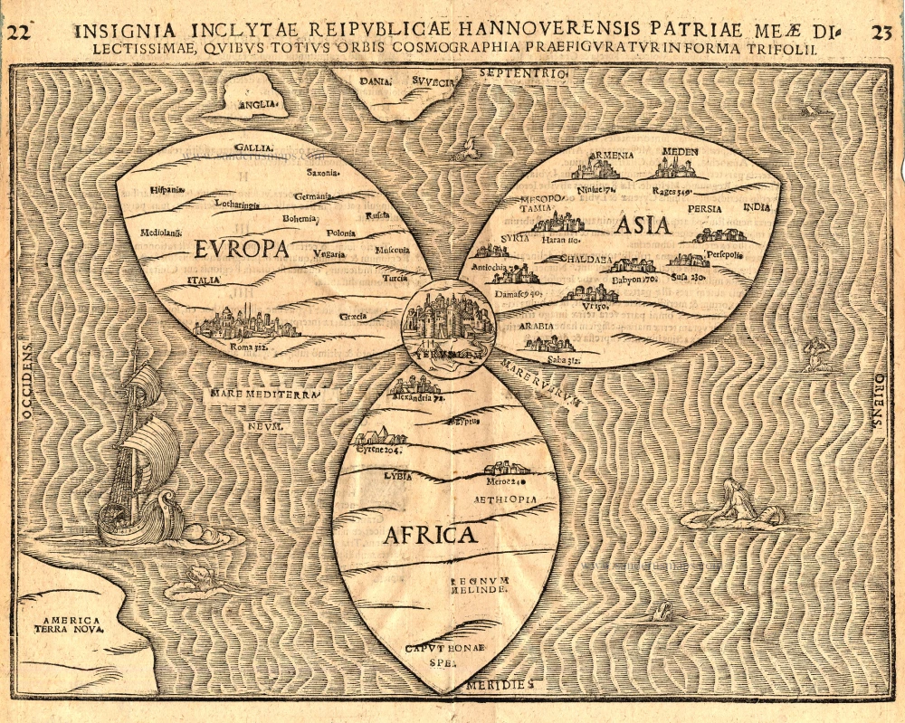
Antique map of World as a clover leaf by Bünting H. 1581
Insignia Inclytae Reipublicae Hannoverensis Patriae Meae Dilectissimae, quibus totius Orbis Cosmographia Praefiguratur in Forma Trifolii.
Item Number: 5908 Authenticity Guarantee
Category: Antique maps > Curiosities
Map of the world as a clover leaf.
Heinrich Bünting, a theological commentator from Hanover, first published his Itinerarium in 1581. It is illustrated by several curious woodcut maps. The first of two world maps shows the three principal continents, Europe, Asia and Africa, arranged in the form of a clover leaf with Jerusalem at the centre, a device suggested by the arms of Bünting's native town Hanover. Three countries lie outside this trefoil: England, Scandinavia, and in the lower left-hand corner, America. The wavely-engraved sea contains monsters and mermaids, and the whole map is a veritable cartographical oddity.
Woodcut
Size: 27 x 36cm (10.5 x 14 inches)
Condition: Excellent.
Condition Rating: A+
References: Shirley (World), 142.
From: Itinerarium Sacrae Scriptura . . . Magdeburg, 1581.

