
Old antique map showing the world as a clover leaf, by Heinrich Bünting. 1581
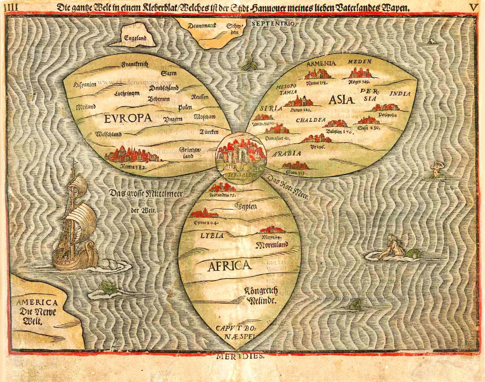


The world fancifully portrayed as a clover leaf: the emblem of Bünting's home town of Hanover. One of ten maps in Bünting's Itinerarium, in which the author, a theological commentator, rewrote the Bible as an illustrated travel book. Other maps in the series bear out his imaginative approach to cartography, which pictures the Asia as Pegasus and Europe as the Queen of the World.
Heinrich Bünting, a theological commentator from Hanover, first published his Itinerarium in 1581. It is illustrated by several curious woodcut maps. The first of two world maps shows the three principal continents, Europe, Asia and Africa, arranged in the form of a clover leaf with Jerusalem at the centre, a device suggested by the arms of Bünting's native town Hanover. Three countries lie outside this trefoil: England, Scandinavia, and in the lower left-hand corner, America. The wavely-engraved sea contains monsters and mermaids, and the whole map is a veritable cartographical oddity.
Heinrich Bünting (Hannover, 1545-1606)
Heinrich Bünting was a protestant pastor and theologian. He was also a brewer in Hannover, and he was concerned with history and wrote a Braunschweigische Chronica in 1584. His main work was the popular Itinerarium Sacrae Scripturae, which after the first edition in Magdeburg in 1581 had many editions in German, Latin, Dutch, Swedish, Danish, Czech and English.
The book gave an overview of biblical geography based on the travel descriptions of various notable people from the Old and New Testaments. It contained ten woodcut maps, including three figurative maps: the world depicted as a cloverleaf with Jerusalem in the centre, Europe in the shape of a crowned woman, and Asia as the winged horse Pegasus.
Die Gantze Welt in ein Kleberblat / welches in der Stadt Hannover / meines Lieben Vaterlandes Wapen.
Item Number: 26561 Authenticity Guarantee
Category: Antique maps > Curiosities
Old map of the World as a clover leaf, by H. Bünting.
Date of the first edition: 1581
Date of this map: 1581
Woodcut
Size (not including margins): 27 x 36cm (10.5 x 14 inches)
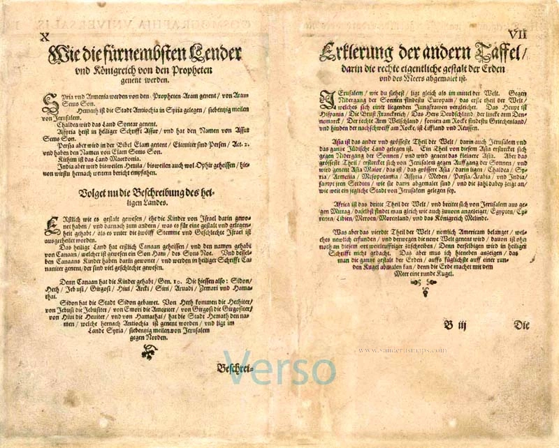
Verso text: German
Condition: Original coloured, margins and centrefold restored.
Condition Rating: C
References: Shirley (World), 142; Baynton-Williams New Worlds, p.38.
From: Itinerarium Sacrae Scriptura . . . Magdeburg, 1581.
The world fancifully portrayed as a clover leaf: the emblem of Bünting's home town of Hanover. One of ten maps in Bünting's Itinerarium, in which the author, a theological commentator, rewrote the Bible as an illustrated travel book. Other maps in the series bear out his imaginative approach to cartography, which pictures the Asia as Pegasus and Europe as the Queen of the World.
Heinrich Bünting, a theological commentator from Hanover, first published his Itinerarium in 1581. It is illustrated by several curious woodcut maps. The first of two world maps shows the three principal continents, Europe, Asia and Africa, arranged in the form of a clover leaf with Jerusalem at the centre, a device suggested by the arms of Bünting's native town Hanover. Three countries lie outside this trefoil: England, Scandinavia, and in the lower left-hand corner, America. The wavely-engraved sea contains monsters and mermaids, and the whole map is a veritable cartographical oddity.
Heinrich Bünting (Hannover, 1545-1606)
Heinrich Bünting was a protestant pastor and theologian. He was also a brewer in Hannover, and he was concerned with history and wrote a Braunschweigische Chronica in 1584. His main work was the popular Itinerarium Sacrae Scripturae, which after the first edition in Magdeburg in 1581 had many editions in German, Latin, Dutch, Swedish, Danish, Czech and English.
The book gave an overview of biblical geography based on the travel descriptions of various notable people from the Old and New Testaments. It contained ten woodcut maps, including three figurative maps: the world depicted as a cloverleaf with Jerusalem in the centre, Europe in the shape of a crowned woman, and Asia as the winged horse Pegasus.