
Austria, by Blaeu W. & J. 1635
The Blaeus: Willem Janszoon, Cornelis & Joan
Willem Jansz. Blaeu and his son Joan Blaeu are the seventeenth century's most widely known cartographic publishers.
Willem Jansz. (also written Guilielmus Janssonius) = Willem Janszoon Blaeu was born in Uitgeest (Netherlands), near Alkmaar, in 1571. He studied mathematics under Tycho Brahe and learned the theory and practice of astronomical observations and the art of instrument- and globe-making.
In 1596, he came to Amsterdam, where he settled down as a globe-, instrument- and mapmaker. He published his first cartographic work (a globe) in 1599 and probably published his first printed map (a map of the Netherlands) in 1604. He specialised in maritime cartography, published the first edition of the pilot guide Het Licht der Zeevaert in 1608, and was appointed Hydrographer of the V.O.C. (United East India Company) in 1633. After publishing books, wall maps, globes, charts and pilot guides for thirty years, he brought out his first atlas, Atlas Appendix (1630). This was the beginning of the great tradition of atlas-making by the Blaeus.
In 1618, another mapmaker, bookseller and publisher, Johannes Janssonius, established himself in Amsterdam next door to Blaeu's shop. No wonder these two neighbours began accusing each other of copying and stealing their information and became fierce competitors who did not have a good word to say about each other. In about 1621 Willem Jansz. decided to end the confusion between his name and his competitor's and assumed his grandfather's nickname, 'blauwe Willem' ('blue Willem'), as the family name; after that, he called himself Willem Jansz. Blaeu.
Willem Janszoon Blaeu died in 1638, leaving his prospering business to his sons, Cornelis and Joan. We only know that Cornelis's name occurs in the prefaces of books and atlases until c. 1645.
Joan Blaeu, born in Amsterdam in 1596, became a partner in his father's book trade and printing business. 1638, he was appointed his father's successor in the Hydrographic Office of the V.O.C. His efforts culminated in the magnificent Atlas Major and the town books of the Netherlands and Italy – works unsurpassed in history and modern times, giving eternal fame to the name of the Blaeu's.
A fire ruined the business on February 23, 1672, and one year later, Dr. Joan Blaeu died. The fire and the director's passing caused the complete sale of the Blaeu House's stock. Five public auctions dispersed the remaining books, atlases, copperplates, globes, etc., among many other map dealers and publishers in Amsterdam. The majority was acquired by several booksellers acting in partnership.
In the succeeding years, the remaining printing department remained in the hands of the Blaeu family until 1695, when the printing house's inventory was sold at a public auction. That meant the end of the Blaeu family as a printing house of world renown.
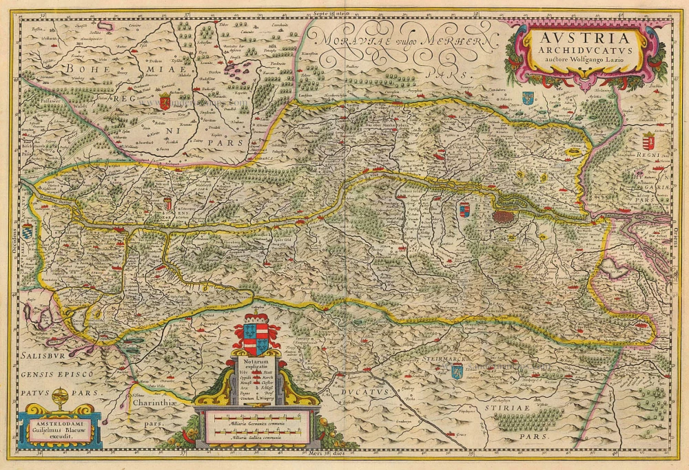
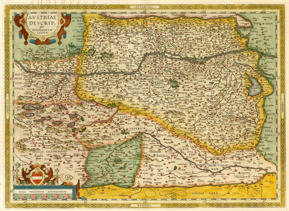
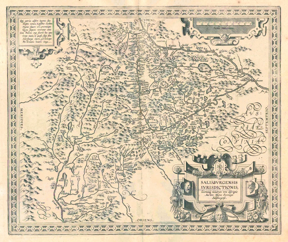
Austria Archiducatus.
Currently not available
Item Number: 20385 Authenticity Guarantee
Category: Antique maps > Europe > Austria
Antique map of Austria by Willem Blaeu.
Title: Austria Archiducatus.
auctore Wolfgango Lazio.
Amstelodami Guiljelmus Blaeuw excudit.
Cartographer: Wolfgang Lazius.
Date of the first edition: 1630.
Date of this map: 1635.
Copper engraving, printed on paper.
Size (not including margins): 365 x 545mm (14.37 x 21.46 inches).
Verso: Latin text.
Condition: Original coloured, excellent.
Condition Rating: A+.
From: Theatrum Orbis Terrarum, W.& J. Blaeu, 1635. (Van der Krogt 2, 101)
The Blaeus: Willem Janszoon, Cornelis & Joan
Willem Jansz. Blaeu and his son Joan Blaeu are the seventeenth century's most widely known cartographic publishers.
Willem Jansz. (also written Guilielmus Janssonius) = Willem Janszoon Blaeu was born in Uitgeest (Netherlands), near Alkmaar, in 1571. He studied mathematics under Tycho Brahe and learned the theory and practice of astronomical observations and the art of instrument- and globe-making.
In 1596, he came to Amsterdam, where he settled down as a globe-, instrument- and mapmaker. He published his first cartographic work (a globe) in 1599 and probably published his first printed map (a map of the Netherlands) in 1604. He specialised in maritime cartography, published the first edition of the pilot guide Het Licht der Zeevaert in 1608, and was appointed Hydrographer of the V.O.C. (United East India Company) in 1633. After publishing books, wall maps, globes, charts and pilot guides for thirty years, he brought out his first atlas, Atlas Appendix (1630). This was the beginning of the great tradition of atlas-making by the Blaeus.
In 1618, another mapmaker, bookseller and publisher, Johannes Janssonius, established himself in Amsterdam next door to Blaeu's shop. No wonder these two neighbours began accusing each other of copying and stealing their information and became fierce competitors who did not have a good word to say about each other. In about 1621 Willem Jansz. decided to end the confusion between his name and his competitor's and assumed his grandfather's nickname, 'blauwe Willem' ('blue Willem'), as the family name; after that, he called himself Willem Jansz. Blaeu.
Willem Janszoon Blaeu died in 1638, leaving his prospering business to his sons, Cornelis and Joan. We only know that Cornelis's name occurs in the prefaces of books and atlases until c. 1645.
Joan Blaeu, born in Amsterdam in 1596, became a partner in his father's book trade and printing business. 1638, he was appointed his father's successor in the Hydrographic Office of the V.O.C. His efforts culminated in the magnificent Atlas Major and the town books of the Netherlands and Italy – works unsurpassed in history and modern times, giving eternal fame to the name of the Blaeu's.
A fire ruined the business on February 23, 1672, and one year later, Dr. Joan Blaeu died. The fire and the director's passing caused the complete sale of the Blaeu House's stock. Five public auctions dispersed the remaining books, atlases, copperplates, globes, etc., among many other map dealers and publishers in Amsterdam. The majority was acquired by several booksellers acting in partnership.
In the succeeding years, the remaining printing department remained in the hands of the Blaeu family until 1695, when the printing house's inventory was sold at a public auction. That meant the end of the Blaeu family as a printing house of world renown.
Related items
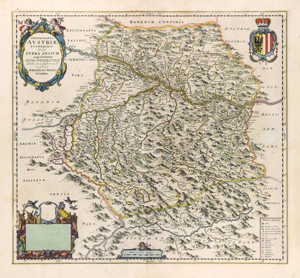
Archiducatus Austriae Superioris Vulgo Supra Anisum cognominatio Nova Descriptio. 1662
Oberösterreich, by Joan Blaeu.
[Item number: 9831]
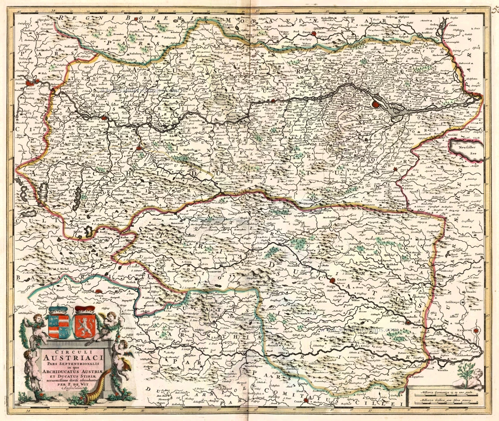
Circuli Austriaci pars Septentrionalis in qua Archiducatus Austriae et Ducatus Stiriae ... c. 1680
Northern Austria, by F. De Wit.
[Item number: 10567]
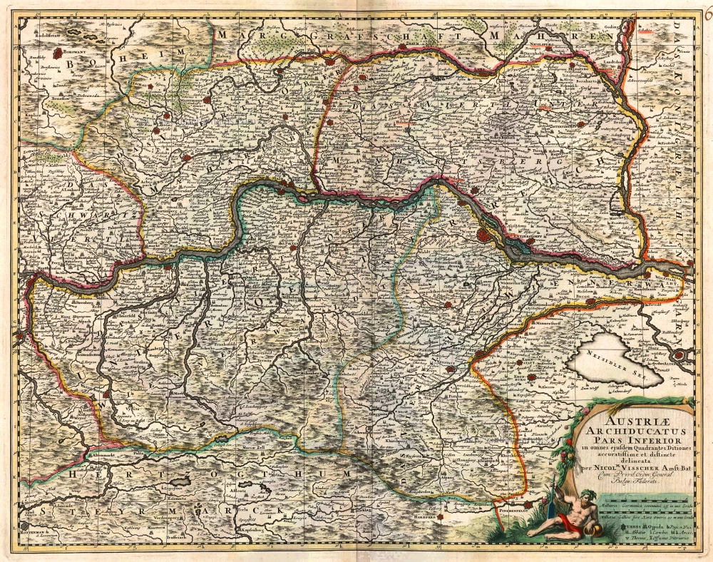
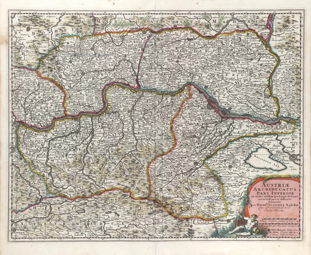
Austriae Archiducatus Pars Inferior 1683-1696
Austria, by Nicolaas Visscher II.
[Item number: 10615]
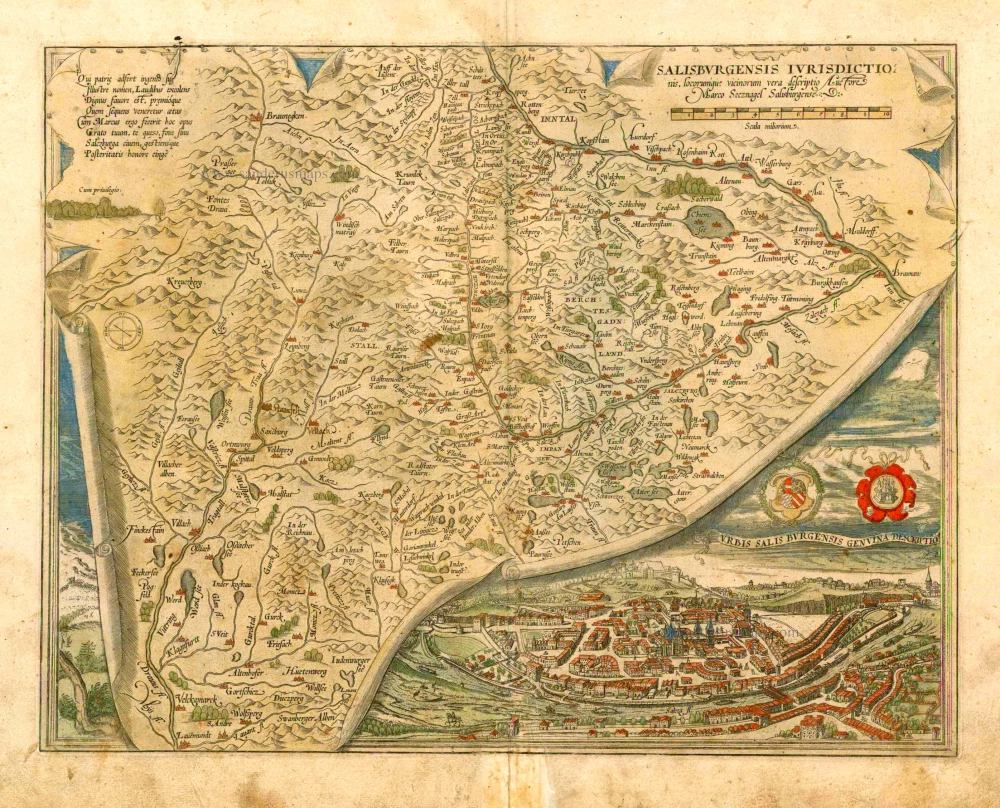
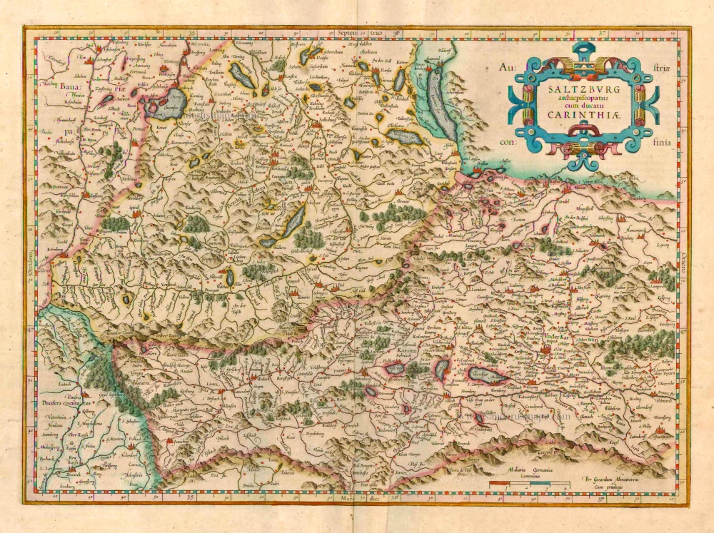
Salisburgensis Iurisdictionis, locorumque vicinorum vera descriptio. 1572
Austria, by Abraham Ortelius.
[Item number: 16002]
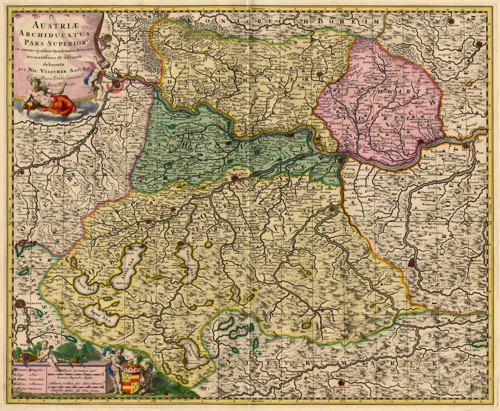
Austriae Archiducatus Pars Superior, in omnes ejusdem Quadrantes Ditiones accuratissime et distincte delineata. 1683-1696
Austria, by N. Visscher.
[Item number: 18679]
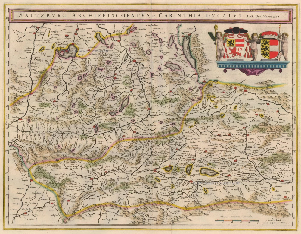
Salzburg Archiepiscopatus, et Carinthia Ducatus 1635
Old, antique map of Salzburg by Blaeu W. & J.
[Item number: 20389]
Austriae Descrip. per Wolfgangum Lazium. 1598
Austria, by A. Ortelius.
[Item number: 21893]
Salisburgensis Iurisdictionis, locorumq vicinorum vera descriptio. Auctore Marco Secznagel Salisburgense 1612
Salzburg, by A. Ortelius.
[Item number: 23004]
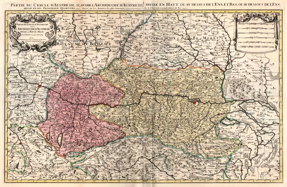
Partie du Cercle d'Austriche, Scavoir l'Archduche d'Austriche Divise en Haute et Basse ... c. 1695
Austria, by Jaillot - Covens & Mortier.
[Item number: 23810]
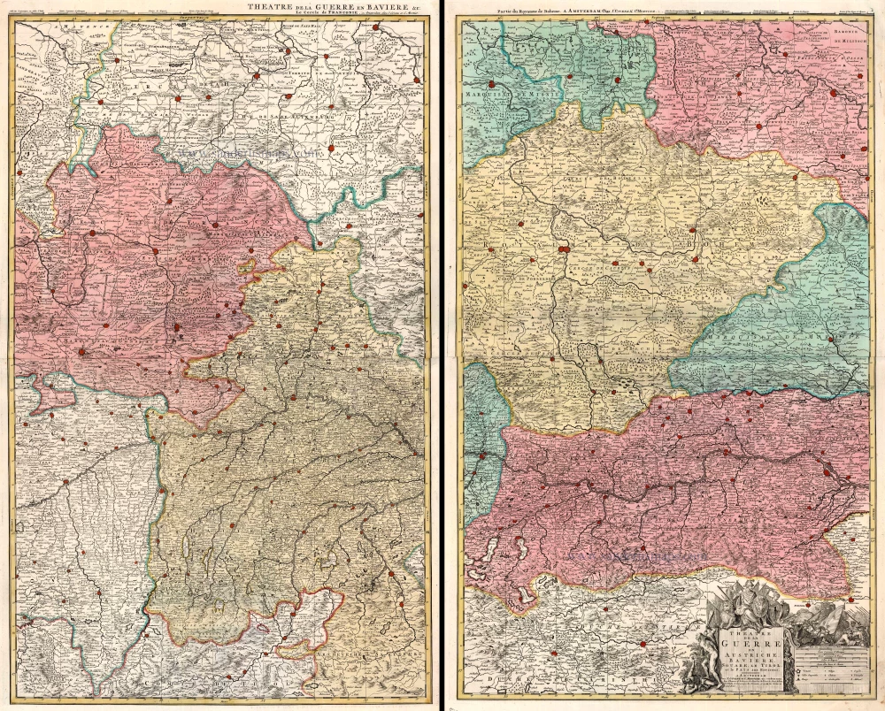
Theatre de la Guerre en Austriche, Baviere, Souabe, le Tirol et le Pays aux Environs. 1721-41
Austria, Bavaria, Swabia and Tyrol, by Covens & Mortier.
[Item number: 23813]
Saltzburg Archiepiscopatus cum Ducatu Carinthiae 1623
Salzburg - Kärnten, by G. Mercator.
[Item number: 24946]
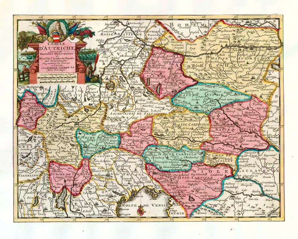
Cercle d'Autriche. 1713
Austria, by Pieter van der Aa.
[Item number: 26180]
Austriae Archiducatus Pars Inferior. 1683-1696
Austria by Nicolaas Visscher II.
[Item number: 29613]
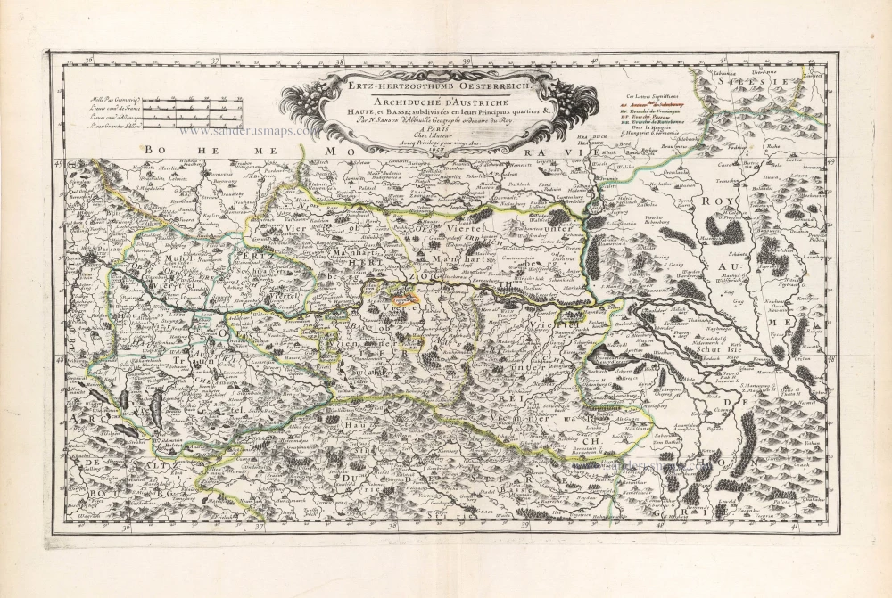
Ertz-Herzogthumb Oesterreich. - Archiduché d'Autriche Haute, et Basse: subdivisées en leurs Principaux quartiers &c. 1659
Austria by Nicolas Sanson.
[Item number: 29622]