
Antwerp (Antwerpen), by Joan Blaeu. 1652
The Blaeus: Willem Janszoon, Cornelis & Joan
Willem Jansz. Blaeu and his son Joan Blaeu are the seventeenth century's most widely known cartographic publishers.
Willem Jansz. (also written Guilielmus Janssonius) = Willem Janszoon Blaeu was born in Uitgeest (Netherlands), near Alkmaar, in 1571. He studied mathematics under Tycho Brahe and learned the theory and practice of astronomical observations and the art of instrument- and globe-making.
In 1596, he came to Amsterdam, where he settled down as a globe-, instrument- and mapmaker. He published his first cartographic work (a globe) in 1599 and probably published his first printed map (a map of the Netherlands) in 1604. He specialised in maritime cartography, published the first edition of the pilot guide Het Licht der Zeevaert in 1608, and was appointed Hydrographer of the V.O.C. (United East India Company) in 1633. After publishing books, wall maps, globes, charts and pilot guides for thirty years, he brought out his first atlas, Atlas Appendix (1630). This was the beginning of the great tradition of atlas-making by the Blaeus.
In 1618, another mapmaker, bookseller and publisher, Johannes Janssonius, established himself in Amsterdam next door to Blaeu's shop. No wonder these two neighbours began accusing each other of copying and stealing their information and became fierce competitors who did not have a good word to say about each other. In about 1621 Willem Jansz. decided to end the confusion between his name and his competitor's and assumed his grandfather's nickname, 'blauwe Willem' ('blue Willem'), as the family name; after that, he called himself Willem Jansz. Blaeu.
Willem Janszoon Blaeu died in 1638, leaving his prospering business to his sons, Cornelis and Joan. We only know that Cornelis's name occurs in the prefaces of books and atlases until c. 1645.
Joan Blaeu, born in Amsterdam in 1596, became a partner in his father's book trade and printing business. 1638, he was appointed his father's successor in the Hydrographic Office of the V.O.C. His efforts culminated in the magnificent Atlas Major and the town books of the Netherlands and Italy – works unsurpassed in history and modern times, giving eternal fame to the name of the Blaeu's.
A fire ruined the business on February 23, 1672, and one year later, Dr. Joan Blaeu died. The fire and the director's passing caused the complete sale of the Blaeu House's stock. Five public auctions dispersed the remaining books, atlases, copperplates, globes, etc., among many other map dealers and publishers in Amsterdam. The majority was acquired by several booksellers acting in partnership.
In the succeeding years, the remaining printing department remained in the hands of the Blaeu family until 1695, when the printing house's inventory was sold at a public auction. That meant the end of the Blaeu family as a printing house of world renown.
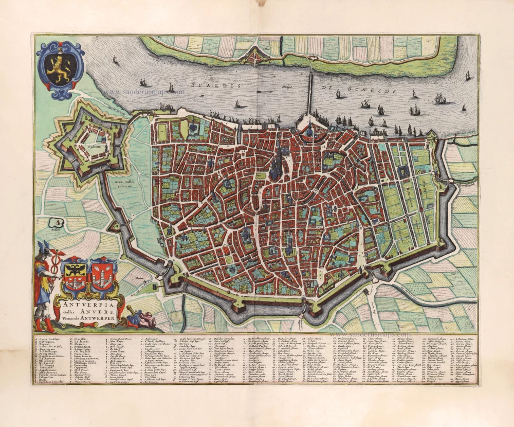
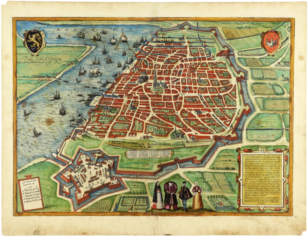
Antverpia; Gallis Anvers. Vernacule Antwerpen.
Item Number: 29420 Authenticity Guarantee
Category: Antique maps > Europe > Belgium - Cities
Old, antique bird’s-eye view plan of Antwerp (Antwerpen), by Joan Blaeu.
Title: Antverpia; Gallis Anvers. Vernacule Antwerpen.
Oriented to the west.
Date of the first edition: 1649.
Date of this map: 1652.
Copper engraving, printed on paper.
Map size: 420 x 535mm (16.54 x 21.06 inches).
Sheet size: 545 x 645mm (21.46 x 25.39 inches).
Verso: Dutch text.
Condition: Original coloured, water stain in margins.
Condition Rating: A+.
From: Toonneel der Steden van 's Konings Nederlanden. Amsterdam, J. Blaeu, 1652. (Van der Krogt 4, 43:121.2)
The plan shows the situation 1640-46 with the ship bridge over the Schelde. The polders in the north were reclaimed, which was in 1651.
The Blaeus: Willem Janszoon, Cornelis & Joan
Willem Jansz. Blaeu and his son Joan Blaeu are the seventeenth century's most widely known cartographic publishers.
Willem Jansz. (also written Guilielmus Janssonius) = Willem Janszoon Blaeu was born in Uitgeest (Netherlands), near Alkmaar, in 1571. He studied mathematics under Tycho Brahe and learned the theory and practice of astronomical observations and the art of instrument- and globe-making.
In 1596, he came to Amsterdam, where he settled down as a globe-, instrument- and mapmaker. He published his first cartographic work (a globe) in 1599 and probably published his first printed map (a map of the Netherlands) in 1604. He specialised in maritime cartography, published the first edition of the pilot guide Het Licht der Zeevaert in 1608, and was appointed Hydrographer of the V.O.C. (United East India Company) in 1633. After publishing books, wall maps, globes, charts and pilot guides for thirty years, he brought out his first atlas, Atlas Appendix (1630). This was the beginning of the great tradition of atlas-making by the Blaeus.
In 1618, another mapmaker, bookseller and publisher, Johannes Janssonius, established himself in Amsterdam next door to Blaeu's shop. No wonder these two neighbours began accusing each other of copying and stealing their information and became fierce competitors who did not have a good word to say about each other. In about 1621 Willem Jansz. decided to end the confusion between his name and his competitor's and assumed his grandfather's nickname, 'blauwe Willem' ('blue Willem'), as the family name; after that, he called himself Willem Jansz. Blaeu.
Willem Janszoon Blaeu died in 1638, leaving his prospering business to his sons, Cornelis and Joan. We only know that Cornelis's name occurs in the prefaces of books and atlases until c. 1645.
Joan Blaeu, born in Amsterdam in 1596, became a partner in his father's book trade and printing business. 1638, he was appointed his father's successor in the Hydrographic Office of the V.O.C. His efforts culminated in the magnificent Atlas Major and the town books of the Netherlands and Italy – works unsurpassed in history and modern times, giving eternal fame to the name of the Blaeu's.
A fire ruined the business on February 23, 1672, and one year later, Dr. Joan Blaeu died. The fire and the director's passing caused the complete sale of the Blaeu House's stock. Five public auctions dispersed the remaining books, atlases, copperplates, globes, etc., among many other map dealers and publishers in Amsterdam. The majority was acquired by several booksellers acting in partnership.
In the succeeding years, the remaining printing department remained in the hands of the Blaeu family until 1695, when the printing house's inventory was sold at a public auction. That meant the end of the Blaeu family as a printing house of world renown.
Related items
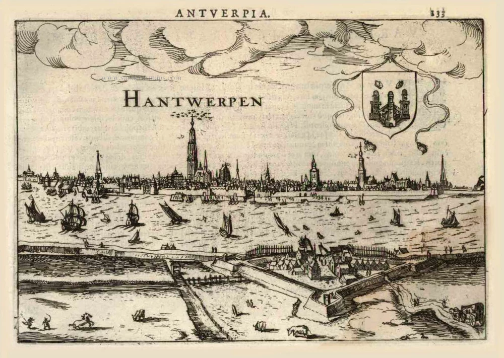
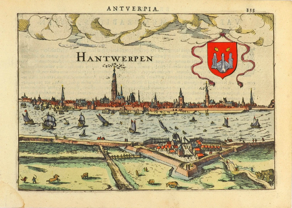
Hantwerpen. 1616
Antwerp (Antwerpen), by Lodovico Guicciardini.
[Item number: 224]
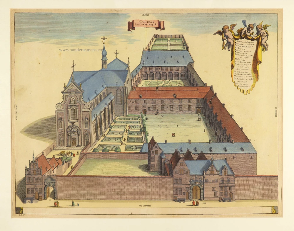
Carmelus Antverpiensis. 1726
Antwerpen - Carmelieten by Antonius Sanderus.
[Item number: 2793]

Mons Omnium Sanctorum sive Conventus Antverpiensis Fratrum Minor. 1726
Antwerpen - Minderbroeders, by Antonius Sanderus.
[Item number: 3560]

Rare
Antwerpen. 1726
Antwerpen by D. Fassmann
[Item number: 5946]
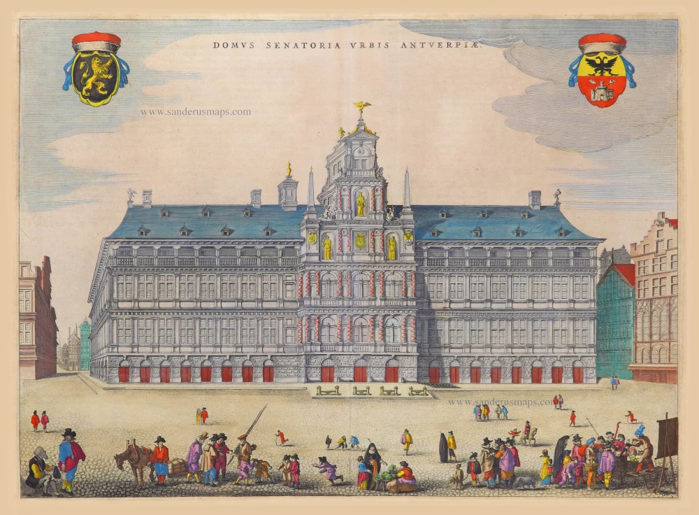
Domus Senatoria Urbis Antverpiae 1652
City Hall by Joan Blaeu. (Antwerp)
[Item number: 17590]

Domus Hansae Teutonicae - Sacri Romani Imperi. 1612
Hanse (Antwerp), by Lodovico Guicciardini.
[Item number: 18160]

BURSA 1582
Beurs (Antwerp) by Lodovico Guicciardini.
[Item number: 18161]

Vue du Marché aux oeufs, à Anvers - View of the egg Market at Antwerp. c. 1846
Antwerpen Eiermarkt by Granello L.
[Item number: 21811]
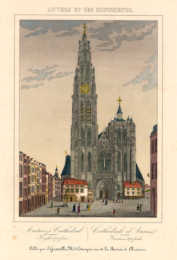
Antwerp Cathedral - Cathédrale d'Anvers c. 1846
Antwerp Cathedral (Antwerpen Kathedraal), by Granello L.
[Item number: 21821]
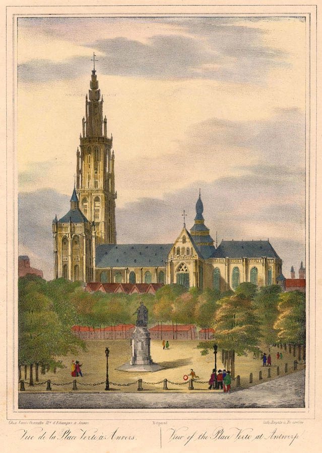
Vue de la Place Verte à Anvers. - View of the Place Verte at Antwerp. c. 1846
Antwerpen Groenplaats by Granello L.
[Item number: 21826]

Plan de la ville et citadelle d'Anvers. 1712
Antwerpen by Eugène Fricx.
[Item number: 29541]
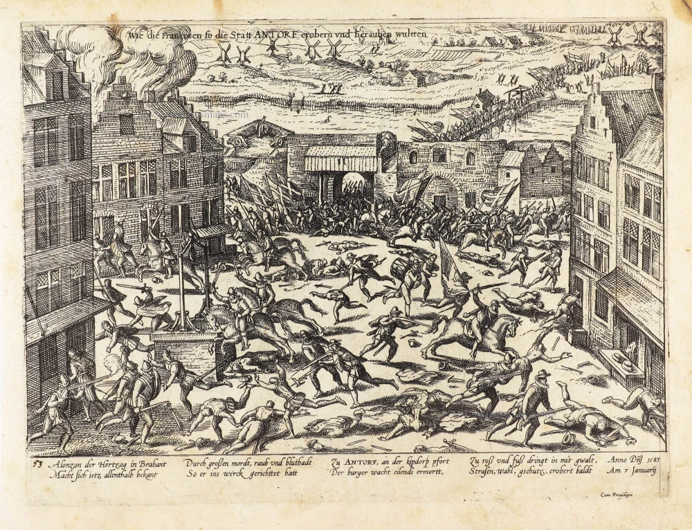
Wie die Françosen so die Statt Antorf erobern und berauben wultten. 1583-1612
The invasion of François-Hercule de Valois with French troops in Antwerp (French Fury), 7 January 1583, by Frans Hogenberg.
[Item number: 29941]
Rare
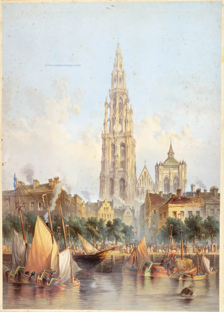
[No title] c. 1850
Antwerp Cathedral, large lithograph.
[Item number: 30799]
First edition 1572 - Heightened in gold
Anverpia, nobile in Brabantia oppidum, ... 1572
Antwerp, by Georg Braun and Frans Hogenberg
[Item number: 31119]

Rare broadsheet
[No title]
Dutch attack on Antwerp in 1623
[Item number: 31121]

One of Antwerp's most beautiful maps
Marchionatus Sacri Romani Imperii. c. 1760
Antwerp, by Nicolaes Visscher I, published by Petrus Schenk Jr.
[Item number: 31137]
Hantwerpen. 1616
Antwerp (Antwerpen), by Lodovico Guicciardini.
[Item number: 31167]

Antwerpen. 1686
Antwerpen by Christoph Riegel.
[Item number: 31503]
Antwerpen 1659
Antwerp by C. Merian.
[Item number: 31845]

Le Pourtraict de la tres noble ville d'Anvers, ainsi qu'elle se comporte a present. 1575
Antwerp (Antwerpen), by François de Belleforest.
[Item number: 31871]

Marchionatus Sacri Romani Imperii. 1617
Antwerp (Antwerpen), by Petrus Kaerius.
[Item number: 32003]

Spectacular view by Hoefnagel
Antverpia. 1596
Antwerp, by Georg Braun and Frans Hogenberg, after G. Hoefnagel.
[Item number: 32468]

Port d'Anvers 1823
Antwerpen, lithograph by Dewasme, after Prosper de la Barrière.
[Item number: 33108]
new

Marché aux Poissons, à Anvers. 1823
Antwerpen - Vismarkt, lithograph by Dewasme, after Prosper de la Barrière.
[Item number: 33109]