
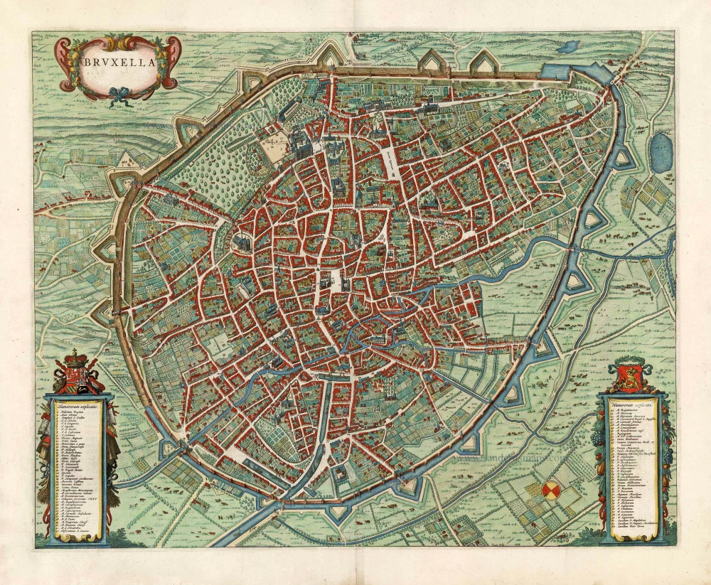
Brussels, by J.J. de Ferraris. 1777
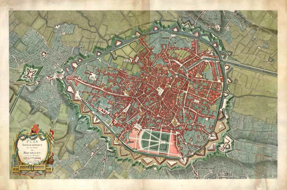
Plan Topographique de la Ville de Bruxelles.
Item Number: 27567 Authenticity Guarantee
Category: Antique maps > Europe > Belgium - Cities
Brussels, by J.J. de Ferraris.
Title: Plan Topographique de la Ville de Bruxelles.
Cartographer: Joseph Jean de Ferraris (Comte) .
Date of the first edition: 1777.
Date of this map: 1777.
Copper engraving, printed on paper.
Image size: 560 x 890mm (22.05 x 35.04 inches).
Sheet size: 640 x 960mm (25.2 x 37.8 inches).
Verso: Blank.
Condition: Hand coloured, minor repair at bottom right.
Condition Rating: A.
From: Ferraris, Carte Chorographique des Pays-Bas Autrichiens. Bruxelles, 1777.
Related items
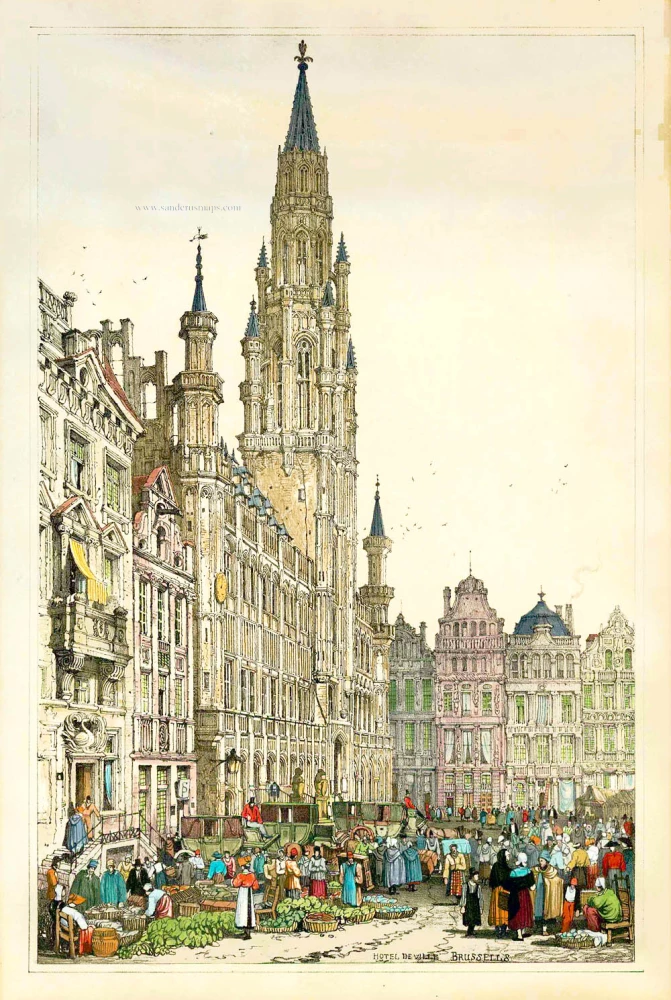
Hotel de Ville - Brussels. 1833
View of Brussels - (Brussel - Bruxelles) by S. Prout.
[Item number: 1829]
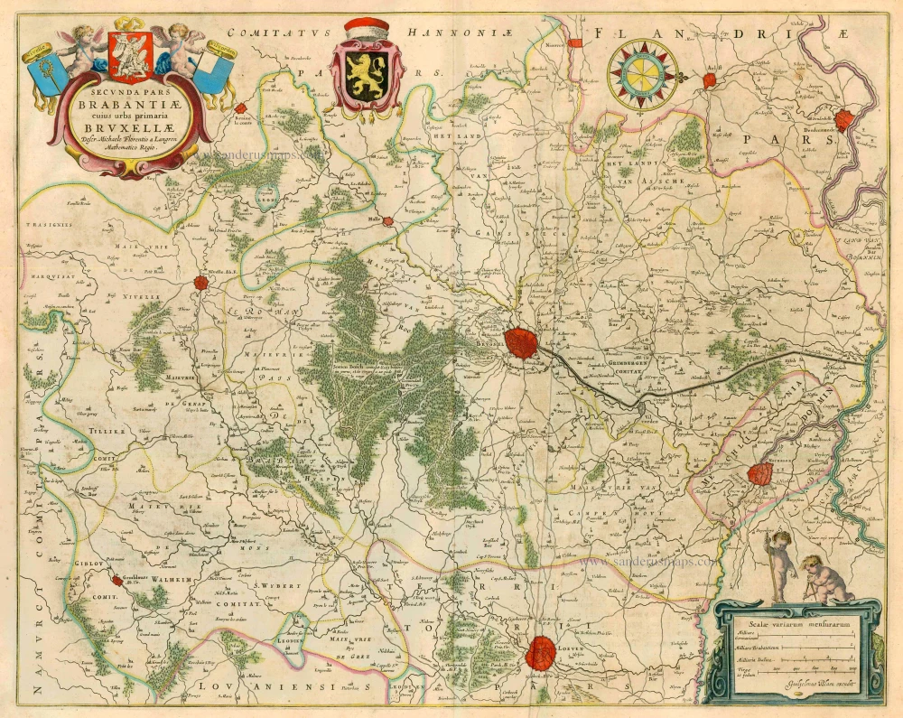
Secunda Pars Brabantiae cuius urbs primaria Bruxellae. 1659-72
Old antique map of Brussels by W. & J. Blaeu.
[Item number: 2966]
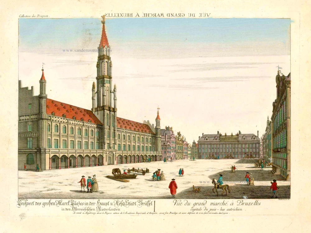
Prospect des grossen Marck Plasses in der Haupf u: Reside Stadt Brüssel ... - Vue du Grand Marché à Bruxelles, capitale du Pais-Bas Autrichien. 18e eeuw
Bruxelles - Brussel, optica
[Item number: 25325]
Rare!
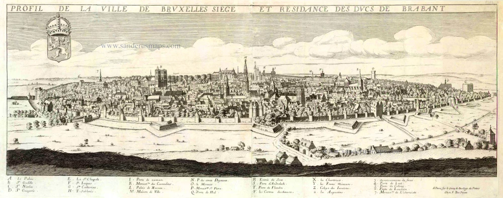
Profil de la ville de Bruxelles Siege et Residance des Ducs de Brabant. c. 1668
View of Brussels by Jean Boisseau.
[Item number: 25574]
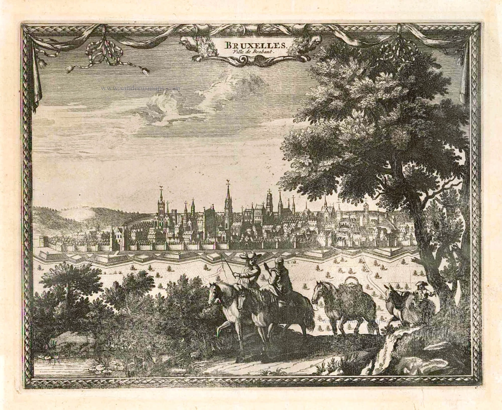
Bruxelles, Ville de Brabant. c.1715
Brussels (Brussel - Bruxelles), by Pieter van der Aa.
[Item number: 25647]
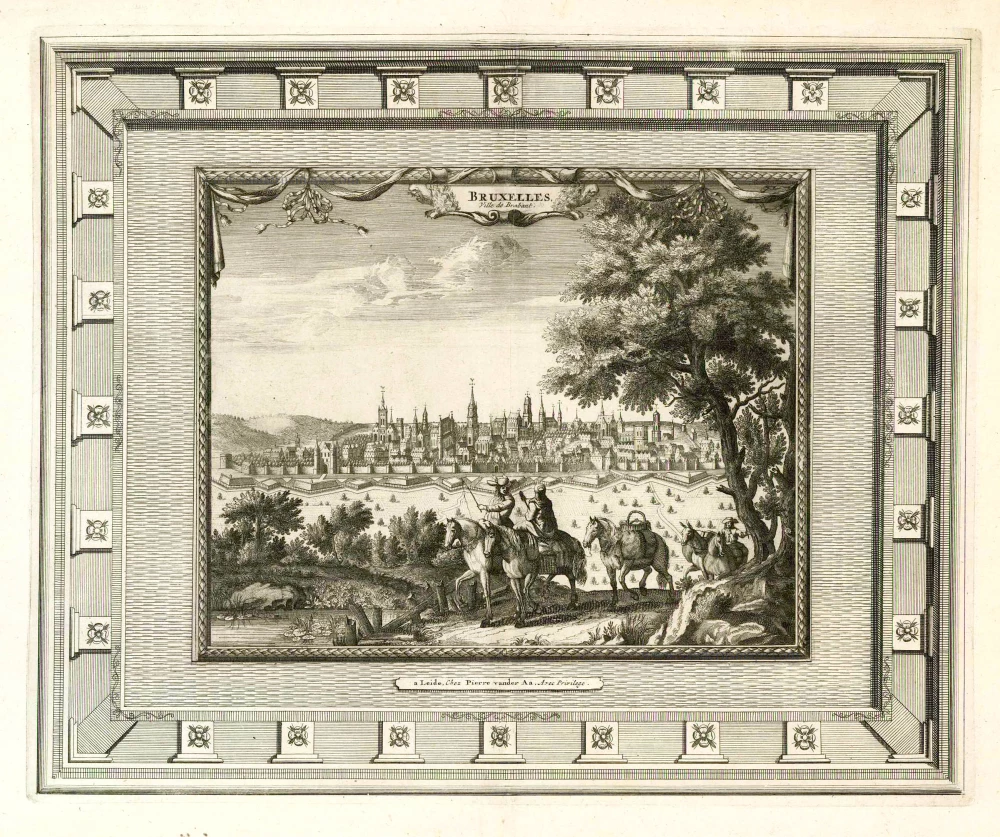
Bruxelles, Ville de Brabant. 1728
Brussels (Brussel - Bruxelles), by Pieter van der Aa.
[Item number: 25767]
Bruxella. 1652
Brussels (Brussel, Bruxelles) by Joan Blaeu.
[Item number: 27499]
Heightened in gold and silver.
Bruselles. 1567
Brussel - Bruxelles by Lodovico Guicciardini
[Item number: 27585]
Rare!
Brussel. 1675
Brussel - Bruxelles, by Clement de Jonghe.
[Item number: 28120]

Bruxella. 1682
Brussels (Bruxelles) by the Heirs Joannes Janssonius van Waesberge.
[Item number: 29514]
Bruxel. 1613
Brussels (Brussel - Bruxelles) by Ludovico Guicciardini.
[Item number: 29557]
Bruxellensis Tetrarchia, in omnes ejusdem subjacentes ditiones accuratissime divisa. 1683-1696
Brussels (Bruxelles) by Nicolaas Visscher II
[Item number: 29592]
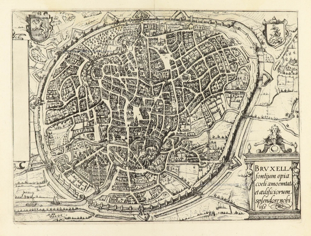
Bruxella fontium copia coelu amoemtate et aedificiorum, splendore nobiliss. 1609
Brussel - Bruxelles by Ludovico Guicciardini.
[Item number: 30814]