
Old antique plan of Ostend [Oostende] by Georg Keller oriented to the South 1604
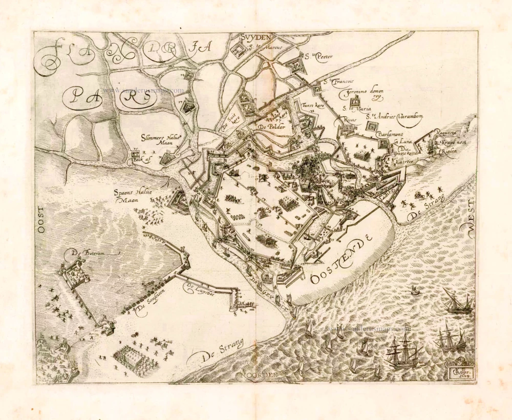
Oostende.
Item Number: 25367 Authenticity Guarantee
Category: Antique maps > Europe > Belgium - Cities
Very rare plan of the siege of Ostend (Oostende) during the last attack in 1604.
Copper engraving
Size: 23 x 29cm (9 x 11.3 inches)
Verso: Blank
Condition: Excellent.
References: Verbouwe (Oostende), #242.
From: Separate publication.
Related items
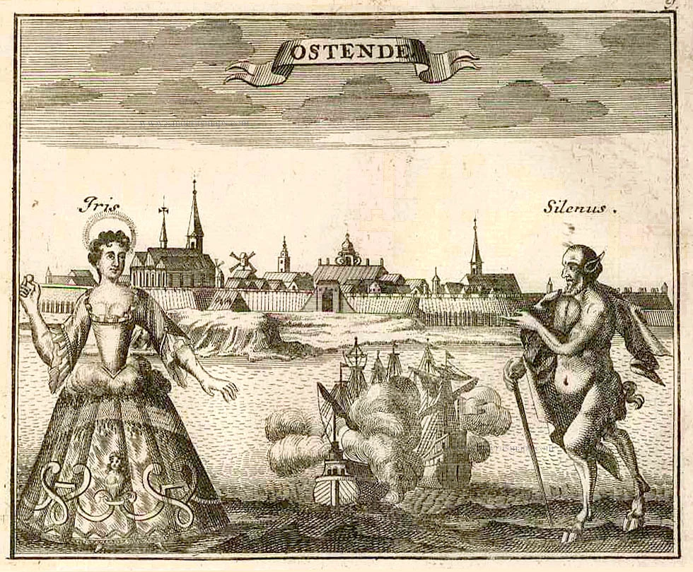
Ostende. 1726
Ostend (Oostende) by D. Fassmann
[Item number: 6090]
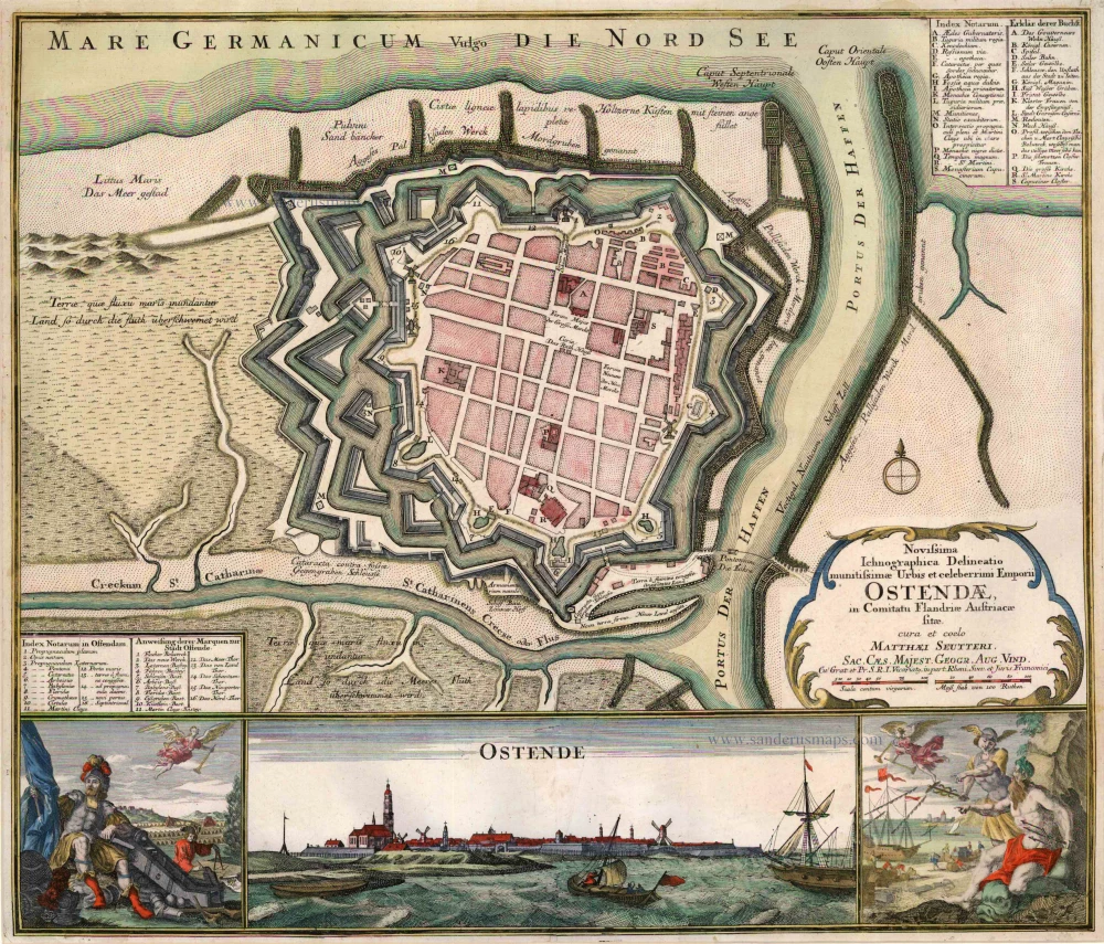
Novissima Ichnographica Delineatio munitissimae Urbis et celeberrimi Emporii Ostendae in Comitatu Flandriae Austriaecae sitae. 1740
Oostende, by Seutter M.
[Item number: 14285]
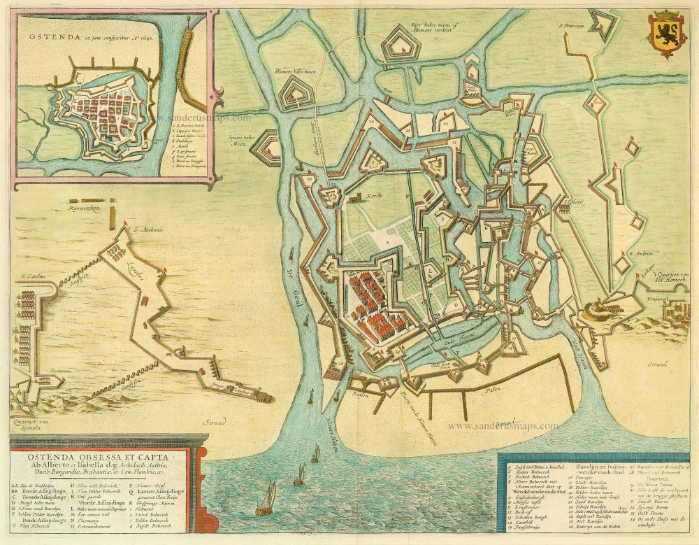
Ostenda Obsessa et Capta. 1649
Ostend (Oostende), by Antonius Sanderus, published by Joan Blaeu.
[Item number: 14985]