
Oostende, by Seutter M. 1740
Matthäus Seutter (Augsburg, 1678 - 1757)
Matthäus Seutter was an engraver, globe maker and map publisher in Augsburg. He apprenticed as an engraver to publisher J.B. Homann in Nuremberg in 1697. He returned to Augsburg c. 1707 and set up his own map publishing house, which became a primary competitor of the Homann company. As a result, most of Seutter's maps were based upon, if not copies, earlier work done by the Homann and Delisle firms.
Karl VI awarded him the title of Imperial Geographer in 1731.
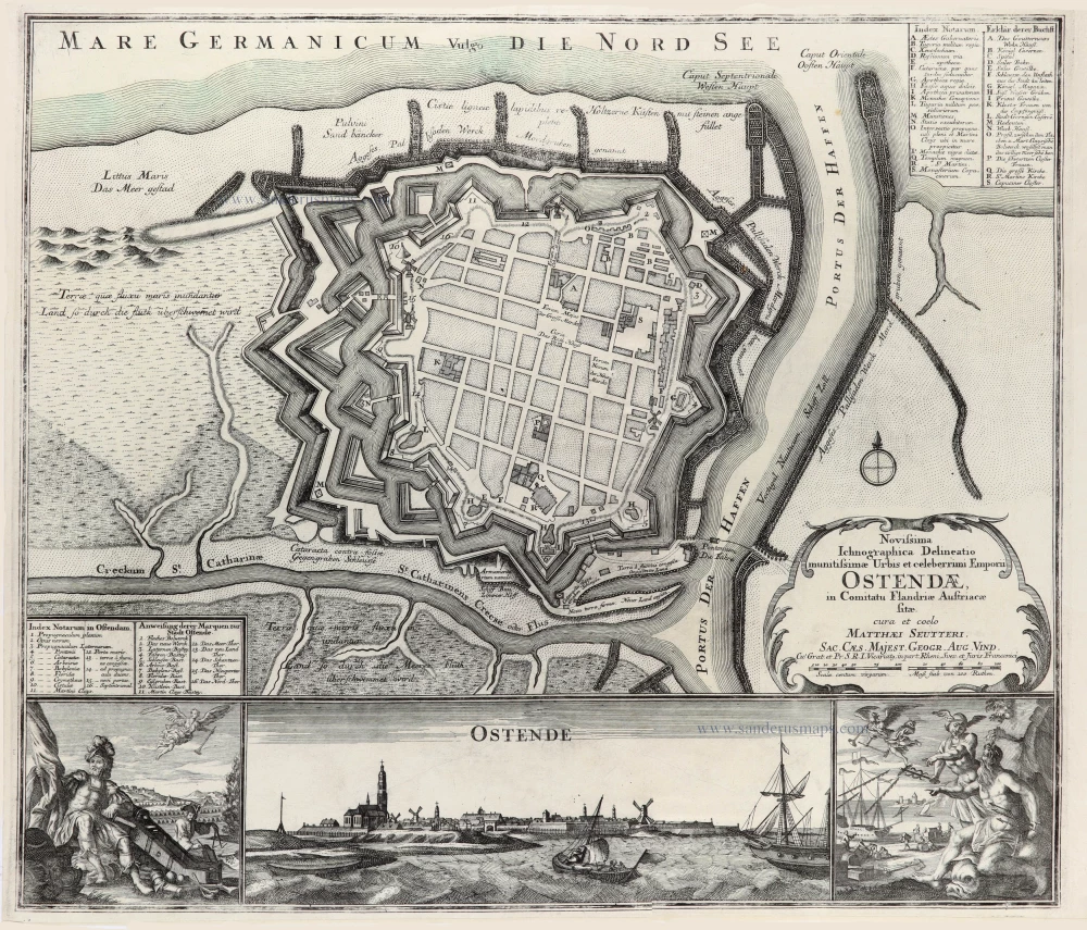
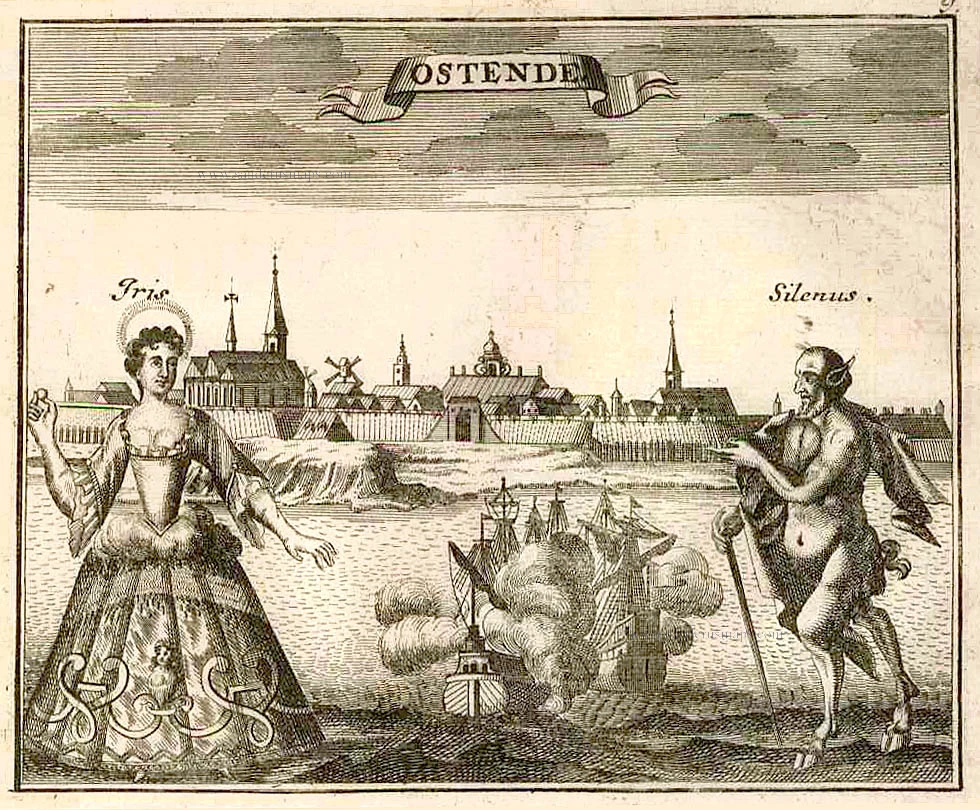
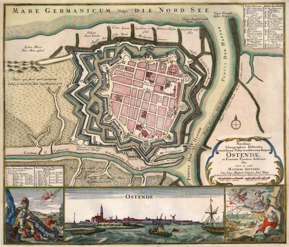
Novissima Ichnographica Delineatio munitissimae Urbis et celeberrimi Emporii Ostendae in Comitatu Flandriae Austriaecae sitae.
Item Number: 31444 Authenticity Guarantee
Category: Antique maps > Europe > Belgium - Cities
Oostende, by Seutter M.
Title: Novissima Ichnographica Delineatio munitissimae Urbis et celeberrimi Emporii Ostendae in Comitatu Flandriae Austriaecae sitae.
cura et coelo Matthaei Seutteri, Sac. Caes. Majest. Geogr. Aug. Vind.
Cu Grat. et Pr. S.R.I. Vicariatq, in part Rheni, Suev. et Furis Franconici.
Date of the first edition: c. 1740.
Date of this map: 1740.
Copper engraving, printed on paper.
Image size: 494 x 477mm (19½ x 18¾ inches).
Sheet size: 505 x 600mm (20 x 23½ inches).
Verso: Blank.
Condition: Original coloured, excellent.
Condition Rating: .
From: Atlas Novus. Augsburg, c. 1740.
Matthäus Seutter (Augsburg, 1678 - 1757)
Matthäus Seutter was an engraver, globe maker and map publisher in Augsburg. He apprenticed as an engraver to publisher J.B. Homann in Nuremberg in 1697. He returned to Augsburg c. 1707 and set up his own map publishing house, which became a primary competitor of the Homann company. As a result, most of Seutter's maps were based upon, if not copies, earlier work done by the Homann and Delisle firms.
Karl VI awarded him the title of Imperial Geographer in 1731.
Related items
Ostende. 1726
Ostend (Oostende) by D. Fassmann
[Item number: 6090]
Novissima Ichnographica Delineatio munitissimae Urbis et celeberrimi Emporii Ostendae in Comitatu Flandriae Austriaecae sitae. 1740
Oostende, by Seutter M.
[Item number: 14285]

Ostenda Obsessa et Capta. 1649
Ostend (Oostende), by Antonius Sanderus, published by Joan Blaeu.
[Item number: 14985]
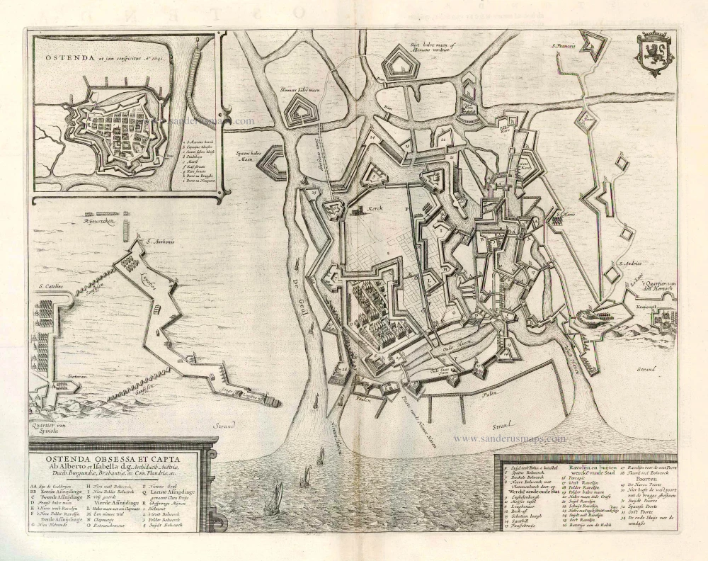
Ostenda Obsessa et Capta. 1652
Ostend (Oostende) by Antonius Sanderus, published by Joan Blaeu.
[Item number: 25989]
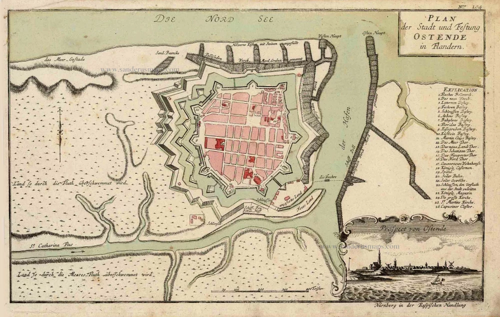
Plan der Stadt und Festung Ostende in Flandern. [With:] Prospect von Ostende. c. 1770
Oostende, by 'Raspischen Handlung'.
[Item number: 27987]
Oostende. 1613
Oostende by Ludovico Guicciardini.
[Item number: 29983]
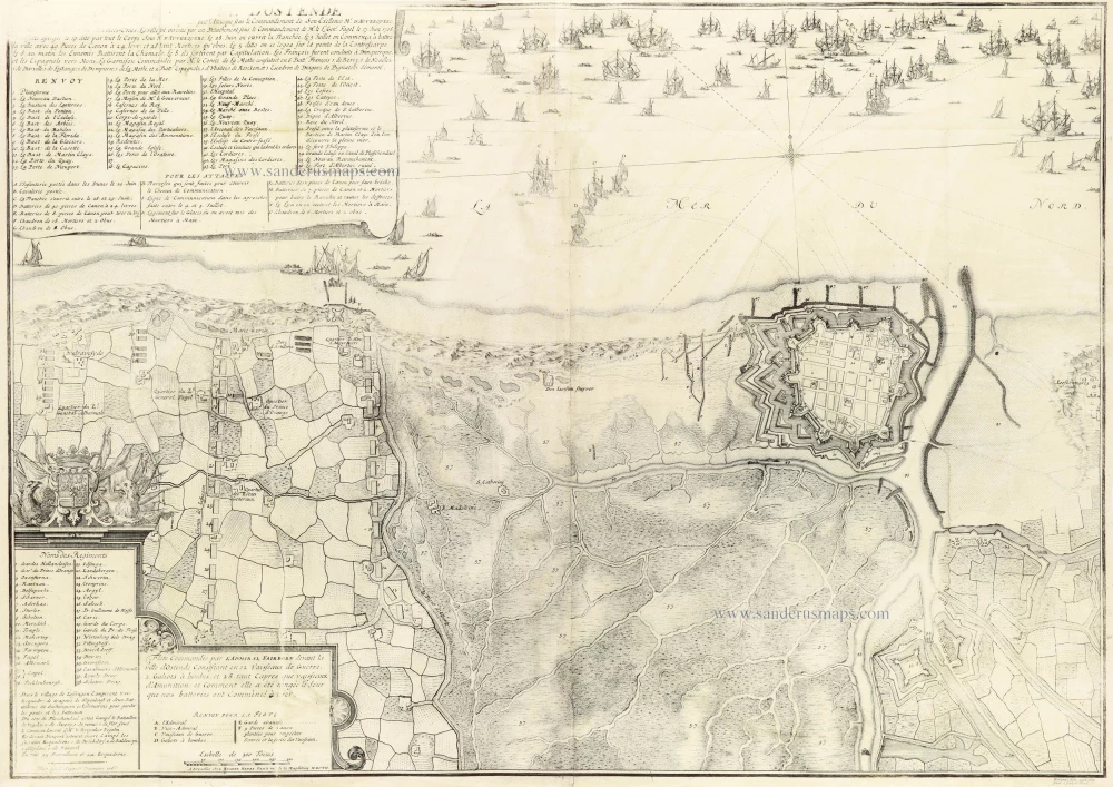
Plan de la ville d'Ostende 1712
Oostende by Eugène Fricx.
[Item number: 30792]

Oostende. 1616
Oostende by Ludovico Guicciardini.
[Item number: 32091]
![Oostende [On verso:] Koekelare, door Antonius Sanderus](https://sanderusmaps.com/assets/WEBP/m32849.webp)
Ostenda Obsessa et Capta Ab Alberto et Isabella d.g. Archiduib. Austriae, Ducib. Burgundiae, Brabantiae, etc. Com. Flandriae, etc. [On verso:] Cokelaere 1641
Oostende [On verso:] Koekelare, door Antonius Sanderus
[Item number: 32849]