
Antique map of British Isles by Ortelius A. 1612
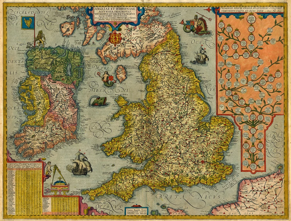
Angliae et Hiberniae Accurata Descriptio, Veteribus et Recentioribus Nominibus Illustrata: ...
Item Number: 3945 Authenticity Guarantee
Category: Antique maps > Europe > British Isles
One of the most decorative maps of the British Isles including a genealogical tree from William the Conqueror to the time of publication and James I. This rare Vrients map appeared only in the Ortelius editions 1606-1612.
Copper engraving
Size: 44 x 56.5cm (17.2 x 22 inches)
Verso text: Spanish
Condition: Old coloured, new side margins, nice copy.
Condition Rating: B+
References: Van der Krogt 3, 5000:31B.2; Van den Broecke, 17.2; Shirley (BI to 1650), 290.
From: Ortelius A. Theatro d'el Orbe de la Tierra. Antwerp. Plantin Press, 1612. (Van der Krogt 3, 1:453)