
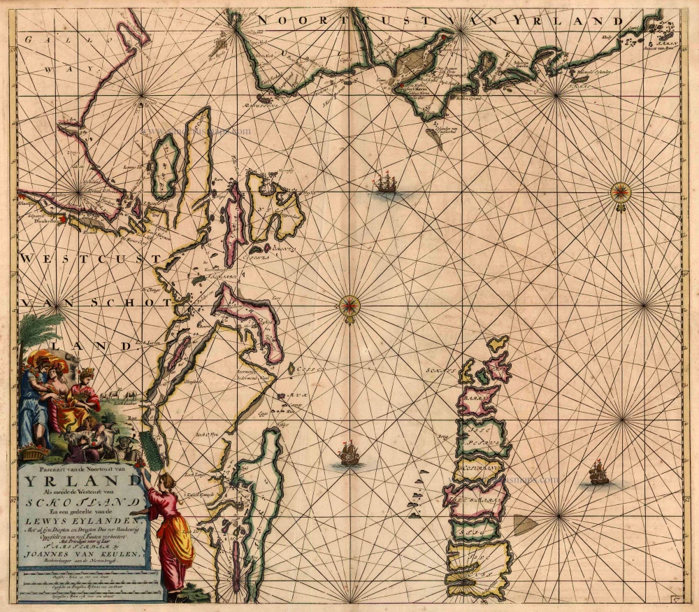
Antique map of Northern Ireland & Western Scotland by Van Keulen Johannes 1697-1709
back
References: Koeman - Keu (77)
Pascaart van de Noortcust van Yrland als meede de Westcust van Schotland En een gedeelte van de Lewys Eylanden.
SOLD
Item Number: 2634 Authenticity Guarantee
Category: Antique maps > Europe > British Isles
Map of Northern Ireland and Western Scotland , oriented to the South
Date: 1697-1709
Copper engraving
Size: 50 x 57cm (19.5 x 22.2 inches)
Verso: Blank
Condition: Old coloured, age-toned.
Condition Rating: B
References: Koeman, Keu (77).
From: De Nieuwe Groote Lichtende Zee-Fakkel, ... Amsterdam, J. van Keulen, 1697-1709.