
Antique map of Scotland - Mull by J. Blaeu 1664
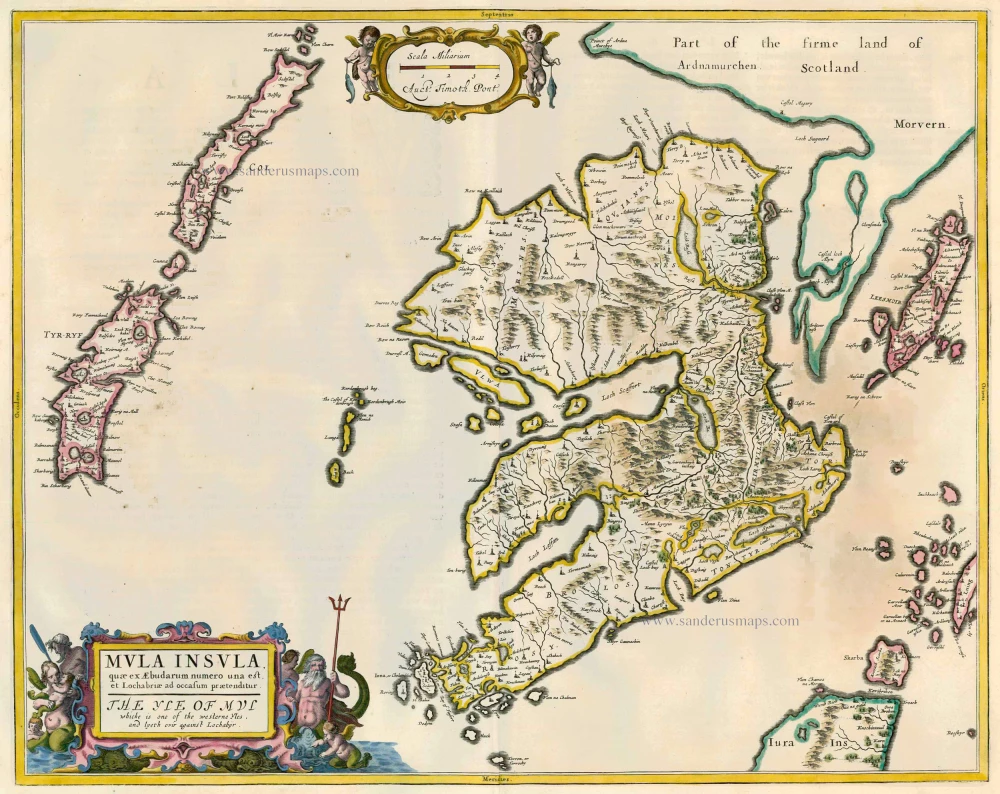
Mula Insula, quae ex Aebudarum numero una est, et Lochabriae ad occasum praetenditur. - The Yle of Mul ...
Item Number: 13085 Authenticity Guarantee
Category: Antique maps > Europe > British Isles
Map of Scotland - the Isle of Mull, oriented to the North
Cartographer: Timothy Pont
Copper engraving
Size: 42.5 x 53.5cm (16.6 x 20.9 inches)
Verso text: Dutch
Condition: Old coloured, on heavy paper, shine-through of verso text, some browning at the right side.
Condition Rating: B
References: Van der Krogt 2, 5871:2.
From: J. Blaeus Grooten Atlas, oft Werelt- Beschryving, in welcke 't Aerdryck, de Zee, en Hemel, wort vertoont en beschreven. Amsterdam, J. Blaeu, 1664. (Van der Krogt 2, 621)