
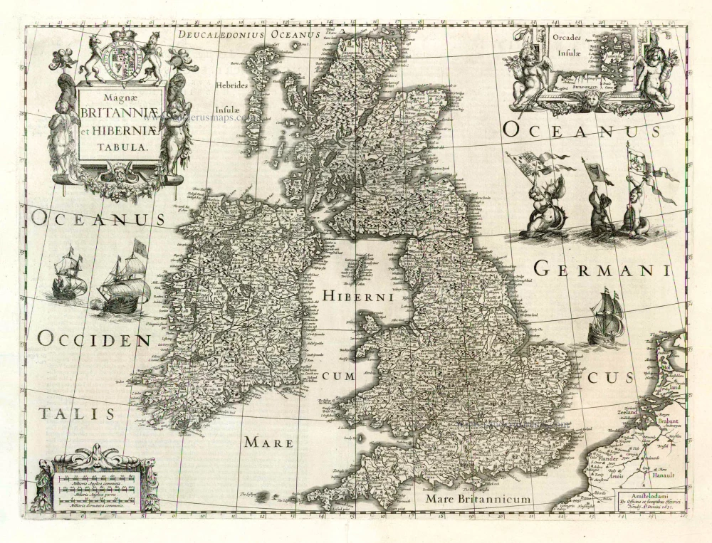
Antique map of the British Isles by H. Hondius 1633
back
References: Van der Krogt 1 - 5000:1C; Shirley (BI to 1650) - 435
Magnae Britanniae et Hiberniae Tabula
SOLD
Item Number: 1473 Authenticity Guarantee
Category: Antique maps > Europe > British Isles
Antique map of the British Isles by H. Hondius
Date of the first edition: 1631
Date of this map: 1633
Date on the map: 1631
Copper engraving
Size: 38.5 x 50cm (15 x 19.5 inches)
Verso text: French
Condition: Uncoloured, centrefold split restored.
Condition Rating: A
References: Van der Krogt 1, 5000:1C; Shirley (BI to 1650), 435, pl.129
From: Gerardi Mercatoris et I. Hondii - Atlas ou Representation du Monde Universel, ... Amsterdam, H. Hondius, 1633. (Van der Krogt 1, 311)