
Antique sea chart of North England by Waghenaer L.J. 1586
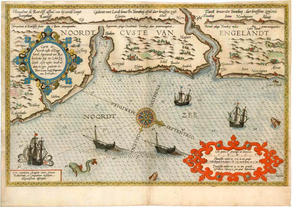


Caerte der Noordt custe va Engelandt, beginnende van Robinhodes baij tot Cocket Eijlandt, . . .
Item Number: 2055 Authenticity Guarantee
Category: Antique maps > Europe > British Isles
Antique sea chart of North England by Waghenaer L.J., engraved by B. & J. van Doetecum.
Copper engraving
Size: 33 x 51cm (12.9 x 19.9 inches)
Verso text: Latin
Condition: Old coloured, upper and side margins trimmed (0,5 - 1 cm of margins left), upper corners skillfully repaired.
Condition Rating: C
From: Speculum nauticum super navigatione maris Occidentalis confectum, continens omnes oras maritimas Galliae, Hispaniae et praecipuarum partiu Angliae, ... - Spieghel der Zeevaerdt, vande navigatie der Westersche zee Innehoudende alle de Custen van Franckrijck, Spaignen, en t' principaelste deel van Engelandt, ... Lugduni Batavorum (Leiden), Excudebat typis Plantiniannis Franciscus Raphelengius, pro Luca Ioannis Aurigario. MDLXXXVI (1586). (Koeman IV, Wag5A)