
Old antique plan and view of London, by Frederick de Wit After 1695


Frederick de Wit (1630-1706)
The engraver and map-seller, Frederick de Wit, was born in Gouda (Netherlands) in 1630 as a son of Hendrick Fredericksz de Wit. Through his marriage with Maria van der Waag of Amsterdam in 1661, he obtained citizenship of the city where he had been working since 1648 and where he became one of the most famous engravers of maps of the second half of the 17th century. Although De Wit was a Catholic, which meant that he was not favoured at the time by the city council, he was awarded the honour of being listed as one of the "excellent citizens" on the roll of the city council in the years 1694-1704. However, his name was not written in the Guild of St. Luke book before 1664. At that time, he lived on the Kalverstraat "in de Witte Pascaert", where he stayed until his death in 1706. His earliest dates on maps engraved are 1659 (Regni Daniae) and 1660 (World map).
Frederick de Wit published several world atlases, a sea atlas, and an atlas of the Netherlands.
The dating of the maps is difficult. However, as a privilege was granted in 1689, the annotation 'cum privilegio' marks an edition after 1688.
Around 1700, Frederick de Wit entered the market with a town atlas. He produced two volumes with a total of 260 plans and views. Most were printed from plates used for Janssonius and Blaeu town atlases.
After he died in 1706, his widow continued the shop until 1709. The plates and stock of De Wit's atlas were sold to Covens & Mortier in 1710, who sold the atlas for an extended period.
Londini Angliae Regni Metropolis Novissima & Accuratissima Autore F. De Witt Cum Privilegio.
Item Number: 26731 Authenticity Guarantee
Category: Antique maps > Europe > British Isles
Old, antique plan and view of London, by Frederick de Wit.
With inset panoramic view of London at the bottom (8.5 x 58 cm).
With the portraits of William III and Mary.
With 'Names of Places Containd in this Mapp' (key to numbers 1-148) and in the centre of the map 'Places of Southwark' (key 1-10).
Cartographer: Joannes de Ram
Date of the first edition: c. 1690
Date of this map: After 1695
Copper engraving, printed on paper.
Size (not including margins): 49.5 x 58cm (19.3 x 22.6 inches)
Verso: Blank
Condition: Original coloured, small tear at lower central margin (closed).
Condition Rating: A+
References: Van der Krogt 4, #2443 State 3; Fauser, #7962; Howgego, #40 (3).
From: Theatrum praecipuarum totius Europae urbium. Amsterdam, F. de Wit, after 1695. (Van der Krogt 4, 44:22)
Frederick de Wit (1630-1706)
The engraver and map-seller, Frederick de Wit, was born in Gouda (Netherlands) in 1630 as a son of Hendrick Fredericksz de Wit. Through his marriage with Maria van der Waag of Amsterdam in 1661, he obtained citizenship of the city where he had been working since 1648 and where he became one of the most famous engravers of maps of the second half of the 17th century. Although De Wit was a Catholic, which meant that he was not favoured at the time by the city council, he was awarded the honour of being listed as one of the "excellent citizens" on the roll of the city council in the years 1694-1704. However, his name was not written in the Guild of St. Luke book before 1664. At that time, he lived on the Kalverstraat "in de Witte Pascaert", where he stayed until his death in 1706. His earliest dates on maps engraved are 1659 (Regni Daniae) and 1660 (World map).
Frederick de Wit published several world atlases, a sea atlas, and an atlas of the Netherlands.
The dating of the maps is difficult. However, as a privilege was granted in 1689, the annotation 'cum privilegio' marks an edition after 1688.
Around 1700, Frederick de Wit entered the market with a town atlas. He produced two volumes with a total of 260 plans and views. Most were printed from plates used for Janssonius and Blaeu town atlases.
After he died in 1706, his widow continued the shop until 1709. The plates and stock of De Wit's atlas were sold to Covens & Mortier in 1710, who sold the atlas for an extended period.
Related items
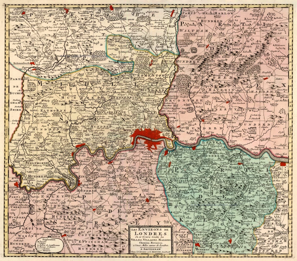
Les Environs de Londres Ou se trouve toutte les Villes, Villages, Maisons, Chemins, Rivières, à Vinct Milles autour de Londres. 1721-41
London, by Covens & Mortier.
[Item number: 23728]
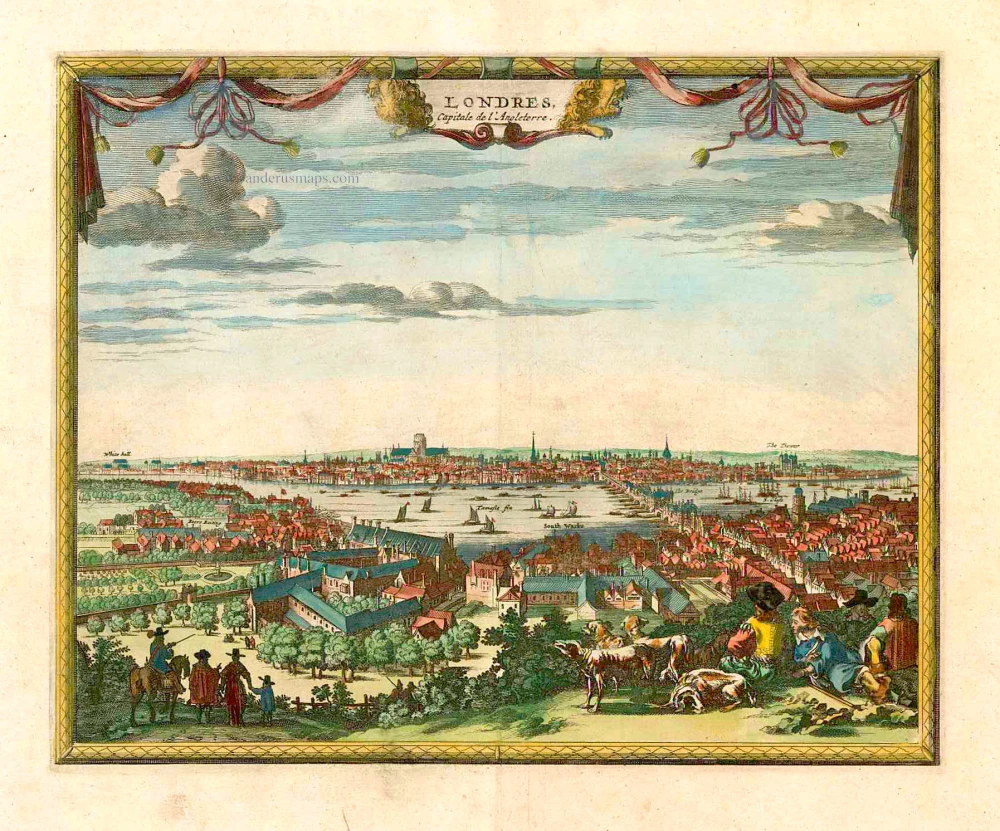
Londres Capitale de l'Angleterre. c. 1715
London, by Pieter van der Aa.
[Item number: 26854]