
Polna in Bohemia, by Georg Braun and Frans Hogenberg. 1617-18
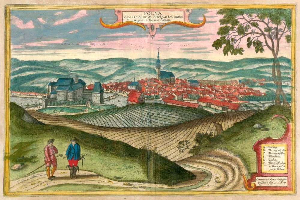
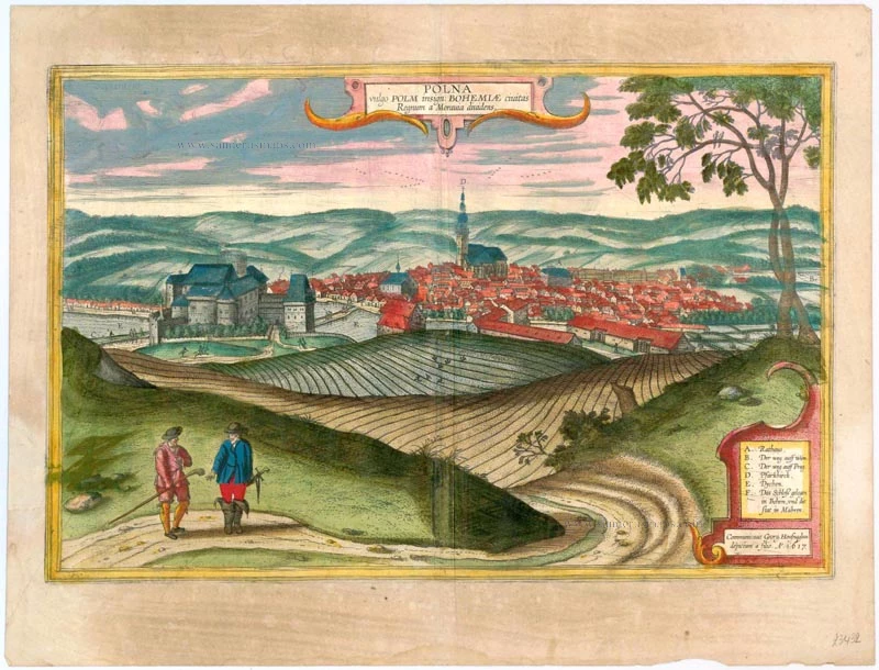


CARTOUCHE TOP: Polna, in the vernacular Polm, eminent town in Bohemia, divides the kingdom from Moravia.
CARTOUCHE BOTTOM RIGHT: Procured by Georg Hoefnagel, painted by his son. In the year 1617.
COMMENTARY BY BRAUN (on verso): "This town lies right on the border between Bohemia and Moravia, such that the town belongs to Moravia but the castle to Bohemia. Both are handsomely built and are in pleasant locations, especially the castle, which in the direction of Prague has fine ponds full of fish. This land not only has all kinds of fruits and pastures, but also birds and game and wild fowl. But since we have at present no other information about this town, and, as we have said, it lies on the border between Bohemia and Moravia, we will here give a brief account of how these two territories came together."
This is a view of Polna from the southwest looking across the Bohemian-Moravian Highlands from a slightly elevated viewpoint. In addition to the parish church (D) in the centre, this view is dominated by the castle (F) beside the river Slapanka. Polna was founded in the first half of the 13th century and was granted a municipal charter in 1479. The trade route from Prague to Vienna passed through here; the town's importance increased with the contruction of the castle in the mid-13th century. In the 15th/16th centuries the town flourished, largely due to the cloth trade. During this period the castle was rebuilt in the Renaissance style. After a fire in 1794 it stood empty until it was restored in the 20th century; today it is used as a hotel.
Braun G. & Hogenberg F. and the Civitates Orbis Terrarum.
The Civitates Orbis Terrarum, also known as the 'Braun & Hogenberg', is a six-volume town atlas and the most excellent book of town views and plans ever published: 363 engravings, sometimes beautifully coloured. It was one of the best-selling works in the last quarter of the 16th century. Georg Braun, a skilled writer, wrote the text accompanying the plans and views on the verso. Many plates were engraved after the original drawings of a professional artist, Joris Hoefnagel (1542-1600). The first volume was published in Latin in 1572 and the sixth in 1617. Frans Hogenberg, a talented engraver, created the tables for volumes I through IV, and Simon van den Neuwel made those for volumes V and VI. Other contributors were cartographers Daniel Freese and Heinrich Rantzau, who provided valuable geographical information. Works by Jacob van Deventer, Sebastian Münster, and Johannes Stumpf were also used as references. Translations appeared in German and French, making the atlas accessible to a broader audience.
Since its original publication of volume 1 in 1572, the Civitates Orbis Terrarum has left an indelible mark on the history of cartography. Seven more editions followed the first volume in 1575, 1577, 1582, 1588, 1593, 1599, and 1612. Vol.2, initially released in 1575, saw subsequent editions in 1597 and 1612. The subsequent volumes, each a treasure trove of historical insights, graced the world in 1581, 1588, 1593, 1599, and 1606. The German translation of the first volume, a testament to its widespread appeal, debuted in 1574, followed by the French edition in 1575.
Several printers were involved: Theodor Graminaeus, Heinrich von Aich, Gottfried von Kempen, Johannis Sinniger, Bertram Buchholtz, and Peter von Brachel, all of whom worked in Cologne.
Georg Braun (1541-1622)
Georg Braun, the author of the text accompanying the plans and views in the Civitates Orbis Terrarum, was born in Cologne in 1541. After his studies in Cologne, he entered the Jesuit Order as a novice, indicating his commitment to learning and intellectual pursuits. In 1561, he obtained his bachelor's degree; in 1562, he received his Magister Artium, further demonstrating his academic achievements. Although he left the Jesuit Order, he continued his studies in theology, gaining a licentiate in theology. His theological background likely influenced the content and tone of the text in the Civitates Orbis Terrarum, adding a unique perspective to the work.
Frans Hogenberg (1535-1590)
Frans Hogenberg was a Flemish and German painter, engraver, and mapmaker. He was born in Mechelen as the son of Nicolaas Hogenberg.
By the end of the 1560s, Frans Hogenberg was employed upon Abraham Ortelius's Theatrum Orbis Terrarum, published in 1570; he is named an engraver of numerous maps. In 1568, he was banned from Antwerp by the Duke of Alva and travelled to London, where he stayed a few years before emigrating to Cologne. He immediately embarked on his two most important works, the Civitates, published in 1572 and the Geschichtsblätter, which appeared in several series from 1569 until about 1587.
Thanks to large-scale projects like the Geschichtsblätter and the Civitates, Hogenberg's social circumstances improved with each passing year. He died as a wealthy man in Cologne in 1590.
Polna vulgo Polm insign: Bohemiae civitas Regnum a Moravia dividens.
Item Number: 23432 Authenticity Guarantee
Category: Antique maps > Europe > Central Europe
Antique map - bird's-eye view of Polna in Bohemia by Braun and Hogenberg after G. Hoefnagel and son, 1617. Key to six locations.
Date of the first edition: 1617
Date of this map: 1618
Copper engraving
Size: 32 x 49cm (12.5 x 19.1 inches)
Verso text: Latin
Condition: Left margin repaired, some smudging, superb old colour.
Condition Rating: B
References: Van der Krogt 4, 3433; Taschen, Braun and Hogenberg, p.465.
From: Theatri praecipuarum Totius Mundi Urbium Liber Sextus Anno MDCXVIII. (Van der Krogt 4, 41:1.6)
CARTOUCHE TOP: Polna, in the vernacular Polm, eminent town in Bohemia, divides the kingdom from Moravia.
CARTOUCHE BOTTOM RIGHT: Procured by Georg Hoefnagel, painted by his son. In the year 1617.
COMMENTARY BY BRAUN (on verso): "This town lies right on the border between Bohemia and Moravia, such that the town belongs to Moravia but the castle to Bohemia. Both are handsomely built and are in pleasant locations, especially the castle, which in the direction of Prague has fine ponds full of fish. This land not only has all kinds of fruits and pastures, but also birds and game and wild fowl. But since we have at present no other information about this town, and, as we have said, it lies on the border between Bohemia and Moravia, we will here give a brief account of how these two territories came together."
This is a view of Polna from the southwest looking across the Bohemian-Moravian Highlands from a slightly elevated viewpoint. In addition to the parish church (D) in the centre, this view is dominated by the castle (F) beside the river Slapanka. Polna was founded in the first half of the 13th century and was granted a municipal charter in 1479. The trade route from Prague to Vienna passed through here; the town's importance increased with the contruction of the castle in the mid-13th century. In the 15th/16th centuries the town flourished, largely due to the cloth trade. During this period the castle was rebuilt in the Renaissance style. After a fire in 1794 it stood empty until it was restored in the 20th century; today it is used as a hotel.
Braun G. & Hogenberg F. and the Civitates Orbis Terrarum.
The Civitates Orbis Terrarum, also known as the 'Braun & Hogenberg', is a six-volume town atlas and the most excellent book of town views and plans ever published: 363 engravings, sometimes beautifully coloured. It was one of the best-selling works in the last quarter of the 16th century. Georg Braun, a skilled writer, wrote the text accompanying the plans and views on the verso. Many plates were engraved after the original drawings of a professional artist, Joris Hoefnagel (1542-1600). The first volume was published in Latin in 1572 and the sixth in 1617. Frans Hogenberg, a talented engraver, created the tables for volumes I through IV, and Simon van den Neuwel made those for volumes V and VI. Other contributors were cartographers Daniel Freese and Heinrich Rantzau, who provided valuable geographical information. Works by Jacob van Deventer, Sebastian Münster, and Johannes Stumpf were also used as references. Translations appeared in German and French, making the atlas accessible to a broader audience.
Since its original publication of volume 1 in 1572, the Civitates Orbis Terrarum has left an indelible mark on the history of cartography. Seven more editions followed the first volume in 1575, 1577, 1582, 1588, 1593, 1599, and 1612. Vol.2, initially released in 1575, saw subsequent editions in 1597 and 1612. The subsequent volumes, each a treasure trove of historical insights, graced the world in 1581, 1588, 1593, 1599, and 1606. The German translation of the first volume, a testament to its widespread appeal, debuted in 1574, followed by the French edition in 1575.
Several printers were involved: Theodor Graminaeus, Heinrich von Aich, Gottfried von Kempen, Johannis Sinniger, Bertram Buchholtz, and Peter von Brachel, all of whom worked in Cologne.
Georg Braun (1541-1622)
Georg Braun, the author of the text accompanying the plans and views in the Civitates Orbis Terrarum, was born in Cologne in 1541. After his studies in Cologne, he entered the Jesuit Order as a novice, indicating his commitment to learning and intellectual pursuits. In 1561, he obtained his bachelor's degree; in 1562, he received his Magister Artium, further demonstrating his academic achievements. Although he left the Jesuit Order, he continued his studies in theology, gaining a licentiate in theology. His theological background likely influenced the content and tone of the text in the Civitates Orbis Terrarum, adding a unique perspective to the work.
Frans Hogenberg (1535-1590)
Frans Hogenberg was a Flemish and German painter, engraver, and mapmaker. He was born in Mechelen as the son of Nicolaas Hogenberg.
By the end of the 1560s, Frans Hogenberg was employed upon Abraham Ortelius's Theatrum Orbis Terrarum, published in 1570; he is named an engraver of numerous maps. In 1568, he was banned from Antwerp by the Duke of Alva and travelled to London, where he stayed a few years before emigrating to Cologne. He immediately embarked on his two most important works, the Civitates, published in 1572 and the Geschichtsblätter, which appeared in several series from 1569 until about 1587.
Thanks to large-scale projects like the Geschichtsblätter and the Civitates, Hogenberg's social circumstances improved with each passing year. He died as a wealthy man in Cologne in 1590.
Related items
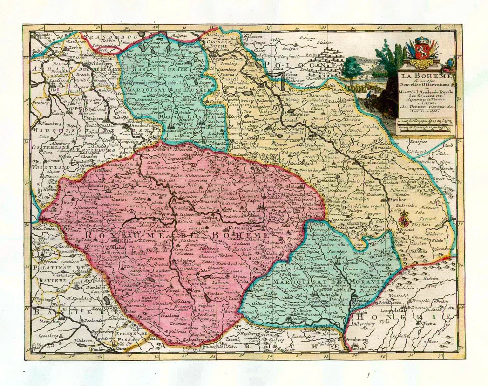
La Boheme. 1713
Bohemia, by Pieter van der Aa.
[Item number: 26179]
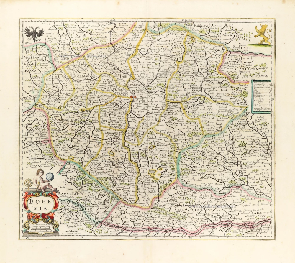
Bohemia. 1653
Bohemia by Johannes Janssonius.
[Item number: 30394]
Bohemia. 1666
Bohemia by Johannes Janssonius.
[Item number: 30929]
Estats de la Couronne de Boheme qui comprennent Le Royaume de Boheme le Duché de Silesie et les Marquisats de Moravie et de Lusace. 1692
Bohemia (Czech Republic) by N. Sanson, so-called published by Hubert Jaillot. (Pirated edition by Pierre Mortier).
[Item number: 31406]