
Kosice (Hungary) by Georg Braun & Frans Hogenberg. c. 1625
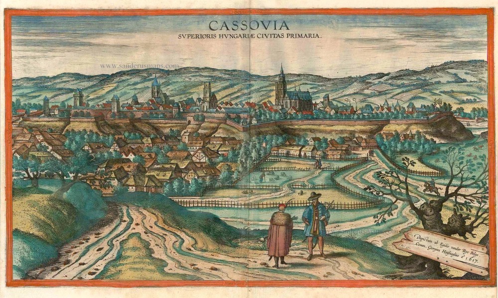


COMMENTARY BY BRAUN: "Kosice is a large and well-fortified city in the Kingdom of Hungary. Situated on the borders to Transylvania on the Hernád, the city is in a good position both for protecting the country and for craft trades and commerce. It is one of the most important strongholds in the whole kingdom and capable of soundly defeating even the most powerful ennemy. Although the city has suffered many battles and dangers, it has nonetheless always remained loyal to the most praiseworthy imperial house of Austria, even at the time when Stephen Bocskay seized not only Transylvania but also large parts of Hungary and was allowed to keep them with the permission of the Emperor."
Kosice is shown from the south on a hill above a suburb. The mighty cathedral of St Elizabeth rises up in the middle of the city. At the beginning of the 13th century, German colonists founded a commercial centre here, beside a Slavic settlement. In 1290 Kosice was one of the first towns in the Kingdom of Hungary to be granted a municipal charter. As an important trade centre, the city developed into the second-largest Hungarian city after Buda and prospered in the 14th/15th centuries. In 1657 the city received its own university. The Turkish Wars as well as internal unrest led to decline, so that Kosice had scarcely any economic importance in the 18th century. After the First World War the city passed to the newly founded state of Czechoslovakia, and became part of the Slovak Republic in 1993. With a population of around 235,000 it is the second-largest city in the country. (Taschen)
Braun G. & Hogenberg F. and the Civitates Orbis Terrarum.
The Civitates Orbis Terrarum, also known as the 'Braun & Hogenberg', is a six-volume town atlas and the most excellent book of town views and plans ever published: 363 engravings, sometimes beautifully coloured. It was one of the best-selling works in the last quarter of the 16th century. Georg Braun, a skilled writer, wrote the text accompanying the plans and views on the verso. Many plates were engraved after the original drawings of a professional artist, Joris Hoefnagel (1542-1600). The first volume was published in Latin in 1572 and the sixth in 1617. Frans Hogenberg, a talented engraver, created the tables for volumes I through IV, and Simon van den Neuwel made those for volumes V and VI. Other contributors were cartographers Daniel Freese and Heinrich Rantzau, who provided valuable geographical information. Works by Jacob van Deventer, Sebastian Münster, and Johannes Stumpf were also used as references. Translations appeared in German and French, making the atlas accessible to a broader audience.
Since its original publication of volume 1 in 1572, the Civitates Orbis Terrarum has left an indelible mark on the history of cartography. Seven more editions followed the first volume in 1575, 1577, 1582, 1588, 1593, 1599, and 1612. Vol.2, initially released in 1575, saw subsequent editions in 1597 and 1612. The subsequent volumes, each a treasure trove of historical insights, graced the world in 1581, 1588, 1593, 1599, and 1606. The German translation of the first volume, a testament to its widespread appeal, debuted in 1574, followed by the French edition in 1575.
Several printers were involved: Theodor Graminaeus, Heinrich von Aich, Gottfried von Kempen, Johannis Sinniger, Bertram Buchholtz, and Peter von Brachel, all of whom worked in Cologne.
Georg Braun (1541-1622)
Georg Braun, the author of the text accompanying the plans and views in the Civitates Orbis Terrarum, was born in Cologne in 1541. After his studies in Cologne, he entered the Jesuit Order as a novice, indicating his commitment to learning and intellectual pursuits. In 1561, he obtained his bachelor's degree; in 1562, he received his Magister Artium, further demonstrating his academic achievements. Although he left the Jesuit Order, he continued his studies in theology, gaining a licentiate in theology. His theological background likely influenced the content and tone of the text in the Civitates Orbis Terrarum, adding a unique perspective to the work.
Frans Hogenberg (1535-1590)
Frans Hogenberg was a Flemish and German painter, engraver, and mapmaker. He was born in Mechelen as the son of Nicolaas Hogenberg.
By the end of the 1560s, Frans Hogenberg was employed upon Abraham Ortelius's Theatrum Orbis Terrarum, published in 1570; he is named an engraver of numerous maps. In 1568, he was banned from Antwerp by the Duke of Alva and travelled to London, where he stayed a few years before emigrating to Cologne. He immediately embarked on his two most important works, the Civitates, published in 1572 and the Geschichtsblätter, which appeared in several series from 1569 until about 1587.
Thanks to large-scale projects like the Geschichtsblätter and the Civitates, Hogenberg's social circumstances improved with each passing year. He died as a wealthy man in Cologne in 1590.
Cassovia superioris Hungariae civitas primaria.
Item Number: 16448 Authenticity Guarantee
Category: Antique maps > Europe > Central Europe
Panoramic view of Kosice by Georg Braun & Frans Hogenberg after Egidius vander Rye, 1617.
Title: Cassovia superioris Hungariae civitas primaria.
Cartographer / Designer: Egidius Vander Rye.
Engraver: Georg Houfnagel.
Date of the first edition: 1617.
Date of this map: c. 1625.
Date on map: 1617.
Copper engraving, printed on paper.
Size (not including margins): 310 x 535mm (12.2 x 21.06 inches).
Verso: French text.
Condition: Contemporary coloured, right margin partly trimmed just to neatline.
Condition Rating: A.
References: Van der Krogt 4, #2141; Fauser, #6940; Taschen, Br. Hog., p. 477
From: Théatre des Principales Villes de tout l'Univers Vol. VI. c. 1625. (Van der Krogt 4, 41:3.6)
COMMENTARY BY BRAUN: "Kosice is a large and well-fortified city in the Kingdom of Hungary. Situated on the borders to Transylvania on the Hernád, the city is in a good position both for protecting the country and for craft trades and commerce. It is one of the most important strongholds in the whole kingdom and capable of soundly defeating even the most powerful ennemy. Although the city has suffered many battles and dangers, it has nonetheless always remained loyal to the most praiseworthy imperial house of Austria, even at the time when Stephen Bocskay seized not only Transylvania but also large parts of Hungary and was allowed to keep them with the permission of the Emperor."
Kosice is shown from the south on a hill above a suburb. The mighty cathedral of St Elizabeth rises up in the middle of the city. At the beginning of the 13th century, German colonists founded a commercial centre here, beside a Slavic settlement. In 1290 Kosice was one of the first towns in the Kingdom of Hungary to be granted a municipal charter. As an important trade centre, the city developed into the second-largest Hungarian city after Buda and prospered in the 14th/15th centuries. In 1657 the city received its own university. The Turkish Wars as well as internal unrest led to decline, so that Kosice had scarcely any economic importance in the 18th century. After the First World War the city passed to the newly founded state of Czechoslovakia, and became part of the Slovak Republic in 1993. With a population of around 235,000 it is the second-largest city in the country. (Taschen)
Braun G. & Hogenberg F. and the Civitates Orbis Terrarum.
The Civitates Orbis Terrarum, also known as the 'Braun & Hogenberg', is a six-volume town atlas and the most excellent book of town views and plans ever published: 363 engravings, sometimes beautifully coloured. It was one of the best-selling works in the last quarter of the 16th century. Georg Braun, a skilled writer, wrote the text accompanying the plans and views on the verso. Many plates were engraved after the original drawings of a professional artist, Joris Hoefnagel (1542-1600). The first volume was published in Latin in 1572 and the sixth in 1617. Frans Hogenberg, a talented engraver, created the tables for volumes I through IV, and Simon van den Neuwel made those for volumes V and VI. Other contributors were cartographers Daniel Freese and Heinrich Rantzau, who provided valuable geographical information. Works by Jacob van Deventer, Sebastian Münster, and Johannes Stumpf were also used as references. Translations appeared in German and French, making the atlas accessible to a broader audience.
Since its original publication of volume 1 in 1572, the Civitates Orbis Terrarum has left an indelible mark on the history of cartography. Seven more editions followed the first volume in 1575, 1577, 1582, 1588, 1593, 1599, and 1612. Vol.2, initially released in 1575, saw subsequent editions in 1597 and 1612. The subsequent volumes, each a treasure trove of historical insights, graced the world in 1581, 1588, 1593, 1599, and 1606. The German translation of the first volume, a testament to its widespread appeal, debuted in 1574, followed by the French edition in 1575.
Several printers were involved: Theodor Graminaeus, Heinrich von Aich, Gottfried von Kempen, Johannis Sinniger, Bertram Buchholtz, and Peter von Brachel, all of whom worked in Cologne.
Georg Braun (1541-1622)
Georg Braun, the author of the text accompanying the plans and views in the Civitates Orbis Terrarum, was born in Cologne in 1541. After his studies in Cologne, he entered the Jesuit Order as a novice, indicating his commitment to learning and intellectual pursuits. In 1561, he obtained his bachelor's degree; in 1562, he received his Magister Artium, further demonstrating his academic achievements. Although he left the Jesuit Order, he continued his studies in theology, gaining a licentiate in theology. His theological background likely influenced the content and tone of the text in the Civitates Orbis Terrarum, adding a unique perspective to the work.
Frans Hogenberg (1535-1590)
Frans Hogenberg was a Flemish and German painter, engraver, and mapmaker. He was born in Mechelen as the son of Nicolaas Hogenberg.
By the end of the 1560s, Frans Hogenberg was employed upon Abraham Ortelius's Theatrum Orbis Terrarum, published in 1570; he is named an engraver of numerous maps. In 1568, he was banned from Antwerp by the Duke of Alva and travelled to London, where he stayed a few years before emigrating to Cologne. He immediately embarked on his two most important works, the Civitates, published in 1572 and the Geschichtsblätter, which appeared in several series from 1569 until about 1587.
Thanks to large-scale projects like the Geschichtsblätter and the Civitates, Hogenberg's social circumstances improved with each passing year. He died as a wealthy man in Cologne in 1590.
Related items

Dotis Ungaris Thata c. 1625
Tata (Hungary) by Braun G. & Hogenberg F.
[Item number: 16381]

Very rare
Hungaria Regnum. 16th cent.
Hungary by an unknown mapmaker.
[Item number: 24501]
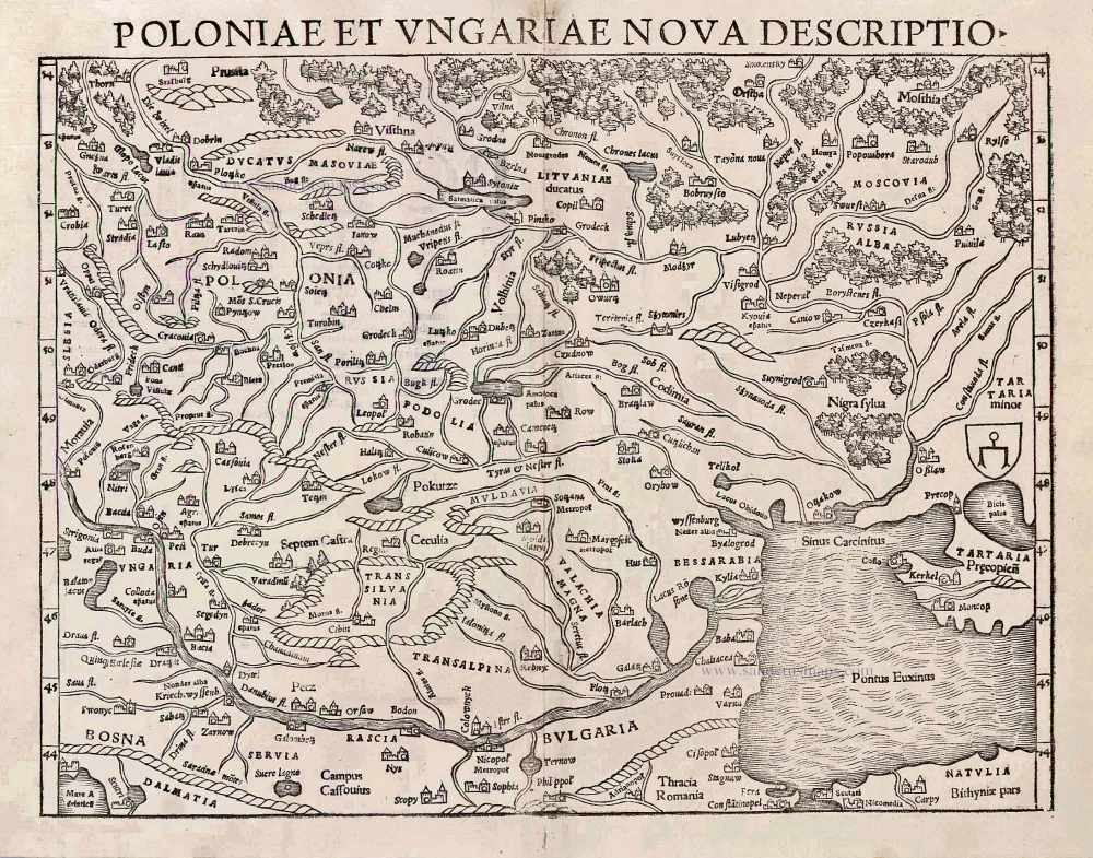
Poloniae et Ungariae Nova Descriptio. 1552
Poland and Hungary, by S. Münster.
[Item number: 25905]

La ville d'Eger, iadis subiette à l'empire romain et auiourd'huy au royaume de Bohem. 1575
Eger (Hungary), by François de Belleforest.
[Item number: 27372]
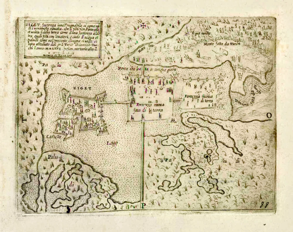
Ziget fortezza innespugnabile, si come ogi di è veramente situata. ... c. 1575
Szigetvár by Giovanni Francesco Camocio
[Item number: 27629]