
Antique map of Gulf of Finland by Van Keulen Johannes 1697-1709
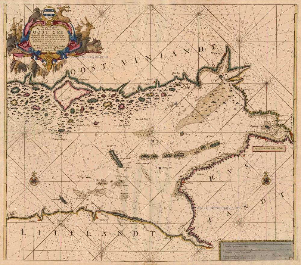
Nieuwe Paskaert Voor een Gedeelte Van de Oost Zee Beginnende 2 Myl bewesten Broklom tot aen Strellen, als mede de Kust van Oost Vinlandt, Beginnende van Parna tot aen de Schans ter Ny.
Item Number: 9267 Authenticity Guarantee
Category: Antique maps > Europe > Eastern Europe
Sea chart of the Gulf of Finland, oriented to the North, with a part of Estland, Russia with St. Petersburg and Finland
Date: 1697-1709
Copper engraving
Size: 50 x 57.5cm (19.5 x 22.4 inches)
Verso: Blank
Condition: Old coloured, age-toned, minor spotting.
Condition Rating: B
References: Koeman, Keu (56).
From: De Nieuwe Groote Lichtende Zee-Fakkel, ... Amsterdam, J. van Keulen, 1697-1709.