
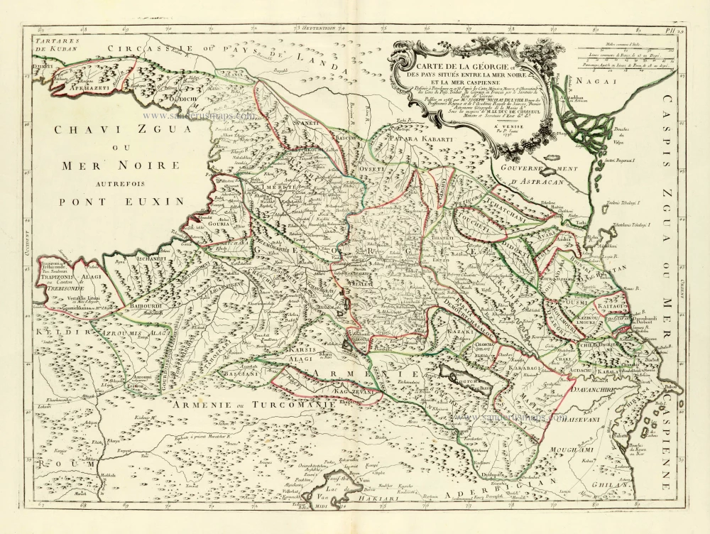
Georgia (Caucasus), by Paolo Santini. 1776-79
Francesco and Paolo Santini (c.1729-1793)
Francesco Santini, a Venetian publisher, acquired the printing plates of Vaugondy’s Atlas Universel …, a commercial and cartographic success, with widespread influence on mapmakers throughout Europe. Together with his brother Paolo, he commissioned a new set of plates and reissued the atlas in 1776. The following year, Paolo Santini assigned all his publication rights to M. Remondini, who in 1777 reissued the same atlas but with his name.
Carte de la Géorgie et des Pays situés entre la Mer Noire et la Mer Caspienne.
Item Number: 28078 Authenticity Guarantee
Category: Antique maps > Europe > Eastern Europe
Old, antique map of Georgia (Caucasus), by Paolo Santini.
Title: Carte de la Géorgie et des Pays situés entre la Mer Noire et la Mer Caspienne.
Dessinée à Petersbourg en 1738 d'après les Cartes, Mémoires, Mesures, et Observations des Gens du Pays. Traduit du Géorgien en François par le Secretaire du Roy de Géorgie.
Publiee en 1766 par M. Joseph Nicolas de L'Isle Doyen des Prossesseurs Royaux et de l'Académie Royale des Sciences, Premier Astronome Géographe de la Marine &a.
Sous les auspices de M. Le Duc de Choiseul Ministre et Secretaire d'Etat &a, &a.
A Venise, Par P. Santini, 1775.
Cartographer: J.N. de L'Isle.
Date of the first edition: 1776.
Date of this map: 1776-79.
Date on map: 1775.
Copper engraving, printed on paper.
Image size: 485 x 660mm (19.09 x 25.98 inches).
Sheet size: 560 x 790mm (22.05 x 31.1 inches).
Verso: Blank.
Condition: Original coloured in outline, excellent.
Condition Rating: A+.
From: Atlas Universel dressé sur les meilleures cartes modernes. Venice, Remondini, 1776-79.
Francesco and Paolo Santini (c.1729-1793)
Francesco Santini, a Venetian publisher, acquired the printing plates of Vaugondy’s Atlas Universel …, a commercial and cartographic success, with widespread influence on mapmakers throughout Europe. Together with his brother Paolo, he commissioned a new set of plates and reissued the atlas in 1776. The following year, Paolo Santini assigned all his publication rights to M. Remondini, who in 1777 reissued the same atlas but with his name.
Related items
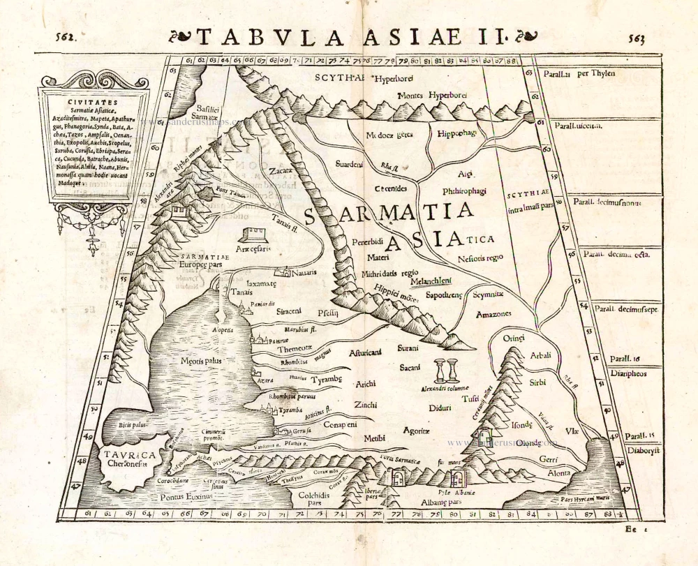
Tabula Asiae II. 1545
The Caucasus, by Sebastian Münster.
[Item number: 26596]
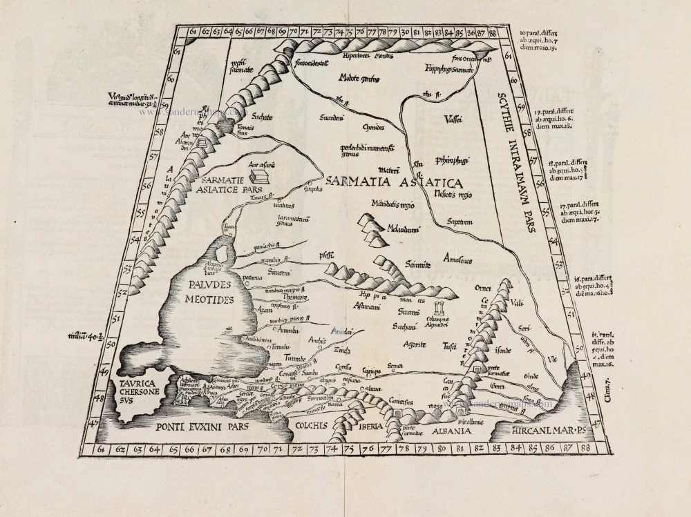
[Title on verso:] Tabula .II. Asia. 1525
Caucasus, by Lorenz Fries.
[Item number: 27974]
With rare old colour
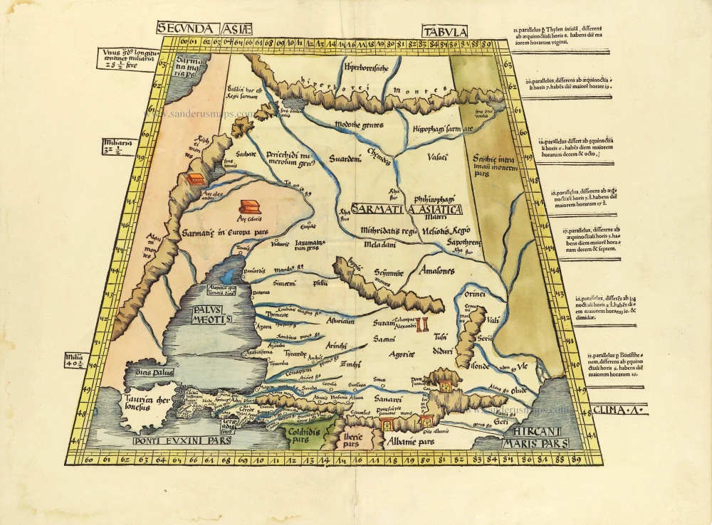
Secunda Asiae Tabula. 1513
Russia and Caucasus by Martin Waldseemüller.
[Item number: 28794]