
Prussia, by Francesco Santini. 1776-79

Francesco and Paolo Santini (c.1729-1793)
Francesco Santini, a Venetian publisher, acquired the printing plates of Vaugondy’s Atlas Universel …, a commercial and cartographic success, with widespread influence on mapmakers throughout Europe. Together with his brother Paolo, he commissioned a new set of plates and reissued the atlas in 1776. The following year, Paolo Santini assigned all his publication rights to M. Remondini, who in 1777 reissued the same atlas but with his name.
Carte de la Prusse Occidentale où sont tracées les Provinces cédées par la Pologne au Roi de Prusse.
Item Number: 26968 Authenticity Guarantee
Category: Antique maps > Europe > Eastern Europe
Old, antique map of Prussia, by Francesco Santini.
Cartographer: J.B. Homann
First state with the imprint of Remondini: with engraved page numbers in the top right corner: "P.I.49".
Date of the first edition: 1776
Date of this map: 1776
Copper engraving, printed on paper.
Size (not including margins): 45 x 65cm (17.6 x 25.4 inches)
Verso: Blank
Condition: Original coloured in outline, excellent.
Condition Rating: A+
From: Atlas Universel dressé sur les meilleures cartes modernes. Venice, Remondini, 1776.
Francesco and Paolo Santini (c.1729-1793)
Francesco Santini, a Venetian publisher, acquired the printing plates of Vaugondy’s Atlas Universel …, a commercial and cartographic success, with widespread influence on mapmakers throughout Europe. Together with his brother Paolo, he commissioned a new set of plates and reissued the atlas in 1776. The following year, Paolo Santini assigned all his publication rights to M. Remondini, who in 1777 reissued the same atlas but with his name.
Related items

Prussiae Vera Descriptio. 1601
Prussia (Poland) by Abraham Ortelius.
[Item number: 25260]
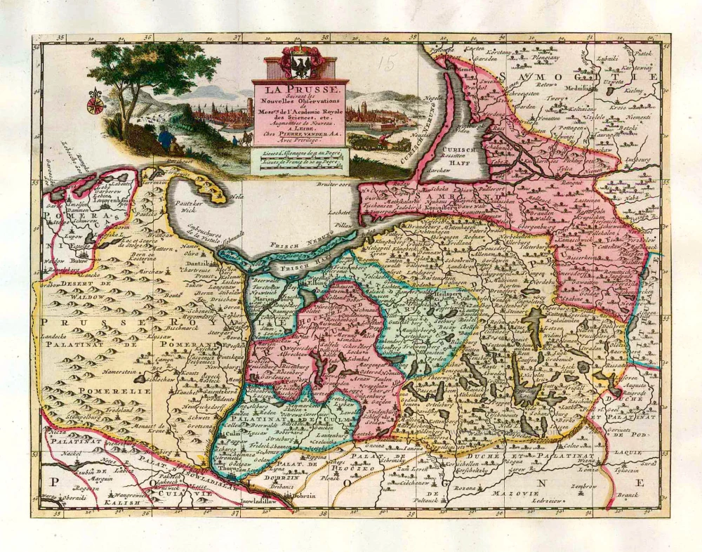
La Prusse, Suivant les Nouvelles Observations de Mess.rs de l'Academie Royale des Sciences, etc. 1713
Prussia, by Pieter van der Aa.
[Item number: 26047]

La Prusse divisée en Prusse Royale, et Prusse Ducale. 1776-79
Prussia, by Francesco Santini.
[Item number: 26967]
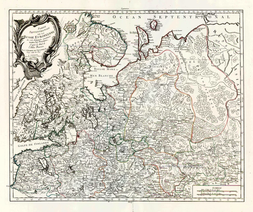
Partie Septentrionale de la Russie Européenne où sont distingées exactement toutes les Provinces, d'après le détail de l'Atlas Russien. 1776-79
Northern European Russia, by Francesco Santini.
[Item number: 26970]

Prussia. 1619
Prussia, by Gerard Mercator.
[Item number: 27197]

Regni Prussiae et Prussiae Polonicae. after 1721
Prussia by Frederik de Wit, published by Covens & Mortier.
[Item number: 28263]

Prussiae Vera Descriptio. 1601
Prussia (Poland) by Abraham Ortelius.
[Item number: 30679]

Prussia. 1618
Prussia by Petrus Bertius, published by Jodocus Hondius II.
[Item number: 31856]

Il Regno di Prussia con la Prussia Polacca. 1779-1785
Prussia, by Antonio Zatta.
[Item number: 32038]
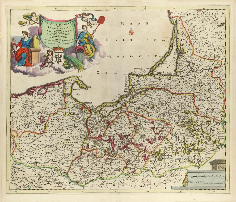
Ducatus Prussiae tam Polono Regiae, quam Brandenburgo, correcta Descriptio, et Divisio Regiae scilicet in tres Palatinatus, et Ducalis in totidem Circulos, cim Utriusq. Subdivisione in Tractus minores. 1696-1713
Prussia (Poland - Lithuania) by Justus Danckerts.
[Item number: 32521]