
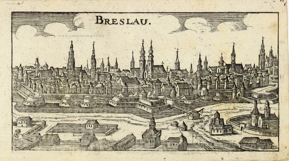
Wroclaw (Breslau), by Henricus Hondius. 1641
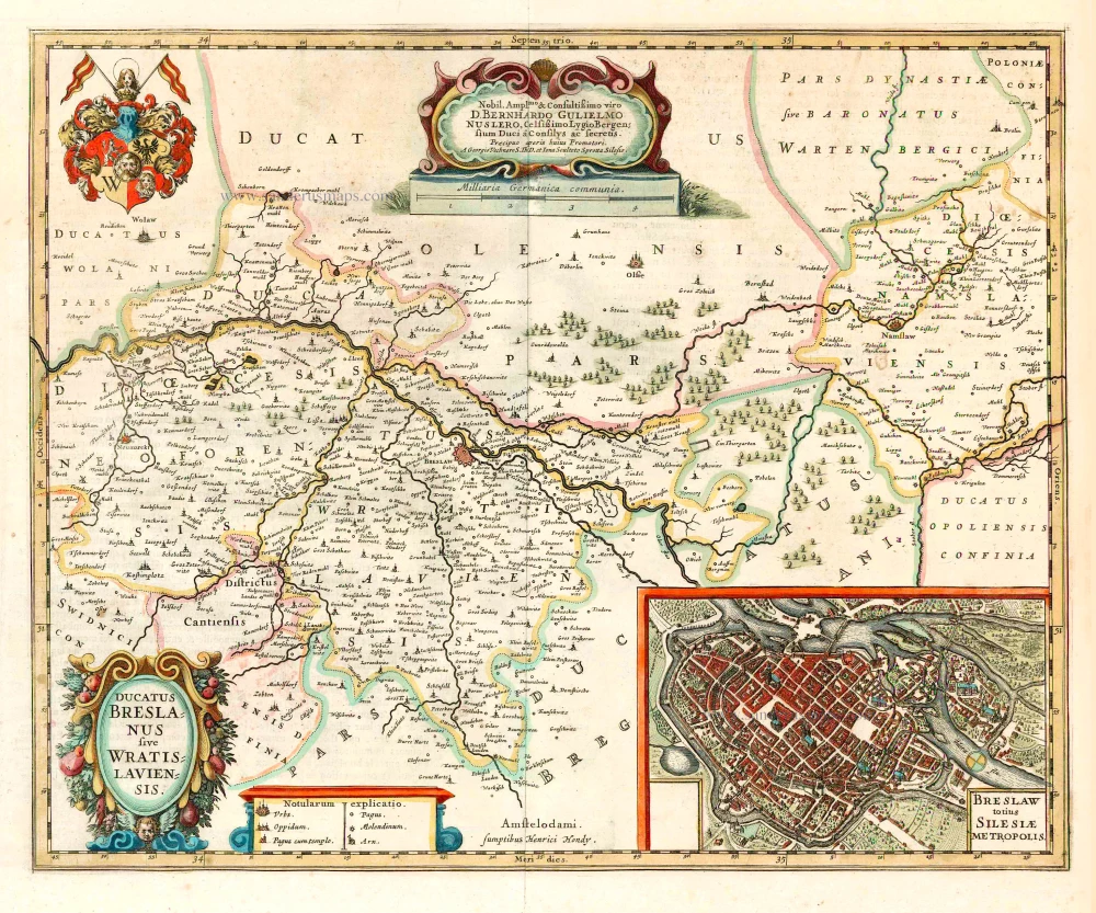


Dedication to Berhardus Guilielmus Nuslerus by Georgius Vechnerus S.Th.D. and Ionas Scultetus Sprotta Silesius.
The Hondius Family
Jodocus Hondius the Elder (1563-1612)
Joost d’Hondt was born at Wakken (Flanders) in 1563. Two years later, his family settled in Ghent, where young Joost displayed an excellent gift for drawing and calligraphy. Through study and lessons, he developed his talents and became an engraver with a good reputation.
Due to the circumstances of the war, he moved to London in 1584, where he settled down as an engraver, instrument-maker, and map-maker. In 1587, he married Coletta van den Keere, sister of the well-known engraver Pieter van den Keere (Petrus Kaerius); some years earlier, his sister, Jacomina, had married Pieter van den Berghe (Petrus Montanus). Joost, who had Latinized his name to Jodocus Hondius, closely co-operated with his two brothers-in-law.
The political situation in the Northern Netherlands in 1593 was such that Jodocus seemed justified in establishing himself in Amsterdam, where many Antwerp printers, publishers, and engravers had gone. In this new centre of cartography, Jodocus Hondius set up his business “In de Wackere Hondt” (in the vigilant dog), this name being an allusion to his birthplace and name. He engraved many maps and published atlases and many other works, such as his continuation of Gerard Mercator’s Atlas.
He suddenly passed away in February 1612. The publishing firm of Jodocus Hondius was continued by his widow, later on, by his two sons, Jodocus Jr. and Henricus, and by his son-in-law, J. Janssonius.
Jodocus Hondius II (1594-1629) & Henricus Hondius (1597-1651)
After the father’s death, the widow and her seven children continued publishing the atlases under the name of Jodocus Hondius till 1620. The firm was reinforced by the very welcome help of Joannes Janssonius (1588-1664), who married 24-year-old Elisabeth Hondius in 1612. After 1619, Mercator’s Atlas was published under the name of Henricus Hondius.
One of the most dramatic events in the early history of commercial cartography in Amsterdam was the sale of Jodocus Hondius Jr.’s copper plates to Willem Jansz. Blaeu in 1629, the year of his death. At least 34 plates, from which Jodocus II had printed single-sheet maps for his benefit, passed into the hands of his great competitor. Immediately after that, his brother, Henricus, and Joannes Janssonius ordered the engraving of identical plates.
Henricus devoted all his energy to publishing the Atlas for an extended period. He saw its growth up to and including the fourth part in 1646; after that, his name no longer figures on the title pages. After 1638, the title of the Atlas was changed to Atlas Novus; Joannes Janssonius mainly carried it on.
The competition with the Blaeu's dates from 1630. In 1630, Willem Janszoon (=Blaeu) first attacked with his Atlantis Appendix. In 1635, Blaeu completed his Theatrum Orbis Terrarum in two volumes with French, Latin, Dutch, and German texts, prompting Henricus Hondius to speed up the enlargement of his Atlas.
Ducatus Breslanus sive Wratislaviensis.
Item Number: 26280 Authenticity Guarantee
Category: Antique maps > Europe > Eastern Europe
Poland - Wroclaw (Breslau) by Henricus Hondius.
With an inset map of Wroclaw.
Title: Ducatus Breslanus sive Wratislaviensis.
Date of the first edition: 1639.
Date of this map: 1641.
Copper engraving, printed on paper.
Size (not including margins): 400 x 500mm (15.75 x 19.69 inches).
Verso: French text.
Condition: Original coloured, excellent.
Condition Rating: A+.
From: Nouveau Theatre du Monde ou Nouvel Atlas comprenant Les Tables et Descriptions de toutes les Regions de la Terre. Amsterdam, H. Hondius, 1641. (Van der Krogt 1, 412)
Dedication to Berhardus Guilielmus Nuslerus by Georgius Vechnerus S.Th.D. and Ionas Scultetus Sprotta Silesius.
The Hondius Family
Jodocus Hondius the Elder (1563-1612)
Joost d’Hondt was born at Wakken (Flanders) in 1563. Two years later, his family settled in Ghent, where young Joost displayed an excellent gift for drawing and calligraphy. Through study and lessons, he developed his talents and became an engraver with a good reputation.
Due to the circumstances of the war, he moved to London in 1584, where he settled down as an engraver, instrument-maker, and map-maker. In 1587, he married Coletta van den Keere, sister of the well-known engraver Pieter van den Keere (Petrus Kaerius); some years earlier, his sister, Jacomina, had married Pieter van den Berghe (Petrus Montanus). Joost, who had Latinized his name to Jodocus Hondius, closely co-operated with his two brothers-in-law.
The political situation in the Northern Netherlands in 1593 was such that Jodocus seemed justified in establishing himself in Amsterdam, where many Antwerp printers, publishers, and engravers had gone. In this new centre of cartography, Jodocus Hondius set up his business “In de Wackere Hondt” (in the vigilant dog), this name being an allusion to his birthplace and name. He engraved many maps and published atlases and many other works, such as his continuation of Gerard Mercator’s Atlas.
He suddenly passed away in February 1612. The publishing firm of Jodocus Hondius was continued by his widow, later on, by his two sons, Jodocus Jr. and Henricus, and by his son-in-law, J. Janssonius.
Jodocus Hondius II (1594-1629) & Henricus Hondius (1597-1651)
After the father’s death, the widow and her seven children continued publishing the atlases under the name of Jodocus Hondius till 1620. The firm was reinforced by the very welcome help of Joannes Janssonius (1588-1664), who married 24-year-old Elisabeth Hondius in 1612. After 1619, Mercator’s Atlas was published under the name of Henricus Hondius.
One of the most dramatic events in the early history of commercial cartography in Amsterdam was the sale of Jodocus Hondius Jr.’s copper plates to Willem Jansz. Blaeu in 1629, the year of his death. At least 34 plates, from which Jodocus II had printed single-sheet maps for his benefit, passed into the hands of his great competitor. Immediately after that, his brother, Henricus, and Joannes Janssonius ordered the engraving of identical plates.
Henricus devoted all his energy to publishing the Atlas for an extended period. He saw its growth up to and including the fourth part in 1646; after that, his name no longer figures on the title pages. After 1638, the title of the Atlas was changed to Atlas Novus; Joannes Janssonius mainly carried it on.
The competition with the Blaeu's dates from 1630. In 1630, Willem Janszoon (=Blaeu) first attacked with his Atlantis Appendix. In 1635, Blaeu completed his Theatrum Orbis Terrarum in two volumes with French, Latin, Dutch, and German texts, prompting Henricus Hondius to speed up the enlargement of his Atlas.
Related items
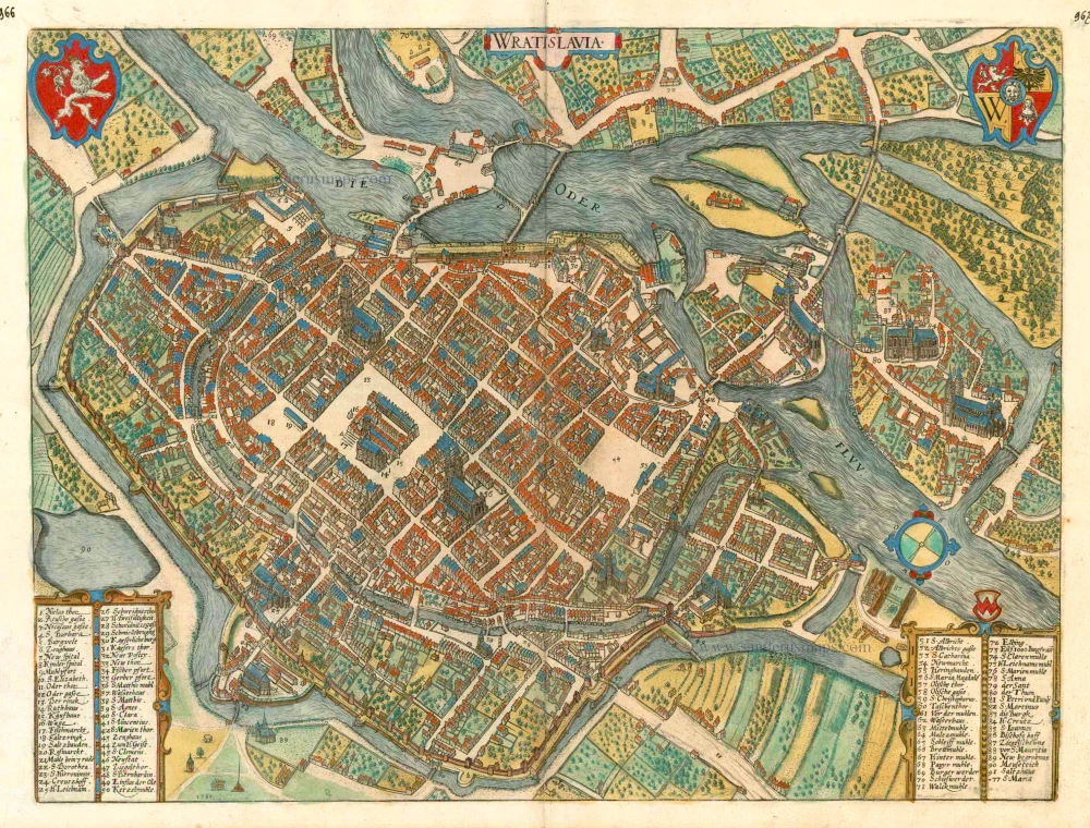
Wratislavia. c. 1593
Wroclaw (Breslau), by Georg Braun and Frans Hogenberg.
[Item number: 24572]
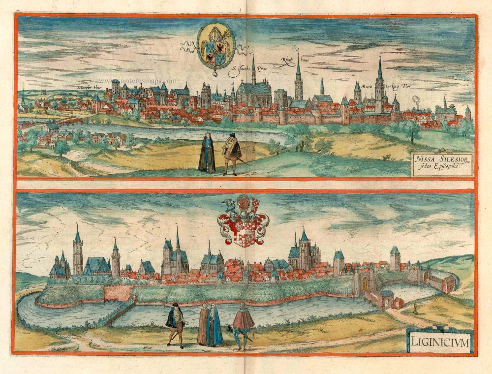
Nissa Silesior Sedes Episcopalis [on sheet with] Liginicium c. 1625
Nysa and Legnica (Poland), by Georg Braun and Frans Hogenberg.
[Item number: 24584]

Wratislavia. 1590
Wroclaw (Breslau), by Georg Braun & Frans Hogenberg.
[Item number: 26777]
Breslau. 1686
Wroclaw (Breslau) by Christoph Riegel.
[Item number: 31701]

Prospectus quartae partis Circuli et Fori Vratislaviensis per forum cupedinarium versus plateam Albrechtianam spectandi. - Prospect des vierten Theils vom Markt oder Ringe zu Breslau den Naschmarkt hinauf gegen der Albrechts Gassen zusehen. c. 1750
Optical View of Wroclaw (Breslau), by Martin Engelbrecht.
[Item number: 31911]

Prospectus tertia pars Circuli et Fori Vratislaviensis versus domum Staticum s:plateam Viadrinam spectanda. - Prospect des dritten Theils des Ringes in Breßlau gegen der Waag und Oder Gaßen anzusehen. c. 1750
Optical View of Wroclaw (Breslau), by Martin Engelbrecht.
[Item number: 31913]

Prospectus alterius partis fori Vratislaviensis et sic dicti Circuli, à foro foenario verus fornicem Olaviensem contemplandus. - Prospect des andern Theils vom Breslauischen Marckte oder so genänten Ringes vom Neu-Marckt gegen dem Slavischen Schwibogen anzusehen. c. 1750
Optical View of Wroclaw (Breslau), by Martin Engelbrecht.
[Item number: 31914]

Prospectus prima partis Fori Vratislaviensis vel sic dicti Circuli à foro frumentario versus Pontem Fabrorum videndus.. - Prospect des Ersten Theils vom Breslauischen Marckt oder sogenänten Ringes vom Kornmarckte gegen der Schmide Brucken anzusehen. c. 1750
Optical View of Wroclaw (Breslau), by Martin Engelbrecht.
[Item number: 31915]

Very rare suite of views of Wroclaw (Breslau)
Prospectus prima partis Fori Vratislaviensis vel sic dicti Circuli à foro frumentario versus Pontem Fabrorum videndus.. - Prospect des Ersten Theils vom Breslauischen Marckt oder sogenänten Ringes vom Kornmarckte gegen der Schmide Brucken anzusehen. c. 1750
Marketplace of Wroclaw (Breslau), by Martin Engelbrecht.
[Item number: 31918]
new