
Poland by Zacharias Châtelain. 1714
The Châtelain Family
Zacharias Châtelain (1684-1743) was a bookseller and publisher of Amsterdam. He was succeeded by his sons Zacharias jr and Henry Abraham. The Châtelain family was best known for the historical atlas Atlas Historique, ou nouvelle introduction à l’histoire…, a major work of its time. It was an encyclopaedia in seven volumes, including geography as one of its main subjects. The atlas was published in Amsterdam in seven volumes in various editions with different imprints from 1705 to 1739. An anonym person (Mr. C***) compiled the work with compositions of text, maps, plates and chronological and genealogical tables by Gueudeville, except volume 7, where H.P. Limiers took over this task. The maps were made mainly after the work of Guillaume de l'Isle.
The 1705 edition was published with the imprint “L’Honoré & Châtelain”. Later editions had the imprint: “les Frères Châtelain Libraires” or “L’Honoré & Châtelain Libraires”.
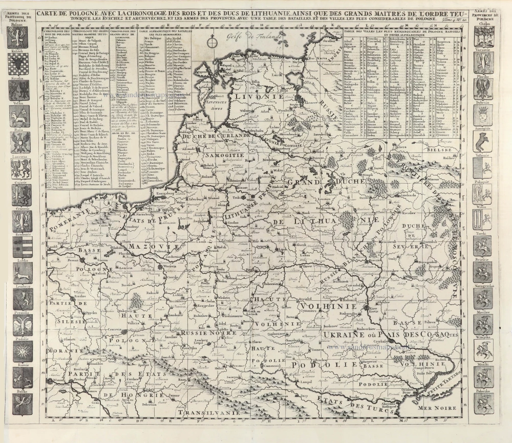
Carte de Pologne avec la Chronologie des Rois et des Ducs de Lithuanie ainsi que des Grands Maitres de l'Ordre Teutonique, les Evechez, et les Armes des Provinces, avec une Table de Batailles, et des Villes les plus Considerables de Pologne.
Item Number: 29428 Authenticity Guarantee
Category: Antique maps > Europe > Eastern Europe
Old, antique map of Poland by Zacharias Châtelain.
Title: Carte de Pologne avec la Chronologie des Rois et des Ducs de Lithuanie ainsi que des Grands Maitres de l'Ordre Teutonique, les Evechez, et les Armes des Provinces, avec une Table de Batailles, et des Villes les plus Considerables de Pologne.
Tome 4. N° 20.
Date of the first edition: 1714.
Date of this map: 1714.
Copper engraving, printed on paper.
Map size: 505 x 580mm (19.88 x 22.83 inches).
Sheet size: 500 x 590mm (19.69 x 23.23 inches).
Verso: Blank.
Condition: Folds as issued, excellent.
Condition Rating: A+.
From: Châtelain Z. Atlas Historique, ou Nouvelle Introduction A l'Histoire, à la Chronologie & à la Geographie Ancienne & Moderne; ... Tome IV. Qui comprend le Danemarck, la Suède, la Pologne, la Moscovie, la Turquie, etc. A Amsterdam, Chez les Frères Châtelain Libraires, M.DCC.XIV. (1714). (Koeman II, p. 36, Cha5)
The Châtelain Family
Zacharias Châtelain (1684-1743) was a bookseller and publisher of Amsterdam. He was succeeded by his sons Zacharias jr and Henry Abraham. The Châtelain family was best known for the historical atlas Atlas Historique, ou nouvelle introduction à l’histoire…, a major work of its time. It was an encyclopaedia in seven volumes, including geography as one of its main subjects. The atlas was published in Amsterdam in seven volumes in various editions with different imprints from 1705 to 1739. An anonym person (Mr. C***) compiled the work with compositions of text, maps, plates and chronological and genealogical tables by Gueudeville, except volume 7, where H.P. Limiers took over this task. The maps were made mainly after the work of Guillaume de l'Isle.
The 1705 edition was published with the imprint “L’Honoré & Châtelain”. Later editions had the imprint: “les Frères Châtelain Libraires” or “L’Honoré & Châtelain Libraires”.
Related items
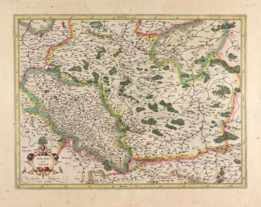
Polonia et Silesia. 1613
Poland, by Gerard Mercator.
[Item number: 29762]
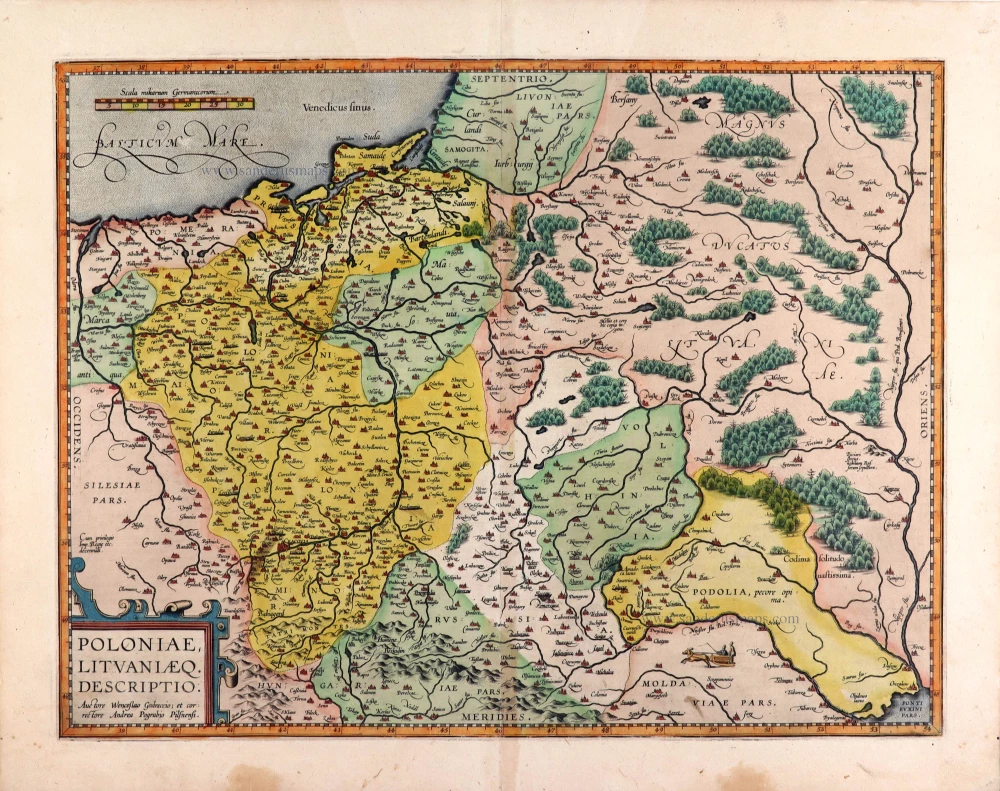
Poloniae, Lituaniaeq. Descriptio. 1595
Lithuania, Poland & Ukraine by Abraham Ortelius
[Item number: 29857]
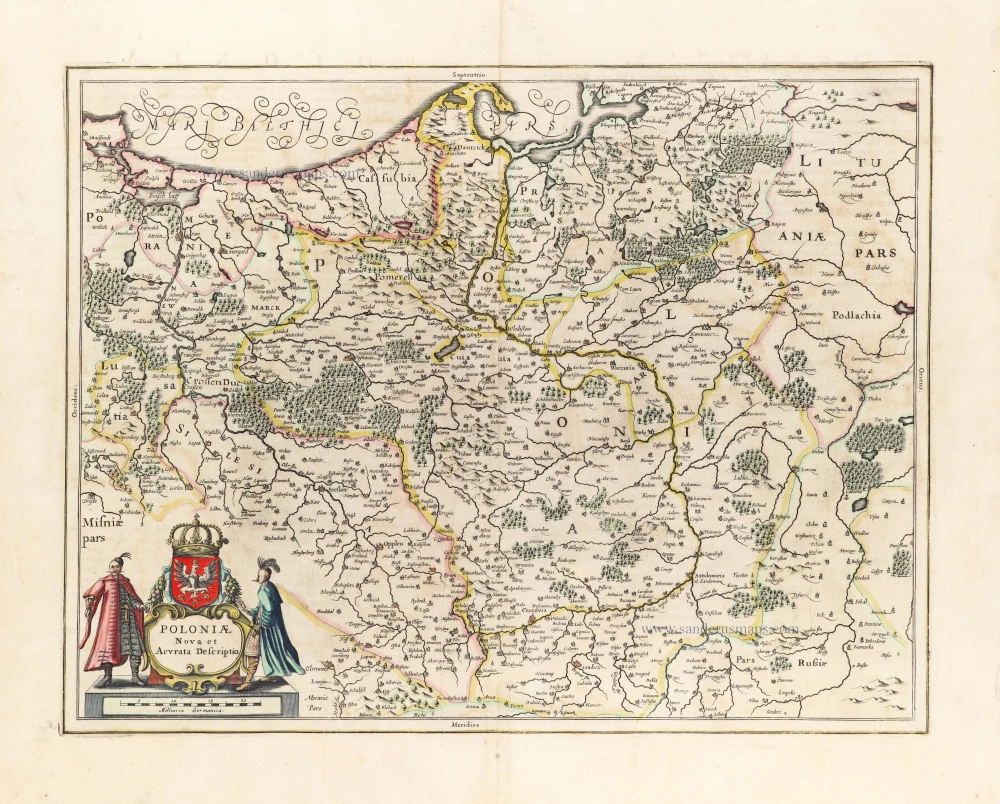
Poloniae Nova et Descriptio. 1653
Poland by Johannes Janssonius.
[Item number: 30345]