
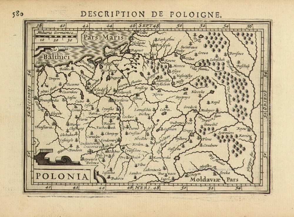
Poland, Lithuania, and Ukraine by Danckert Danckerts. After 1657
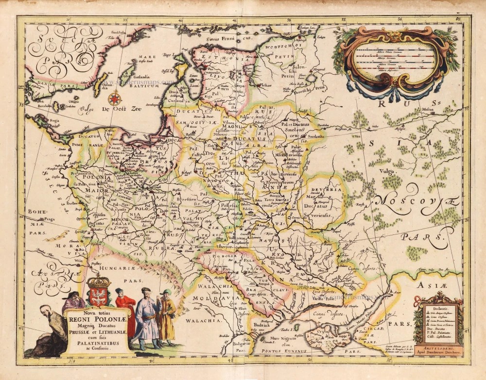

Scarce map of Poland, Lithuania, and Ukraine by Danckert Danckerts.
Hugo Allard, c. 1655, first published the map.
According to Pastoureau, Cornelis Danckerts has been working at Melchior Tavernier in Paris; she mentions several maps by Danckerts, among this one, that appear in French composite atlases.
The Danckerts Family.
The Danckerts family of Amsterdam was one of the best-known print and map sellers in 17th century Amsterdam. Their business activity covered a vast period, from ca. 1633. From 1669 until 1701, father Justus and his sons had their shop in the ‘Calverstraet in de Danckbaerheyt’.
Cornelis Danckerts (1561-1631) was a printseller born in Amsterdam and active in Antwerp.
Cornelis Danckerts, the elder (1603-1656) was an engraver and publisher in Amsterdam and Nieuwendijk. Son of Cornelis (above), whom he succeeded in 1631.
The house of Danckerts gained its greatest fame from Justus Danckerts (1635-1701 - son of Cornelis the elder) and his two sons, Theodorus and Cornelis. Dancker Danckerts (1634-1666), the elder brother of Justus, was known for his etchings of paintings, maps, and publications.
The grandfather, father, and sons were highly skilled and excellent artistic drafters and engravers. They are famous for the edition of their Atlas, which appeared from ca. 1686, and for several monumental and beautiful wall maps and views. However, compared with that published by the Blaeu's or Janssonius's, their cartographic work has attracted little attention and has never received proper recognition.
On 14 August 1684, Justus and his sons obtained the privilege from the States of Holland for their publications. In 1713, twelve years after Justus Danckerts, the heirs decided to sell part of the stock of maps and atlases and many copperplates. In 1727, after the death of the last surviving brother Theodorus, a final sale took place.
Nova totius Regni Poloniae, Magniq Ducatus Prussiae et Lithuaniae, cum suis Palatinatibus ac Confiniis.
Item Number: 28898 Authenticity Guarantee
Category: Antique maps > Europe > Eastern Europe
Old, antique map of Poland, Lithuania, and Ukraine by Danckert Danckerts.
Title: Nova totius Regni Poloniae, Magniq Ducatus Prussiae et Lithuaniae, cum suis Palatinatibus ac Confiniis.
Amstelodami, Apud Danckerum Danckerts.
Exacta delineato per G. le Vaßeur de Beauplan S.R.M.tis Architectum milit. et Capitaneum.
Cartographer: Le Vasseur de Beauplan (1595-1885).
Date: After 1657.
Copper engraving, printed on paper.
Map size: 390 x 505mm (15.35 x 19.88 inches).
Sheet size: 425 x 550mm (16.73 x 21.65 inches).
Verso: Blank.
Condition: Original coloured, excellent.
Condition Rating: A+.
Separate publication.
Scarce map of Poland, Lithuania, and Ukraine by Danckert Danckerts.
Hugo Allard, c. 1655, first published the map.
According to Pastoureau, Cornelis Danckerts has been working at Melchior Tavernier in Paris; she mentions several maps by Danckerts, among this one, that appear in French composite atlases.
The Danckerts Family.
The Danckerts family of Amsterdam was one of the best-known print and map sellers in 17th century Amsterdam. Their business activity covered a vast period, from ca. 1633. From 1669 until 1701, father Justus and his sons had their shop in the ‘Calverstraet in de Danckbaerheyt’.
Cornelis Danckerts (1561-1631) was a printseller born in Amsterdam and active in Antwerp.
Cornelis Danckerts, the elder (1603-1656) was an engraver and publisher in Amsterdam and Nieuwendijk. Son of Cornelis (above), whom he succeeded in 1631.
The house of Danckerts gained its greatest fame from Justus Danckerts (1635-1701 - son of Cornelis the elder) and his two sons, Theodorus and Cornelis. Dancker Danckerts (1634-1666), the elder brother of Justus, was known for his etchings of paintings, maps, and publications.
The grandfather, father, and sons were highly skilled and excellent artistic drafters and engravers. They are famous for the edition of their Atlas, which appeared from ca. 1686, and for several monumental and beautiful wall maps and views. However, compared with that published by the Blaeu's or Janssonius's, their cartographic work has attracted little attention and has never received proper recognition.
On 14 August 1684, Justus and his sons obtained the privilege from the States of Holland for their publications. In 1713, twelve years after Justus Danckerts, the heirs decided to sell part of the stock of maps and atlases and many copperplates. In 1727, after the death of the last surviving brother Theodorus, a final sale took place.
Related items
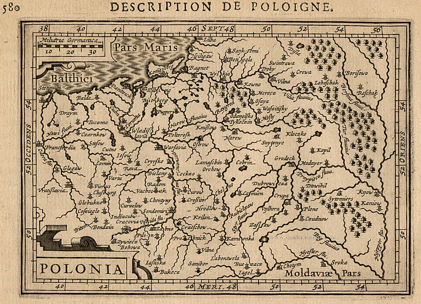
Polonia. 1618
Poland, by Petrus Bertius.
[Item number: 18262]
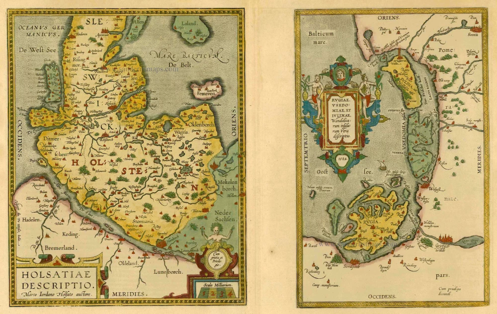
Holsatiae Descriptio [on sheet with] Rugiae, Usedomiae, et Iulinae, Wandalicarum Insularum Vera Descriptio. 1601
Poland - Rügen - Holstein, by Ortelius A.
[Item number: 21277]
Polonia. 1618
Poland by Petrus Bertius, published by Jodocus Hondius II.
[Item number: 31855]