
Lyon, by Georg Braun and Frans Hogenberg. 1593
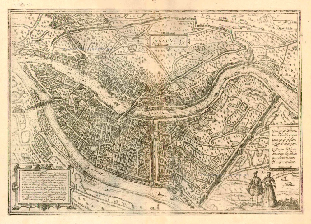
TRANSLATION CARTOUCHE TEXT LEFT: Strabo writes that Lyons was, in his day, the second best-known city in Gaul and the most densely populated after Narbonne. And the city has by no means grown any smaller today, for its walls surround such a large area, including two hills and vineyards, that very few cities in France come before Lyons. There is a great influx of foreigners who have taken up residence here to buy and sell goods conveniently in every part of the world. The pleasantness of the location can be seen in the course of the rivers and in the fact that it lies almost at the centre of Europe. The rivers are the Rhône and the Arar (today called the Saône), which converge near Lyons and flow into the Ligurian Sea, which is very convenient for importing and exporting goods.
COMMENTARY BY BRAUN (on verso): "Lyons has beautiful houses and well-tended gardens. In wealth, it exceeds all other cities in the whole of Romandy. This wealth is due to the rivers because they lie near major cities. Since Lyons is situated in the middle of Europe and hence is called the heart of the Welschland, these rivers offer the best means of exporting and importing all interesting kinds of goods from most European lands."
Lyons's position between the Saône and the Rhône, so advantageous in terms of transportation, is impressively conveyed in this plan view from a steep bird's-eye perspective. The city's oldest surviving church, the Romanesque Benedictine abbey of Saint-Martin-d'Ainay, consecrated in 1107, is visible in the city's centre, together with the Romanesque, part Gothic cathedral of Saint-Jean. Through its close trade links with Italy and due to the Italian Wars (1494-1559), Lyons became a centre of humanism and printing in the late 15th and early 16th centuries. In the 16th century, the city's proximity to Geneva resulted in increased exposure to Protestant ideas, and in 1562-1563 Lyons was even taken by Protestants. In 1536 Francis I awarded Lyons the monopoly for weaving gold, silver and silk textiles and thereby fuelled the growth of the silk industry that, from the 16th century onwards, would make Lyons France's first "industrial town". More than half the population of Lyons earned their living from silk. Faience production also increased from 1512.
Braun G. & Hogenberg F. and the Civitates Orbis Terrarum.
The Civitates Orbis Terrarum, or the "Braun & Hogenberg", is a six-volume town atlas and the greatest book of town views and plans ever published: 363 engravings, sometimes beautifully coloured. It was one of the best-selling works in the last quarter of the 16th century. Georg Braun wrote the text accompanying the plans and views on the verso. A large number of the plates were engraved after the original drawings of Joris Hoefnagel (1542-1600), who was a professional artist. The first volume was published in Latin in 1572, the sixth volume in 1617. Frans Hogenberg created the tables for volumes I through IV, and Simon van den Neuwel created those for volumes V and VI. Other contributors were cartographer Daniel Freese, and Heinrich Rantzau. Works by Jacob van Deventer, Sebastian Münster, and Johannes Stumpf were also used. Translations appeared in German and French.
Following the original publication of Volume 1 of the Civitates in 1572, seven further editions of 1575, 1577, 1582, 1588, 1593, 1599 and 1612 can be identified. Vol.2, first issued in 1575, was followed by further editions in 1597 and in 1612. The next volumes appeared in 1581, 1588, 1593, 1599 and 1606. The German translation of the first volume appeared from 1574 on and the French edition from 1575 on.
Several printers were involved: Theodor Graminaeus, Heinrich von Aich, Gottfried von Kempen, Johannis Sinniger, Bertram Buchholtz and Peter von Brachel, who all worked in Cologne.
Georg Braun (1541-1622)
Georg Braun was born in Cologne in 1541. After his studies in Cologne, he entered the Jesuit Order as a novice. In 1561 he obtained his bachelor's degree and in 1562 his Magister Artium. Although he left the Jesuit Order, he studied theology, gaining a licentiate in theology.
Frans Hogenberg (1535-1590)
Frans Hogenberg was a Flemish and German painter, engraver, and mapmaker. He was born in Mechelen as the son of Nicolaas Hogenberg.
By the end of the 1560s Frans Hogenberg was employed upon Abraham Ortelius's Theatrum Orbis Terrarum, published in 1570; he is named as an engraver of numerous maps. In 1568 he was banned from Antwerp by the Duke of Alva and travelled to London, where he stayed a few years before emigrating to Cologne. There he immediately embarked on his two most important works, the Civitates published from 1572 and the Geschichtsblätter, which appeared in several series from 1569 until about 1587.
Thanks to such large scale projects as the Geschichtsblätter and the Civitates, Hogenberg's social circumstances improved with each passing year. He died as a wealthy man in Cologne in 1590.
Lugdunum.
Item Number: 16971 Authenticity Guarantee
Category: Antique maps > Europe > France - Cities
Old, antique bird’s-eye view plan of Lyon, by Georg Braun and Frans Hogenberg.
Title: Lugdunum.
Date of the first edition: 1572.
Date of this map: 1593.
Copper engraving, printed on paper.
Size (not including margins): 340 x 480mm (13.39 x 18.9 inches).
Verso: Latin text.
Condition: Uncoloured, excellent.
Condition Rating: A.
From: Civitates Orbis Terrarum, Liber Primus. Köln, Gottfried von Kempen, 1593. (Van der Krogt 4, 41:1.1(1593))
TRANSLATION CARTOUCHE TEXT LEFT: Strabo writes that Lyons was, in his day, the second best-known city in Gaul and the most densely populated after Narbonne. And the city has by no means grown any smaller today, for its walls surround such a large area, including two hills and vineyards, that very few cities in France come before Lyons. There is a great influx of foreigners who have taken up residence here to buy and sell goods conveniently in every part of the world. The pleasantness of the location can be seen in the course of the rivers and in the fact that it lies almost at the centre of Europe. The rivers are the Rhône and the Arar (today called the Saône), which converge near Lyons and flow into the Ligurian Sea, which is very convenient for importing and exporting goods.
COMMENTARY BY BRAUN (on verso): "Lyons has beautiful houses and well-tended gardens. In wealth, it exceeds all other cities in the whole of Romandy. This wealth is due to the rivers because they lie near major cities. Since Lyons is situated in the middle of Europe and hence is called the heart of the Welschland, these rivers offer the best means of exporting and importing all interesting kinds of goods from most European lands."
Lyons's position between the Saône and the Rhône, so advantageous in terms of transportation, is impressively conveyed in this plan view from a steep bird's-eye perspective. The city's oldest surviving church, the Romanesque Benedictine abbey of Saint-Martin-d'Ainay, consecrated in 1107, is visible in the city's centre, together with the Romanesque, part Gothic cathedral of Saint-Jean. Through its close trade links with Italy and due to the Italian Wars (1494-1559), Lyons became a centre of humanism and printing in the late 15th and early 16th centuries. In the 16th century, the city's proximity to Geneva resulted in increased exposure to Protestant ideas, and in 1562-1563 Lyons was even taken by Protestants. In 1536 Francis I awarded Lyons the monopoly for weaving gold, silver and silk textiles and thereby fuelled the growth of the silk industry that, from the 16th century onwards, would make Lyons France's first "industrial town". More than half the population of Lyons earned their living from silk. Faience production also increased from 1512.
Braun G. & Hogenberg F. and the Civitates Orbis Terrarum.
The Civitates Orbis Terrarum, or the "Braun & Hogenberg", is a six-volume town atlas and the greatest book of town views and plans ever published: 363 engravings, sometimes beautifully coloured. It was one of the best-selling works in the last quarter of the 16th century. Georg Braun wrote the text accompanying the plans and views on the verso. A large number of the plates were engraved after the original drawings of Joris Hoefnagel (1542-1600), who was a professional artist. The first volume was published in Latin in 1572, the sixth volume in 1617. Frans Hogenberg created the tables for volumes I through IV, and Simon van den Neuwel created those for volumes V and VI. Other contributors were cartographer Daniel Freese, and Heinrich Rantzau. Works by Jacob van Deventer, Sebastian Münster, and Johannes Stumpf were also used. Translations appeared in German and French.
Following the original publication of Volume 1 of the Civitates in 1572, seven further editions of 1575, 1577, 1582, 1588, 1593, 1599 and 1612 can be identified. Vol.2, first issued in 1575, was followed by further editions in 1597 and in 1612. The next volumes appeared in 1581, 1588, 1593, 1599 and 1606. The German translation of the first volume appeared from 1574 on and the French edition from 1575 on.
Several printers were involved: Theodor Graminaeus, Heinrich von Aich, Gottfried von Kempen, Johannis Sinniger, Bertram Buchholtz and Peter von Brachel, who all worked in Cologne.
Georg Braun (1541-1622)
Georg Braun was born in Cologne in 1541. After his studies in Cologne, he entered the Jesuit Order as a novice. In 1561 he obtained his bachelor's degree and in 1562 his Magister Artium. Although he left the Jesuit Order, he studied theology, gaining a licentiate in theology.
Frans Hogenberg (1535-1590)
Frans Hogenberg was a Flemish and German painter, engraver, and mapmaker. He was born in Mechelen as the son of Nicolaas Hogenberg.
By the end of the 1560s Frans Hogenberg was employed upon Abraham Ortelius's Theatrum Orbis Terrarum, published in 1570; he is named as an engraver of numerous maps. In 1568 he was banned from Antwerp by the Duke of Alva and travelled to London, where he stayed a few years before emigrating to Cologne. There he immediately embarked on his two most important works, the Civitates published from 1572 and the Geschichtsblätter, which appeared in several series from 1569 until about 1587.
Thanks to such large scale projects as the Geschichtsblätter and the Civitates, Hogenberg's social circumstances improved with each passing year. He died as a wealthy man in Cologne in 1590.
Related items

Marseille. 1576
Marseille, by Georg Braun and Frans Hogenberg.
[Item number: 25583]

Rare
La Puissante et Importante Ville de Lion Archevesche et Metropolitaine des Gaulles. 1648
Lyon, by J. Boisseau.
[Item number: 25600]
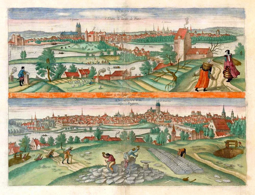
Turones vulgo Tours, le Iardin de France. [on sheet with:] Andegavum vulgo Angiers. c. 1610
Tours and Angers, by Georg Braun and Frans Hogenberg.
[Item number: 25956]
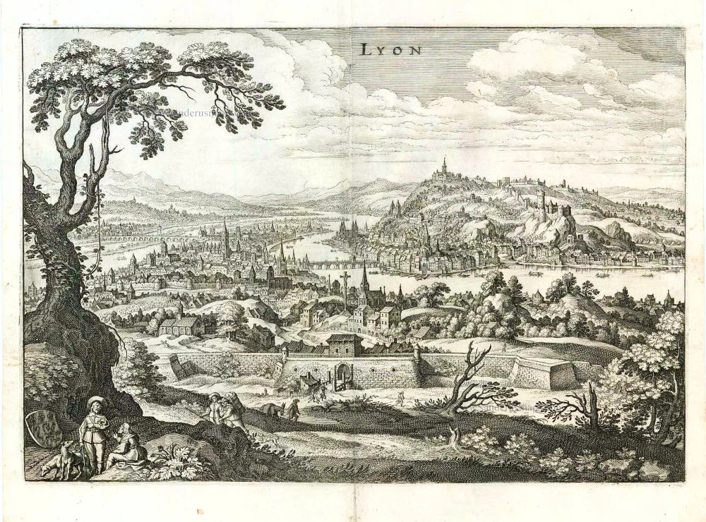
Lyon. 1638
Lyon, by Matthäus Merian.
[Item number: 27091]

Pourtraict de la ville, & ancienne Cité de Lyon. 1575
Lyon, by François de Belleforest.
[Item number: 27234]

Lion LXXXVIII 1493
Lyon, by Hartmann Schedel.
[Item number: 30955]