
Nancy, by Braun & Hogenberg. 1617
The item displayed on this page has been sold. However, we have a similar map in stock:
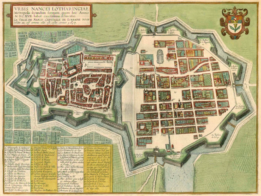
Nancy by Braun & Hogenberg 1618
Urbis Nancei Lotharingiae Metropolis secundum...
[Item number: 23412]
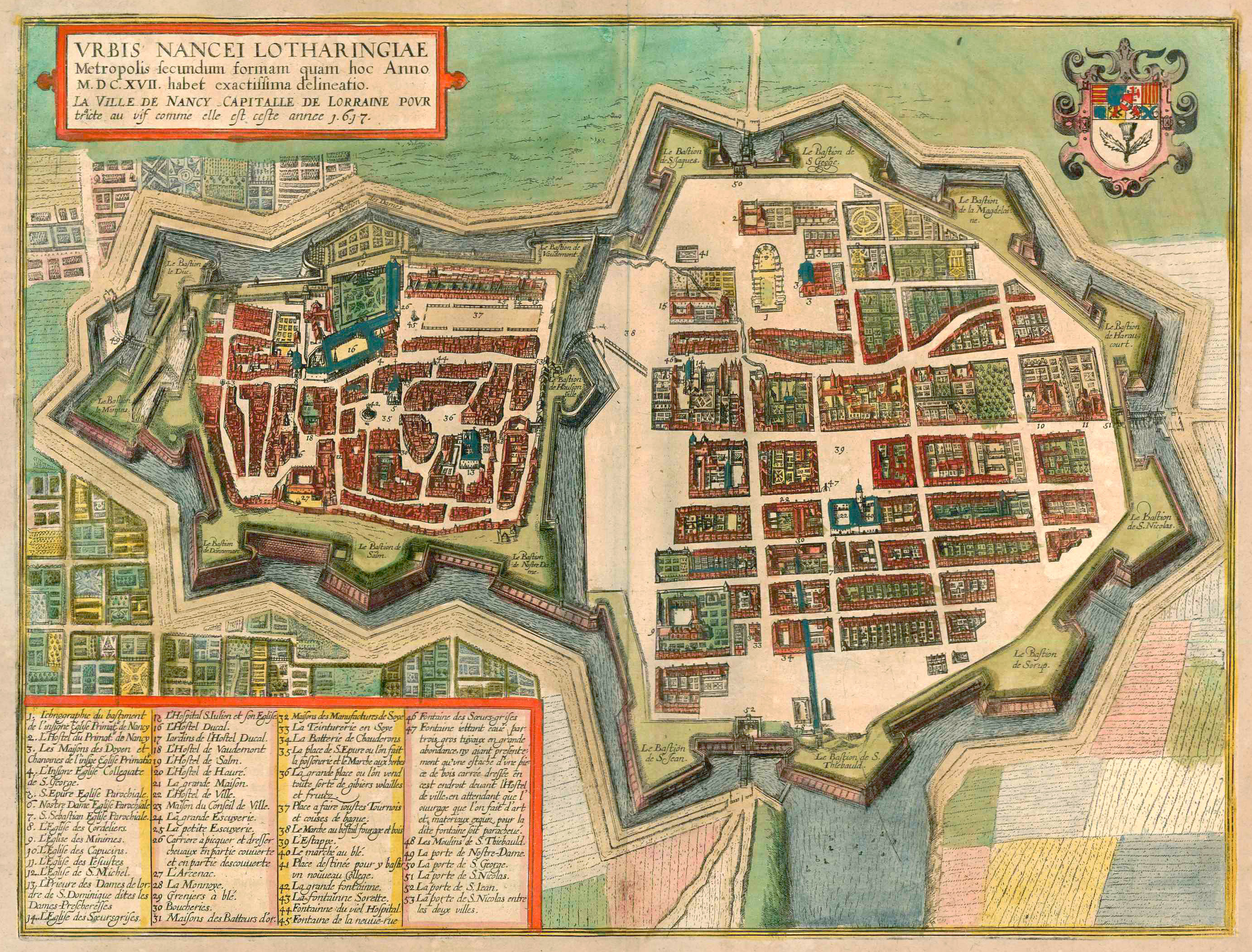


TRANSLATION OF CARTOUCHE TEXT: This is a very exact drawing of Nancy, the capital of Lorraine, as it appears in the year 1617.
COMMENTARY BY BRAUN: "The fortifications largely began in 1587, when France was troubled by internal conflicts. [...] With admirable speed, the Duke of Lorraine erected thick suburb walls fortified with mighty bastions. In this way, two towns were turned into one. In 1609, not far from the upper gate, work began on the construction of a collegiate church, which, when it is finished, will be counted among the most beautiful. The palace of the dukes or kings is in the smaller town; it has beautiful gardens and a small racecourse or playing field, which is partly open and partly covered."
This bird's-eye view from the west clearly shows the fortifications and the bastions. The building site of the Cathedral of Notre-Dame-de-l'Annonciation (1), which was not completed until 1742, can be identified in the New Town, whose streets are all at right angles, founded in the 16th century. In contrast, the ducal palace (16) with its adjoining garden (17) and the jousting arena (37) can be seen in the Old Town. Castrum Nanceium was mentioned for the first time in 1073; the settlement around the castle was granted a municipal charter in 1266. In 1475, Nancy was conquered by Duke Charles the Bold of Burgundy during the Burgundian Wars and was recaptured in 1476 by Duke René II of Lorraine. By 1870, the walls had been completely pulled down.
The engraving is made after a map by Friedrich Brentel, published in 1611 and commissioned by or according to the agenda of Claude de la Ruelle. (Taschen)
Braun G. & Hogenberg F. and the Civitates Orbis Terrarum.
The Civitates Orbis Terrarum, also known as the 'Braun & Hogenberg', is a six-volume town atlas and the most excellent book of town views and plans ever published: 363 engravings, sometimes beautifully coloured. It was one of the best-selling works in the last quarter of the 16th century. Georg Braun, a skilled writer, wrote the text accompanying the plans and views on the verso. Many plates were engraved after the original drawings of a professional artist, Joris Hoefnagel (1542-1600). The first volume was published in Latin in 1572 and the sixth in 1617. Frans Hogenberg, a talented engraver, created the tables for volumes I through IV, and Simon van den Neuwel made those for volumes V and VI. Other contributors were cartographers Daniel Freese and Heinrich Rantzau, who provided valuable geographical information. Works by Jacob van Deventer, Sebastian Münster, and Johannes Stumpf were also used as references. Translations appeared in German and French, making the atlas accessible to a broader audience.
Since its original publication of volume 1 in 1572, the Civitates Orbis Terrarum has left an indelible mark on the history of cartography. Seven more editions followed the first volume in 1575, 1577, 1582, 1588, 1593, 1599, and 1612. Vol.2, initially released in 1575, saw subsequent editions in 1597 and 1612. The subsequent volumes, each a treasure trove of historical insights, graced the world in 1581, 1588, 1593, 1599, and 1606. The German translation of the first volume, a testament to its widespread appeal, debuted in 1574, followed by the French edition in 1575.
Several printers were involved: Theodor Graminaeus, Heinrich von Aich, Gottfried von Kempen, Johannis Sinniger, Bertram Buchholtz, and Peter von Brachel, all of whom worked in Cologne.
Georg Braun (1541-1622)
Georg Braun, the author of the text accompanying the plans and views in the Civitates Orbis Terrarum, was born in Cologne in 1541. After his studies in Cologne, he entered the Jesuit Order as a novice, indicating his commitment to learning and intellectual pursuits. In 1561, he obtained his bachelor's degree; in 1562, he received his Magister Artium, further demonstrating his academic achievements. Although he left the Jesuit Order, he continued his studies in theology, gaining a licentiate in theology. His theological background likely influenced the content and tone of the text in the Civitates Orbis Terrarum, adding a unique perspective to the work.
Frans Hogenberg (1535-1590)
Frans Hogenberg was a Flemish and German painter, engraver, and mapmaker. He was born in Mechelen as the son of Nicolaas Hogenberg.
By the end of the 1560s, Frans Hogenberg was employed upon Abraham Ortelius's Theatrum Orbis Terrarum, published in 1570; he is named an engraver of numerous maps. In 1568, he was banned from Antwerp by the Duke of Alva and travelled to London, where he stayed a few years before emigrating to Cologne. He immediately embarked on his two most important works, the Civitates, published in 1572 and the Geschichtsblätter, which appeared in several series from 1569 until about 1587.
Thanks to large-scale projects like the Geschichtsblätter and the Civitates, Hogenberg's social circumstances improved with each passing year. He died as a wealthy man in Cologne in 1590.
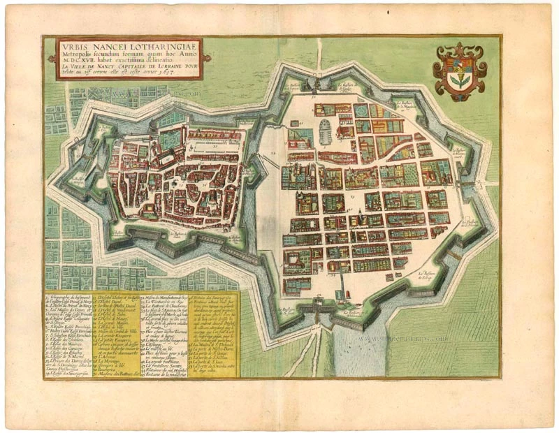
Urbis Nancei Lotharingiae Metropolis secundum formam quam hoc Anno M.DC.XVII. habet exactissima delineatio. - La Ville de Nancy Caiptalle de Lorraine pour traicte au vif comme elles est ceste annee 1617.
Item Number: 22127 Authenticity Guarantee
Category: Antique maps > Europe > France - Cities
Antique map of Nancy by Braun & Hogenberg.
Title: Urbis Nancei Lotharingiae Metropolis secundum formam quam hoc Anno M.DC.XVII. habet exactissima delineatio. - La Ville de Nancy Caiptalle de Lorraine pour traicte au vif comme elles est ceste annee 1617.
Oriented to the northeast.
Date of the first edition: 1617.
Date of this map: 1617.
Copper engraving, printed on paper.
Size (not including margins): 345 x 460mm (13.58 x 18.11 inches).
Verso: Latin text.
Condition: Original coloured, excellent.
Condition Rating: A+.
From: Theatri praecipuarum Totius Mundi Urbium Liber Sextus Anno MDCXVII. (Koeman, B&H6)
TRANSLATION OF CARTOUCHE TEXT: This is a very exact drawing of Nancy, the capital of Lorraine, as it appears in the year 1617.
COMMENTARY BY BRAUN: "The fortifications largely began in 1587, when France was troubled by internal conflicts. [...] With admirable speed, the Duke of Lorraine erected thick suburb walls fortified with mighty bastions. In this way, two towns were turned into one. In 1609, not far from the upper gate, work began on the construction of a collegiate church, which, when it is finished, will be counted among the most beautiful. The palace of the dukes or kings is in the smaller town; it has beautiful gardens and a small racecourse or playing field, which is partly open and partly covered."
This bird's-eye view from the west clearly shows the fortifications and the bastions. The building site of the Cathedral of Notre-Dame-de-l'Annonciation (1), which was not completed until 1742, can be identified in the New Town, whose streets are all at right angles, founded in the 16th century. In contrast, the ducal palace (16) with its adjoining garden (17) and the jousting arena (37) can be seen in the Old Town. Castrum Nanceium was mentioned for the first time in 1073; the settlement around the castle was granted a municipal charter in 1266. In 1475, Nancy was conquered by Duke Charles the Bold of Burgundy during the Burgundian Wars and was recaptured in 1476 by Duke René II of Lorraine. By 1870, the walls had been completely pulled down.
The engraving is made after a map by Friedrich Brentel, published in 1611 and commissioned by or according to the agenda of Claude de la Ruelle. (Taschen)
Braun G. & Hogenberg F. and the Civitates Orbis Terrarum.
The Civitates Orbis Terrarum, also known as the 'Braun & Hogenberg', is a six-volume town atlas and the most excellent book of town views and plans ever published: 363 engravings, sometimes beautifully coloured. It was one of the best-selling works in the last quarter of the 16th century. Georg Braun, a skilled writer, wrote the text accompanying the plans and views on the verso. Many plates were engraved after the original drawings of a professional artist, Joris Hoefnagel (1542-1600). The first volume was published in Latin in 1572 and the sixth in 1617. Frans Hogenberg, a talented engraver, created the tables for volumes I through IV, and Simon van den Neuwel made those for volumes V and VI. Other contributors were cartographers Daniel Freese and Heinrich Rantzau, who provided valuable geographical information. Works by Jacob van Deventer, Sebastian Münster, and Johannes Stumpf were also used as references. Translations appeared in German and French, making the atlas accessible to a broader audience.
Since its original publication of volume 1 in 1572, the Civitates Orbis Terrarum has left an indelible mark on the history of cartography. Seven more editions followed the first volume in 1575, 1577, 1582, 1588, 1593, 1599, and 1612. Vol.2, initially released in 1575, saw subsequent editions in 1597 and 1612. The subsequent volumes, each a treasure trove of historical insights, graced the world in 1581, 1588, 1593, 1599, and 1606. The German translation of the first volume, a testament to its widespread appeal, debuted in 1574, followed by the French edition in 1575.
Several printers were involved: Theodor Graminaeus, Heinrich von Aich, Gottfried von Kempen, Johannis Sinniger, Bertram Buchholtz, and Peter von Brachel, all of whom worked in Cologne.
Georg Braun (1541-1622)
Georg Braun, the author of the text accompanying the plans and views in the Civitates Orbis Terrarum, was born in Cologne in 1541. After his studies in Cologne, he entered the Jesuit Order as a novice, indicating his commitment to learning and intellectual pursuits. In 1561, he obtained his bachelor's degree; in 1562, he received his Magister Artium, further demonstrating his academic achievements. Although he left the Jesuit Order, he continued his studies in theology, gaining a licentiate in theology. His theological background likely influenced the content and tone of the text in the Civitates Orbis Terrarum, adding a unique perspective to the work.
Frans Hogenberg (1535-1590)
Frans Hogenberg was a Flemish and German painter, engraver, and mapmaker. He was born in Mechelen as the son of Nicolaas Hogenberg.
By the end of the 1560s, Frans Hogenberg was employed upon Abraham Ortelius's Theatrum Orbis Terrarum, published in 1570; he is named an engraver of numerous maps. In 1568, he was banned from Antwerp by the Duke of Alva and travelled to London, where he stayed a few years before emigrating to Cologne. He immediately embarked on his two most important works, the Civitates, published in 1572 and the Geschichtsblätter, which appeared in several series from 1569 until about 1587.
Thanks to large-scale projects like the Geschichtsblätter and the Civitates, Hogenberg's social circumstances improved with each passing year. He died as a wealthy man in Cologne in 1590.