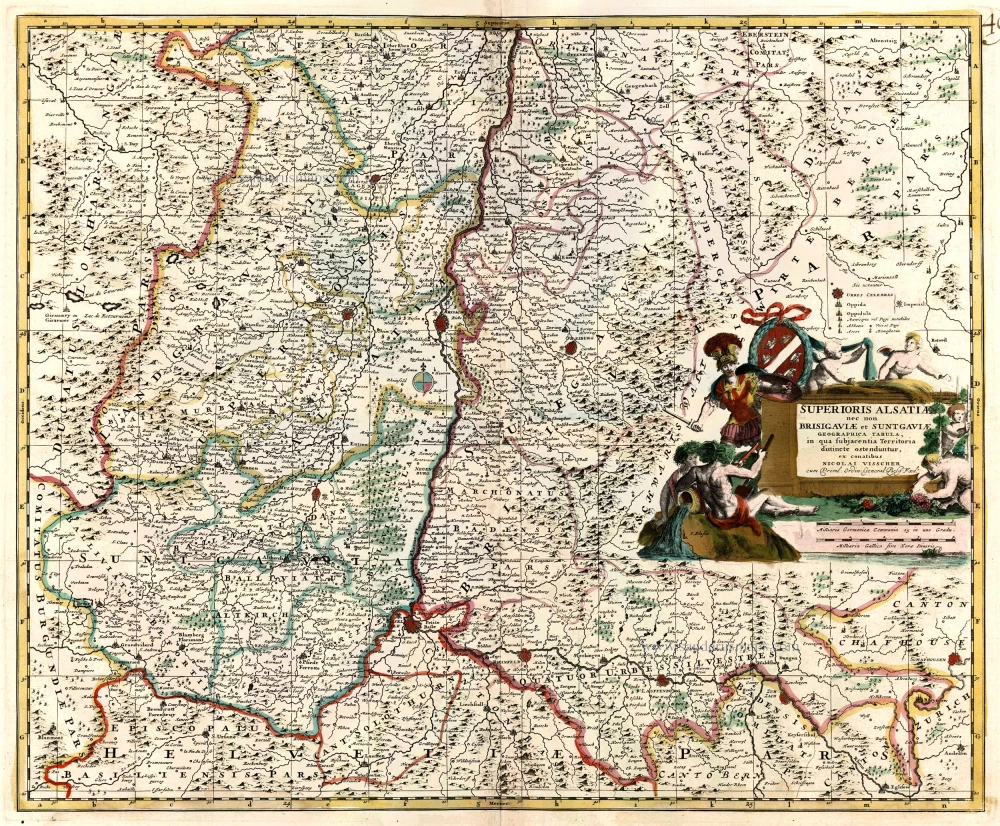
Upper Alsace, by N. Visscher. c. 1680
back
Superioris Alsatiae nec non Brisigaviae et Suntgaviae Geographica Tabula, ...
€290
($330.6 / £246.5)
add to cart
Buy now
questions?
PRINT
Item Number: 24381 Authenticity Guarantee
Category: Antique maps > Europe > France
Antique map of Upper Alsace by N. Visscher.
Title: Superioris Alsatiae nec non Brisigaviae et Suntgaviae Geographica Tabula, ...
Cartographer: N. Visscher.
Date: c. 1680.
Copper engraving, printed on paper.
Size (not including margins): 465 x 560mm (18.31 x 22.05 inches).
Verso: Blank.
Condition: Old coloured, excellent.
Condition Rating: A.
From: Composite Atlas by F. De Wit, c. 1680.