
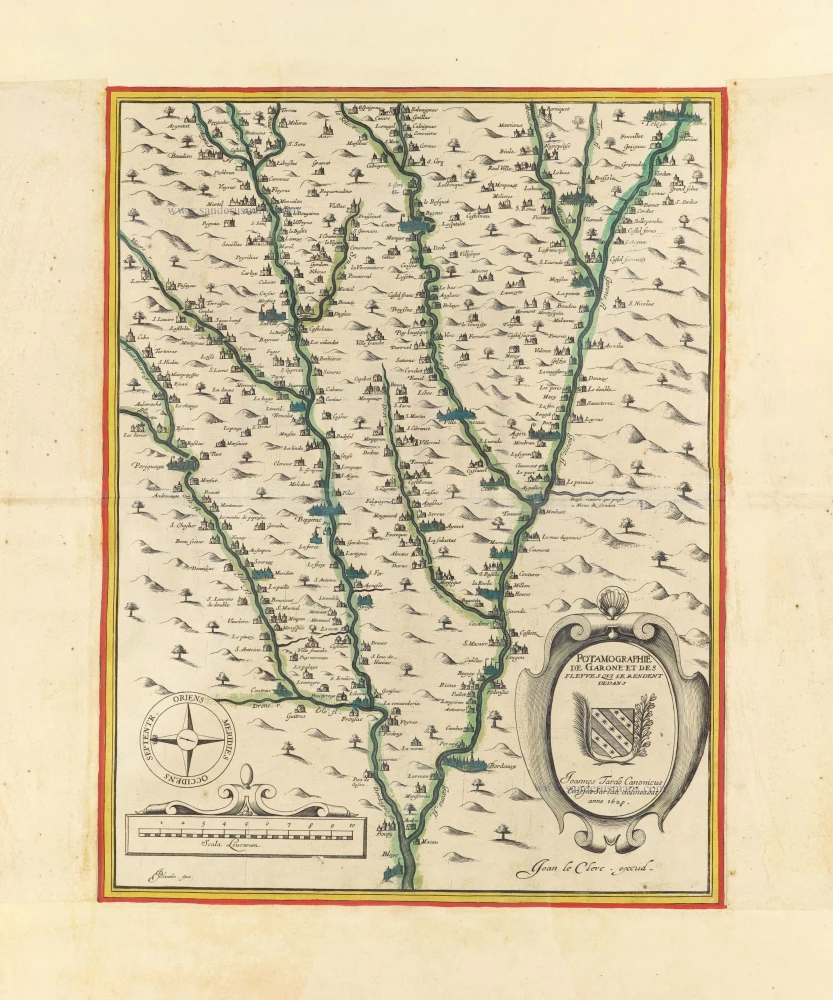
Garonne region by Jean Leclerc. c. 1628-1650
Jean Le Clerc (1560-c. 1622)
Geographer, publisher, and engraver, fourth in a dynasty of printers and booksellers. Trades from 'Rue S. Jean de Latran à la Sallemandre Royalle'. He worked for a while for Maurice Bouguereau, the plates for whose Le Théâtre François passed to Leclerc sometime before 1619. These formed the core of his own Théâtre.
Potamographie de Garone et des fleuves qui se rendent dedans.
Item Number: 30888 Authenticity Guarantee
Category: Antique maps > Europe > France
Scarce map of the Garonne region by Jean Leclerc.
Title: Potamographie de Garone et des fleuves qui se rendent dedans.
Joannes Tardo Canonicus Ecclesiae Sarlatti delineabat anno 1628.
J. Le Clerc Excudit.
JBlanchin fecit.
Cartographer: Joannes Tardo.
Engraver: Jean Blanchin.
Date of the first edition: 1628.
Date of this map: c. 1628-1633.
Date on map: 1628.
Copper engraving, printed on paper.
Image size: 460 x 350mm (18.11 x 13.78 inches).
Sheet size: 685 x 505mm (26.97 x 19.88 inches).
Verso: Blank.
Condition: Original coloured, upper and bottom margins extended; excellent.
Condition Rating: A+.
Separate publication - from a French Composite Atlas, c. 1610-1650.
Appeared in: Theatre geographique du royaume de France. Paris, Veuve Jean Le Clerc, 1631. (Pastoureau, Leclerc A 1619)
Jean Le Clerc (1560-c. 1622)
Geographer, publisher, and engraver, fourth in a dynasty of printers and booksellers. Trades from 'Rue S. Jean de Latran à la Sallemandre Royalle'. He worked for a while for Maurice Bouguereau, the plates for whose Le Théâtre François passed to Leclerc sometime before 1619. These formed the core of his own Théâtre.
