
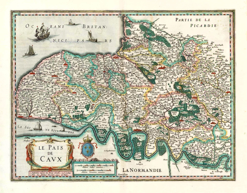
Normandie - Pays de Caux, by Jean Leclerc. 1619-21

Maurice Bouguereau (? - 1596)
Maurice Bouguereau worked in Tours as a French printer, bookseller, cartographer, and publisher. From 1588 to 1596, his address there was 'à la Petite Fontaine du Carroy de Beaulne', in the Rue de la Scellerie.
The most important work of Maurice Bouguereau was the atlas Le Theatre Francoys (20 maps), which he published in Tours in 1594. It was the first atlas of France ever and, thus, a milestone in the history of French cartography. Henry IV commissioned him to produce this work (1553–1610); who was fighting for the unification of his kingdom at the time and wanted to demonstrate his power and greatness with this publication.
Jean Le Clerc (1560-c. 1622)
Geographer, publisher, and engraver, fourth in a dynasty of printers and booksellers. Trades from 'Rue S. Jean de Latran à la Sallemandre Royalle'. He worked for a while for Maurice Bouguereau, the plates for whose Le Théâtre François passed to Leclerc sometime before 1619. These formed the core of his own Théâtre.
Description du Pais de Caux.
Item Number: 30900 Authenticity Guarantee
Category: Antique maps > Europe > France
Normandie - Pays de Caux, by Jean Leclerc. RARE
Title: Description du Pais de Caux.
Jean le Clerc excudit cum privilegio Regis.
Salomon Rogers sculpsit.
Engraver: Salomon Rogers.
Date of the first edition: 1594.
Date of this map: 1619-21.
Copper engraving, printed on paper.
Image size: 350 x 465mm (13.78 x 18.31 inches).
Sheet size: 505 x 685mm (19.88 x 26.97 inches).
Verso: Blank.
Condition: Original coloured in outline, on heavy paper, side margins extended; excellent.
Condition Rating: A+.
Separate publication - from a French Composite Atlas, c. 1610-1650.
Maurice Bouguereau (? - 1596)
Maurice Bouguereau worked in Tours as a French printer, bookseller, cartographer, and publisher. From 1588 to 1596, his address there was 'à la Petite Fontaine du Carroy de Beaulne', in the Rue de la Scellerie.
The most important work of Maurice Bouguereau was the atlas Le Theatre Francoys (20 maps), which he published in Tours in 1594. It was the first atlas of France ever and, thus, a milestone in the history of French cartography. Henry IV commissioned him to produce this work (1553–1610); who was fighting for the unification of his kingdom at the time and wanted to demonstrate his power and greatness with this publication.
Jean Le Clerc (1560-c. 1622)
Geographer, publisher, and engraver, fourth in a dynasty of printers and booksellers. Trades from 'Rue S. Jean de Latran à la Sallemandre Royalle'. He worked for a while for Maurice Bouguereau, the plates for whose Le Théâtre François passed to Leclerc sometime before 1619. These formed the core of his own Théâtre.
Related items
Le Pais de Caux. 1633
Le Pays de Caux, by Henricus Hondius.
[Item number: 27327]
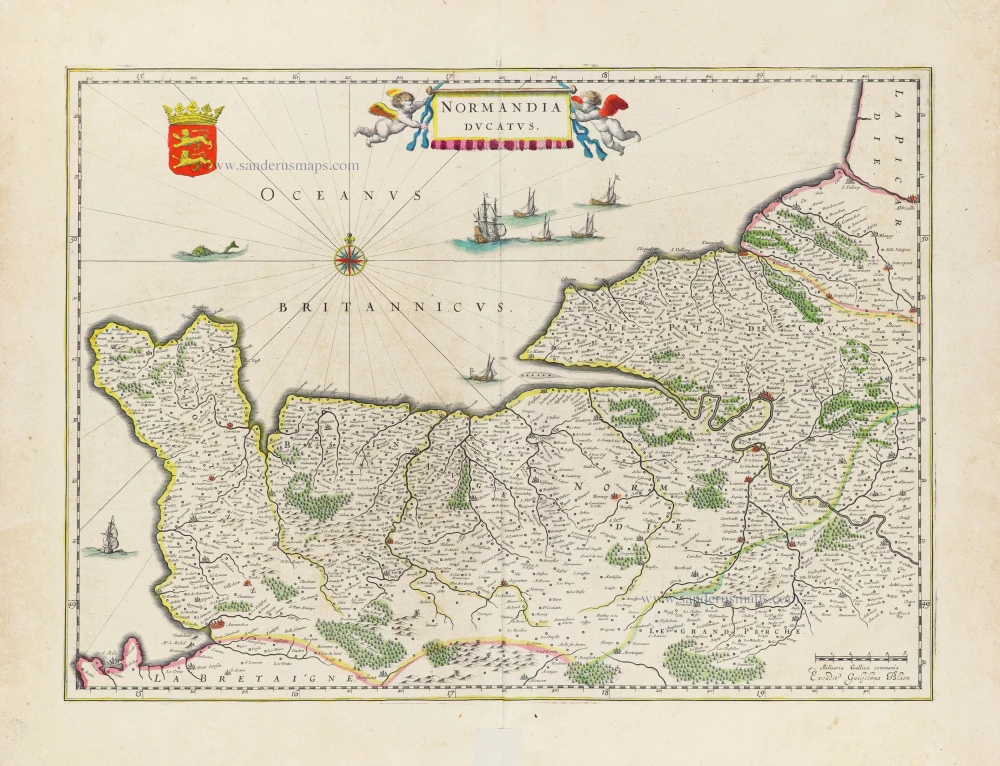
Normandia Ducatus. 1640
Normandy, by W. Blaeu.
[Item number: 31263]
Normandia. 1618
Normandie by Petrus Bertius, published by Jodocus Hondius II.
[Item number: 31597]