
From the famous Ulm-Ptolemy atlas. 1482-1486
Ptolemy map of France, printed in Ulm by Johann Reger. 1486
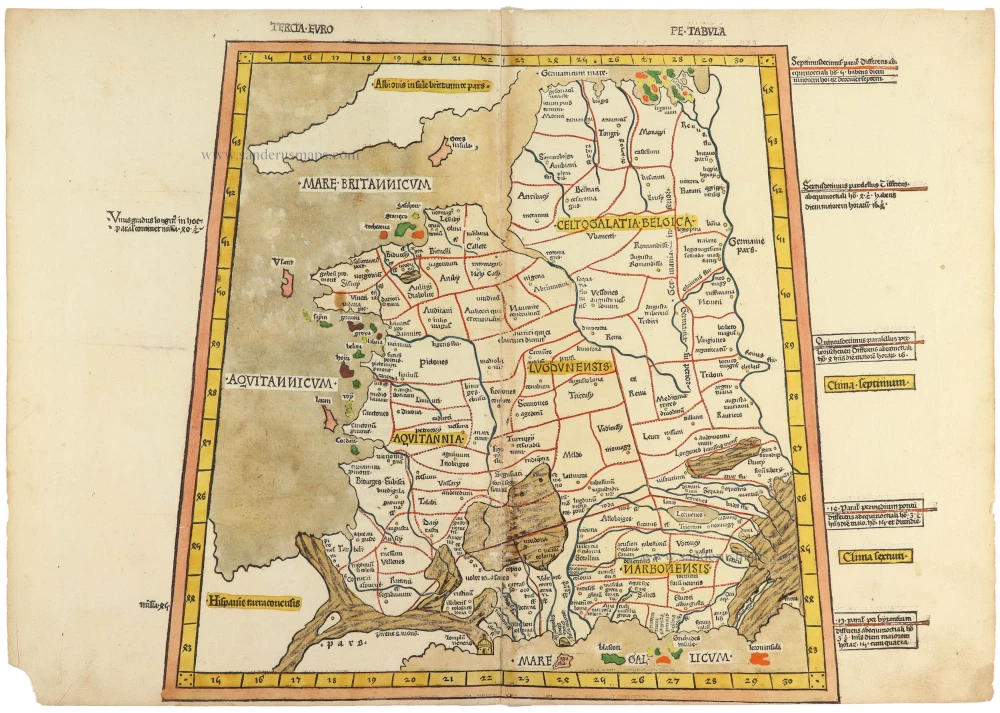


Cosmographia’s Tercia Europe Tabula, published in Ulm by Johann Reger in 1486, is among the earliest printed maps of Europe and a landmark of Renaissance cartography. Based on the geographical work of Claudius Ptolemy, the map reflects the revival of classical learning that swept through Europe in the fifteenth century, when scholars and printers sought to recover and disseminate the scientific knowledge of antiquity.
The Tercia Europe Tabula (“Third Map of Europe”) depicts a portion of southeastern Europe according to Ptolemy’s second-century understanding of the world. Like other maps in the Geographia, it was constructed using mathematical coordinates of latitude and longitude — a revolutionary concept for medieval and early Renaissance audiences. Although many geographical details appear distorted by modern standards, the map represents a crucial moment in the history of cartography: the transition from symbolic medieval mapping traditions to a more scientific and measured representation of space.
The 1486 Ulm edition is particularly important because it was the first printed edition of Ptolemy produced north of the Alps, and among the earliest atlases illustrated with woodcut maps. Johann Reger’s edition followed the famous 1482 Ulm printing and continued its ambitious program of combining classical geography with contemporary printing technology. The maps were notable for their large format, strong visual clarity, and elegant Gothic typography, making them both scholarly tools and objects of artistic beauty.
Collectors and historians value the Tercia Europe Tabula not only for its antiquity but also for its intellectual significance. It embodies the Renaissance rediscovery of ancient science, the spread of printing in Europe, and the growing desire to understand the world through observation, measurement, and systematised knowledge. As such, the map stands at the intersection of art, science, and humanist scholarship — a remarkable survival from the dawn of printed cartography.
Claudius Ptolemy (c.100 – c.170 AD)
Johann Reger (Kemnat, 1454 - After 199)
Johann Reger was one of the important early printers of the German Renaissance, active in Ulm during the late fifteenth century. Although less widely known today than printers such as Johannes Gutenberg or Anton Koberger, Reger played a significant role in the spread of humanist scholarship and scientific knowledge through the new technology of movable-type printing.
Reger is best remembered for publishing the 1486 edition of Geographia by Claudius Ptolemy, one of the most celebrated early printed atlases. Produced in Ulm, this edition was among the first printed books to combine classical geographical knowledge with detailed woodcut maps. The work reflected the growing Renaissance fascination with antiquity and the rediscovery of Greek and Roman scientific texts. Reger’s edition helped disseminate Ptolemaic geography to scholars, merchants, and educated readers across Europe at a time when geographical understanding was rapidly expanding.
The Ulm editions of Ptolemy were notable for their impressive craftsmanship. The maps were printed from finely cut woodblocks and often hand-colored after printing, giving them both scholarly and artistic appeal. Reger’s publications demonstrated how the printing press could preserve and circulate complex visual and textual information on an unprecedented scale. In this sense, he belonged to the first generation of printers who transformed books from rare manuscripts into widely distributed vehicles of learning.
Though relatively little survives about Reger’s personal life, his work stands as evidence of Ulm’s importance as a center of early printing and commerce. His editions are now prized by collectors, libraries, and museums not only for their rarity, but also for their historical importance in the development of cartography, printing, and Renaissance intellectual culture.
Tercia Europe Tabula.
Item Number: 33070 Authenticity Guarantee
Category: Antique maps > Europe > France
Ptolemy map of France, printed in Ulm by Johann Reger.
Title: Tercia Europe Tabula.
Date: 1486.
Woodcut, printed on paper.
Image size (excluding marginal texts): 380 x 395mm (15 x 15½ inches).
Sheet size: 405 x 475mm (16 x 18¾ inches).
Verso: Blank.
Condition: Original coloured, a small part of the lower left corner torn off, not affecting the text or image.
Condition Rating: A+.
From: [Colophon] Ptolemei Viri Alexandrini Cosmographie . . . Explicit. Opus Donni Nicolai Germani Secundum Ptolomeum Finit. [separate colophon] Impressum Ulme Opera . . . Johannem Reger. Anno MCCCLXXXVI [1486]. (Shirley (Brit.Lib.) T.PTOL-4f)
Cosmographia’s Tercia Europe Tabula, published in Ulm by Johann Reger in 1486, is among the earliest printed maps of Europe and a landmark of Renaissance cartography. Based on the geographical work of Claudius Ptolemy, the map reflects the revival of classical learning that swept through Europe in the fifteenth century, when scholars and printers sought to recover and disseminate the scientific knowledge of antiquity.
The Tercia Europe Tabula (“Third Map of Europe”) depicts a portion of southeastern Europe according to Ptolemy’s second-century understanding of the world. Like other maps in the Geographia, it was constructed using mathematical coordinates of latitude and longitude — a revolutionary concept for medieval and early Renaissance audiences. Although many geographical details appear distorted by modern standards, the map represents a crucial moment in the history of cartography: the transition from symbolic medieval mapping traditions to a more scientific and measured representation of space.
The 1486 Ulm edition is particularly important because it was the first printed edition of Ptolemy produced north of the Alps, and among the earliest atlases illustrated with woodcut maps. Johann Reger’s edition followed the famous 1482 Ulm printing and continued its ambitious program of combining classical geography with contemporary printing technology. The maps were notable for their large format, strong visual clarity, and elegant Gothic typography, making them both scholarly tools and objects of artistic beauty.
Collectors and historians value the Tercia Europe Tabula not only for its antiquity but also for its intellectual significance. It embodies the Renaissance rediscovery of ancient science, the spread of printing in Europe, and the growing desire to understand the world through observation, measurement, and systematised knowledge. As such, the map stands at the intersection of art, science, and humanist scholarship — a remarkable survival from the dawn of printed cartography.
Claudius Ptolemy (c.100 – c.170 AD)
Johann Reger (Kemnat, 1454 - After 199)
Johann Reger was one of the important early printers of the German Renaissance, active in Ulm during the late fifteenth century. Although less widely known today than printers such as Johannes Gutenberg or Anton Koberger, Reger played a significant role in the spread of humanist scholarship and scientific knowledge through the new technology of movable-type printing.
Reger is best remembered for publishing the 1486 edition of Geographia by Claudius Ptolemy, one of the most celebrated early printed atlases. Produced in Ulm, this edition was among the first printed books to combine classical geographical knowledge with detailed woodcut maps. The work reflected the growing Renaissance fascination with antiquity and the rediscovery of Greek and Roman scientific texts. Reger’s edition helped disseminate Ptolemaic geography to scholars, merchants, and educated readers across Europe at a time when geographical understanding was rapidly expanding.
The Ulm editions of Ptolemy were notable for their impressive craftsmanship. The maps were printed from finely cut woodblocks and often hand-colored after printing, giving them both scholarly and artistic appeal. Reger’s publications demonstrated how the printing press could preserve and circulate complex visual and textual information on an unprecedented scale. In this sense, he belonged to the first generation of printers who transformed books from rare manuscripts into widely distributed vehicles of learning.
Though relatively little survives about Reger’s personal life, his work stands as evidence of Ulm’s importance as a center of early printing and commerce. His editions are now prized by collectors, libraries, and museums not only for their rarity, but also for their historical importance in the development of cartography, printing, and Renaissance intellectual culture.
Related items
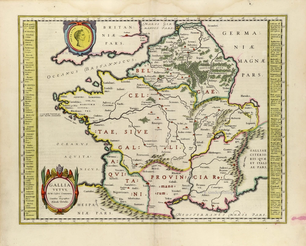
Gallia Vetus. 1635
Ancient France, by Willem Blaeu.
[Item number: 33213]
new

Nova et accurata Territorii Ulmensis cum Dominio Wainensi 1712
Ulm and surroundings by Johann Baptist Homann.
[Item number: 33233]
new

Carte Geographicque des Postes qui traversent la France dediée 1637
Map showing the postal stations of France, published by Nicolas Sanson and Melchior Tavernier.
[Item number: 33239]
new