
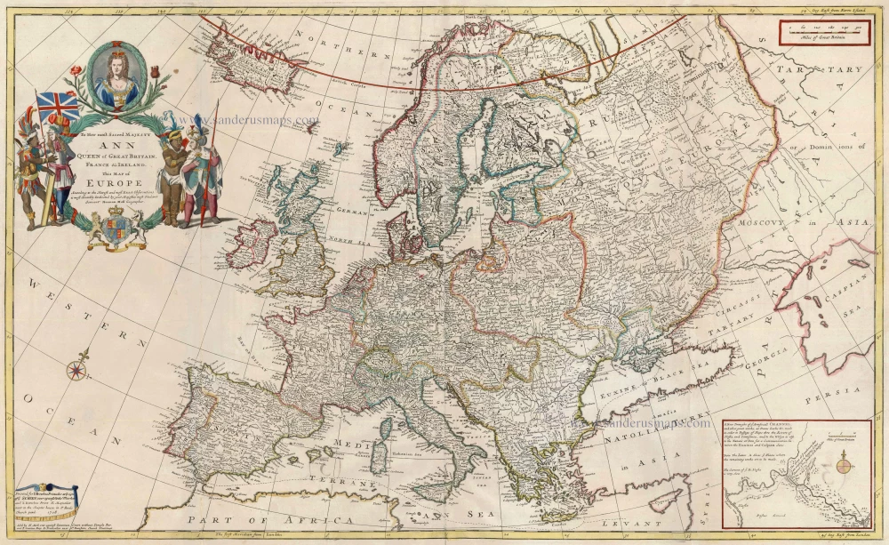
Antique map of Europe by H. Moll c. 1726
back
To Her Most Sacred Majesty Ann Queen of Great Britain, France & Ireland ... This Map of Europe ... is Most Humbly Dedicated ...
SOLD
Item Number: 13724 Authenticity Guarantee
Category: Antique maps > Europe > Europe Continent
Map of Europe, with inset: Proposed canal works to join the Black & Caspian Seas.
Copper engraving, printed from two plates, joined.
Size: 58 x 96cm (22.6 x 37.4 inches)
Verso: Blank
Condition: Old coloured with later additions, small repairs at folds.
Condition Rating: A
From: Moll Herman, The World Described, or a New and Correct Sett of Maps . . . London, J. & T. Bowles, c. 1726. (Phillips (Atlases), 554)