
Antique map of Europe by W. Blaeu 1647-50
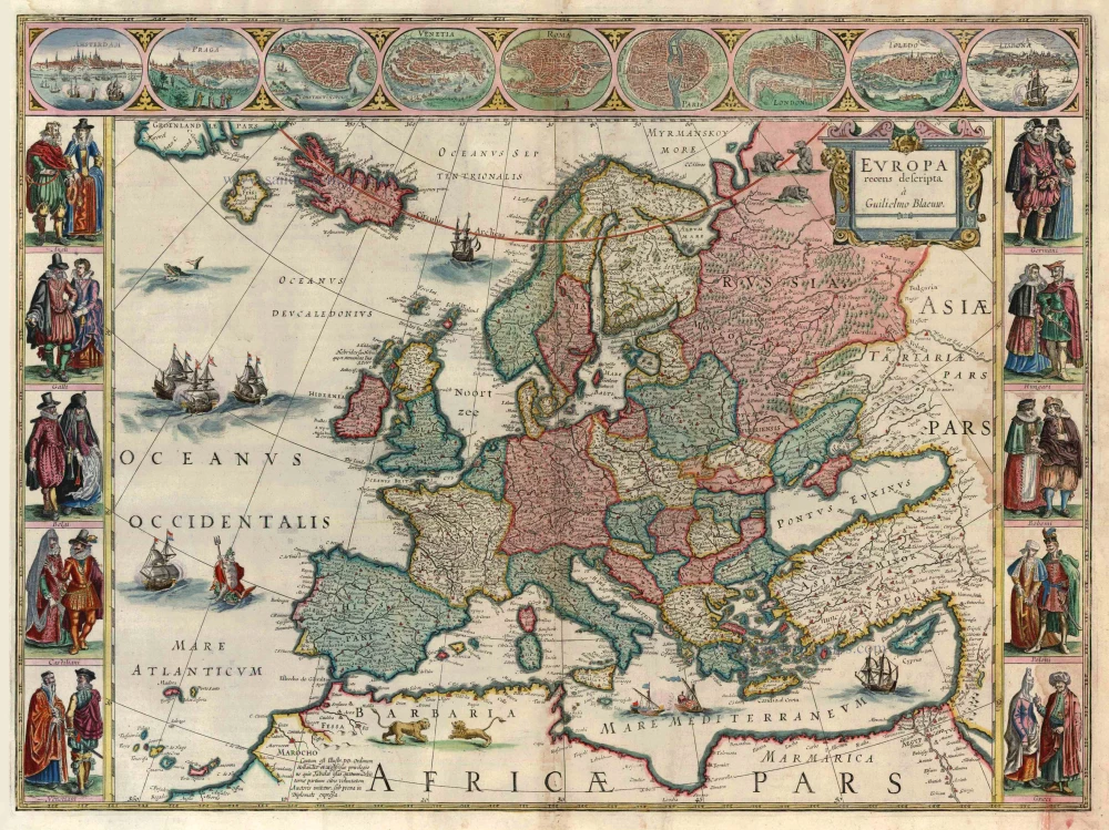
Europa Recens Descripta
Item Number: 11231 Authenticity Guarantee
Category: Antique maps > Europe > Europe Continent
Antique map of Europe by W. Blaeu
Date of the first edition: 1630
Date of this map: 1647-50
Copper engraving
Size: 41 x 56cm (16 x 21.7 inches)
Verso text: Dutch
Condition: Full body colour, some staining in lower margin, waterstain at right, beautiful original coloured.
Condition Rating: A
References: Van der Krogt 2, 1000,2; Schilder 6, 26.3.
From: Toonneel des Aerdrycx, ofte nieuwe Atlas, ... W. & J. Blaeu, 1647-50. (Van der Krogt 2, 222).
This map is a reduction of Blaeu's 1608 wall map.
The map is framed on both sides by five costumed figures. Left border: Angli; Galli; Belgi; Castiliani; Venetiani. Right border: Germani; Hungari; Bohemi; Poloni; Graeci. Along the upper edge runs a decorative border with nine European towns in oval frames: Amsterdam; Praga; Constantinopolis; Venetia; Roma; Paris; London; Toledo; and Lisboa.