
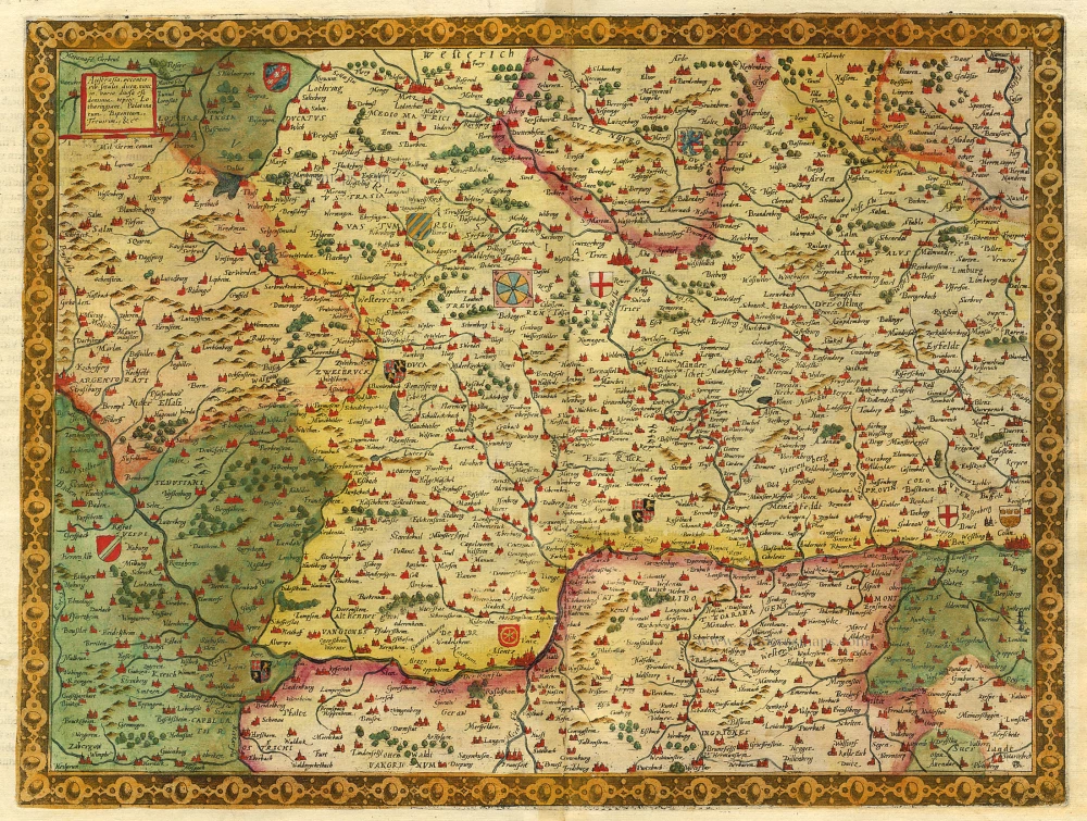
Old, antique map of the Rhine River by F. de Wit c. 1680

Frederick de Wit (1630-1706)
The engraver and map-seller, Frederick de Wit, was born in Gouda (Netherlands) in 1630 as a son of Hendrick Fredericksz de Wit. Through his marriage with Maria van der Waag of Amsterdam in 1661, he obtained citizenship of the city where he had been working since 1648 and where he became one of the most famous engravers of maps of the second half of the 17th century. Although De Wit was a Catholic, which meant that he was not favoured at the time by the city council, he was awarded the honour of being listed as one of the "excellent citizens" on the roll of the city council in the years 1694-1704. However, his name was not written in the Guild of St. Luke book before 1664. At that time, he lived on the Kalverstraat "in de Witte Pascaert", where he stayed until his death in 1706. His earliest dates on maps engraved are 1659 (Regni Daniae) and 1660 (World map).
Frederick de Wit published several world atlases, a sea atlas, and an atlas of the Netherlands.
The dating of the maps is difficult. However, as a privilege was granted in 1689, the annotation 'cum privilegio' marks an edition after 1688.
Around 1700, Frederick de Wit entered the market with a town atlas. He produced two volumes with a total of 260 plans and views. Most were printed from plates used for Janssonius and Blaeu town atlases.
After he died in 1706, his widow continued the shop until 1709. The plates and stock of De Wit's atlas were sold to Covens & Mortier in 1710, who sold the atlas for an extended period.
Fluviorum Rheni Mosae Mosellae Moeni Neccaris aliorumque minorum in eosdem se exonerantium et regionum circumjacent descriptio emendata per F. De Wit.
Item Number: 24383 Authenticity Guarantee
Category: Antique maps > Europe > Europe Continent
Old, antique map of the Rhine River by F. de Wit, oriented to the West
The map is flanked at the left, right and bottom with blind bird-eye views of Landaw, Freiburg, Mainz, Cologne, Namur, Basel, Fort Louis, Philisbourg, Brisach, Strasbourg, Coblenz, Mont Royal, Huningen,Trier, Luxembourg, Maastricht and Bonn.
Copper engraving, printed on two sheets, joined.
Size: 50 x 89cm (19.5 x 34.7 inches)
Verso: Blank
Condition: Old coloured.
Condition Rating: A
From: Composite Atlas by F. De Wit, c. 1680.
Frederick de Wit (1630-1706)
The engraver and map-seller, Frederick de Wit, was born in Gouda (Netherlands) in 1630 as a son of Hendrick Fredericksz de Wit. Through his marriage with Maria van der Waag of Amsterdam in 1661, he obtained citizenship of the city where he had been working since 1648 and where he became one of the most famous engravers of maps of the second half of the 17th century. Although De Wit was a Catholic, which meant that he was not favoured at the time by the city council, he was awarded the honour of being listed as one of the "excellent citizens" on the roll of the city council in the years 1694-1704. However, his name was not written in the Guild of St. Luke book before 1664. At that time, he lived on the Kalverstraat "in de Witte Pascaert", where he stayed until his death in 1706. His earliest dates on maps engraved are 1659 (Regni Daniae) and 1660 (World map).
Frederick de Wit published several world atlases, a sea atlas, and an atlas of the Netherlands.
The dating of the maps is difficult. However, as a privilege was granted in 1689, the annotation 'cum privilegio' marks an edition after 1688.
Around 1700, Frederick de Wit entered the market with a town atlas. He produced two volumes with a total of 260 plans and views. Most were printed from plates used for Janssonius and Blaeu town atlases.
After he died in 1706, his widow continued the shop until 1709. The plates and stock of De Wit's atlas were sold to Covens & Mortier in 1710, who sold the atlas for an extended period.
Related items
Scarce
Austrasia ... 1593
The Rhine River, by Gerard de Jode.
[Item number: 5428]
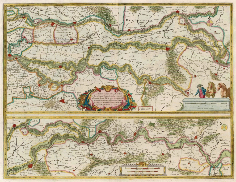
Tractus Rheni et Mosae totusque Vahalis à Rhenoberca Gorcomium usque cum turris adjacentibus ducatus Cliviae regno Noviomagensi et Bommelerwaert. ... 1664-65
Rhine, Waal & Meuse, by J. Blaeu.
[Item number: 12126]
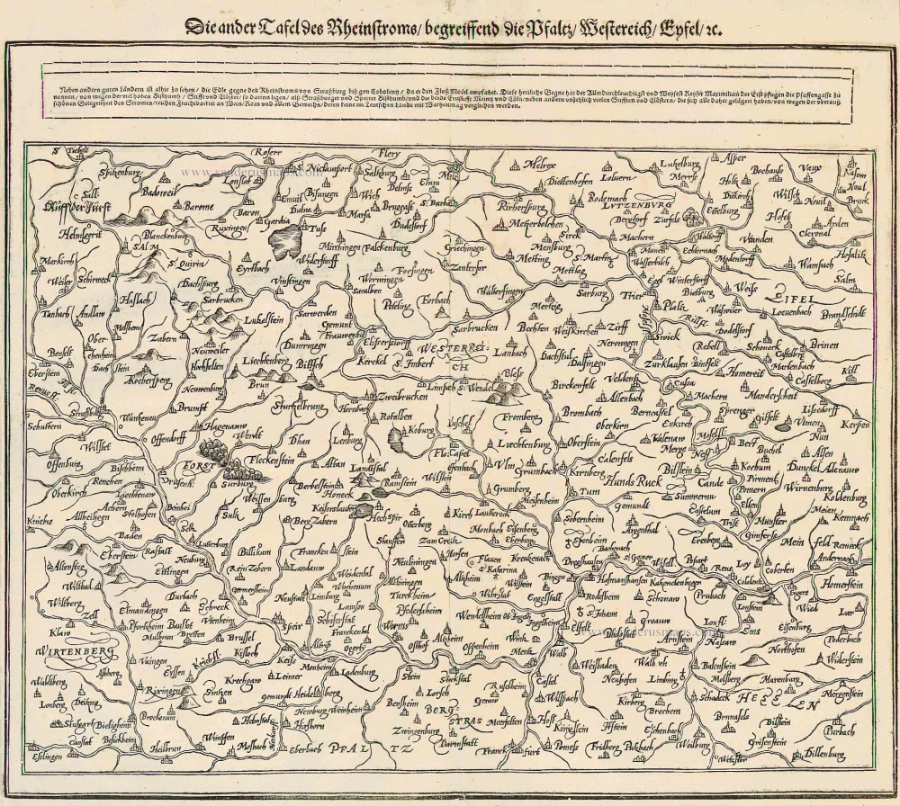
Die ander Tafel des Rheinstroms begreiffens die Pfalz, Westereich, Eyfel ... 1578
The Rhine River, by Münster S.
[Item number: 14630]

Le Cours de la Rivière du Rhein depuis sa Source jusques à son Emboucheure ou sont distingues Toutes les Estats et Souverainetés qui sont dessus et aux environs. ... c. 1700
RHINE RIVER by Schenk P.
[Item number: 19152]
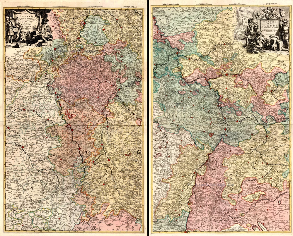
Téâtre de la Guerre sur le Rhein, Moesselle. Mayn, & le Necker, Meuse. Avec les Pais Voisins. 1721-41
The Upper Rhine and surroundings by N. Sanson / Covens & Mortier.
[Item number: 23695]
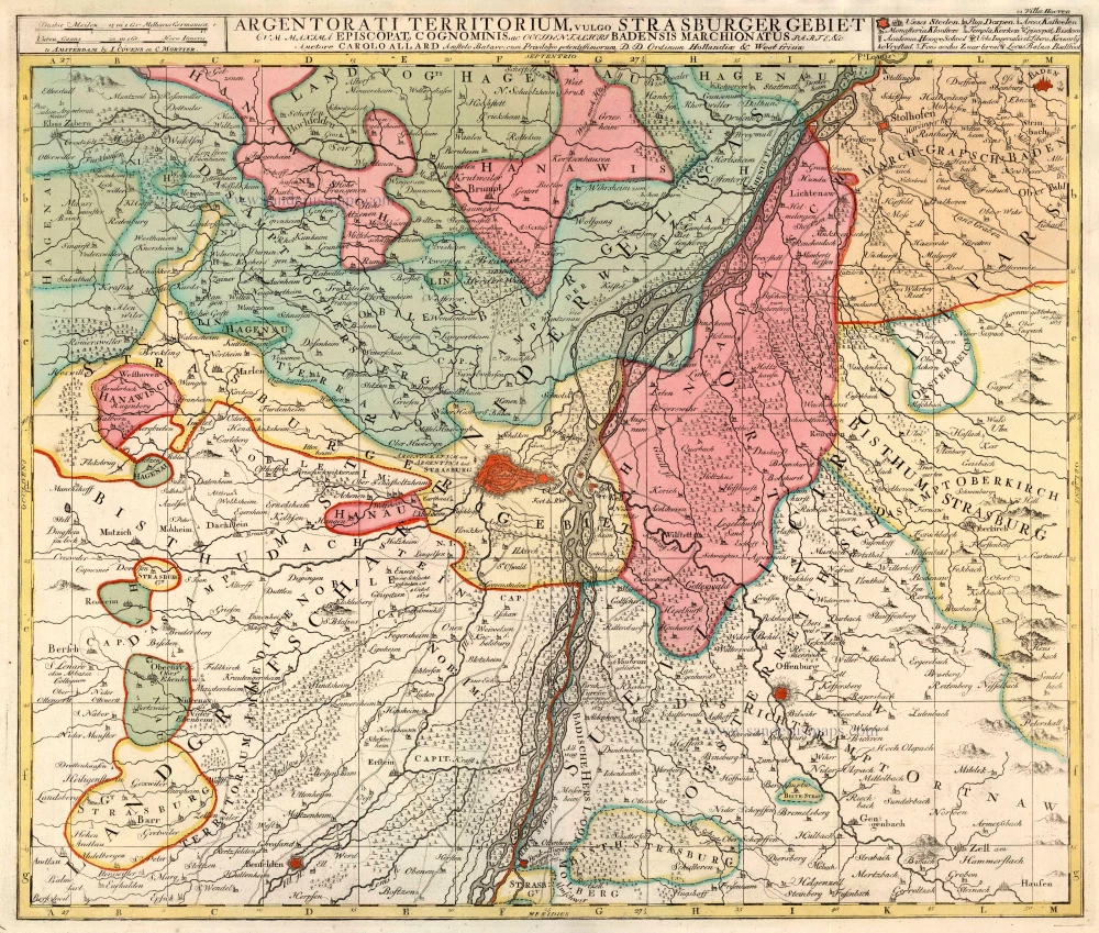
Argentorati Territorium, vulgo Strasburger Gebiet 1721-41
Strasbourg, by Covens & Mortier.
[Item number: 23803]
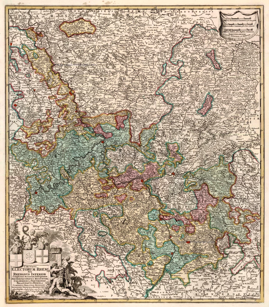
Circulus Electorum Rheni Sive Rhenanus Inferior ... 1721-41
Rhine River, by Covens & Mortier.
[Item number: 23824]