Bamberg by Braun & Hogenberg. 1618


TRANSLATION OF CARTOUCHE TEXT: Impression of the well-known episcopal city of Bamberg, drawn true to life.
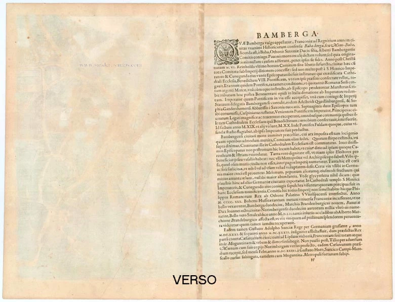
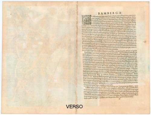
COMMENTARY BY BRAUN (on verso): "The Emperor Henry the Holy and his wife Cunigunde set up a diocese, built a splendid collegiate church in this city, and invited Pope Benedict VIII to come personally to consecrate the church. Then 72 bishops met in this town with the Emperor, the princes and the imperial estates to welcome the Pope with great honours and to be present at the consecration of the Benedictine monastery and the collegiate church."
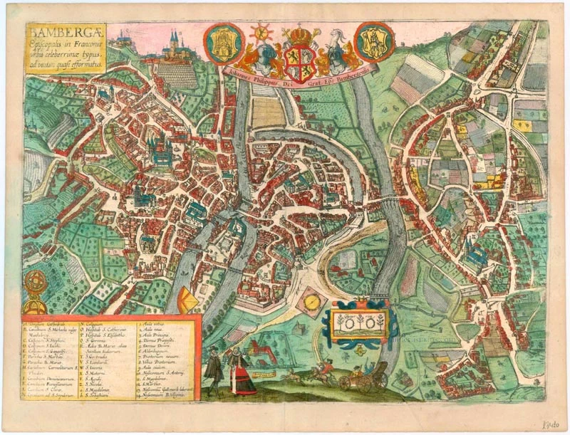
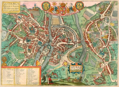
This bird's-eye view from the south has the character of a street plan and clearly shows the two centres of the city: the Gothic cathedral dedicated to St Peter (A) is the seat of spiritual power. It was erected on the site of the building endowed by the Ottonian Emperor Henry II in the 11th century, which was destroyed by fire. The centre of the Old Town is marked by the town hall, built on an artificial island in the Regnitz. Directly below the palace is the northern tip of a second island, which served as the prince-bishop's residence from 1580 onwards. Top left is the Benedictine monastery of St Michael, above a vineyard. The ornately framed liquorice plants symbolise the importance of vegetable cultivation in the garden city on the far side of the right-hand arm of the Regnitz. (Taschen)
Braun G. & Hogenberg F. and the Civitates Orbis Terrarum.
The Civitates Orbis Terrarum, or the "Braun & Hogenberg", is a six-volume town atlas and the greatest book of town views and plans ever published: 363 engravings, sometimes beautifully coloured. It was one of the best-selling works in the last quarter of the 16th century. Georg Braun wrote the text accompanying the plans and views on the verso. A large number of the plates were engraved after the original drawings of Joris Hoefnagel (1542-1600), who was a professional artist. The first volume was published in Latin in 1572, the sixth volume in 1617. Frans Hogenberg created the tables for volumes I through IV, and Simon van den Neuwel created those for volumes V and VI. Other contributors were cartographer Daniel Freese, and Heinrich Rantzau. Works by Jacob van Deventer, Sebastian Münster, and Johannes Stumpf were also used. Translations appeared in German and French.
Following the original publication of Volume 1 of the Civitates in 1572, seven further editions of 1575, 1577, 1582, 1588, 1593, 1599 and 1612 can be identified. Vol.2, first issued in 1575, was followed by further editions in 1597 and in 1612. The next volumes appeared in 1581, 1588, 1593, 1599 and 1606. The German translation of the first volume appeared from 1574 on and the French edition from 1575 on.
Several printers were involved: Theodor Graminaeus, Heinrich von Aich, Gottfried von Kempen, Johannis Sinniger, Bertram Buchholtz and Peter von Brachel, who all worked in Cologne.
Georg Braun (1541-1622)
Georg Braun was born in Cologne in 1541. After his studies in Cologne, he entered the Jesuit Order as a novice. In 1561 he obtained his bachelor's degree and in 1562 his Magister Artium. Although he left the Jesuit Order, he studied theology, gaining a licentiate in theology.
Frans Hogenberg (1535-1590)
Frans Hogenberg was a Flemish and German painter, engraver, and mapmaker. He was born in Mechelen as the son of Nicolaas Hogenberg.
By the end of the 1560s Frans Hogenberg was employed upon Abraham Ortelius's Theatrum Orbis Terrarum, published in 1570; he is named as an engraver of numerous maps. In 1568 he was banned from Antwerp by the Duke of Alva and travelled to London, where he stayed a few years before emigrating to Cologne. There he immediately embarked on his two most important works, the Civitates published from 1572 and the Geschichtsblätter, which appeared in several series from 1569 until about 1587.
Thanks to such large scale projects as the Geschichtsblätter and the Civitates, Hogenberg's social circumstances improved with each passing year. He died as a wealthy man in Cologne in 1590.
Bambergae Episcopalis in Franconiae urbis celeberrimae typus, ad viutim quasi efformatus.
Item Number: 23420 Authenticity Guarantee
Category: Antique maps > Europe > Germany - Cities
Bamberg by Braun & Hogenberg.
Title: Bambergae Episcopalis in Franconiae urbis celeberrimae typus, ad viutim quasi efformatus.
Date of the first edition: 1617.
Date of this map: 1618.
Copper engraving, printed on paper.
Image size: 310 x 450mm (12¼ x 17¾ inches).
Sheet size: 410 x 540mm (16¼ x 21¼ inches).
Verso: Latin text.
Condition: A few faint printercreases, nice old colour.
Condition Rating: A.
From: Theatri praecipuarum Totius Mundi Urbium Liber Sextus Anno MDCXVIII. (Van der Krogt 4, 41:1.6)
TRANSLATION OF CARTOUCHE TEXT: Impression of the well-known episcopal city of Bamberg, drawn true to life.
COMMENTARY BY BRAUN (on verso): "The Emperor Henry the Holy and his wife Cunigunde set up a diocese, built a splendid collegiate church in this city, and invited Pope Benedict VIII to come personally to consecrate the church. Then 72 bishops met in this town with the Emperor, the princes and the imperial estates to welcome the Pope with great honours and to be present at the consecration of the Benedictine monastery and the collegiate church."
This bird's-eye view from the south has the character of a street plan and clearly shows the two centres of the city: the Gothic cathedral dedicated to St Peter (A) is the seat of spiritual power. It was erected on the site of the building endowed by the Ottonian Emperor Henry II in the 11th century, which was destroyed by fire. The centre of the Old Town is marked by the town hall, built on an artificial island in the Regnitz. Directly below the palace is the northern tip of a second island, which served as the prince-bishop's residence from 1580 onwards. Top left is the Benedictine monastery of St Michael, above a vineyard. The ornately framed liquorice plants symbolise the importance of vegetable cultivation in the garden city on the far side of the right-hand arm of the Regnitz. (Taschen)
Braun G. & Hogenberg F. and the Civitates Orbis Terrarum.
The Civitates Orbis Terrarum, or the "Braun & Hogenberg", is a six-volume town atlas and the greatest book of town views and plans ever published: 363 engravings, sometimes beautifully coloured. It was one of the best-selling works in the last quarter of the 16th century. Georg Braun wrote the text accompanying the plans and views on the verso. A large number of the plates were engraved after the original drawings of Joris Hoefnagel (1542-1600), who was a professional artist. The first volume was published in Latin in 1572, the sixth volume in 1617. Frans Hogenberg created the tables for volumes I through IV, and Simon van den Neuwel created those for volumes V and VI. Other contributors were cartographer Daniel Freese, and Heinrich Rantzau. Works by Jacob van Deventer, Sebastian Münster, and Johannes Stumpf were also used. Translations appeared in German and French.
Following the original publication of Volume 1 of the Civitates in 1572, seven further editions of 1575, 1577, 1582, 1588, 1593, 1599 and 1612 can be identified. Vol.2, first issued in 1575, was followed by further editions in 1597 and in 1612. The next volumes appeared in 1581, 1588, 1593, 1599 and 1606. The German translation of the first volume appeared from 1574 on and the French edition from 1575 on.
Several printers were involved: Theodor Graminaeus, Heinrich von Aich, Gottfried von Kempen, Johannis Sinniger, Bertram Buchholtz and Peter von Brachel, who all worked in Cologne.
Georg Braun (1541-1622)
Georg Braun was born in Cologne in 1541. After his studies in Cologne, he entered the Jesuit Order as a novice. In 1561 he obtained his bachelor's degree and in 1562 his Magister Artium. Although he left the Jesuit Order, he studied theology, gaining a licentiate in theology.
Frans Hogenberg (1535-1590)
Frans Hogenberg was a Flemish and German painter, engraver, and mapmaker. He was born in Mechelen as the son of Nicolaas Hogenberg.
By the end of the 1560s Frans Hogenberg was employed upon Abraham Ortelius's Theatrum Orbis Terrarum, published in 1570; he is named as an engraver of numerous maps. In 1568 he was banned from Antwerp by the Duke of Alva and travelled to London, where he stayed a few years before emigrating to Cologne. There he immediately embarked on his two most important works, the Civitates published from 1572 and the Geschichtsblätter, which appeared in several series from 1569 until about 1587.
Thanks to such large scale projects as the Geschichtsblätter and the Civitates, Hogenberg's social circumstances improved with each passing year. He died as a wealthy man in Cologne in 1590.