
Magdeburg by Braun & Hogenberg 1612
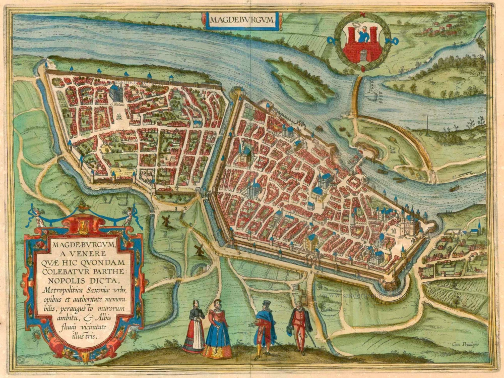
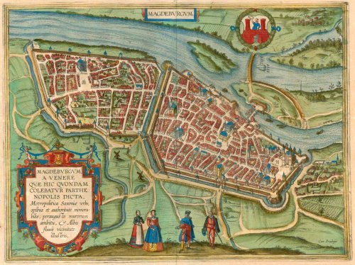
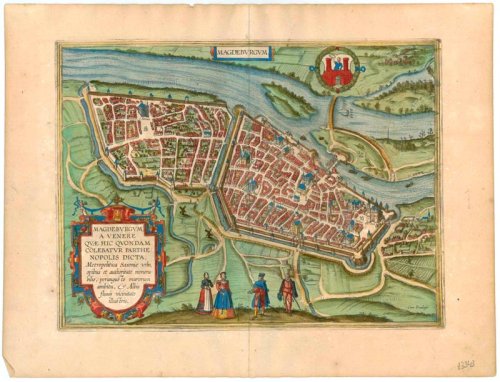
TRANSLATION OF CARTOUCHE TEXT: Magdeburg was called Parthenopolis (virgin city) after Venus, who was once worshipped here: it is the capital of Saxony, remarkable for its wealth and power and known for its narrow city walls and its proximity to the Elbe.
COMMENTARY BY BRAUN: "Magdeburg [...] is the noblest city in Saxony [...]. Here, there are splendid houses, magnificent streets, and large and richly decorated churches: the church of St Maurice, built by Emperor Otto, is particularly handsome. There used to be a fortified castle surrounded by fishermen's huts, similar to a village or other open Bourg in Magdeburg. However, there used to be burgraves here as in Nuremberg: whether they were Saxons or Vandals is uncertain. However, it is known that after Otto, a burgraviate was created by Imperial mandate and numbered amongst the four burgraves in the empire."
In this plan view seen from a lofty bird's-eye perspective, Magdeburg - the name is probably derived from 'Magadoburg' (Ger. mächtige Burg, "mighty fortress") - lies on the right bank of the Elbe. The Gothic cathedral of SS. Maurice and Catherine are recognisable on the right (Der Dom). Further left is the ensemble of St John's church, where Martin Luther preached in 1524, and the town hall overlooking the Alter Markt, the old market square on which it is also possible to make out the famous equestrian statue of the Magdeburg Knight and a Magdeburg Roland statue. (Taschen)
Magdeburgum a venere quae hic quondam colebatur parthenopolis dicta, Metropolitica Saxoniae Urbs, opibus & authoritate memorabilis, peraugusto murorum ambitu, & Albis fluvij vicinitate illustris.
Item Number: 23343 Authenticity Guarantee
Category: Antique maps > Europe > Germany - Cities
Magdeburg by Braun & Hogenberg.
Title: Magdeburgum a venere quae hic quondam colebatur parthenopolis dicta, Metropolitica Saxoniae Urbs, opibus & authoritate memorabilis, peraugusto murorum ambitu, & Albis fluvij vicinitate illustris.
Cum Privilegio.
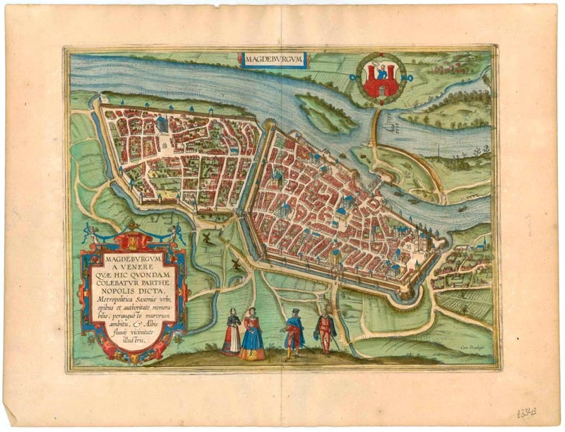
Date of the first edition: 1572.
Date of this map: 1612.
Copper engraving, printed on paper.
Size (not including margins): 320 x 440mm (12½ x 17¼ inches).
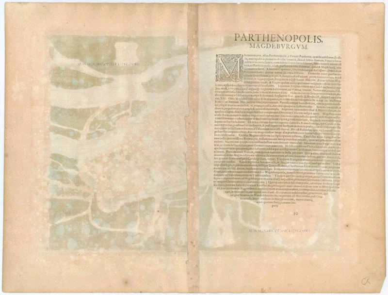
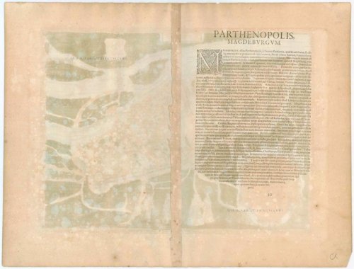
Verso: Latin text.
Condition: Superb old colour, excellent.
Condition Rating: A+.
From: Civitates Orbis Terrarum, Liber Primus. Cologne, Petrus von Brachel, 1612. (Van der Krogt 4, 41:1.1(1612))
TRANSLATION OF CARTOUCHE TEXT: Magdeburg was called Parthenopolis (virgin city) after Venus, who was once worshipped here: it is the capital of Saxony, remarkable for its wealth and power and known for its narrow city walls and its proximity to the Elbe.
COMMENTARY BY BRAUN: "Magdeburg [...] is the noblest city in Saxony [...]. Here, there are splendid houses, magnificent streets, and large and richly decorated churches: the church of St Maurice, built by Emperor Otto, is particularly handsome. There used to be a fortified castle surrounded by fishermen's huts, similar to a village or other open Bourg in Magdeburg. However, there used to be burgraves here as in Nuremberg: whether they were Saxons or Vandals is uncertain. However, it is known that after Otto, a burgraviate was created by Imperial mandate and numbered amongst the four burgraves in the empire."
In this plan view seen from a lofty bird's-eye perspective, Magdeburg - the name is probably derived from 'Magadoburg' (Ger. mächtige Burg, "mighty fortress") - lies on the right bank of the Elbe. The Gothic cathedral of SS. Maurice and Catherine are recognisable on the right (Der Dom). Further left is the ensemble of St John's church, where Martin Luther preached in 1524, and the town hall overlooking the Alter Markt, the old market square on which it is also possible to make out the famous equestrian statue of the Magdeburg Knight and a Magdeburg Roland statue. (Taschen)
Related items

Magdeburgum ... Metropolitica Saxoniae Urbs 1582
Magdeburg, by Georg Braun and Frans Hogenberg.
[Item number: 4119]
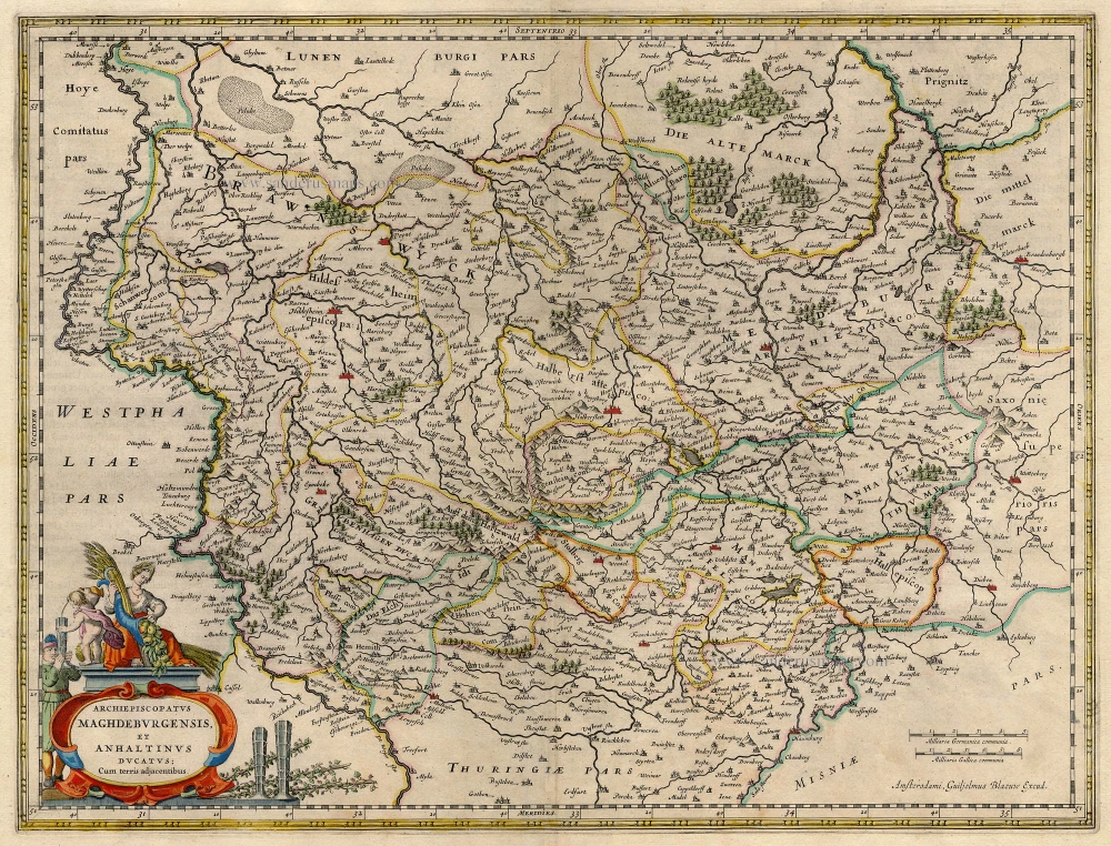
Archiepiscopatus Maghdeburgensis et Anhaltinus Ducatus; cum terris adjacentibus. 1647-50
Braunschweig - Magdeburg, by Blaeu W.
[Item number: 5362]

Braunswyck et Meydburg cum terris adjacentibus. 1636
Braunschweig and Magdeburg, by J. Janssonius.
[Item number: 7795]

Braunswyck & Meydburg 1619
Braunschweig - Magdeburg, by Mercator-Hondius.
[Item number: 12575]

Madeburga. 1493
Magdeburg, by H. Schedel.
[Item number: 17061]

Braunswick & Magdebourg. 1633
Braunschweig & Magdeburg by C. Tassin.
[Item number: 31760]