
Marburg and Cassel, by Georg Braun and Frans Hogenberg. 1612

MARBURG
CARTOUCHE: Marburg, the capital of Hesse, is distinguished for its university.
COMMENTARY BY BRAUN: "On top of a high hill is the residence of the Prince, with a chapel built by Louis, bishop of Münster, third son of Landgrave Henry of Thuringia. There is also a university here where the liberal arts are taught, founded in 1527 and renewed in 1535 by Prince Philip."
In this view of Marburg from the east, the city's two most familiar buildings are seen to advantage: the palace on top of the hill (centre), where a castle had first been built in the 9th century, and St Elizabeth's church (in front of it on the left). Marburg only assumed importance from 1228, when Elizabeth of Thuringa settled here and began her selfless mission tending the poor and sick. In 1235, just four years after her death, she was canonized, and the Teutonic Order began constructing the early Gothic church of St Elizabeth. Due to the pilgrims from all over Europe visiting Elizabeth's tomb, Marburg's economy flourished. In 1539, however, wishing to halt this pilgrimage, the Protestant landgrave Philip the Magnanimous of Hesse-Marburg removed Elizabeth's bones from the church.
KASSEL
TRANSLATION OF CARTOUCHE TEXT: Cassula, commonly known as Kassel, a flourishing town in wool-producing Hesse, strongly fortified by moats, a citadel and bulwarks; called Stereontium by Ptolemy.
COMMENTARY BY BRAUN: " Kassel, the noblest town in Hesse, so called on account of its fortified castle; for formerly, it is said, only a palace stood there. The Rivers Fulda, Ahne, and Drusel flow through Kassel; hence the city has fertile soil. [...] Its most important commodities are cattle, animal hides and wool. They sell these wares, particularly wool, partly to Buvonia, which lies close to the land of Thuringia, partly within their native land, and they take it to the famous mercantile city of Antwerp and from there to London."
St Martin's church is in the centre of the picture, dating from the 14th/15th centuries; the soaring south tower was given its octagonal turret and Italian cupola as late as the 16th century. In the left-hand foreground, on the other side of the Fulda, are the grounds of the Neuer Lustgarten, the forerunner of the present Fuldaaue park, which, together with the Karlsaue and the hillside Wilhelmshöhe Berg numbers amongst modern-day Kassel's spacious parks and gardens. First mentioned in records in AD 913, the town evolved out of a castle, from which it also derives its name. From 1277 Kassel - alternating with Marburg - was the capital of Hesse. (Taschen)
Braun G. & Hogenberg F. and the Civitates Orbis Terrarum.
The Civitates Orbis Terrarum, also known as the 'Braun & Hogenberg', is a six-volume town atlas and the most excellent book of town views and plans ever published: 363 engravings, sometimes beautifully coloured. It was one of the best-selling works in the last quarter of the 16th century. Georg Braun, a skilled writer, wrote the text accompanying the plans and views on the verso. Many plates were engraved after the original drawings of a professional artist, Joris Hoefnagel (1542-1600). The first volume was published in Latin in 1572 and the sixth in 1617. Frans Hogenberg, a talented engraver, created the tables for volumes I through IV, and Simon van den Neuwel made those for volumes V and VI. Other contributors were cartographers Daniel Freese and Heinrich Rantzau, who provided valuable geographical information. Works by Jacob van Deventer, Sebastian Münster, and Johannes Stumpf were also used as references. Translations appeared in German and French, making the atlas accessible to a broader audience.
Since its original publication of volume 1 in 1572, the Civitates Orbis Terrarum has left an indelible mark on the history of cartography. Seven more editions followed the first volume in 1575, 1577, 1582, 1588, 1593, 1599, and 1612. Vol.2, initially released in 1575, saw subsequent editions in 1597 and 1612. The subsequent volumes, each a treasure trove of historical insights, graced the world in 1581, 1588, 1593, 1599, and 1606. The German translation of the first volume, a testament to its widespread appeal, debuted in 1574, followed by the French edition in 1575.
Several printers were involved: Theodor Graminaeus, Heinrich von Aich, Gottfried von Kempen, Johannis Sinniger, Bertram Buchholtz, and Peter von Brachel, all of whom worked in Cologne.
Georg Braun (1541-1622)
Georg Braun, the author of the text accompanying the plans and views in the Civitates Orbis Terrarum, was born in Cologne in 1541. After his studies in Cologne, he entered the Jesuit Order as a novice, indicating his commitment to learning and intellectual pursuits. In 1561, he obtained his bachelor's degree; in 1562, he received his Magister Artium, further demonstrating his academic achievements. Although he left the Jesuit Order, he continued his studies in theology, gaining a licentiate in theology. His theological background likely influenced the content and tone of the text in the Civitates Orbis Terrarum, adding a unique perspective to the work.
Frans Hogenberg (1535-1590)
Frans Hogenberg was a Flemish and German painter, engraver, and mapmaker. He was born in Mechelen as the son of Nicolaas Hogenberg.
By the end of the 1560s, Frans Hogenberg was employed upon Abraham Ortelius's Theatrum Orbis Terrarum, published in 1570; he is named an engraver of numerous maps. In 1568, he was banned from Antwerp by the Duke of Alva and travelled to London, where he stayed a few years before emigrating to Cologne. He immediately embarked on his two most important works, the Civitates, published in 1572 and the Geschichtsblätter, which appeared in several series from 1569 until about 1587.
Thanks to large-scale projects like the Geschichtsblätter and the Civitates, Hogenberg's social circumstances improved with each passing year. He died as a wealthy man in Cologne in 1590.
Marpurg. - Martpurgum Urbs Hassiae Metropolis, Universitate Clara [on sheet with] Cassel. - Cassula, Communiter Cassel, Florentissimu Lanigerae Oppidum
Item Number: 22324 Authenticity Guarantee
Category: Antique maps > Europe > Germany - Cities
Old, antique print with two views by Braun and Hogenberg: Marburg and Cassel.
Title: Marpurg. - Martpurgum Urbs Hassiae Metropolis, Universitate Clara [on sheet with] Cassel. - Cassula, Communiter Cassel, Florentissimu Lanigerae Oppidum.
Date of the first edition: 1572.
Date of this map: 1612.
Copper engraving, printed on paper.
Size (not including margins): 340 x 480mm (13.39 x 18.9 inches).
Verso: Latin text.
Condition: Uncoloured, evidence of cracks in the printing plate.
Condition Rating: A.
From: Civitates Orbis Terrarum, Liber Primus. Cologne, Petrus von Brachel, 1612. (Van der Krogt 4, 41:1.1(1612))
MARBURG
CARTOUCHE: Marburg, the capital of Hesse, is distinguished for its university.
COMMENTARY BY BRAUN: "On top of a high hill is the residence of the Prince, with a chapel built by Louis, bishop of Münster, third son of Landgrave Henry of Thuringia. There is also a university here where the liberal arts are taught, founded in 1527 and renewed in 1535 by Prince Philip."
In this view of Marburg from the east, the city's two most familiar buildings are seen to advantage: the palace on top of the hill (centre), where a castle had first been built in the 9th century, and St Elizabeth's church (in front of it on the left). Marburg only assumed importance from 1228, when Elizabeth of Thuringa settled here and began her selfless mission tending the poor and sick. In 1235, just four years after her death, she was canonized, and the Teutonic Order began constructing the early Gothic church of St Elizabeth. Due to the pilgrims from all over Europe visiting Elizabeth's tomb, Marburg's economy flourished. In 1539, however, wishing to halt this pilgrimage, the Protestant landgrave Philip the Magnanimous of Hesse-Marburg removed Elizabeth's bones from the church.
KASSEL
TRANSLATION OF CARTOUCHE TEXT: Cassula, commonly known as Kassel, a flourishing town in wool-producing Hesse, strongly fortified by moats, a citadel and bulwarks; called Stereontium by Ptolemy.
COMMENTARY BY BRAUN: " Kassel, the noblest town in Hesse, so called on account of its fortified castle; for formerly, it is said, only a palace stood there. The Rivers Fulda, Ahne, and Drusel flow through Kassel; hence the city has fertile soil. [...] Its most important commodities are cattle, animal hides and wool. They sell these wares, particularly wool, partly to Buvonia, which lies close to the land of Thuringia, partly within their native land, and they take it to the famous mercantile city of Antwerp and from there to London."
St Martin's church is in the centre of the picture, dating from the 14th/15th centuries; the soaring south tower was given its octagonal turret and Italian cupola as late as the 16th century. In the left-hand foreground, on the other side of the Fulda, are the grounds of the Neuer Lustgarten, the forerunner of the present Fuldaaue park, which, together with the Karlsaue and the hillside Wilhelmshöhe Berg numbers amongst modern-day Kassel's spacious parks and gardens. First mentioned in records in AD 913, the town evolved out of a castle, from which it also derives its name. From 1277 Kassel - alternating with Marburg - was the capital of Hesse. (Taschen)
Braun G. & Hogenberg F. and the Civitates Orbis Terrarum.
The Civitates Orbis Terrarum, also known as the 'Braun & Hogenberg', is a six-volume town atlas and the most excellent book of town views and plans ever published: 363 engravings, sometimes beautifully coloured. It was one of the best-selling works in the last quarter of the 16th century. Georg Braun, a skilled writer, wrote the text accompanying the plans and views on the verso. Many plates were engraved after the original drawings of a professional artist, Joris Hoefnagel (1542-1600). The first volume was published in Latin in 1572 and the sixth in 1617. Frans Hogenberg, a talented engraver, created the tables for volumes I through IV, and Simon van den Neuwel made those for volumes V and VI. Other contributors were cartographers Daniel Freese and Heinrich Rantzau, who provided valuable geographical information. Works by Jacob van Deventer, Sebastian Münster, and Johannes Stumpf were also used as references. Translations appeared in German and French, making the atlas accessible to a broader audience.
Since its original publication of volume 1 in 1572, the Civitates Orbis Terrarum has left an indelible mark on the history of cartography. Seven more editions followed the first volume in 1575, 1577, 1582, 1588, 1593, 1599, and 1612. Vol.2, initially released in 1575, saw subsequent editions in 1597 and 1612. The subsequent volumes, each a treasure trove of historical insights, graced the world in 1581, 1588, 1593, 1599, and 1606. The German translation of the first volume, a testament to its widespread appeal, debuted in 1574, followed by the French edition in 1575.
Several printers were involved: Theodor Graminaeus, Heinrich von Aich, Gottfried von Kempen, Johannis Sinniger, Bertram Buchholtz, and Peter von Brachel, all of whom worked in Cologne.
Georg Braun (1541-1622)
Georg Braun, the author of the text accompanying the plans and views in the Civitates Orbis Terrarum, was born in Cologne in 1541. After his studies in Cologne, he entered the Jesuit Order as a novice, indicating his commitment to learning and intellectual pursuits. In 1561, he obtained his bachelor's degree; in 1562, he received his Magister Artium, further demonstrating his academic achievements. Although he left the Jesuit Order, he continued his studies in theology, gaining a licentiate in theology. His theological background likely influenced the content and tone of the text in the Civitates Orbis Terrarum, adding a unique perspective to the work.
Frans Hogenberg (1535-1590)
Frans Hogenberg was a Flemish and German painter, engraver, and mapmaker. He was born in Mechelen as the son of Nicolaas Hogenberg.
By the end of the 1560s, Frans Hogenberg was employed upon Abraham Ortelius's Theatrum Orbis Terrarum, published in 1570; he is named an engraver of numerous maps. In 1568, he was banned from Antwerp by the Duke of Alva and travelled to London, where he stayed a few years before emigrating to Cologne. He immediately embarked on his two most important works, the Civitates, published in 1572 and the Geschichtsblätter, which appeared in several series from 1569 until about 1587.
Thanks to large-scale projects like the Geschichtsblätter and the Civitates, Hogenberg's social circumstances improved with each passing year. He died as a wealthy man in Cologne in 1590.
Related items

Gorlitz - Gorlitium, Urbs Superioris Lusatiae, ad vivum delineata, Anno Salutis MDLXXV 1576
Gorlitz, by Georg Braun and Frans Hogenberg.
[Item number: 4057]
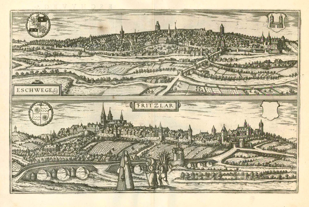
Eschwege [on sheet with] Fritzlar 1599
Eschwege and Fritzlar, by Georg Braun and Frans Hogenberg.
[Item number: 24054]