
Schleswig by Georg Braun & Frans Hogenberg. 1617
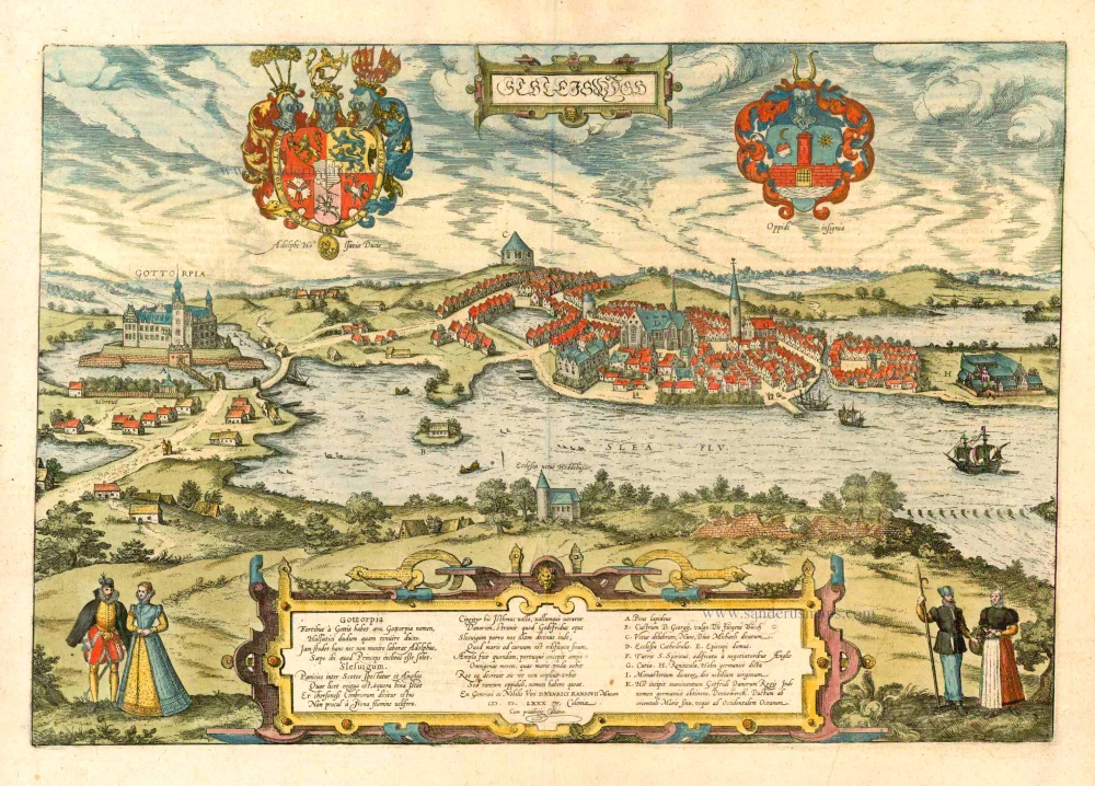


TRANSLATION OF CARTOUCHE TEXT: Gottorp. The castle of Gottorp, which came into the possession of the Dukes of Holstein only recently, got its name from the powerful Goths. And Adolph is already fortifying it in no small measure, for this illustrious prince is fond of staying here. Schleswig. It faces the plain between the Scots and the Angles, which, although it is small, borders on two seas, and it is said that the sea of the Cimbrian Peninsula is not far from the River Schlei with its many ships. The isthmus is girded here by the rampart of the Danes, a work built by Godfred. And we call this town Schleswig because it is built on a curved inlet of the sea. It was once a great city with a friendly harbour that received goods of all kinds that the sea waves carried here. But it has declined to such an extent that it no longer seeks to be called a city, but only a small town. From the book of the Muses of that generous and distinguished gentleman D. Heinrich Rantzau, Cologne 1584, with imperial privilege.
COMMENTARY BY BRAUN: "Long ago, Schleswig was the capital of the whole territory of Cimbria, a big city and wealthy because of its important commercial activities, but now it has lost its former splendour because of the misfortune brought upon it by God. It has a harbour, which is ideally suited to trade. For formerly the trade goods were brought from the Netherlands, England, France and Spain to the Eider Estuary, and then on the Treene to Hollingstedt and from there very easily to Schleswig, and further over the Baltic Sea to the Kingdom of Denmark, to Norway, also Livonia, Russia, Prussia and other German provinces on the Belt."
The ducal coat of arms and the arms of the city of Schleswig at the corners of an equilateral triangle draw our attention down to the little church of Hedeby in the foreground, and thus to the origin of Schleswig and the castle of Gottorp, namely the old commercial metropolis of Haithabu. After its destruction in 1066, its place was taken by Schleswig. The moated castle, the residence of the Dukes of Schleswig-Holstein-Gottorp, developed out of a fortress on the Danish frontier wall, the Danewerk (K). The view across the Schlei in cavalier perspective, with north at the top, shows the city overlooked by the tower of St Michael (C). The cathedral of St Peter (D) was begun in 1134 and completed in the 16th century. To the right of it is the former collegiate church of the 13th-century Franciscan monastery, which was converted into a town hall (G) after the Reformation. At this time, Schleswig had already lost its preeminent position in trade to Lübeck.
Braun G. & Hogenberg F. and the Civitates Orbis Terrarum.
The Civitates Orbis Terrarum, also known as the 'Braun & Hogenberg', is a six-volume town atlas and the most excellent book of town views and plans ever published: 363 engravings, sometimes beautifully coloured. It was one of the best-selling works in the last quarter of the 16th century. Georg Braun, a skilled writer, wrote the text accompanying the plans and views on the verso. Many plates were engraved after the original drawings of a professional artist, Joris Hoefnagel (1542-1600). The first volume was published in Latin in 1572 and the sixth in 1617. Frans Hogenberg, a talented engraver, created the tables for volumes I through IV, and Simon van den Neuwel made those for volumes V and VI. Other contributors were cartographers Daniel Freese and Heinrich Rantzau, who provided valuable geographical information. Works by Jacob van Deventer, Sebastian Münster, and Johannes Stumpf were also used as references. Translations appeared in German and French, making the atlas accessible to a broader audience.
Since its original publication of volume 1 in 1572, the Civitates Orbis Terrarum has left an indelible mark on the history of cartography. Seven more editions followed the first volume in 1575, 1577, 1582, 1588, 1593, 1599, and 1612. Vol.2, initially released in 1575, saw subsequent editions in 1597 and 1612. The subsequent volumes, each a treasure trove of historical insights, graced the world in 1581, 1588, 1593, 1599, and 1606. The German translation of the first volume, a testament to its widespread appeal, debuted in 1574, followed by the French edition in 1575.
Several printers were involved: Theodor Graminaeus, Heinrich von Aich, Gottfried von Kempen, Johannis Sinniger, Bertram Buchholtz, and Peter von Brachel, all of whom worked in Cologne.
Georg Braun (1541-1622)
Georg Braun, the author of the text accompanying the plans and views in the Civitates Orbis Terrarum, was born in Cologne in 1541. After his studies in Cologne, he entered the Jesuit Order as a novice, indicating his commitment to learning and intellectual pursuits. In 1561, he obtained his bachelor's degree; in 1562, he received his Magister Artium, further demonstrating his academic achievements. Although he left the Jesuit Order, he continued his studies in theology, gaining a licentiate in theology. His theological background likely influenced the content and tone of the text in the Civitates Orbis Terrarum, adding a unique perspective to the work.
Frans Hogenberg (1535-1590)
Frans Hogenberg was a Flemish and German painter, engraver, and mapmaker. He was born in Mechelen as the son of Nicolaas Hogenberg.
By the end of the 1560s, Frans Hogenberg was employed upon Abraham Ortelius's Theatrum Orbis Terrarum, published in 1570; he is named an engraver of numerous maps. In 1568, he was banned from Antwerp by the Duke of Alva and travelled to London, where he stayed a few years before emigrating to Cologne. He immediately embarked on his two most important works, the Civitates, published in 1572 and the Geschichtsblätter, which appeared in several series from 1569 until about 1587.
Thanks to large-scale projects like the Geschichtsblätter and the Civitates, Hogenberg's social circumstances improved with each passing year. He died as a wealthy man in Cologne in 1590.
Schleiswygh.
Item Number: 8792 Authenticity Guarantee
Category: Antique maps > Europe > Germany - Cities
Old, antique bird’s-eye view plan of Schleswig, by Georg Braun & Frans Hogenberg.
Title: Schleiswygh.
Ex Generosi ac Nobilis Viri d'Henrici Ransovii Musaeo.
M.D.LXXX IV. Coloniae.
Cum privilegio Caesareo.
Date of the first edition: 1588.
Date of this map: 1617.
Date on map: 1584.
Copper engraving, printed on paper.
Map size: 330 x 480mm (12.99 x 18.9 inches).
Sheet size: 410 x 530mm (16.14 x 20.87 inches).
Verso: Latin text.
Condition: Original coloured, excellent.
Condition Rating: A+.
References: Van der Krogt 4, #3912; Taschen, Br. Hog., p.311; Fauser, #12682
From: Liber Quartus Urbium Praecipuarum Totius Mundi. Cologne, Petrus von Brachel, 1617. (Van der Krogt 4, 41:1.4(1617))
TRANSLATION OF CARTOUCHE TEXT: Gottorp. The castle of Gottorp, which came into the possession of the Dukes of Holstein only recently, got its name from the powerful Goths. And Adolph is already fortifying it in no small measure, for this illustrious prince is fond of staying here. Schleswig. It faces the plain between the Scots and the Angles, which, although it is small, borders on two seas, and it is said that the sea of the Cimbrian Peninsula is not far from the River Schlei with its many ships. The isthmus is girded here by the rampart of the Danes, a work built by Godfred. And we call this town Schleswig because it is built on a curved inlet of the sea. It was once a great city with a friendly harbour that received goods of all kinds that the sea waves carried here. But it has declined to such an extent that it no longer seeks to be called a city, but only a small town. From the book of the Muses of that generous and distinguished gentleman D. Heinrich Rantzau, Cologne 1584, with imperial privilege.
COMMENTARY BY BRAUN: "Long ago, Schleswig was the capital of the whole territory of Cimbria, a big city and wealthy because of its important commercial activities, but now it has lost its former splendour because of the misfortune brought upon it by God. It has a harbour, which is ideally suited to trade. For formerly the trade goods were brought from the Netherlands, England, France and Spain to the Eider Estuary, and then on the Treene to Hollingstedt and from there very easily to Schleswig, and further over the Baltic Sea to the Kingdom of Denmark, to Norway, also Livonia, Russia, Prussia and other German provinces on the Belt."
The ducal coat of arms and the arms of the city of Schleswig at the corners of an equilateral triangle draw our attention down to the little church of Hedeby in the foreground, and thus to the origin of Schleswig and the castle of Gottorp, namely the old commercial metropolis of Haithabu. After its destruction in 1066, its place was taken by Schleswig. The moated castle, the residence of the Dukes of Schleswig-Holstein-Gottorp, developed out of a fortress on the Danish frontier wall, the Danewerk (K). The view across the Schlei in cavalier perspective, with north at the top, shows the city overlooked by the tower of St Michael (C). The cathedral of St Peter (D) was begun in 1134 and completed in the 16th century. To the right of it is the former collegiate church of the 13th-century Franciscan monastery, which was converted into a town hall (G) after the Reformation. At this time, Schleswig had already lost its preeminent position in trade to Lübeck.
Braun G. & Hogenberg F. and the Civitates Orbis Terrarum.
The Civitates Orbis Terrarum, also known as the 'Braun & Hogenberg', is a six-volume town atlas and the most excellent book of town views and plans ever published: 363 engravings, sometimes beautifully coloured. It was one of the best-selling works in the last quarter of the 16th century. Georg Braun, a skilled writer, wrote the text accompanying the plans and views on the verso. Many plates were engraved after the original drawings of a professional artist, Joris Hoefnagel (1542-1600). The first volume was published in Latin in 1572 and the sixth in 1617. Frans Hogenberg, a talented engraver, created the tables for volumes I through IV, and Simon van den Neuwel made those for volumes V and VI. Other contributors were cartographers Daniel Freese and Heinrich Rantzau, who provided valuable geographical information. Works by Jacob van Deventer, Sebastian Münster, and Johannes Stumpf were also used as references. Translations appeared in German and French, making the atlas accessible to a broader audience.
Since its original publication of volume 1 in 1572, the Civitates Orbis Terrarum has left an indelible mark on the history of cartography. Seven more editions followed the first volume in 1575, 1577, 1582, 1588, 1593, 1599, and 1612. Vol.2, initially released in 1575, saw subsequent editions in 1597 and 1612. The subsequent volumes, each a treasure trove of historical insights, graced the world in 1581, 1588, 1593, 1599, and 1606. The German translation of the first volume, a testament to its widespread appeal, debuted in 1574, followed by the French edition in 1575.
Several printers were involved: Theodor Graminaeus, Heinrich von Aich, Gottfried von Kempen, Johannis Sinniger, Bertram Buchholtz, and Peter von Brachel, all of whom worked in Cologne.
Georg Braun (1541-1622)
Georg Braun, the author of the text accompanying the plans and views in the Civitates Orbis Terrarum, was born in Cologne in 1541. After his studies in Cologne, he entered the Jesuit Order as a novice, indicating his commitment to learning and intellectual pursuits. In 1561, he obtained his bachelor's degree; in 1562, he received his Magister Artium, further demonstrating his academic achievements. Although he left the Jesuit Order, he continued his studies in theology, gaining a licentiate in theology. His theological background likely influenced the content and tone of the text in the Civitates Orbis Terrarum, adding a unique perspective to the work.
Frans Hogenberg (1535-1590)
Frans Hogenberg was a Flemish and German painter, engraver, and mapmaker. He was born in Mechelen as the son of Nicolaas Hogenberg.
By the end of the 1560s, Frans Hogenberg was employed upon Abraham Ortelius's Theatrum Orbis Terrarum, published in 1570; he is named an engraver of numerous maps. In 1568, he was banned from Antwerp by the Duke of Alva and travelled to London, where he stayed a few years before emigrating to Cologne. He immediately embarked on his two most important works, the Civitates, published in 1572 and the Geschichtsblätter, which appeared in several series from 1569 until about 1587.
Thanks to large-scale projects like the Geschichtsblätter and the Civitates, Hogenberg's social circumstances improved with each passing year. He died as a wealthy man in Cologne in 1590.
Related items
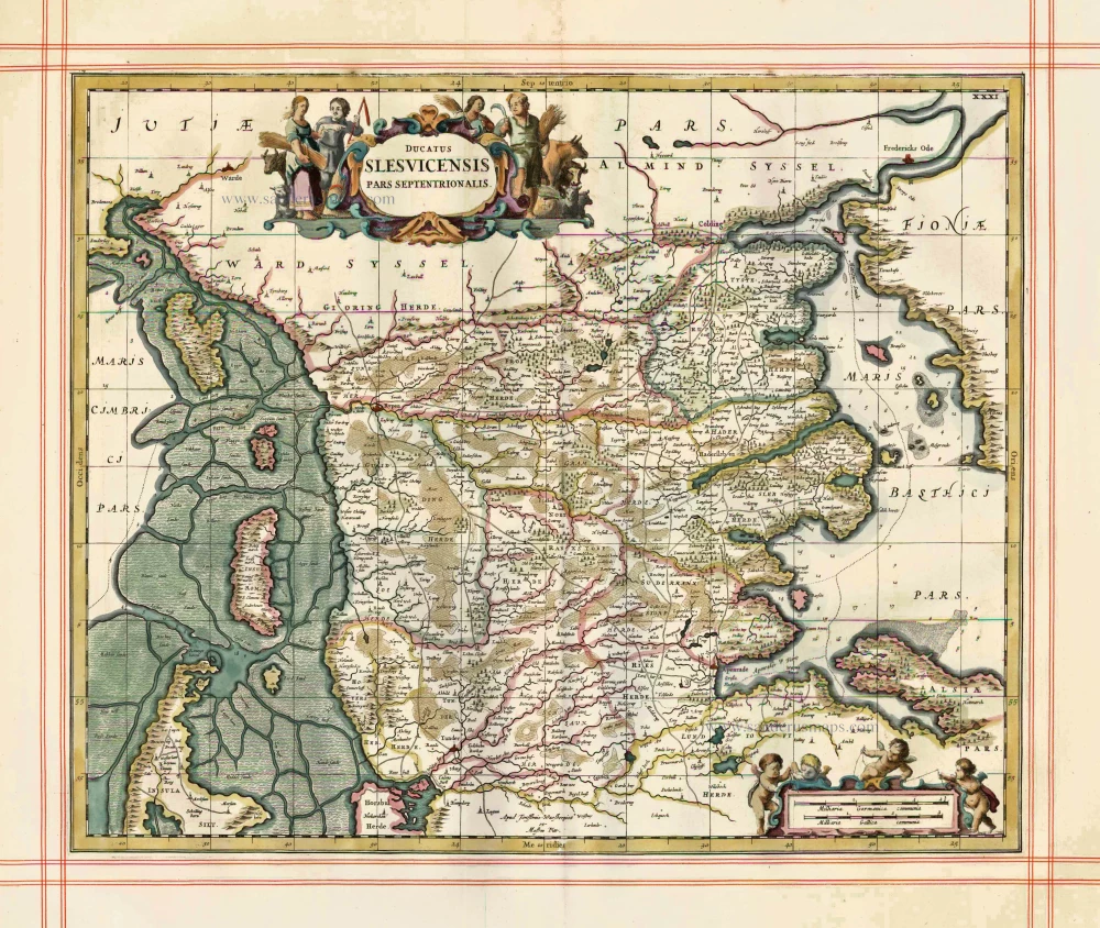
Ducatus Slesvicensis Pars Septentrionalis 1680
Northern Schleswig, by J. Janssonius, published by Moses Pitt and J. Janssonius-Waesberge
[Item number: 1486]

Ducatus Slesvicensis in omnes suas Praefecturas Circulos et Provincias Distinte Divisus. c. 1680
Schleswig-Holstein, by Frederick de Wit.
[Item number: 14614]
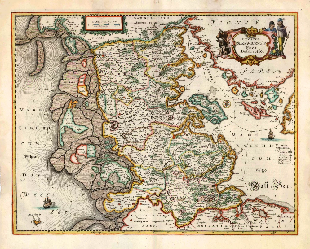
Ducatus Sleswicensis Nova Descriptio. 1666
Schleswig, by Joannes Janssonius.
[Item number: 26765]